Calhoun, Alabama | |
|---|---|
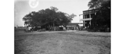 Calhoun, 1928 | |
 Calhoun  Calhoun | |
| Coordinates: 32°03′01″N86°32′42″W / 32.05028°N 86.54500°W | |
| Country | United States |
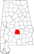
| State | Alabama |
| County | Lowndes |
| Elevation | 272 ft (83 m) |
| Time zone | UTC-6 (Central (CST)) |
| • Summer (DST) | UTC-5 (CDT) |
| Area code | 334 |
Calhoun is an unincorporated community in Lowndes County, Alabama, United States. [1]