Benton, Alabama

Last updated

Benton, Alabama
Benton, Alabama Pink CARE Building.JPG
Lowndes County Alabama Incorporated and Unincorporated areas Benton Highlighted 0105692.svg
Location of Benton in Lowndes County, Alabama.
Coordinates: 32°18′22″N86°49′3″W / 32.30611°N 86.81750°W / 32.30611; -86.81750
Country United States
State Alabama
County Lowndes
Area
[1]
  Total0.34 sq mi (0.87 km2)
  Land0.30 sq mi (0.78 km2)
  Water0.04 sq mi (0.09 km2)
Elevation
141 ft (43 m)
Population
 (2020)
  Total41
  Density135.76/sq mi (52.43/km2)
Time zone UTC-6 (Central (CST))
  Summer (DST) UTC-5 (CDT)
ZIP code
36785
Area code 334
FIPS code 01-05692
GNIS feature ID0113937

Benton is a town in Lowndes County, Alabama, United States. Its population was 41 at the 2020 census, down from 49 at the 2010 census. [2]

Contents

Geography

Benton is located at 32°18′22″N86°49′3″W / 32.30611°N 86.81750°W / 32.30611; -86.81750 (32.306248, -86.817551). [3]

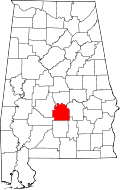
According to the U.S. Census Bureau, the town has a total area of 0.3 square miles (0.78 km2), of which 0.3 square miles (0.78 km2) is land and 0.04 square miles (0.10 km2) (8.82%) is water.

History

Settled in 1832 on land owned by James Maull, it was initially known as Maull's Landing, before it was renamed and incorporated as Benton in 1834. [4] It was named after Thomas Hart Benton, then the U.S. Senator from Missouri, who had served under General Andrew Jackson in the Creek Campaign. During the steamboat era, it was a major trading stop along the Alabama River.

Maull's son, Edward, auctioned off lots in 1855, that were incorporated into the town. The earliest year any population figures were returned by the U.S. Census for the area (below the county level) was in 1870, when Benton Beat (then one of ten divisions in Lowndes County) returned 2,627 residents, the majority of whom were newly emancipated blacks. [5]

In 1880, Lowndes County was subdivided further into 20 beats (precincts), and the Benton Beat fell to 1,094 residents. [6] In 1890, it declined to 994, and for the first time, the town of Benton was reported separately with a population of 265. [7]

Benton's incorporation would lapse shortly (the town did not report a separate population in 1900) and with the shift to railroads, followed by the outmigration of the majority black population, it would dwindle in size. The Benton Precinct would fall from 1,049 in 1900 (same as its 1880 population), down to 409 by 1950, before all the county precincts were eliminated and redistricted into census divisions.

In 1964, Benton was reincorporated, reporting 115 residents as of the 1970 census. As of 1990, it has declined to just under 50 residents and has held steady as of 2010. Out of Lowndes County's seven incorporated communities, it is one of only two with a white majority (as of 2000 and 2010), Lowndesboro being the other. It is also one of the smallest incorporated communities in the state.

Benton, Alabama can be confused in genealogy research with Calhoun County, Alabama, which was known as Benton County from 1832 to 1858, and which was also originally named for Senator Benton, but renamed because of his unpopular (in Alabama) political views — namely, opposition to slavery — by the late 1850s.

Demographics

Historical population
CensusPop.Note
1890 265
1970 115
1980 74−35.7%
1990 48−35.1%
2000 47−2.1%
2010 494.3%
2020 41−16.3%
U.S. Decennial Census [8]
The Alabama River as seen from Benton Park in Benton Alabama River at Benton Park.JPG
The Alabama River as seen from Benton Park in Benton

As of the census [9] of 2000, there were 47 people, 18 households, and 14 families residing in the town. The population density was 153.4 inhabitants per square mile (59.2/km2). There were 19 housing units at an average density of 62.0 per square mile (23.9/km2). The racial makeup of the town was 76.60% White and 23.40% Black or African American.

There were 18 households, out of which 38.9% had children under the age of 18 living with them, 72.2% were married couples living together, 5.6% had a female householder with no husband present, and 16.7% were non-families. 16.7% of all households were made up of individuals, and none had someone living alone who was 65 years of age or older. The average household size was 2.61 and the average family size was 2.87.

In the town, the population was spread out, with 29.8% under the age of 18, 34.0% from 25 to 44, 19.1% from 45 to 64, and 17.0% who were 65 years of age or older. The median age was 41 years. For every 100 females, there were 123.8 males. For every 100 females age 18 and over, there were 135.7 males.

The median income for a household in the town was $90,000, and the median income for a family was $92,113. Males had a median income of $41,250 versus $26,875 for females. The per capita income for the town was $28,035. There were 7.7% of families and 7.5% of the population living below the poverty line, including 14.3% of under eighteens and none of those over 64.

Notable people

Related Research Articles

<span class="mw-page-title-main">Autaugaville, Alabama</span> Town in Alabama, United States

Autaugaville is a town in Autauga County, Alabama, United States. At the 2020 census, the population was 795. It is part of the Montgomery Metropolitan Statistical Area.

<span class="mw-page-title-main">Deatsville, Alabama</span> Town in Alabama, United States

Deatsville is a town in Elmore County, Alabama, United States. Although Deatsville initially incorporated in 1903, it lapsed at some point after the 1910 U.S. Census and did not appear again as incorporated until 2000. As of the 2020 census, the population was 1,679.

<span class="mw-page-title-main">Eclectic, Alabama</span> Village in Alabama, United States

Eclectic is a town in Elmore County, Alabama, United States. It incorporated in 1907. At the 2020 census, the population was 1,193. It is part of the Montgomery Metropolitan Statistical Area.

<span class="mw-page-title-main">Elmore, Alabama</span> Town in Alabama, United States

Elmore is a town in Elmore County, Alabama, United States. Although initially incorporated in 1906, it lapsed and was not reincorporated again until 1997. At the 2010 census the population was 1,262, up from 199 in 2000. It is part of the Montgomery Metropolitan Statistical Area.

<span class="mw-page-title-main">Ridgeville, Alabama</span> Town in Alabama, United States

Ridgeville is a town in Etowah County, Alabama, United States. It incorporated in 1969 and is part of the Gadsden Metropolitan Statistical Area. At the 2020 census the population was 83, down from 158 in 2000. It is noteworthy for being the only community in Etowah County to have a black majority. Since 1970, it has also been the least populated community wholly within the county.

<span class="mw-page-title-main">Argo, Alabama</span> Town in Alabama, United States

Argo is a town in Jefferson and St. Clair counties, Alabama, United States. It incorporated in 1987. At the 2020 census, the population was 4,368.

<span class="mw-page-title-main">Town Creek, Alabama</span> Town in Alabama, United States

Town Creek is a town in Lawrence County, Alabama, United States, and is included in the Decatur Metropolitan Area, as well as the Huntsville-Decatur Combined Statistical Area. It incorporated in March 1875. As of the 2010 census, the population of the town is 1100, down from 1216 in 2000. Since 1920, it has been the second largest town in Lawrence County after Moulton.

<span class="mw-page-title-main">Fort Deposit, Alabama</span> Town in Alabama, United States

Fort Deposit is a town in Lowndes County, Alabama, United States. Since 1890, it has been the largest town in Lowndes County. At the 2010 census the population was 1,344, up from 1,270 in 2000. It is part of the Montgomery Metropolitan Statistical Area.

<span class="mw-page-title-main">Gordonville, Alabama</span> Town in Alabama, United States

Gordonville is a town in Lowndes County, Alabama, United States. At the 2010 census the population was 326, up from 318 in 2000. It is part of the Montgomery Metropolitan Statistical Area. It incorporated effective January 20, 1990.

<span class="mw-page-title-main">Hayneville, Alabama</span> Town in Alabama, US

Hayneville is a town in Lowndes County, Alabama, United States and its county seat. At the 2010 census the population was 932, down from its record high of 1,177 in 2000. It is also part of the Montgomery Metropolitan Statistical Area. It initially incorporated in 1831, but lapsed, finally reincorporating in 1967. Before 1970, the town appeared only twice on the U.S. Census: in 1850 and 1890. The 1850 estimate of 800 residents ranked it as the largest town in the county at the time.

<span class="mw-page-title-main">Lowndesboro, Alabama</span> Town in Alabama, United States

Lowndesboro is a town in Lowndes County, Alabama, United States. At the 2010 census the population was 115, down from 140 in 2000. It is part of the Montgomery Metropolitan Statistical Area. Although initially incorporated in 1856 by an act of the state legislature, it lapsed and was not reincorporated until 1962.

<span class="mw-page-title-main">Mosses, Alabama</span> Town in Alabama, United States

Mosses is a town in Lowndes County, Alabama, United States. At the 2010 census the population was 1,029, down from 1,101 in 2000. It is part of the Montgomery Metropolitan Statistical Area. It incorporated in 1979.

<span class="mw-page-title-main">White Hall, Alabama</span> Town in Alabama, United States

White Hall is a town in Lowndes County, Alabama, United States. The community was named for a plantation that was destroyed in an 1882 tornado. At the 2010 census the population was 858, down from its record high of 1,014 in 2000. It is part of the Montgomery Metropolitan Statistical Area.

<span class="mw-page-title-main">Springville, Alabama</span> City in Alabama, United States

Springville is a city in St. Clair County, Alabama, United States. It incorporated in December 1880. At the 2020 census the population was 4,786, up from 4,080 in 2010.

<span class="mw-page-title-main">Geiger, Alabama</span> Town in Alabama, United States

Geiger is a town in Sumter County, Alabama, United States. It incorporated in 1912. At the 2010 census the population was 170, up from 161 in 2000.

<span class="mw-page-title-main">Bay Township, Michigan</span> Civil township in Michigan, United States

Bay Township is a civil township of Charlevoix County, Michigan, United States. The population was 1,142 at the 2020 census.

<span class="mw-page-title-main">South Woodbridge, California</span> Unincorporated community in California, United States

South Woodbridge was a former census-designated place (CDP) in San Joaquin County, California, United States. The population was 2,825 at the 2000 census. For the 2010 census, the CDP's of South Woodbridge and North Woodbridge were merged into Woodbridge.

<span class="mw-page-title-main">Crawford, Mississippi</span> Town in Mississippi, United States

Crawford is a small town in Lowndes County, Mississippi, United States. The population was 641 at the 2010 census.

<span class="mw-page-title-main">Kimball, Wisconsin</span> Town in Wisconsin, United States

Kimball is a town in Iron County, Wisconsin, United States. The population was 540 at the 2000 census. The unincorporated communities of Kimball and Orva are located in the town.

Lake No. 2 is an unorganized territory in Lake County, Minnesota, United States. The population was 1,955 at the 2000 census.

References

  1. "2020 U.S. Gazetteer Files". United States Census Bureau. Retrieved October 29, 2021.
  2. "Explore Census Data". data.census.gov. Retrieved May 18, 2022.
  3. "US Gazetteer files: 2010, 2000, and 1990". United States Census Bureau. February 12, 2011. Retrieved April 23, 2011.
  4. "Benton".
  5. "Population of Civil Divisions less than counties" (PDF). United States Census Bureau. 1870. pp. 77–82.
  6. "Population of Civil Divisions less than counties, in the aggregate, at the Censuses of 1880 and 1870" (PDF). United States Census Bureau. 1880.
  7. "Statistics of Population - Minor Civil Divisions 1880 and 1890 - Alabama" (PDF). United States Census Bureau. 1890. pp. 52–59.
  8. "U.S. Decennial Census". Census.gov. Retrieved June 6, 2013.
  9. "U.S. Census website". United States Census Bureau . Retrieved January 31, 2008.

32°18′22″N86°49′03″W / 32.306248°N 86.817551°W / 32.306248; -86.817551