White Hall, Alabama

Last updated

White Hall, Alabama
White Hall, Alabama.JPG
White Hall Town Hall
Lowndes County Alabama Incorporated and Unincorporated areas White Hall Highlighted 0181912.svg
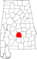
Location of White Hall in Lowndes County, Alabama.
Coordinates: 32°18′50″N86°42′50″W / 32.31389°N 86.71389°W / 32.31389; -86.71389
Country United States
State Alabama
County Lowndes
Area
[1]
  Total15.54 sq mi (40.24 km2)
  Land15.32 sq mi (39.67 km2)
  Water0.22 sq mi (0.57 km2)
Elevation
184 ft (56 m)
Population
 (2020)
  Total806
  Density52.62/sq mi (20.32/km2)
Time zone UTC-6 (Central (CST))
  Summer (DST) UTC-5 (CDT)
FIPS code 01-81912
GNIS feature ID0153961

White Hall is a town in Lowndes County, Alabama, United States. The community was named for a plantation that was destroyed in an 1882 tornado. At the 2010 census the population was 858, down from its record high of 1,014 in 2000. It is part of the Montgomery Metropolitan Statistical Area.

Contents

It was established during the Great Depression in 1935 as a New Deal project under the Resettlement Administration, similar to the town of Skyline. Because of Southern racial segregation, White Hall was intended for the African-American majority population in the area. The town did not incorporate until 1979. [2]

Geography

White Hall is located at 32°18′50″N86°42′50″W / 32.31389°N 86.71389°W / 32.31389; -86.71389 (32.313866, -86.714019). [3]

According to the U.S. Census Bureau, the town has a total area of 15.5 square miles (40 km2), of which 15.5 square miles (40 km2) is land and 0.1 square miles (0.26 km2) (0.39%) is water.

Demographics

Historical population
CensusPop.Note
1970 367
1980 251−31.6%
1990 814224.3%
2000 1,01424.6%
2010 858−15.4%
2020 806−6.1%
U.S. Decennial Census [4]
2013 Estimate [5]

2020 census

White Hall town, Alabama – Racial and Ethnic Composition
(NH = Non-Hispanic)
Note: the US Census treats Hispanic/Latino as an ethnic category. This table excludes Latinos from the racial categories and assigns them to a separate category. Hispanics/Latinos may be of any race.
Race / EthnicityPop 2010 [6] Pop 2020 [7] % 2010% 2020
White alone (NH)21222.45%2.73%
Black or African American alone (NH)82075995.57%94.17%
Native American or Alaska Native alone (NH)200.23%0.00%
Asian alone (NH)000.00%0.00%
Pacific Islander alone (NH)000.00%0.00%
Some Other Race alone (NH)030.00%0.37%
Mixed Race/Multi-Racial (NH)7110.82%1.36%
Hispanic or Latino (any race)8110.93%1.36%
Total858806100.00%100.00%

2000 Census

As of the census [8] of 2000, there were 1,014 people, 361 households, and 266 families residing in the town. The population density was 65.6 inhabitants per square mile (25.3/km2). There were 398 housing units at an average density of 25.7 per square mile (9.9/km2). The racial makeup of the town was 98.03% Black or African American, 1.38% White, 0.10% Native American, 0.20% Asian, and 0.30% from two or more races. 0.79% of the population were Hispanic or Latino of any race.

There were 361 households, out of which 40.4% had children under the age of 18 living with them, 33.5% were married couples living together, 35.7% had a female householder with no husband present, and 26.3% were non-families. 23.5% of all households were made up of individuals, and 10.8% had someone living alone who was 65 years of age or older. The average household size was 2.81 and the average family size was 3.33.

In the town, the population was spread out, with 32.4% under the age of 18, 10.1% from 18 to 24, 25.7% from 25 to 44, 20.8% from 45 to 64, and 10.9% who were 65 years of age or older. The median age was 31 years. For every 100 females, there were 77.0 males. For every 100 females age 18 and over, there were 70.8 males.

The median income for a household in the town was $18,158, and the median income for a family was $21,875. Males had a median income of $20,885 versus $18,125 for females. The per capita income for the town was $10,062. About 29.4% of families and 31.7% of the population were below the poverty line, including 35.8% of those under age 18 and 47.5% of those age 65 or over.

Notable people

See also

Related Research Articles

<span class="mw-page-title-main">Coosa County, Alabama</span> County in Alabama, United States

Coosa County is located in the east central portion of the U.S. state of Alabama. As of the 2020 census the population was 10,387. Its county seat is Rockford. Its name derives from a town of the Creek tribe and the Coosa River, which forms one of the county borders.

<span class="mw-page-title-main">Elmore, Alabama</span> Town in Alabama, United States

Elmore is a town in Elmore County, Alabama, United States. Although initially incorporated in 1906, it lapsed and was not reincorporated again until 1997. At the 2010 census the population was 1,262, up from 199 in 2000. It is part of the Montgomery Metropolitan Statistical Area.

<span class="mw-page-title-main">Ridgeville, Alabama</span> Town in Alabama, United States

Ridgeville is a town in Etowah County, Alabama, United States. It incorporated in 1969 and is part of the Gadsden Metropolitan Statistical Area. At the 2020 census the population was 83, down from 158 in 2000. It is noteworthy for being the only community in Etowah County to have a black majority. Since 1970, it has also been the least populated community wholly within the county.

<span class="mw-page-title-main">Akron, Alabama</span> Town in Alabama, United States

Akron is a town in Hale County, Alabama, United States. In 1906, the owner of a large plantation, Waller Evan Wedgworth, sold part of his land to developers, and a construction boom followed. The town was incorporated in March 1918. At the 2010 census the population was 356, down from 521 at the 2000 census. Akron has one site on the National Register of Historic Places, the Greek Revival cottage known as Tanglewood.

<span class="mw-page-title-main">Argo, Alabama</span> Town in Alabama, United States

Argo is a town in Jefferson and St. Clair counties, Alabama, United States. It incorporated in 1987. At the 2020 census, the population was 4,368.

<span class="mw-page-title-main">Pleasant Grove, Alabama</span> City in Alabama, United States

Pleasant Grove is a city in western Jefferson County, Alabama, United States. It is part of the Birmingham metropolitan area. The population was 9,544 at the 2020 census.

<span class="mw-page-title-main">Tarrant, Alabama</span> City in Alabama, United States

Tarrant is a city in Jefferson County, Alabama, bordering Birmingham to the north. At the 2020 census, the population was 6,124. It is home to the ABC Coke plant owned by the Drummond Company, "the largest single producer of foundry coke in the U.S.".

<span class="mw-page-title-main">Fort Deposit, Alabama</span> Town in Alabama, United States

Fort Deposit is a town in Lowndes County, Alabama, United States. Since 1890, it has been the largest town in Lowndes County. At the 2010 census the population was 1,344, up from 1,270 in 2000. It is part of the Montgomery Metropolitan Statistical Area.

<span class="mw-page-title-main">Gordonville, Alabama</span> Town in Alabama, United States

Gordonville is a town in Lowndes County, Alabama, United States. At the 2010 census the population was 326, up from 318 in 2000. It is part of the Montgomery Metropolitan Statistical Area. It incorporated effective January 20, 1990.

<span class="mw-page-title-main">Mosses, Alabama</span> Town in Alabama, United States

Mosses is a town in Lowndes County, Alabama, United States. At the 2010 census the population was 1,029, down from 1,101 in 2000. It is part of the Montgomery Metropolitan Statistical Area. It incorporated in 1979.

<span class="mw-page-title-main">Pelham, Alabama</span> City in Alabama, United States

Pelham is a city in Shelby County, Alabama, United States. The population was 24,318 at the 2020 census, It incorporated on July 10, 1964 and is a suburb located in the Birmingham metropolitan area, Alabama which was home to nearly 1.2 million residents as of the 2020 census. It was named for Confederate Civil War officer John Pelham.

<span class="mw-page-title-main">Camp Hill, Alabama</span> Town in Alabama, United States

Camp Hill is a town in Tallapoosa County, Alabama, United States. It was incorporated in 1895. At the 2010 census the population was 1,014, down from 1,273 in 2000. Camp Hill is the home to Southern Preparatory Academy.

<span class="mw-page-title-main">Oak Hill, Alabama</span> Town in Alabama, United States

Oak Hill is a town in Wilcox County, Alabama, United States. According to the 1940 U.S. Census, it incorporated in 1938. Per the 2020 census, the population was 14. It is the smallest incorporated town in Alabama as of 2020, succeeding McMullen. The smallest unincorporated census-designated place in the state is also located in Wilcox County, that of Catherine, which had 22 residents as of 2010. With a median household income of $9,286, Oak Hill is the poorest community in Alabama.

<span class="mw-page-title-main">Pine Apple, Alabama</span> Town in Alabama, United States

Pine Apple is a town in Wilcox County, Alabama, United States. It incorporated in 1872. Per the 2020 census, the population was 143. It has two places on the National Register of Historic Places, the Hawthorne House and the Pine Apple Historic District.

<span class="mw-page-title-main">South Highpoint, Florida</span> Census-designated place in Florida, United States

South Highpoint is a census-designated place (CDP) in Pinellas County, Florida, United States. The population was 5,195 at the 2010 census.

<span class="mw-page-title-main">Woodland, Illinois</span> Village in Illinois, United States

Woodland is a village in Belmont Township, Iroquois County, Illinois, United States. The population was 324 as of the 2010 census.

Milroy is a census-designated place (CDP) that is located in the Kishacoquillas Valley of Mifflin County, Pennsylvania, United States. The population was 1,386 at the time of the 2000 census.

<span class="mw-page-title-main">Holland, La Crosse County, Wisconsin</span> Town in Wisconsin, United States

Holland is a town in La Crosse County, Wisconsin, United States. The population was 3,756 at the 2010 census. It is part of the La Crosse, Wisconsin Metropolitan Statistical Area. The unincorporated community of Council Bay is located in the town.

<span class="mw-page-title-main">Sugar Camp, Wisconsin</span> Town in Wisconsin, United States

Sugar Camp is a town in Oneida County, Wisconsin, United States. The population was 1,694 at the 2010 census. The unincorporated community of Sugar Camp is located in the town

<span class="mw-page-title-main">Stetsonville, Wisconsin</span> Village in Wisconsin, United States

Stetsonville is a village in Taylor County, Wisconsin, United States. The population was 541 at the 2010 census.

References

  1. "2020 U.S. Gazetteer Files". United States Census Bureau. Retrieved October 29, 2021.
  2. "White Hall". Encyclopedia of Alabama.
  3. "US Gazetteer files: 2010, 2000, and 1990". United States Census Bureau. February 12, 2011. Retrieved April 23, 2011.
  4. "U.S. Decennial Census". Census.gov. Retrieved June 6, 2013.
  5. "Annual Estimates of the Resident Population: April 1, 2010 to July 1, 2013" . Retrieved June 3, 2014.
  6. "P2 HISPANIC OR LATINO, AND NOT HISPANIC OR LATINO BY RACE – 2010: DEC Redistricting Data (PL 94-171) – White Hall town, Alabama". United States Census Bureau .
  7. "P2 HISPANIC OR LATINO, AND NOT HISPANIC OR LATINO BY RACE - 2020: DEC Redistricting Data (PL 94-171) - White Hall town, Alabama". United States Census Bureau .
  8. "U.S. Census website". United States Census Bureau . Retrieved January 31, 2008.

32°18′50″N86°42′50″W / 32.313866°N 86.714019°W / 32.313866; -86.714019