
State Route 91 (SR 91) is a major east–west state highway in the U.S. state of California that serves several regions of the Greater Los Angeles urban area. A freeway throughout its entire length, it officially runs from Vermont Avenue in Gardena, just west of the junction with the Harbor Freeway, east to Riverside at the junction with the Pomona and Moreno Valley freeways.
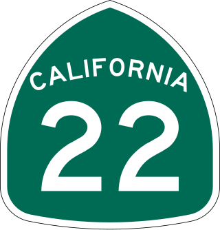
State Route 22 is an east–west state highway in the U.S. state of California that connects Long Beach with northern Orange County. It runs between Pacific Coast Highway in Long Beach and the Costa Mesa Freeway in Orange by way of Garden Grove. The westernmost part of SR 22 runs along Long Beach's 7th Street. From West Garden Grove to its eastern terminus in Orange, it is known as the Garden Grove Freeway. It is one of the two principal east–west routes in Orange County.

Route 110, consisting of State Route 110 (SR 110) and Interstate 110 (I-110), is a state and auxiliary Interstate Highway in the Los Angeles metropolitan area of the US state of California. The entire route connects San Pedro and the Port of Los Angeles with Downtown Los Angeles and Pasadena. The southern segment from San Pedro to I-10 in downtown Los Angeles is signed as I-110, while the northern segment to Pasadena is signed as SR 110. The entire length of I-110, as well as SR 110 south of the Four Level Interchange with US Route 101 (US 101), is the Harbor Freeway, and SR 110 north from US 101 to Pasadena is the historic Arroyo Seco Parkway, the first freeway in the western United States.

Route 710, consisting of the non-contiguous segments of State Route 710 (SR 710) and Interstate 710 (I-710), is a major north–south state highway and auxiliary Interstate Highway in the Los Angeles metropolitan area of the U.S. state of California. Also called the Los Angeles River Freeway prior to November 18, 1954, the highway was initially planned to connect Long Beach and Pasadena, but a gap in the route exists from Alhambra to Pasadena through South Pasadena due to community opposition to its construction.

The Santa Ana Freeway is one of the principal freeways in Southern California, connecting Los Angeles and its southeastern suburbs including the freeway's namesake, the city of Santa Ana. The freeway begins at its junction with the San Diego Freeway, called the El Toro Y, in Irvine, signed as I-5. From there, it generally goes southeast to northwest to the East Los Angeles Interchange, where it takes the designation of U.S. Route 101 (US 101). It then proceeds 2.95 miles (4.75 km) northwest to the Four Level Interchange in downtown Los Angeles. Formerly, the entirety of the route was marked as US 101 until the 1964 highway renumbering, which truncated US 101 to the East Los Angeles Interchange and designated the rest of the freeway as I-5.

The Ventura Freeway is a freeway in southern California, United States, that runs from the Santa Barbara/Ventura county line to Pasadena in Los Angeles County. It is the principal east–west route through Ventura County and in the southern San Fernando Valley in Los Angeles County. From the Santa Barbara County line to its intersection with the Hollywood Freeway in the southeastern San Fernando Valley in Los Angeles, it is signed as U.S. Route 101 (US 101), which was built in the late 1950s and opened on April 5, 1960. The segments from the Santa Barbara County line to Sea Cliff, and from Solimar Beach to Oxnard, are also concurrent with State Route 1 (SR 1), although no signs mention SR 1 there. East of the Hollywood Freeway intersection, the Ventura Freeway is signed as State Route 134 (SR 134), which was built by 1971.
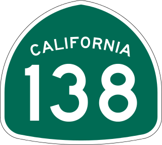
State Route 138 is an east–west state highway in the U.S. state of California that generally follows the northern foothills of the San Gabriel Mountains and the western Mojave Desert. The scenic highway begins in the west at its junction with Interstate 5 located south of Gorman in the Sierra Pelona Mountains, continues eastward through the Antelope Valley and Cajon Pass, to its junction with State Route 18 in the east, located in the San Bernardino Mountains south of Crestline.

State Route 60 (SR 60) is an east–west state highway in the U.S. state of California. It serves the cities and communities on the eastern side of the Los Angeles metropolitan area and runs along the south side of the San Gabriel Valley. It functions as a bypass route of Interstate 10 (I-10) through the area between the East Los Angeles Interchange in Los Angeles and Beaumont. SR 60 provides a route across several spurs of the Peninsular Ranges, linking the Los Angeles Basin with the Pomona Valley and San Gabriel Valley. The highway also runs concurrently with SR 57 and I-215. Portions of SR 60 are designated as either the Pomona Freeway or the Moreno Valley Freeway.
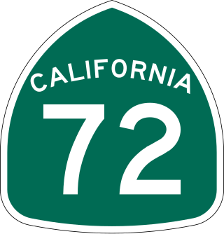
State Route 72 is a state highway in the U.S. state of California. The route runs along Whittier Boulevard in the Los Angeles area from SR 39 in La Habra to Interstate 605 in Whittier. SR 72 forms part of El Camino Real.

State Route 118 is a state highway in the U.S. state of California that runs west to east through Ventura and Los Angeles counties. It travels from State Route 126 at the eastern edge of Ventura immediately northwest of Saticoy, then through Saticoy, in Ventura County east to Interstate 210 near Lake View Terrace in Los Angeles. SR 118 crosses the Santa Susana Pass and the northern rim of the San Fernando Valley along its route.

A vast network of interconnected freeways in the megaregion of Southern California serves a population of over 23 million people. The Master Plan of Metropolitan Los Angeles Freeways was adopted by the Regional Planning Commission in 1947 and construction began in the early 1950s. The plan hit opposition and funding limitations in the 1970s, and by 2004, only some 61% of the original planned network had been completed.

State Route 39 is a state highway in the U.S. state of California that travels through Orange and Los Angeles counties. Its southern terminus is at Pacific Coast Highway, in Huntington Beach. SR 39's northern terminus is at Islip Saddle on Angeles Crest Highway in the Angeles National Forest, but its northernmost 4.5-mile (7.2 km) segment has been closed to public highway traffic since 1978 due to a massive mud and rockslide.

State Route 107 is a state highway in the U.S. state of California that forms part of Hawthorne Boulevard in the Los Angeles Area from State Route 1 in Torrance north to Redondo Beach Boulevard at the Redondo Beach–Lawndale border.

State Route 19 is a state highway in the U.S. state of California, running along Lakewood Boulevard and Rosemead Boulevard in the Los Angeles area. An additional "hidden" state highway, State Route 164, is also signed as part of SR 19, despite having a legal description separate from Route 19. The combined route is a north–south four-to-six lane suburban roadway, lying east of the Long Beach Freeway and west of the San Gabriel River Freeway, and connecting the eastern parts of Long Beach and Pasadena via the Whittier Narrows. Under their legal descriptions, SR 19 runs north to Gallatin Road in Pico Rivera, then SR 164 goes from Gallatin Road to Pasadena. Since 1998, several pieces have been relinquished to local governments, and more transfers are authorized by state law.

State Route 90 is a state highway in the U.S. state of California that consists of two unconnected pieces in Greater Los Angeles.

State Route 7 is a state highway in the U.S. state of California, running from the Calexico East Port of Entry on the U.S.-Mexico border east of Calexico north to its terminus at Interstate 8 (I-8), where Orchard Road continues the route north towards Holtville. The route provides convenient access to the country of Mexico from I-8. The southern portion of the route opened in 1996, and the rest of the route connecting to I-8 opened in 2005.
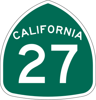
State Route 27, commonly known by its street name Topanga Canyon Boulevard, is a state highway in the U.S. state of California that runs from the Pacific Coast Highway at Topanga State Beach near Pacific Palisades, through the Topanga Canyon in Topanga, and continuing through Woodland Hills, Canoga Park, West Hills, and Chatsworth to the Ronald Reagan Freeway.

State Route 47 is a state highway in the U.S. state of California, connecting Terminal Island to the mainland in the Los Angeles area. From its south end at I-110 in San Pedro, it heads east across the Vincent Thomas Bridge to the island and the end of state maintenance. The state highway begins again at the junction with I-710 on Terminal Island, crossing the Schuyler Heim Bridge north to the mainland and the second terminus, where SR 103 begins. Signage continues along a locally maintained route, mainly Alameda Street, to the Gardena Freeway in Compton, and an unconstructed alignment follows the same corridor to the Santa Monica Freeway (I-10) near downtown Los Angeles.

State Route 213 is a state highway in the U.S. state of California, in Los Angeles County. The California State Legislature has designated the route as Western Avenue from 25th Street in San Pedro north to the San Diego Freeway in Torrance. From 25th Street to Carson Street, the California Transportation Commission has officially adopted Western Avenue as a state highway. The segment of Western Avenue from 25th Street south to Paseo del Mar may have SR 213 signage but is not legally part of the highway. The northerly two miles from Carson Street to Interstate 405 has also not yet been adopted and remains a city street. Beyond Interstate 405, Western Avenue, continues through Torrance, Gardena, and Los Angeles to Los Feliz Boulevard in Hollywood as a city street.

The Commodore Schuyler F. Heim Bridge was a vertical-lift bridge in the Port of Los Angeles. Dedicated on January 10, 1948, the bridge allowed State Route 47 to cross over the Cerritos Channel. Named after Schuyler F. Heim, who was in command of the Naval Air Station on Terminal Island in 1942, the bridge was one of the largest vertical-lift bridges on the West Coast. At the time of its opening, it was the highest in the country with the deck weighing about 820 short tons. Its towers are 186 feet (57 m) tall above the roadway deck and about 236 feet (72 m) tall when measured from the water level at high water. The bridge was decommissioned on October 12, 2015 and replaced by a new, six-lane fixed-span bridge in order to meet current safety and earthquake standards. A replacement bridge, tentatively titled State Route 47 Schuyler Heim Bridge Replacement, was completed in September 2020.

