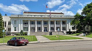
Douglas County is one of the 36 counties in the U.S. state of Oregon. As of the 2020 census, the population was 111,201. The county seat is Roseburg. The county is named after Stephen A. Douglas, an American politician who supported Oregon statehood. Douglas County comprises the Roseburg, OR Micropolitan Statistical Area. In regards to area, Douglas County is the largest county west of the Oregon Cascades.

Roseburg is the most populous city in and the county seat of Douglas County, Oregon. It is located in the Umpqua River Valley in southern Oregon. Founded in 1851, the population was 23,683 at the 2020 census, making it the principal city of the Roseburg, Oregon Micropolitan Statistical Area. The community developed along both sides of the South Umpqua River and is traversed by Interstate 5. Traditionally a lumber industry town, Roseburg was the original home of Roseburg Forest Products, which is now based in nearby Springfield.
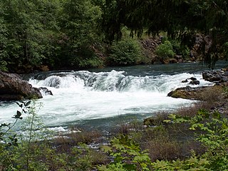
The North Umpqua River is a tributary of the Umpqua River, about 106 miles (171 km) long, in southwestern Oregon in the United States. It drains a scenic and rugged area of the Cascade Range southeast of Eugene, flowing through steep canyons and surrounded by large Douglas-fir forests. Renowned for its emerald green waters, it is considered one of the best fly fishing streams in the Pacific Northwest for anadromous fish.

The South Umpqua River is a tributary of the Umpqua River, approximately 115 miles (185 km) long, in southwestern Oregon in the United States. It drains part of the Cascade Range east of Roseburg. The river passes through a remote canyon in its upper reaches then emerges in the populated South Umpqua Valley east of Canyonville.
The Little River is a tributary of the North Umpqua River, about 30 miles (48 km) long, in southwestern Oregon in the United States. It drains part of the western side of the Cascade Range east of Roseburg, between the North and South Umpqua.

The Calapooya Mountains are a mountain range in Lane and Douglas counties of southwestern Oregon in the United States. The range runs for approximately 60 miles (97 km) west from the Cascade Range between Eugene on the north and Roseburg on the south.

Toketee Falls is a waterfall in Douglas County, Oregon, United States, on the North Umpqua River at its confluence with the Clearwater River. It is located approximately 58 miles (93 km) east of Roseburg near Oregon Route 138.

Silver Falls State Park is a state park in the U.S. state of Oregon, located near Silverton, about 20 miles (32 km) east-southeast of Salem. It is the largest state park in Oregon with an area of more than 9,000 acres (36 km2), and it includes more than 24 miles (39 km) of walking trails, 14 miles (23 km) of horse trails, and a 4-mile (6.4 km) bike path. Its 8.7-mile (14.0 km) Canyon Trail/Trail of Ten Falls runs along the banks of Silver Creek and by ten waterfalls, from which the park received its name. Four of the ten falls have an amphitheater-like surrounding that allows the trail to pass behind the flow of the falls. The Silver Falls State Park Concession Building Area and the Silver Creek Youth Camp-Silver Falls State Park are separately listed on the U.S. National Register of Historic Places.

The Clearwater River is a river in Douglas County of the U.S. state of Oregon. It is a roughly 15-mile (24 km) long tributary of the North Umpqua River, located about 50 miles (80 km) east of Roseburg in the Cascade Range.
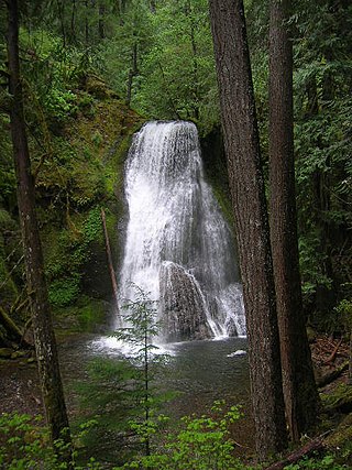
Yakso Falls is a 70-foot (21 m) waterfall on Little River, in the Cascade Range east of Roseburg in the U.S. state of Oregon. The waterfall is about 27 miles (43 km) from the unincorporated community of Glide along Little River Road, which becomes Forest Road 27.
Whitehorse Falls is a 14-foot (4.3 m) waterfall on the Clearwater River, in Douglas County in the U.S. state of Oregon. It is located within the Whitehorse Falls Campground, about 4 miles east of Toketee Lake along Oregon Route 138.
Alkali Falls, is a multi-step waterfall of 6 tiers located in the east side of the Rogue–Umpqua Divide Wilderness, just west of Mount Bailey and Diamond Lake, on Oregon Route 230 in Douglas County, in the U.S. state of Oregon. It totals 510 feet (160 m) fall in six drops, the Upper Alkali and tallest drop is 130 feet (40 m), making it one of the tallest cascades in Oregon.

Cavitt Creek Falls, is a waterfall located on the west edge of the Umpqua National Forest, outside of the town of Glide, in Douglas County, in the U.S. state of Oregon. It totals 8 feet fall in one cascade that shoots into a large swimming bowl and is the centerpiece attraction of the Cavitt Creek Falls trailhead and Recreation Site. Boulders across Cavitt Creek create two channels of water flow that make the cascade and add to a combined width of approximately 15 feet.
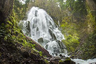
Moon Falls, also spelled Moonfalls, is a waterfall located on the west edge of the Umpqua National Forest in Lane County, in the U.S. state of Oregon. It totals 100 feet fall in one wide veiling cascade and is 1.5 miles from Spirit Falls trailhead.

Fall Creek Falls, is a three to four drop waterfall located on the North Umpqua River at the west skirt of the Umpqua National Forest, in Douglas County, in the U.S. state of Oregon. It is located in a privileged natural area where the river creates several waterfalls: Susan Creek Falls, Emile Falls, and Grotto Falls are two to five miles away.
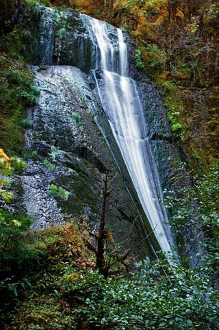
Wolf Creek Falls, is a two tier waterfall located on the west skirt of the Umpqua National Forest, in Douglas County, in the U.S. state of Oregon. It is located in a privileged area where rivers of the forest create several waterfalls: Cavitt Creek Falls, and Shadow Falls are within five miles of Wolf Creek Falls. Grotto Falls is further to the east off Little River Road and National Forest Road 2703.
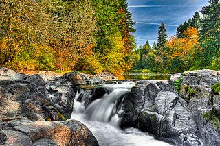
Wildwood Falls, also known as Row River Falls, is a waterfall located on the west skirt of the Umpqua National Forest, in Lane County, in the U.S. state of Oregon. It is located in a privileged area on the west foothills where Willamette National Forest meets with the Umpqua National Forest.
Clover Falls, also known in the past as Upper Hemlock Falls, is a waterfall from the Hemlock Creek, in the heart of the Umpqua National Forest, just north of Hemlock Lake and its campground, in Douglas County, Oregon. Access to Clover Falls is from the Lake in the Woods campground. The waterfall is located in a privileged natural area where the river creates several waterfalls; Hemlock Falls, Yakso Falls, and Tributary Falls are within a mile distance.
Hemlock Falls is a waterfall from the Hemlock Creek, in the heart of the Umpqua National Forest, just north of Hemlock Lake and its campground, in Douglas County, Oregon. Access to Hemlock Falls is from the Lake in the Woods campground. The waterfall is located in a privileged natural area where the river creates several waterfalls: Clover Falls, Yakso Falls, and Tributary Falls are within a mile distance.
Deer Lick Falls is a small waterfall from the Black Rock fork of the South Umpqua River in Douglas County, Oregon. Access to Deer Lick Falls is from Forest Road 28, approximately 4 miles northeast of South Umpqua Falls.


