Canal Mauri

Last updated
Map of the general region, with the canal shown in the centre Txu-oclc-224300691-se19-6.jpg
Map of the general region, with the canal shown in the centre

Canal Mauri is a canal in Peru and Chile. [1] It transfers water from the Mauri River watershed and transfers it into the Caplina River for irrigation purposes. An earlier canal Canal Uchusuma was constructed in the early 19th century and was replaced by the Canal Mauri. This canal collects water from several tributaries of the Mauri River (notably the Uchusuma River) and diverts it through Chilean territory into the Quebrada Vilavilani, a tributary of the Caplina River; from there it is later diverted for irrigation purposes in the Tacna region.

Contents

The diversion has damaged wetlands in the region and consequently the expansion project "Vilavilani II" - which would take additional water directly from the Mauri River - has engendered opposition.

Name

The canal is known in Peruvian sources as Canal Uchusuma, but also as Azucarero, [2] Alto Uchusuma [3] or Canal Uchusuma Alto. [4] Canal Uchusuma is also the name of a canal near Tacna, [5] which starts on the Quebrada Vilavilani at Chuschuco; [6] this canal is also known as Canal Uchusuma Bajo. [7] The Patapujo Canal is for parts of its path also known as Chuapalca-Uchusuma. [8]

Hydrology

According to measurements taken in the years 1936–1956, the amount of water transferred was about 13,581,269 cubic metres per year (0.430 m3/s) through both the Canal Mauri and Canal Uchusuma; [9] further measurements in 1952-1972 indicated a yield of 27,800,000 cubic metres per year (0.880 m3/s). [10] A publication in 2012 estimated a yield of 42,000,000 cubic metres per year (1.34 m3/s). [11]

The amount of water withdrawn from the Uchusuma River is large enough that the river only reaches the Mauri during wet periods when the capacity of the diversion is exceeded. [12] This has also resulted in damage to the wetlands that are located along the Uchusuma, [13] as well as complaints by the Bolivian government. [14]

Path

Canal Mauri is a transbasin diversion that transports water from the Lake Titicaca watershed to the Pacific slope. [15] The construction of the canals was facilitated by the gentle terrain of the Mauri River valley. [16] Other infrastructure associated with the Canal Mauri are the reservoirs Paucarani (8,500,000 cubic metres (6,900 acre⋅ft)) and Condorpico (800,000 cubic metres (650 acre⋅ft)); they store water for Tacna and the valley [4] and regulate water flows in the Uchusuma River. [17] Laguna Casiri is an additional reservoir in the system. [8]

A series of diversion dams on the Quebrada Casillaco, Quebrada Chungará, Quebrada Iñuma [18] of the Kallapuma River basin (a tributary of the Mauri) [19] are the source of the 44.5 kilometres (27.7 mi) long Patapujo II canal, whose final part has a construction aimed to dissipate water energy. This canal in turn becomes the 5 kilometres (3.1 mi) Patapujo I canal, which also receives water from groundwater sources. These canals have capacities of 0.8 cubic metres per second (28 cu ft/s), [18] they collect water from tributaries of the Mauri River to transfer it to the Uchusuma. [20] In 2016 another canal named Calachaca was put into service for the same purpose, since the Patapujo canal was leaky. [21] Another diversion on the Quebrada Queñuta collects its water separately in the Canal Queñuta and diverts it to the Uchusuma River. [18]

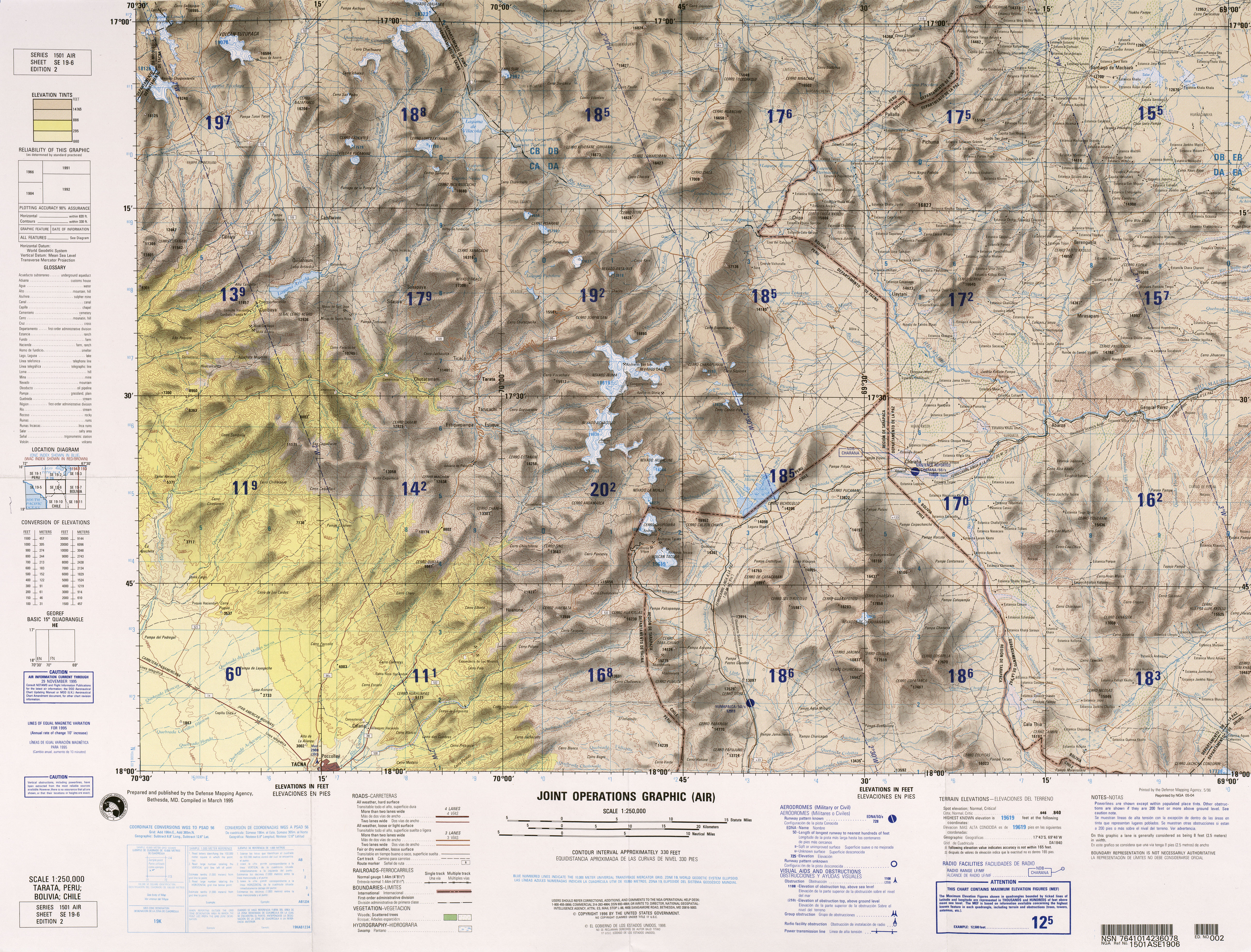
The canal proper starts at a diversion dam [4] on the Uchusuma River and runs for 47.5 kilometres (29.5 mi) (25 kilometres (16 mi) of it through Chilean territory) in a rectangular canal. [22] The Patapujo I canal joins it soon afterwards, [18] and there are two gauging stations there. [23] The path of the canal takes it through Chilean territory from Laguna Blanca along the Arica–La Paz railway southwestward between the mountains Tacora and Caracarani, close to the Canal Uchusuma. It turns around Tacora, crosses the Rio Azufre and ends close to the Peru-Chile border between the mountains Cerro Huaylillas and Cerro Tabajchuno (Paso Huaylillas Sur [4] ) into the Quebrada Vilavilani. [24] It crosses the Cordillera Barroso through the 2.2 kilometres (1.4 mi) long Huaylillas Sur tunnel, [25] [22] the water then enters the Quebrada Vilavilani proper. [2] The Canal Mauri has a capacity of 2 cubic metres per second (71 cu ft/s). [4]

The Quebrada Vilavilani descends the Andes in southwestward direction, where it has several different names, and ends close to the city of Tacna into the Caplina River. [24] There is a diversion on the Quebrada Vilavilani before it reaches the Caplina at Chuschuco, [2] which gives rise to another canal also known as Canal Uchusuma. [6]

History

Already during Spanish colonial time plans were developed to use the waters of the Uchusuma for irrigation. [26] After Chile had occupied what is now its northern territory and Peru's Tacna Department during the War of the Pacific, it examined the possibility of transferring water from the Mauri River into Tacna to enable irrigated agriculture. Construction of the canal finally began in 1921, over the objection of Bolivia which was concerned about navigation on the Desaguadero River (where the Mauri ends into) being impeded by the loss of water and water supply issues; [27] Bolivia however succeeded insofar as the Mauri River itself was not diverted. [26] In 1929, the Treaty of Lima transferred the canal and Tacna back to Peru, which thus became the owner of the system; further the treaty established that Peru had a right to maintain the parts of the canal that still laid in Chile. [1]

An early proposal by the engineer Jorge Vargas Salcedo envisaged transferring 5.8 cubic metres per second (200 cu ft/s) of water 65 kilometres (40 mi) from the Mauri to the Laguna Blanca [28] northwest of General Lagos on the present-day Peru-Chile border. [29] Laguna Blanca would operate as a reservoir and receive additional waters through 45 kilometres (28 mi) and 27 kilometres (17 mi) long canals from the Uchusuma and Putani rivers, respectively. The plan projected that about 14,000 hectares (35,000 acres) of land could be irrigated at a capital cost of US$ 4,443,020; the revenue from the irrigated land would be sufficient to offset the investment. [28]

The Canal Uchusuma already existed since 1820; it intercepted water from the Uchusuma River. [2] The Canal Mauri replaces the Uchusuma canal, [9] but according to a report in 1977, the Canal Uchusuma is still used when the other canal is under maintenance. [30] Groundwater wells were added to the system in 1970 and 1995. [26] The Canal Patapujo became operative in 1992. [31] In 2001 the canal Canal Mauri was modified to reduce seepage losses. [25] Plans to expand the diversion system to the Mauri River itself hit opposition by Bolivia in 2009 and 2010. [32]

In 1977 it was suggested that creating a reservoir in the Uchusuma River would increase the availability of water for the system, since the capacity of the Uchusuma diversion is limited and excess water flows past the diversion. [12] The Electric Power Development Company as a consequence of a contract with the Peruvian government concluded in 1960 devised a plan to extend that canal to the Mauri by pumping water from a reservoir that was to be built on the Mauri, close to the border with Bolivia. [33] The plan was shelved owing to the lack of information on the area and the opposition of the Bolivian government (the reservoir would have extended into Bolivian territory). [34]

Current status

The Canal Mauri is currently a major source of water for the Tacna valley. [35] Further plans published in 2015 envisaged the transfer of water directly from the Mauri River (at Villachaullani) to the Calachaca canal [8] and from the Ojos de Copapujo springs by 2017 and from the Chiliculco River by 2019; this concept is known as "Vilavilani II". [36]

Hydrological analysis of this concept (along with two planned reservoirs at Chuapalca and Chilicollpa) [11] suggest that the Mauri River would lose about 50% of its flow through such diversions and even more during drought periods. [37] Additional wetlands would be impacted. [38] This has resulted in opposition by inhabitants of affected areas and by the Puno Region. Such water disputes about reservoirs and river diversions have become common in Peru. [39]

Minsur's Pucamarca gold mine lies close to the canal, raising concerns about water in the canal becoming polluted. [40] The mine with reserves estimated to be 555,000 ounces gold as of 2015 is 0.5 kilometres (0.31 mi) from the canal. Minsur as a compromise undertook a project to cover part of the canal to resolve issues. [41] The first part of this project was completed in 2014 and covered about 840 metres (2,760 ft) of the canal. [42]

Related Research Articles

<span class="mw-page-title-main">Tacna</span> Place in Peru

Tacna is a city in southern Peru and the regional capital of the Tacna Region. A very commercially active city, it is located only 35 km (22 mi) north of the border with Arica y Parinacota Region from Chile, inland from the Pacific Ocean and in the valley of the Caplina River. It is Peru's tenth most populous city.

<span class="mw-page-title-main">Arica</span> City and Commune in Arica y Parinacota, Chile

Arica is a commune and a port city with a population of 222,619 in the Arica Province of northern Chile's Arica y Parinacota Region. It is Chile's northernmost city, being located only 18 km (11 mi) south of the border with Peru. The city is the capital of both the Arica Province and the Arica and Parinacota Region. Arica is located at the bend of South America's western coast known as the Arica Bend or Arica Elbow. At the location of the city are two valleys that dissect the Atacama Desert converge: Azapa and Lluta. These valleys provide citrus and olives for export.

<span class="mw-page-title-main">Ilo, Peru</span> City in Moquegua, Peru

Ilo is a port city in southern Peru, with 66,118 inhabitants. It is the second largest city in the Moquegua Region and capital of the Ilo Province.

While Peru accounts for about four per cent of the world's annual renewable water resources, over 98% of its water is available east of the Andes, in the Amazon region. The coastal area of Peru, with most of economic activities and more than half of the population, receives only 1.8% of the national freshwater renewable water resources. Economic and population growth are taking an increasing toll on water resources quantity and quality, especially in the coastal area of Peru.

<span class="mw-page-title-main">Lake Vilacota</span> Body of water

Lake Vilacota is a lake in the region of Tacna, in Peru. More precisely, it belongs to Tarata Province, Susapaya District, along the border with the Santa Rosa District of El Collao Province in the neighboring region of Puno. It has a surface elevation of 4,390 metres (14,403 ft) above sea level and a catchment area of 1,440 square kilometres (556 sq mi).

<span class="mw-page-title-main">Yucamane</span> Volcano in Peru

Yucamane, Yucamani or Yucumane is an andesitic stratovolcano in the Tacna Region of southern Peru. It is part of the Peruvian segment of the Central Volcanic Zone, one of the three volcanic belts of the Andes generated by the subduction of the Nazca plate beneath the South America plate. Peru's active volcanoes Ubinas, Sabancaya and El Misti are also part of the Central Volcanic Zone.

<span class="mw-page-title-main">Uchusuma River</span> River in Chile, Peru

The Uchusuma River originates from the Peruvian Altiplano, crosses the northern tip of Chile and reaches Bolivia where empties into Mauri River.

<span class="mw-page-title-main">Canal Lauca</span>

The Canal Lauca is an artificial channel to divert the waters of the Lauca River westward through a canal and tunnel into the Azapa Valley for purposes of irrigation in the valley and hydroelectric-power generation. Its construction began 1948 and water diversion began 14 years later from a dam located about 16 miles southwest of Lago Cotacotani Lake.

<span class="mw-page-title-main">Isluga River</span> River

Isluga River is a river in Chile and Bolivia, and is also known as Sitani or Arabilla. It starts at the confluence of the rivers Chaguane and Huinchuta and flows for 54 kilometres (34 mi) before reaching the Laguna Mucalliri of the Salar de Coipasa. It receives water from the volcanoes Isluga, Cabaray and Quimsachata as well as the Sierra Uscana.

<span class="mw-page-title-main">Canal Uchusuma</span>

Canal Uchusuma is a canal in Chile.

<span class="mw-page-title-main">Tutupaca</span> Volcano in Peru

Tutupaca is a volcano in the region of Tacna in Peru. It is part of the Peruvian segment of the Central Volcanic Zone, one of several volcanic belts in the Andes. Tutupaca consists of three overlapping volcanoes formed by lava flows and lava domes made out of andesite and dacite, which grew on top of older volcanic rocks. The highest of these is usually reported to be 5,815 metres (19,078 ft) tall and was glaciated in the past.

<span class="mw-page-title-main">Ubinas</span> Volcano in southern Peru

Ubinas is an active stratovolcano in the Moquegua Region of southern Peru, approximately 60 kilometres (37 mi) east of the city of Arequipa. Part of the Central Volcanic Zone of the Andes, it rises 5,672 metres (18,609 ft) above sea level. The volcano's summit is cut by a 1.4-kilometre-wide (0.87 mi) and 150-metre-deep (490 ft) caldera, which itself contains a smaller crater. Below the summit, Ubinas has the shape of an upwards-steepening cone with a prominent notch on the southern side. The gently sloping lower part of the volcano is also known as Ubinas I and the steeper upper part as Ubinas II; they represent different stages in the volcano's geological history.

<span class="mw-page-title-main">Chungará Lake</span> Lake situated in the Lauca National Park, Chile

Chungará is a lake situated in the extreme north of Chile at an elevation of 4,517 metres (14,820 ft), in the Altiplano of Arica y Parinacota Region in the Lauca National Park. It has a surface area of about 21.5–22.5 square kilometres (8.3–8.7 sq mi) and has a maximum depth of about 26–40 metres (85–131 ft). It receives inflow through the Río Chungara with some minor additional inflows, and loses most of its water to evaporation; seepage into the Laguna Quta Qutani plays a minor role.

<span class="mw-page-title-main">Chapiquiña Power Plant</span> Hydroelectric power station in Chile

Chapiquiña power plant is a hydroelectric power plant in northern Chile. It takes water from the Canal Lauca and produces electrical power through a Pelton turbine.

<span class="mw-page-title-main">Laguna del Negro Francisco</span> Lake in Atacama Region, Chile

Laguna del Negro Francisco is a lake in the Atacama Region of Chile and the southernmost closed lake in the country. It is situated 200 kilometres (120 mi) northeast of the city of Copiapó. The lake is about 10 kilometres (6.2 mi) long and 4 kilometres (2.5 mi) wide with a surface area of about 20.7 square kilometres (8.0 sq mi) and a depth of about 1 metre. A peninsula, probably formed by a moraine and subsequently modified by wind-driven accumulation of sand, separates the lake into a north-northwesterly and a south-southeasterly half with different colour and water composition.

Majes-Siguas is an irrigation project in Peru which envisages transferring water from the Colca River to the Siguas River for irrigation purposes, and further to take water from the Apurimac River.

Purupuruni is a group of lava domes in southern Peru and a correlative geological formation. They are among the many volcanoes that exist in Peru and whose activity has been associated with the subduction of the Nazca Plate beneath the South America Plate. Purupuruni is associated with a geothermal field and a caldera. Volcanic activity occurred during the Pleistocene 53,000 ± 8,000 years ago but also during the Holocene about 5,300 ± 1,100 years ago; today the volcano is considered to be a low hazard volcano but is being monitored nevertheless.

<span class="mw-page-title-main">Casiri (Tacna)</span> Volcano in Peru

Casiri, also known as Paucarani, is an about 5,650 metres (18,537 ft) high complex volcano in the Barroso mountain range of the Andes, in the Tacna Region of Peru. It consists of four individual volcanic edifices with lava domes; the southeasternmost edifice has been active during the Holocene, producing thick lava flows that have overrun moraines of Pleistocene age. The youngest lava flow has been dated to 2,600 ± 400 years ago. Although no historical eruptions are known, the volcano is considered to be potentially active and is monitored.

<span class="mw-page-title-main">Chilean–Peruvian territorial dispute</span>

The Chilean–Peruvian territorial dispute is a territorial dispute between Chile and Peru that started in the aftermath of the War of the Pacific and ended significantly in 1929 with the signing of the Treaty of Lima and in 2014 with a ruling by the International Court of Justice. The dispute applies since 2014 to a 37,610 km2 territory in the Chile–Peru border, as a result of the maritime dispute between both states.

References

  1. 1 2 Glassner 1970, p. 204.
  2. 1 2 3 4 Ministry of Agriculture of Peru 1977, p. 13.
  3. Autoridad Nacional de Agua 2015, p. 176.
  4. 1 2 3 4 5 Pocollay District 2012, p. 142.
  5. Pocollay District 2012, p. 123.
  6. 1 2 Pocollay District 2012, p. 140.
  7. Pocollay District 2012, p. 143.
  8. 1 2 3 Chávez, Manuel Colla. "CRISIS DEL AGUA Y CAMBIO CLIMATICO" (PDF). Centro de Competencias de Agua. Archived from the original (PDF) on 24 February 2017. Retrieved 28 February 2018.
  9. 1 2 Jaén, Hugo; Ortiz, Guillermo (September 1963). "GEOLOGI A DE L CUA DRA NGULO DE HUAYLILLAS" (PDF) (in Spanish). Comision Carta Geologica Nacional. p. 37. Retrieved 27 February 2018.
  10. Pocollay District 2012, p. 39.
  11. 1 2 Molina Carpio, Cruz & Alurralde 2012, p. 5.
  12. 1 2 Ministry of Agriculture of Peru 1977, p. 34.
  13. Molina Carpio, Cruz & Alurralde 2012, p. 4.
  14. Luizaga, Dennis (12 November 2016). "Agente Rodríguez alerta sobre agenda del agua pendiente con Perú y Chile" (in Spanish). La Paz. La Rázon. Retrieved 28 February 2018.
  15. Pocollay District 2012, p. 131.
  16. Ministry of Agriculture of Peru 1977, p. 35.
  17. Grupo Inclam (October 2013). "Plan de gestión de los recursos hídricos de cuenca Caplina - Locumba" (PDF). Autoridad Nacional de Agua (in Spanish). Retrieved 28 February 2018.
  18. 1 2 3 4 Pocollay District 2012, p. 141.
  19. Autoridad Nacional de Agua 2015, p. 230.
  20. Autoridad Nacional de Agua 2015, p. 18.
  21. "Canal Calachaca Tramo II Permite Incrementar Captación hasta 250 L/s" (in Spanish). Projeto Especial Tacna. July 2016. Retrieved 28 February 2018.
  22. 1 2 Ministry of Agriculture of Peru 1977, p. 12.
  23. Autoridad Nacional de Agua 2015, p. 19.
  24. 1 2 Tarata, Peru; Bolivia; Chile (Map) (2nd ed.). 1:250000. Joint Operations Graphic. Defense Mapping Agency . Retrieved 27 February 2018.
  25. 1 2 Autoridad Nacional de Agua 2015, p. 177.
  26. 1 2 3 Laureano del Castillo Pinto 2013, p. 26.
  27. Glassner 1970, p. 203.
  28. 1 2 Castro & Figueroa 2002, p. 85.
  29. Castro & Figueroa 2002, p. 86.
  30. Ministry of Agriculture of Peru 1977, p. 14.
  31. Autoridad Nacional de Agua 2015, p. 122.
  32. Laureano del Castillo Pinto 2013, p. 27.
  33. Ministry of Agriculture of Peru 1977, p. 2.
  34. Ministry of Agriculture of Peru 1977, pp. 2–3.
  35. Pocollay District 2012, p. 38.
  36. Autoridad Nacional de Agua 2015, p. 178.
  37. Molina Carpio, Cruz & Alurralde 2012, p. 6.
  38. Molina Carpio, Cruz & Alurralde 2012, p. 7.
  39. "Proyecto Vilavilani II, la manzana de la discordia entre Tacna y Puno" (in Spanish). La República. 9 October 2017. Retrieved 1 March 2018.
  40. Nieto, Luz Elena Vega (30 August 2013). "Alcalde de Tacna denuncia que movieron hito 52 en frontera con Chile" (in Spanish). La República. Retrieved 28 February 2018.
  41. Rivera, Liz Ferrer (6 March 2015). "Minsur niega uso de más agua para exploraciones" (in Spanish). Tacna. La República. Retrieved 28 February 2018.
  42. Guevara, Diego (11 December 2014). "Tacna: Minera Minsur entregó ayer obra de recubrimiento del canal de Uchusuma". La República (in Spanish). Tacna. Retrieved 28 February 2018.

Sources