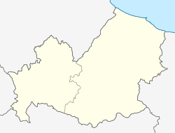
Cantalupo nel Sannio | ||
---|---|---|
Comune | ||
Comune di Cantalupo nel Sannio | ||
| ||
Coordinates: 41°31′N14°40′E / 41.517°N 14.667°E Coordinates: 41°31′N14°40′E / 41.517°N 14.667°E | ||
Country | Italy | |
Region | Molise | |
Province | Isernia (IS) | |
Government | ||
• Mayor | Achille Caranci | |
Area | ||
• Total | 15.64 km2 (6.04 sq mi) | |
Elevation | 587 m (1,926 ft) | |
Population (31 December 2017) | ||
• Total | 764 | |
• Density | 49/km2 (130/sq mi) | |
Demonym(s) | Cantalupesi | |
Time zone | UTC+1 (CET) | |
• Summer (DST) | UTC+2 (CEST) | |
Postal code | 86092 | |
Dialing code | 0865 | |
Patron saint | St. Anne | |
Saint day | July 26 | |
Website | Official website |
Cantalupo nel Sannio is a town and comune in the province of Isernia, in the Molise region of southern Italy.
The town was known simply as Cantalupo until February 4, 1864, when the denomination nel Sannio was added in order to differentiate it from other villages with the same name. [1] The specification of nel Sannio is derived from the fact that the village is located in the ancient territory of Samnium, which was inhabited by the Italic tribes known as the Samnites. The name Cantalupo is thought either to derive from the Greek "Kata-Lupon", meaning "in the middle of the woods", or from the Bulgarian "Kan-Teleped", meaning "chief residence". [1] The latter explanation is favoured due to the well-established Bulgar presence in the territory of Samnium going back at least to the 7th century. [1]
Many Cantalupo's inhabitants emigrated to North America, Australia, South America, and other places following both the Great War and World War II. A substantial population of Cantalupesi settled in Montreal, Quebec, Canada and Anaconda, Montana, United States, where they founded and still maintain the Associazione di Sant'Anna di Cantalupo, named in honour of the village's patron saint, Saint Anne, Christ's maternal grandmother. She became Cantalupo's patron following an earthquake on July 26, 1805 (which is the feast day of Saint Anne), that miraculously ended when the Saint's statue was taken out of the village church of San Salvatore.
Torella del Sannio is a town and comune in the province of Campobasso.
Farra d'Isonzo is an Italian comune in the region of Friuli-Venezia Giulia, in the province of Gorizia.
Cantalupo in Sabina is a town and comune in the province of Rieti, on the Sabine Hills of Lazio. It is famous as the reputed origin of the muskmelon called a cantaloupe melon.
Castel Maggiore is an Italian comune in the Metropolitan City of Bologna, Emilia-Romagna, central Italy, located 9 kilometres (6 mi) north of the centre of Bologna. Literally, its name means Great Castle, but the name is derived from the earlier name Castaniolo Maggiore.
Villamagna is a comune and town in the province of Chieti in the Abruzzo region of south-eastern Italy.
Montefino is a small town and predominantly rural comune of the province of Teramo in the Abruzzo region of eastern Italy. During the second half of the twentieth century the population of the comune declined steadily from 2,399 in 1951 to 1,184—less than half—in 2001.
Truden im Naturpark is a comune (municipality) in South Tyrol in northern Italy, located about 20 kilometres (12 mi) south of the city of Bolzano. Until March 2008 it was called simply Truden.
Borghetto di Borbera is a comune (municipality) in the Province of Alessandria in the Italian region Piedmont, located about 110 kilometres (68 mi) southeast of Turin and about 35 kilometres (22 mi) southeast of Alessandria.
Cantalupo Ligure is a comune (municipality) in the Province of Alessandria in the Italian region Piedmont, located about 110 kilometres (68 mi) southeast of Turin and about 40 kilometres (25 mi) southeast of Alessandria.
Roccaforte Ligure is a comune (municipality) in the Province of Alessandria in the Italian region Piedmont, located about 110 kilometres (68 mi) southeast of Turin and about 40 kilometres (25 mi) southeast of Alessandria, between the Val Sisola and the Valle Spinti.
Calvi is a comune (municipality) in the Province of Benevento in the southern Italian region Campania, located about 60 km northeast of Naples and about 10 km southeast of Benevento. It also belongs to the Samnium historical region. Its territory has an altitude of between 169m and 388m above sea level.
Circello is a comune (municipality) in the Province of Benevento in the Italian region Campania, located about 70 kilometres (43 mi) northeast of Naples and about 25 km north of Benevento and approximately 700 metres (2,300 ft) above sea level.
Pietraroja is a mountain comune (municipality) in the province of Benevento in Campania, southern Italy. It is c. 50 km by car from Benevento, in direction north-west, 83 km from Naples in direction north-east and c. 223 km from Rome in direction south-east.
Baranello is a comune (municipality) in the Province of Campobasso in the Italian region Molise, located about 10 kilometres (6 mi) southwest of Campobasso. This town draws its name as a derivative of Monte Vairano which was a hilltop Samnite village and now is an archeological site.
Castelmauro is a comune (municipality) in the Province of Campobasso in the Italian region Molise, located about 30 kilometres (19 mi) north of Campobasso.
Montefalcone nel Sannio is a comune (municipality) in the Province of Campobasso in the Italian region Molise, located about 35 kilometres (22 mi) north of Campobasso.
Roccavivara is a comune (municipality) in the Province of Campobasso in the Italian region Molise, located about 30 kilometres (19 mi) north of Campobasso.
San Massimo is a comune (municipality) in the Province of Campobasso in the Italian region Molise, located about 25 kilometres (16 mi) southwest of Campobasso, comprising 27.6 square kilometres (10.7 sq mi).
Vinchiaturo is a comune (municipality) in the Province of Campobasso in the Italian region Molise, located about 10 kilometres (6 mi) southwest of Campobasso.
Roccamandolfi is a comune (municipality) in the Province of Isernia in the Italian region Molise, located about 25 kilometres (16 mi) southwest of Campobasso and about 15 kilometres (9 mi) southeast of Isernia.
![]() | This article on a location in Molise is a stub. You can help Wikipedia by expanding it. |