Carovilli | |
---|---|
Comune | |
Comune di Carovilli | |
Coordinates: 41°43′N14°18′E / 41.717°N 14.300°E Coordinates: 41°43′N14°18′E / 41.717°N 14.300°E | |
Country | Italy |
Region | Molise |
Province | Province of Isernia (IS) |
Frazioni | Briccioso, Castiglione, Cerrosavino, Fontecurelli, Pescorvaro |
Area | |
• Total | 41.6 km2 (16.1 sq mi) |
Elevation | 865 m (2,838 ft) |
Population (Dec. 2004) | |
• Total | 1,508 |
• Density | 36/km2 (94/sq mi) |
Demonym(s) | Carovillesi |
Time zone | CET (UTC+1) |
• Summer (DST) | CEST (UTC+2) |
Postal code | 86083 |
Dialing code | 0865 |
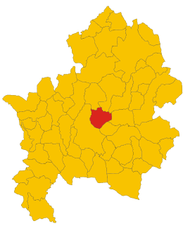
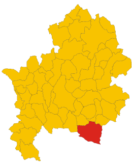
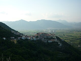
Carovilli is a comune (municipality) in the Province of Isernia in the Italian region Molise, located about 35 kilometres (22 mi) northwest of Campobasso and about 14 kilometres (8.7 mi) northeast of Isernia. As of 31 December 2004, it had a population of 1,508 and an area of 41.6 square kilometres (16.1 sq mi). [1]
The comune is a basic administrative division in Italy, roughly equivalent to a township or municipality.
The province of Isernia is a province in the region of Molise in Italy. The provincial capital is the city Isernia and the president of the province is Luigi Brasiello. The province of Isernia has an area of 1,535.24 square kilometres (592.76 sq mi) and a population of 86,405 inhabitants as of 2016. It contains 52 comunes in the province, listed at comunes of the Province of Isernia.
Italy, officially the Italian Republic, is a country in Southern and Western Europe. Located in the middle of the Mediterranean Sea, Italy shares open land borders with France, Switzerland, Austria, Slovenia and the enclaved microstates San Marino and Vatican City. Italy covers an area of 301,340 km2 (116,350 sq mi) and has a largely temperate seasonal and Mediterranean climate. With around 61 million inhabitants, it is the fourth-most populous EU member state and the most populous country in Southern Europe.
The municipality of Carovilli contains the frazioni (subdivisions, mainly villages and hamlets) Briccioso, Castiglione, Cerrosavino, Fontecurelli, and Pescorvaro.
"Frazione" is the Italian name given in administrative law to a type of territorial subdivision of a comune; for other administrative divisions, see municipio, circoscrizione, quartiere. It is cognate to the English word fraction, but in practice is roughly equivalent to "parishes" or "wards" in other countries.
Carovilli borders the following municipalities: Agnone, Miranda, Pescolanciano, Roccasicura, Vastogirardi.
Agnone is a comune in the province of Isernia, in the Molise region of southern Italy. Agnone is known for the manufacturing of bells by the Marinelli Bell Foundry. It is some 53 kilometres (33 mi) northwest of Campobasso. The town of Agnone proper is complemented with other populated centers like Fontesambuco, Villa Canale and Rigaini.
Pescolanciano is a comune (municipality) in the Province of Isernia in the Italian region Molise, located about 30 kilometres (19 mi) northwest of Campobasso and about 12 kilometres (7 mi) northeast of Isernia.
Roccasicura is a comune (municipality) in the Province of Isernia in the Italian region Molise, located about 40 kilometres (25 mi) northwest of Campobasso and about 11 kilometres (7 mi) north of Isernia. As of 31 December 2004, it had a population of 610 and an area of 29.0 square kilometres (11.2 sq mi).
Carpinone is a comune (municipality) in the Province of Isernia in the Italian region Molise, located about 30 kilometres (19 mi) west of Campobasso and about 7 kilometres (4 mi) east of Isernia. As of 31 December 2004, it had a population of 1,273 and an area of 32.5 square kilometres (12.5 sq mi).
Cerro al Volturno is a comune (municipality) in the Province of Isernia in the Italian region Molise, located about 45 kilometres (28 mi) west of Campobasso and about 10 kilometres (6 mi) northwest of Isernia.
Chiauci is a comune (municipality) in the Province of Isernia in the Italian region Molise, located about 25 kilometres (16 mi) northwest of Campobasso and about 15 kilometres (9 mi) northeast of Isernia.
Colli a Volturno is a comune (municipality) in the Province of Isernia in the Italian region Molise, located about 45 kilometres (28 mi) west of Campobasso and about 11 kilometres (7 mi) west of Isernia. As of 31 December 2004, it had a population of 1,377 and an area of 24.3 square kilometres (9.4 sq mi).
Conca Casale is a comune (municipality) in the Province of Isernia in the Italian region Molise, located about 50 kilometres (31 mi) west of Campobasso and about 20 kilometres (12 mi) southwest of Isernia.
Forlì del Sannio is a comune (municipality) in the Province of Isernia in the Italian region Molise, located about 45 kilometres (28 mi) northwest of Campobasso and about 12 kilometres (7 mi) northwest of Isernia.
For people with the surname, see Fornelli (surname).
Longano is a comune (municipality) in the Province of Isernia in the Italian region of Molise, located about 35 kilometres (22 mi) west of Campobasso and about 9 kilometres (6 mi) south of Isernia. As of 31 December 2004, it had a population of 720 and an area of 27.1 square kilometres (10.5 sq mi).
Macchia d'Isernia is a comune (municipality) in the Province of Isernia in the Italian region Molise, located about 40 kilometres (25 mi) west of Campobasso and about 7 kilometres (4 mi) southwest of Isernia.
Miranda is a comune (municipality) in the Province of Isernia in the Italian region Molise, located about 35 kilometres (22 mi) northwest of Campobasso and about 6 kilometres (4 mi) north of Isernia. As of 31 December 2004, it had a population of 1,065 and an area of 22.3 square kilometres (8.6 sq mi).
Pesche is a comune (municipality) in the Province of Isernia in the Italian region Molise, located about 30 kilometres (19 mi) west of Campobasso and about 5 kilometres (3 mi) northeast of Isernia. As of 31 December 2004, it had a population of 1,459 and an area of 12.7 square kilometres (4.9 sq mi).
Pescopennataro is a comune (municipality) in the Province of Isernia in the Italian region Molise, located about 45 kilometres (28 mi) northwest of Campobasso and about 30 kilometres (19 mi) north of Isernia.
Roccamandolfi is a comune (municipality) in the Province of Isernia in the Italian region Molise, located about 25 kilometres (16 mi) southwest of Campobasso and about 15 kilometres (9 mi) southeast of Isernia.
Sant'Agapito is a comune (municipality) in the Province of Isernia in the Italian region Molise, located about 40 kilometres (25 mi) west of Campobasso and about 6 kilometres (4 mi) south of Isernia.
Sant'Elena Sannita is a comune (municipality) in the Province of Isernia in the Italian region Molise, located about 15 kilometres (9 mi) west of Campobasso and about 20 kilometres (12 mi) east of Isernia.
Sessano del Molise is a comune (municipality) in the Province of Isernia in the Italian region Molise, located about 30 kilometres (19 mi) northwest of Campobasso and about 9 kilometres (6 mi) northeast of Isernia. As of 31 December 2004, it had a population of 871 and an area of 24.7 square kilometres (9.5 sq mi).
Sesto Campano is a comune (municipality) in the Province of Isernia in the Italian region Molise, located about 50 kilometres (31 mi) southwest of Campobasso and about 25 kilometres (16 mi) southwest of Isernia.
Vastogirardi is a comune (municipality) in the Province of Isernia in the Italian region Molise, located about 40 kilometres (25 mi) northwest of Campobasso and about 20 kilometres (12 mi) north of Isernia. As of 31 December 2004, it had a population of 789 and an area of 60.9 square kilometres (23.5 sq mi).
This article on a location in Molise is a stub. You can help Wikipedia by expanding it. |