
The Capo Sandalo Lighthouse is prominent lighthouse on the westernmost point of San Pietro Island marking the southwestern corner of Sardinia, Italy.

Capo dell'Armi Lighthouse is an active lighthouse in Reggio Calabria, southern Italy. Located along the cliffs of the headland, in the comune of Motta San Giovanni, it is an important reference for ships coming into the Strait of Sicily from the south.

Capo Carbonara Lighthouse is a light situated at the extremity of the granite promontory of Capo Carbonara, in the comune of Villasimius, on the eastern side of Gulf of Cagliari inside the Marine protected area of Capo Carbonara.

Capo Vaticano Lighthouse is an active lighthouse located in Capo Vaticano, which is a Cape in the south western Calabria on the Tyrrhenian Sea.
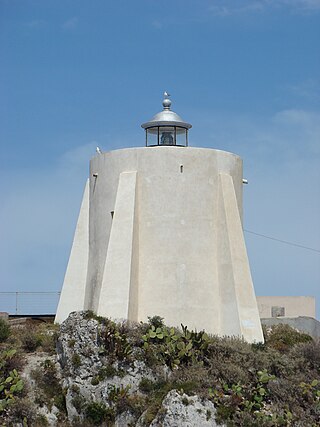
Capo Milazzo Lighthouse is an active lighthouse located at the northern extremity of the peninsula of Capo di Milazzo which extends toward the Tyrrhenian Sea in the province of Milazzo.

Capo Palinuro Lighthouse is an active lighthouse located in the south-western Italy, roughly 40 miles (64 km) south-west of Salerno, in the southern part of Cilento.

Capo Peloro Lighthouse is an active lighthouse located in Punta del Faro on the Strait of Messina, the most north-eastern promontory of Sicily, settled in the Province of Messina, the place closest to Calabria.

Capo Comino Lighthouse is an active lighthouse located on the easternmost promontory of Sardinia, in the municipality of Siniscola, on the Tyrrhenian Sea.
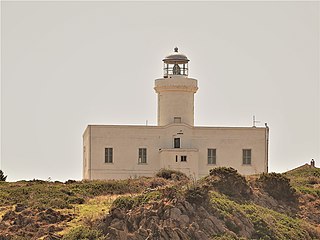
Capo Ferro Lighthouse is an active lighthouse located on the same name promontory which marks the southern entrance to the Strait of Bonifacio and to the Maddalena archipelago, in the municipality of Arzachena, in the north east of Sardinia, Italy, on the Tyrrhenian Sea.
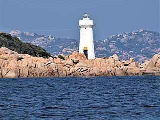
Capo d'Orso Lighthouse is an active lighthouse located on the tip of Capo d'Orso promontory in front of the Maddalena archipelago, in the municipality of Palau, in the north east of Sardinia on the Tyrrhenian Sea.
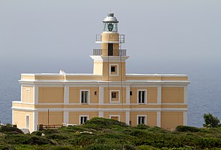
Capo San Marco Lighthouse is an active lighthouse located on Capo San Marco promontory, on the tip of Sinis peninsula overlooking the ruins below of Tharros. The structure is in the municipality of Cabras, in the west of the island on the Sea of Sardinia.
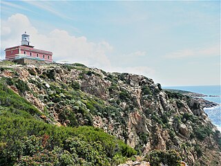
Capo Spartivento Lighthouse is an active lighthouse located on Cape Spartivento promontory which is the southernmost point of Sardinia and represents the eastern boundary of the Gulf of Teulada and the western limit of the Gulf of Cagliari on the Tyrrhenian Sea. The structure is situated in the municipality of Domus de Maria.

Capo Testa Lighthouse is an active lighthouse located on a promontory, which is the northernmost point of Sardinia, and represents the western entrance to the Strait of Bonifacio. Cape Testa promontory is connected to the mainland by an isthmus and the structure is situated in the municipality of Santa Teresa di Gallura on the Sea of Sardinia.
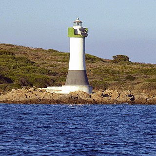
Isola delle Bisce Lighthouse is an active lighthouse located on a small islet, 590 metres (1,940 ft) from Capo Ferro Lighthouse, which make part of the Maddalena archipelago in the Strait of Bonifacio. The lighthouse guides the ships through the narrow Canale delle Bisce; the structure is situated in the municipality of Arzachena on the Tyrrhenian Sea.

Isola della Bocca Lighthouse is an active lighthouse located on a small islet, at the southern entrance of the outer Port of Olbia, 250 metres (820 ft) from the mainland, in the municipality of Olbia on the Tyrrhenian Sea.

Isola dei Cavoli Lighthouse is an active lighthouse located on a small islet, 690 metres (2,260 ft) from Cape Carbonara, the southernmost tip of western Sardinia in the municipality of Villasimius on the Tyrrhenian Sea.

Isolotto della Maddalena Lighthouse is an active lighthouse located on a small islet, 84 metres (276 ft) long, placed 800 metres (2,600 ft) north of the south mole of the Port of Alghero on the Sea of Sardinia.

Porto Conte Lighthouse is an active lighthouse located on a promontory, halfway on the east side of the bay of Porto Conte, opposite to Capo Caccia Lighthouse and west of Alghero on the Sea of Sardinia.

Capo Gallo Lighthouse is an active lighthouse located on the northern tip of the promontory of Monte Pellegrino marks the western entrance to the Gulf of Palermo, Sicily on the Tyrrhenian Sea.

Capo Granitola Lighthouse is an active lighthouse located on the south-western headland south of Mazzara del Vallo a region well known for its Almadraba. The tower is well placed in the nearby archeological park Cave di Cusa and is located in the municipality of Campobello di Mazara, Sicily on the Strait of Sicily.


