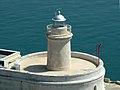
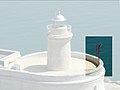
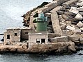
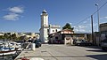
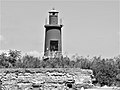
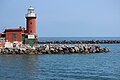
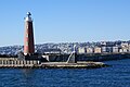
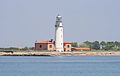
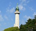
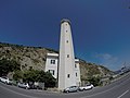
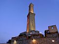
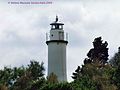
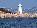
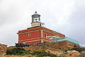
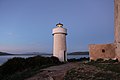
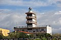
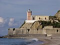
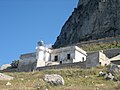
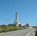
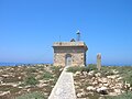
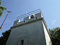
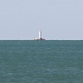
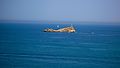
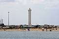
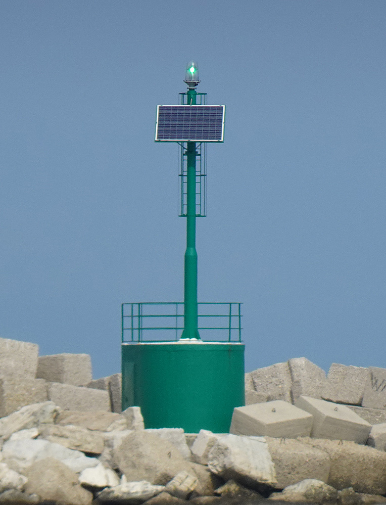
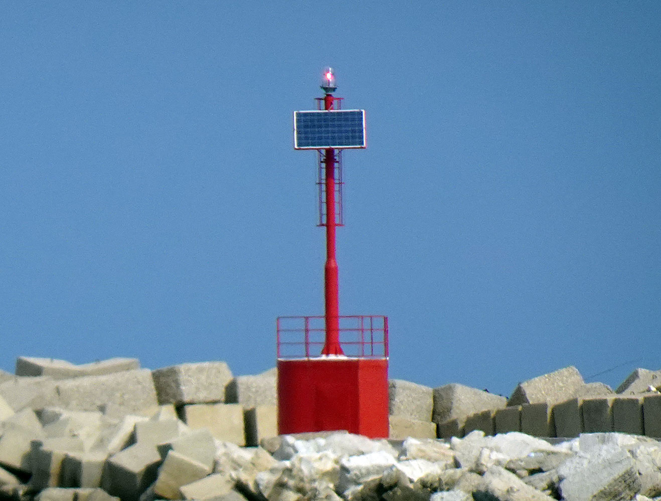
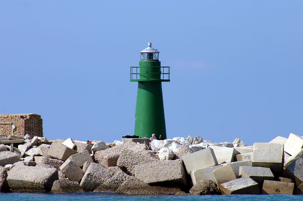
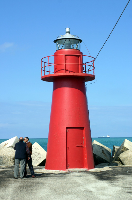
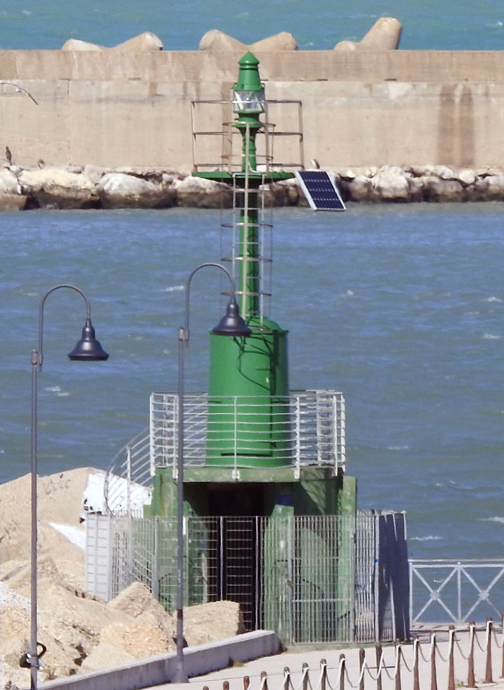
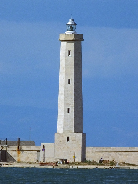
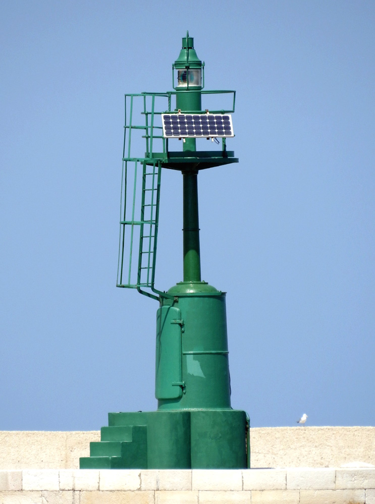
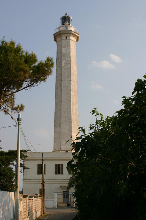
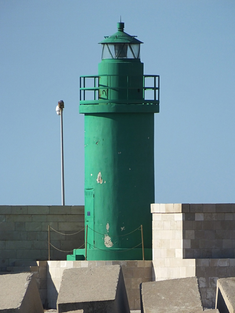
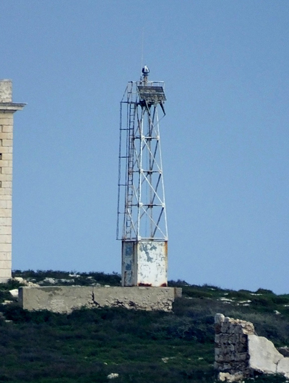
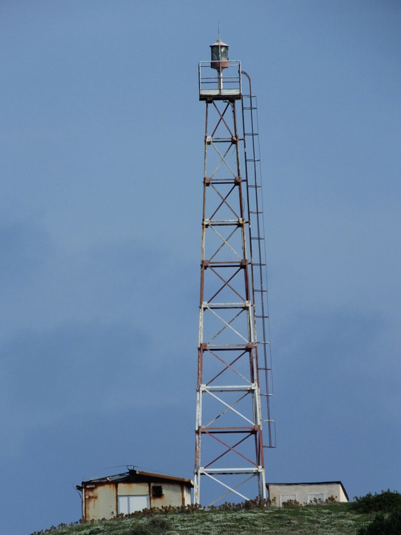
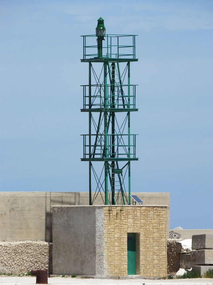
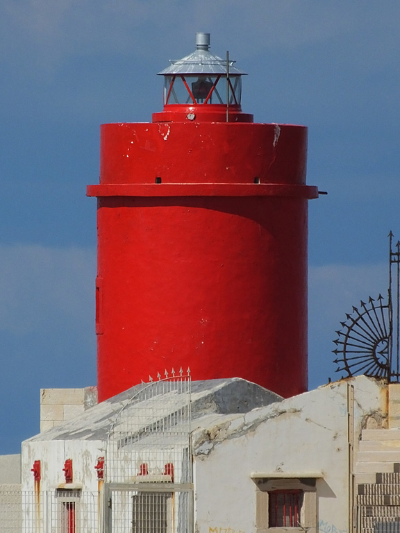
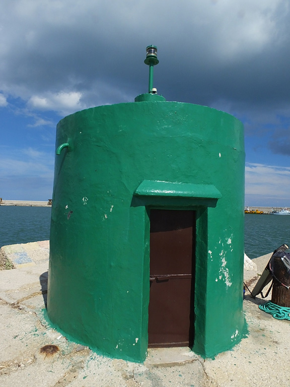
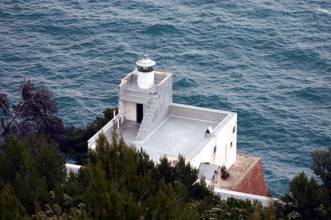
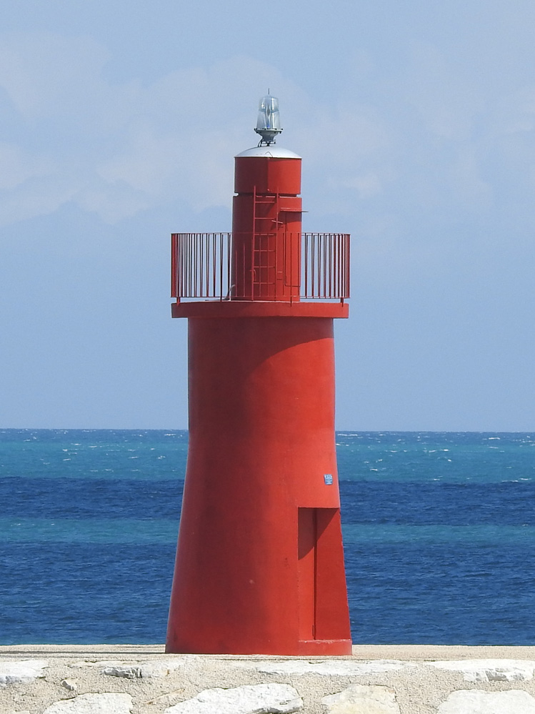
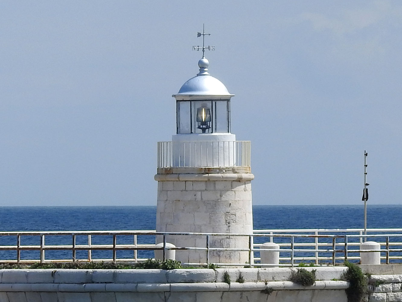
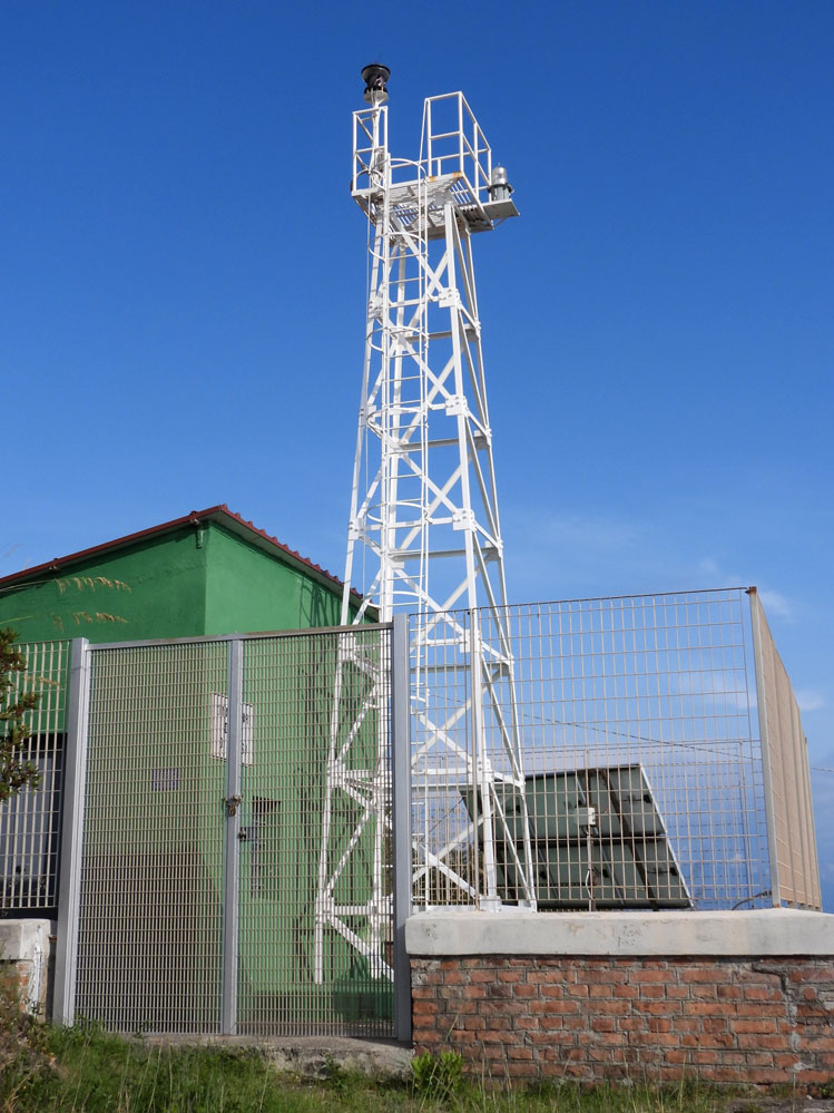
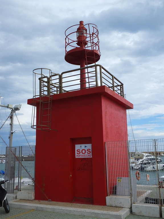
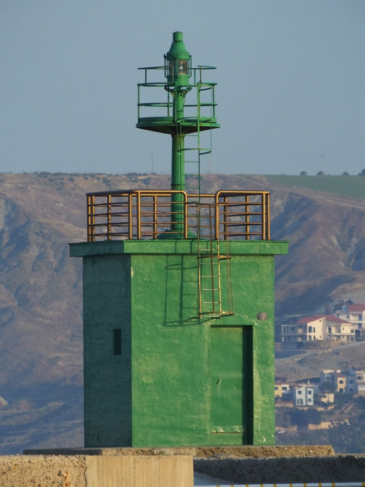
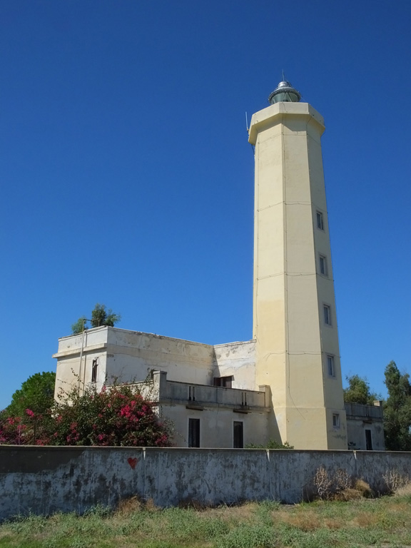
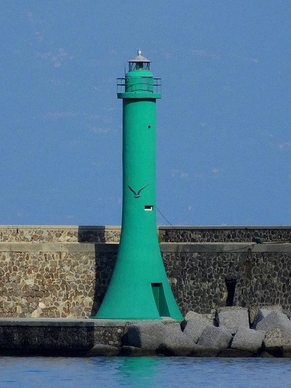
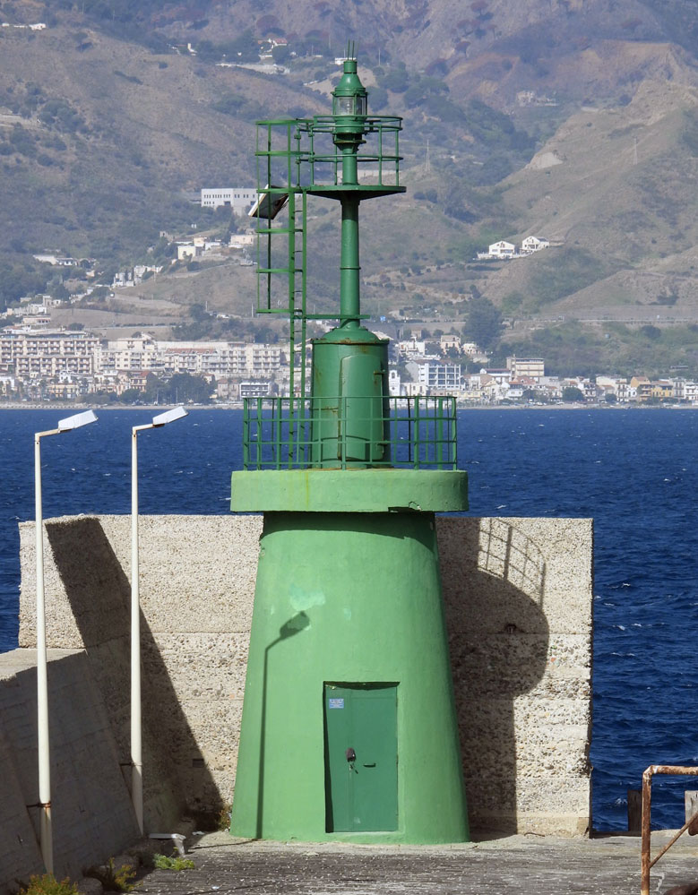
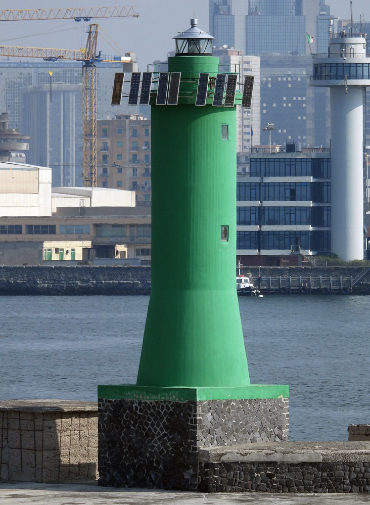
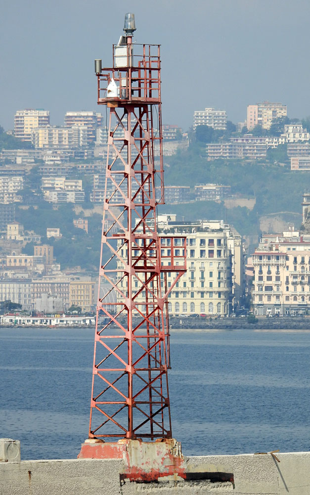
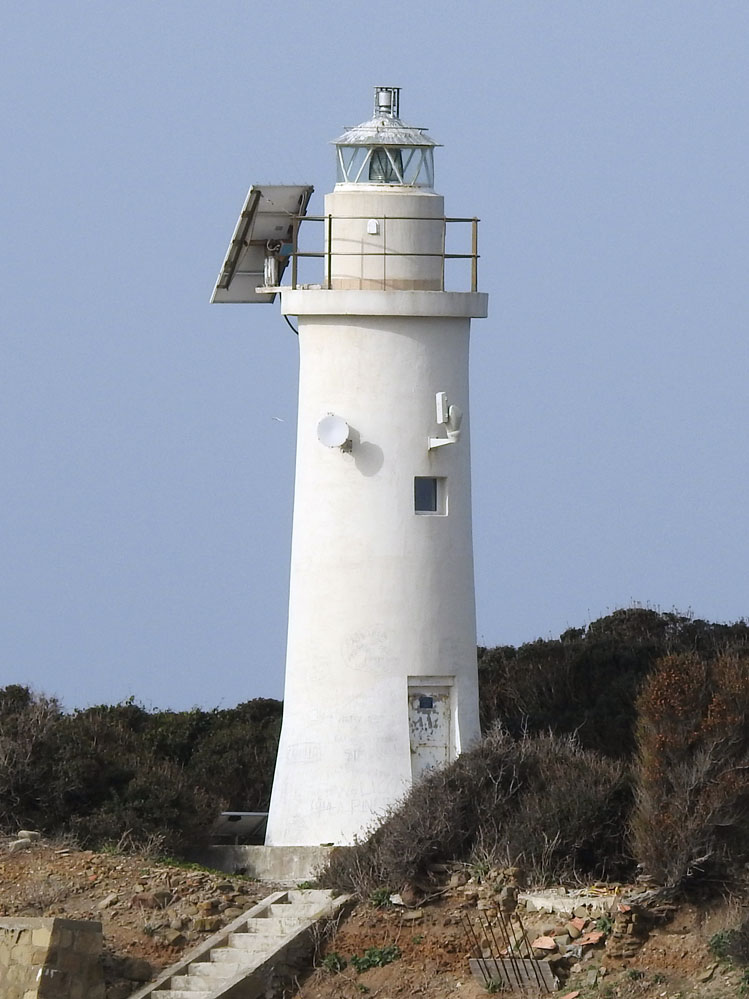
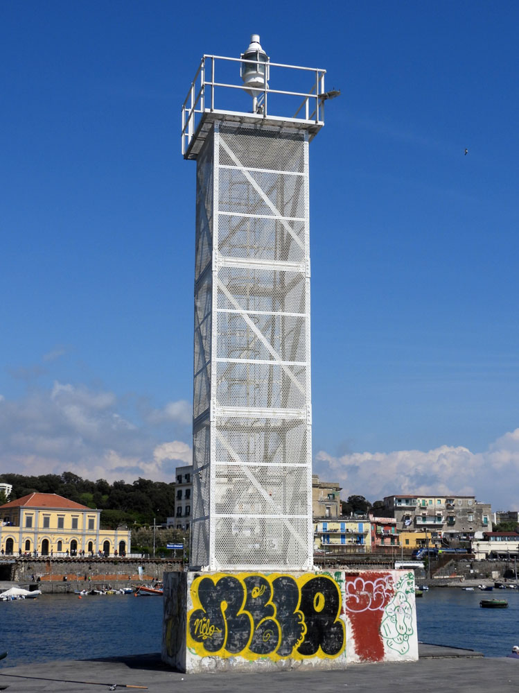
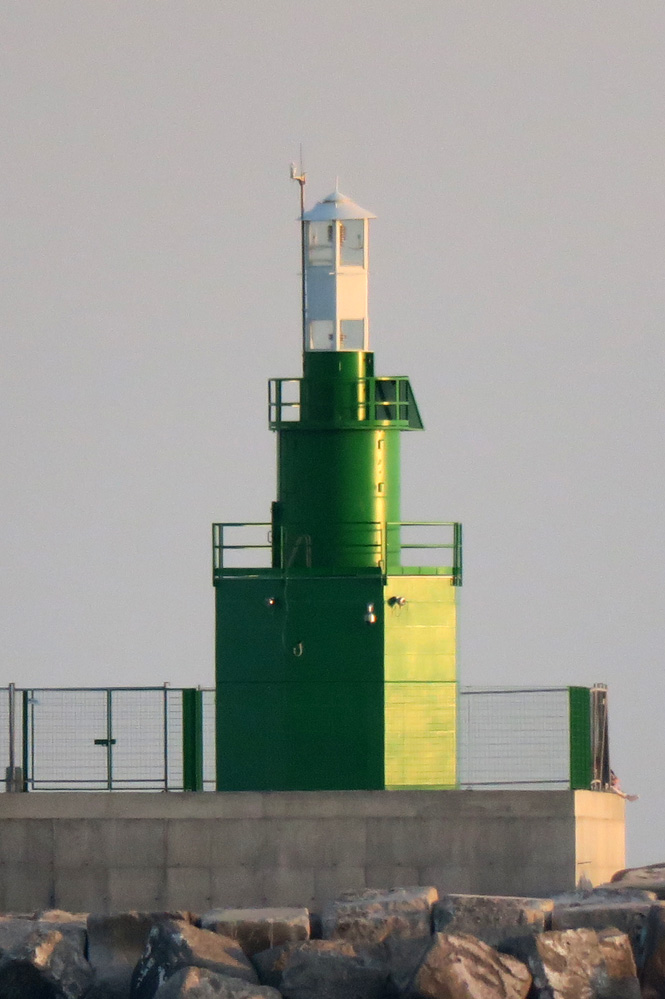
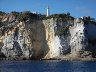
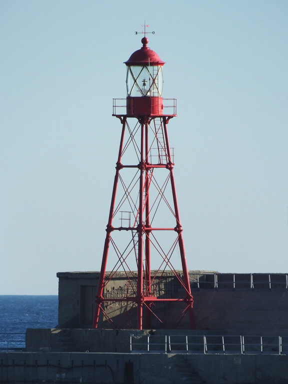
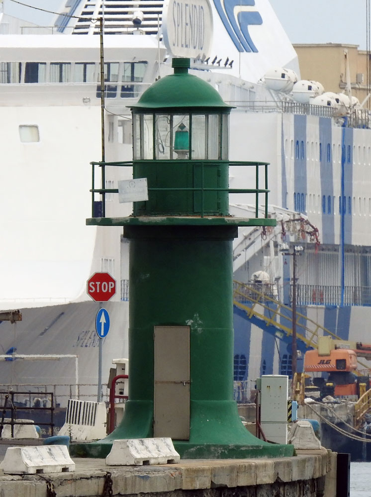
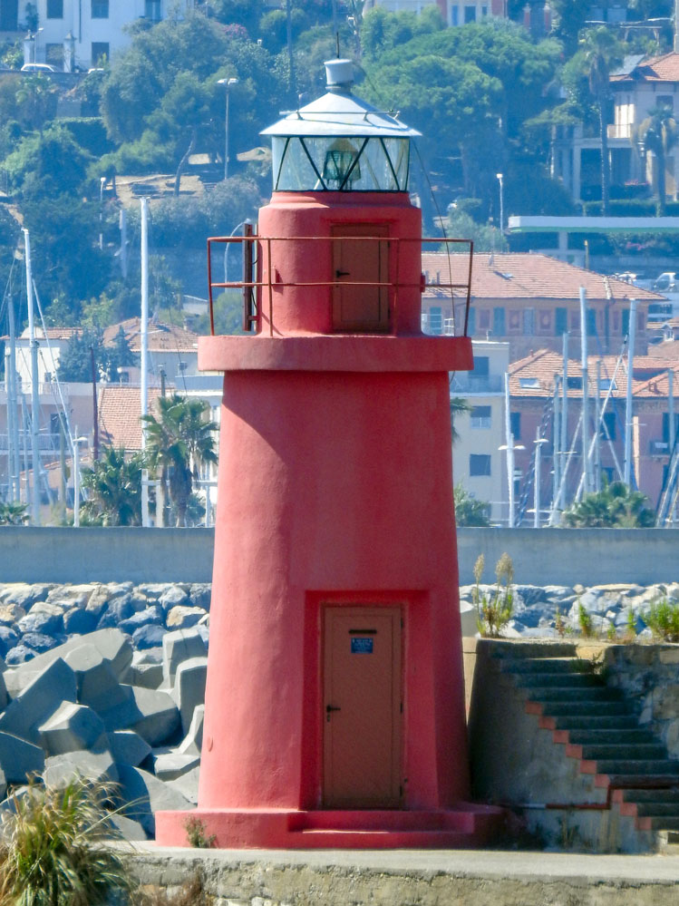
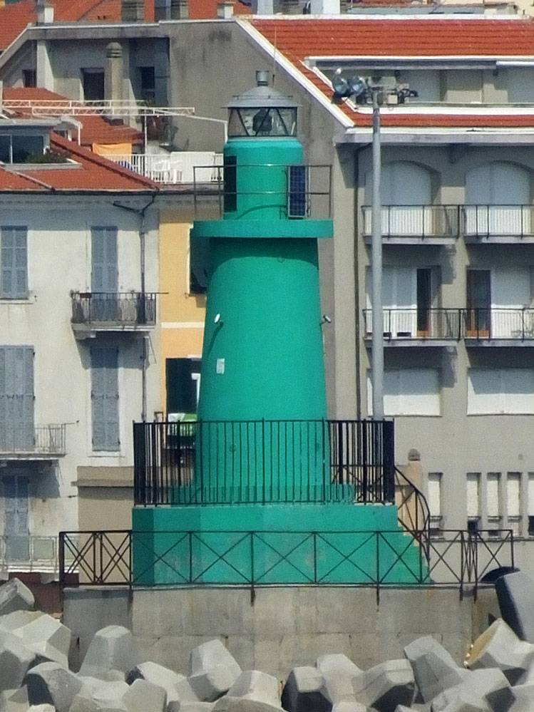
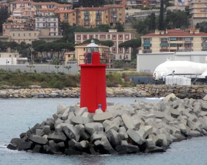
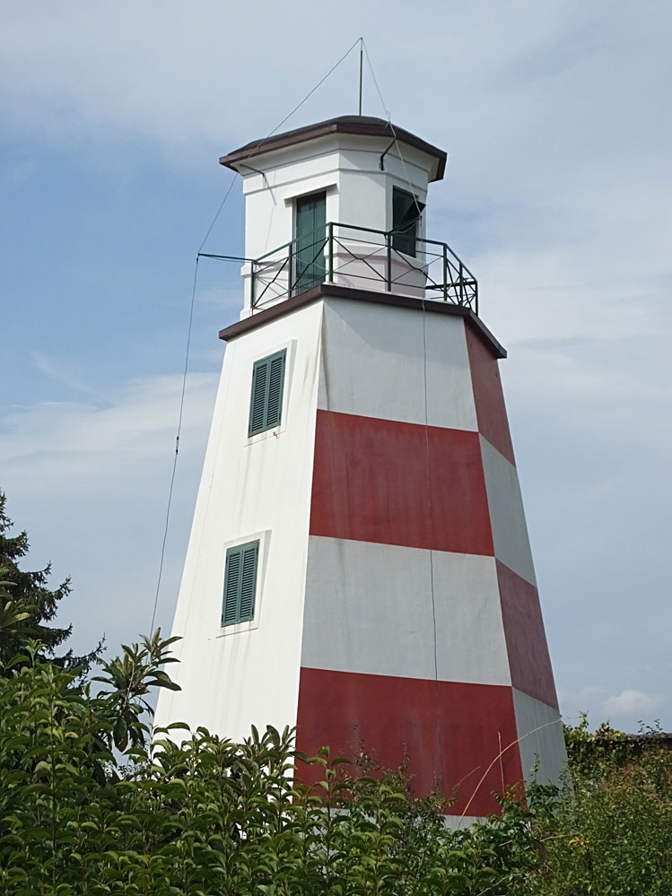
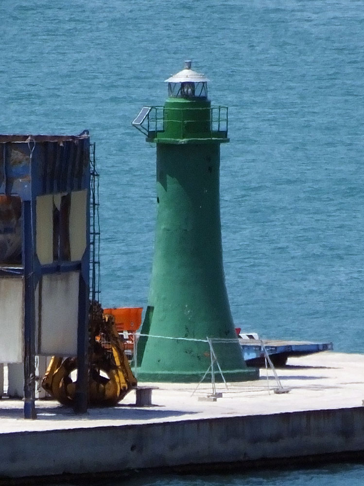
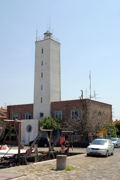
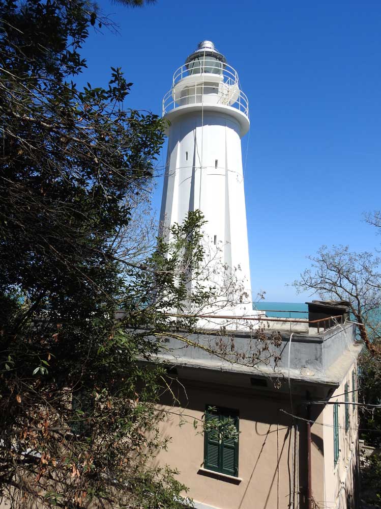
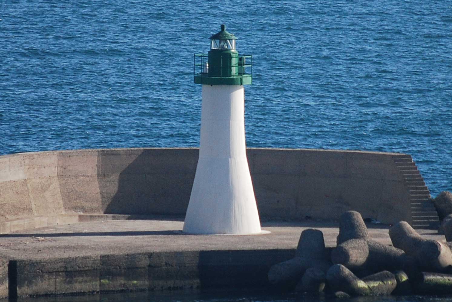
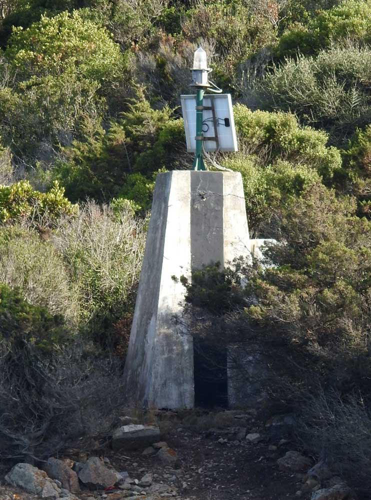
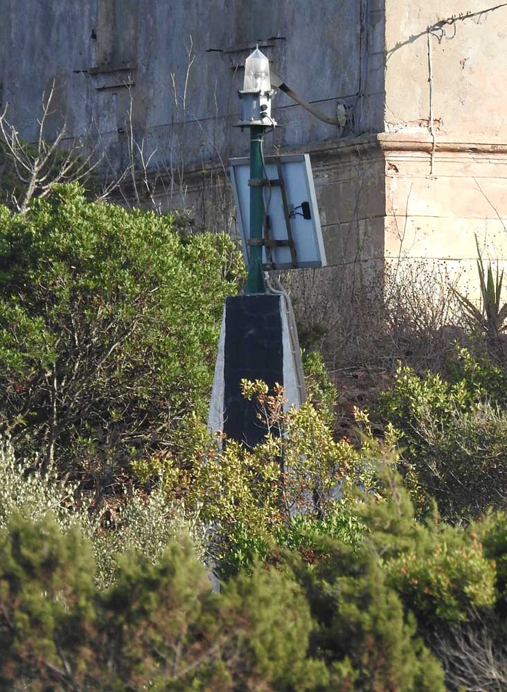
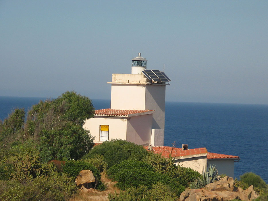
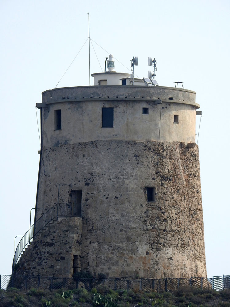
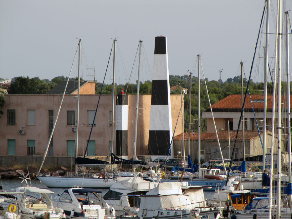
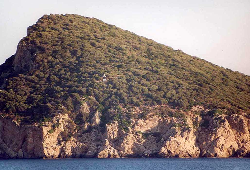
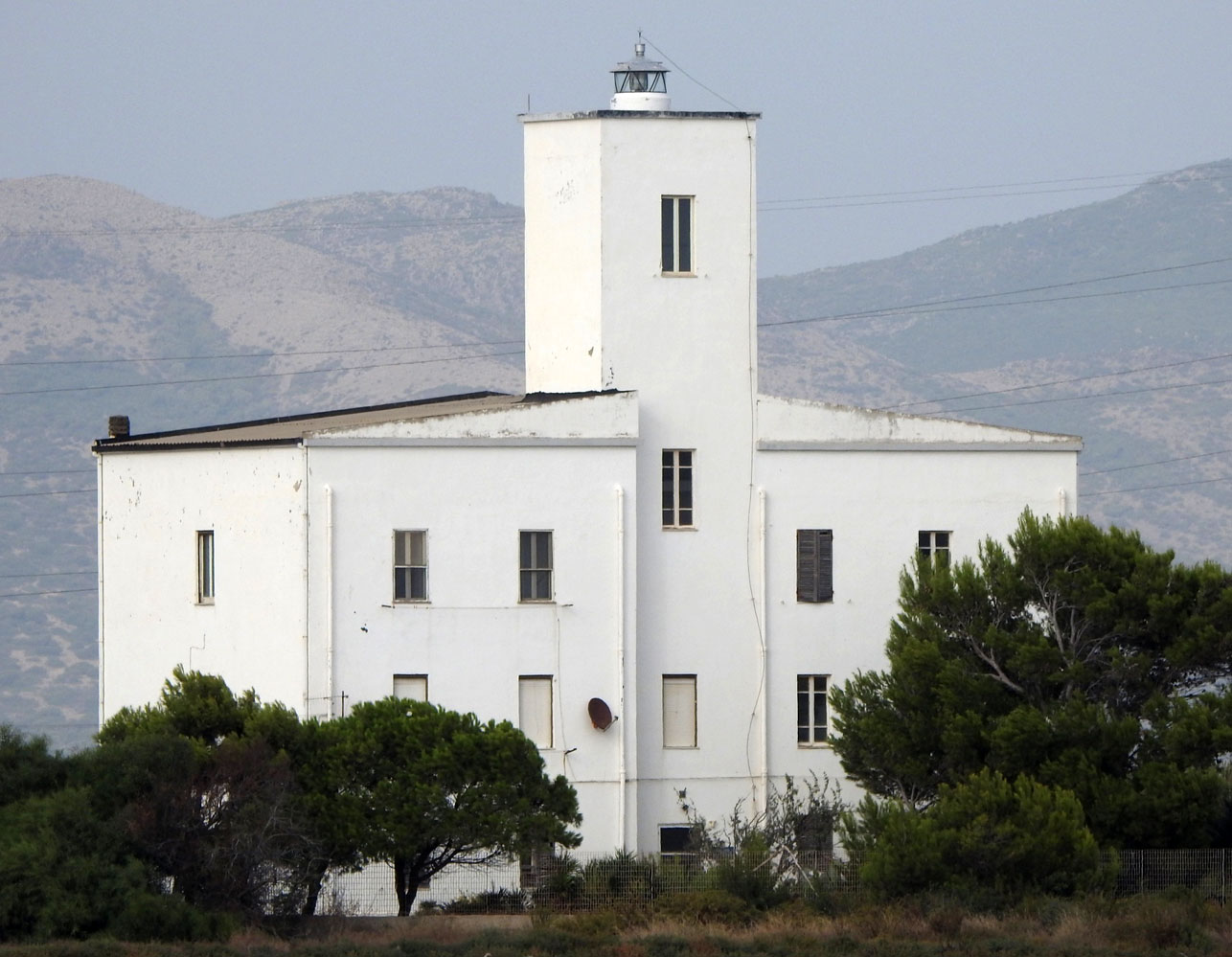
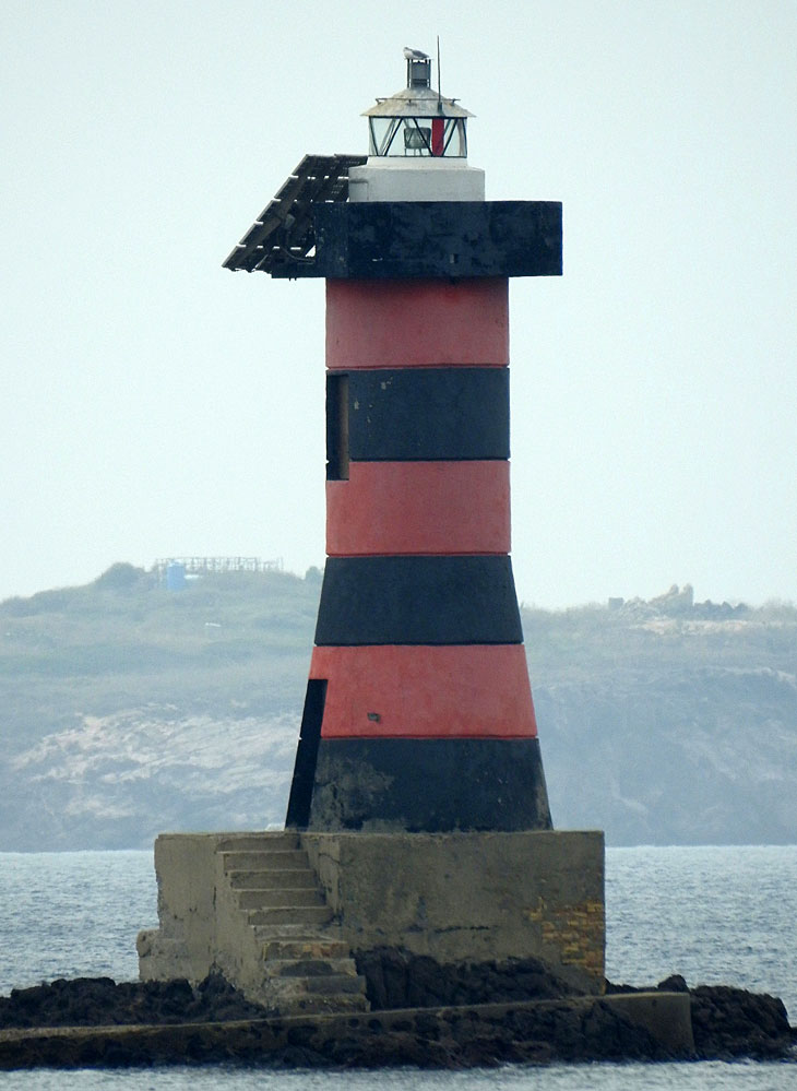
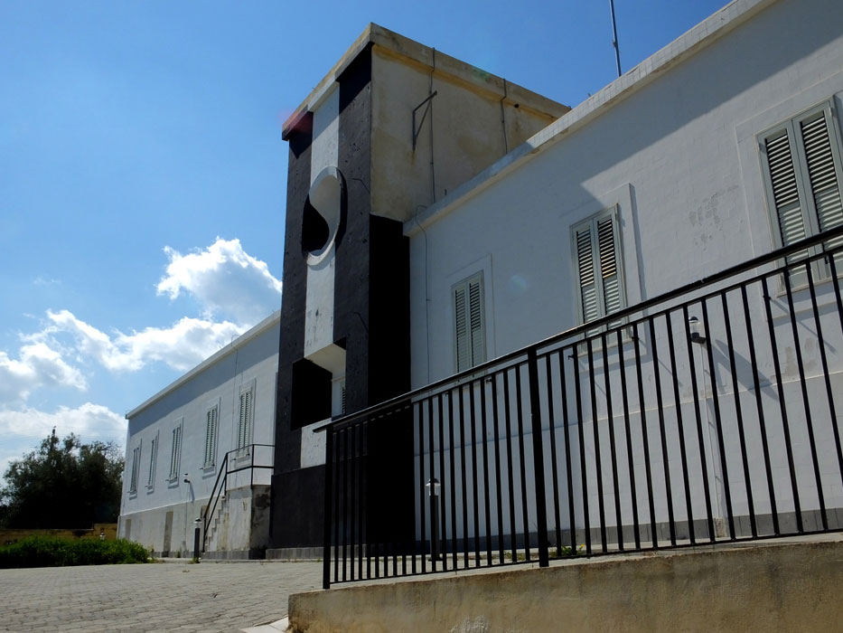
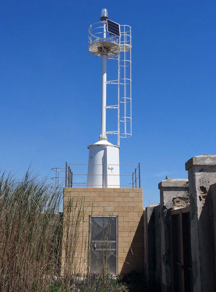
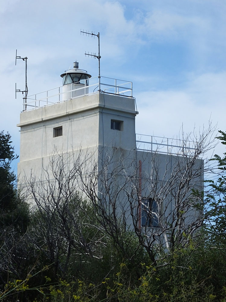
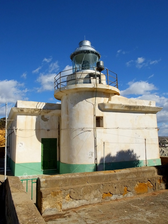
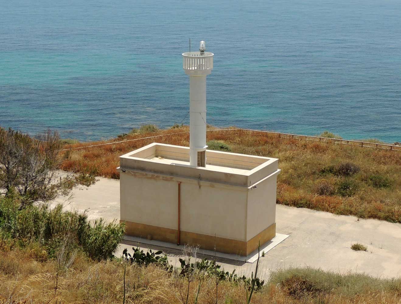
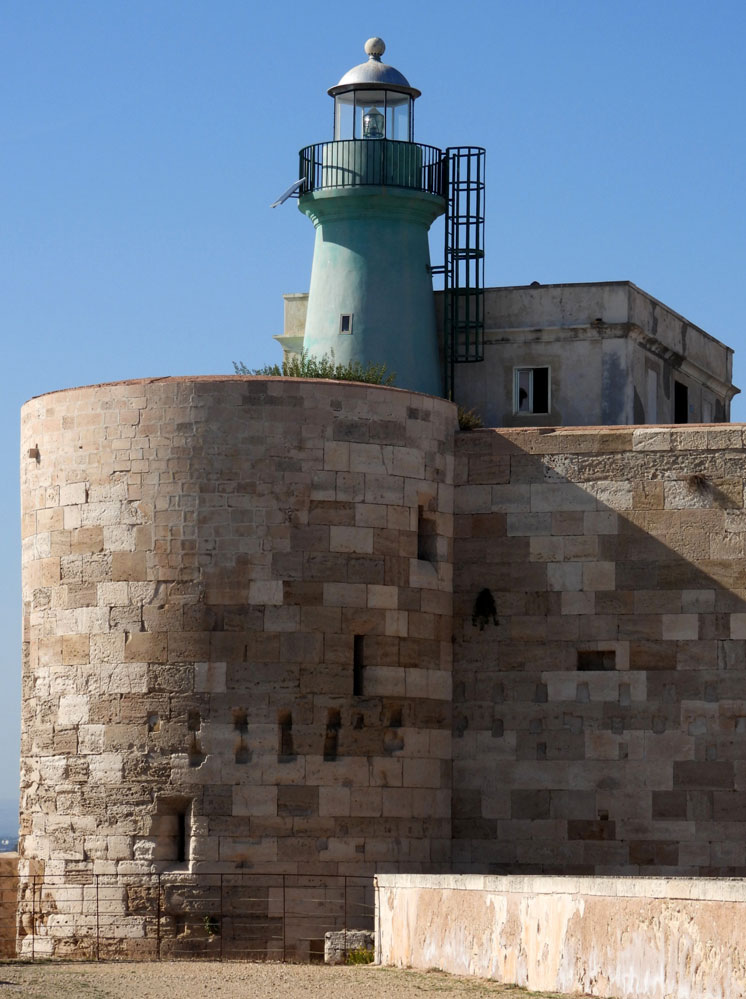
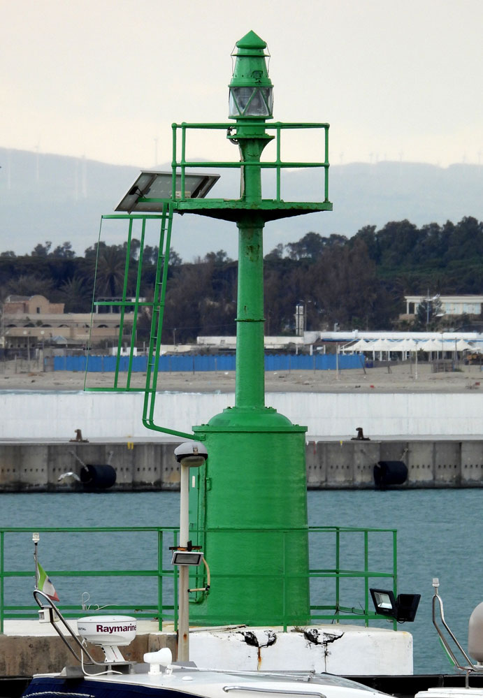
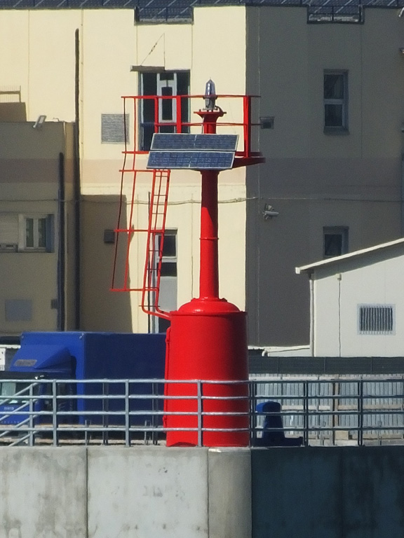
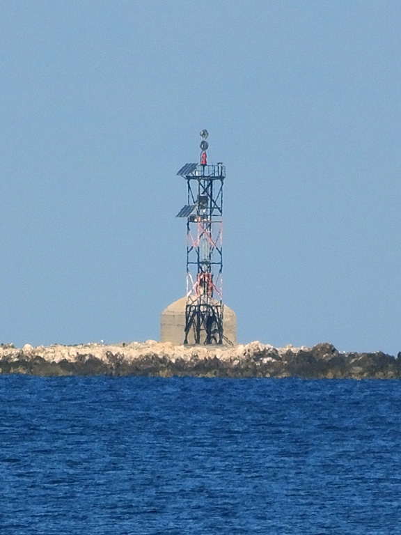
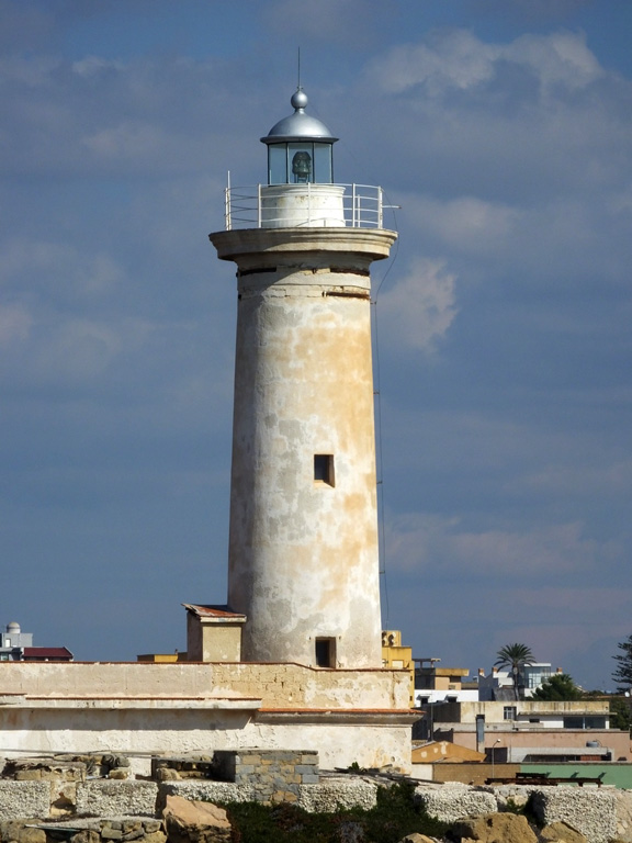
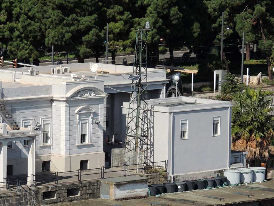
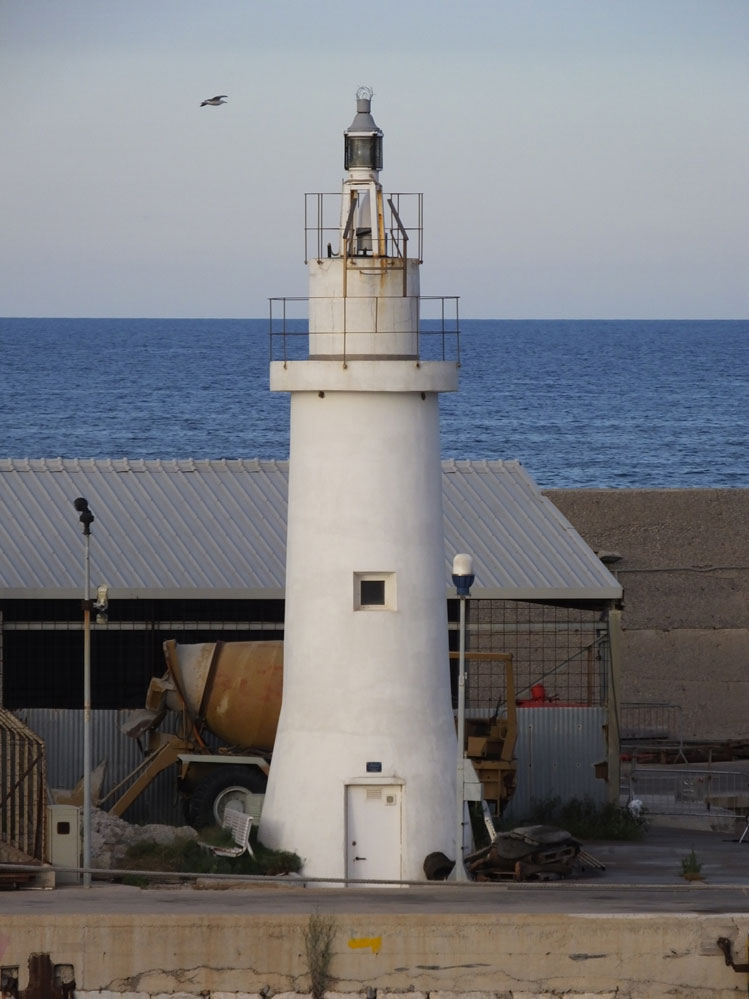
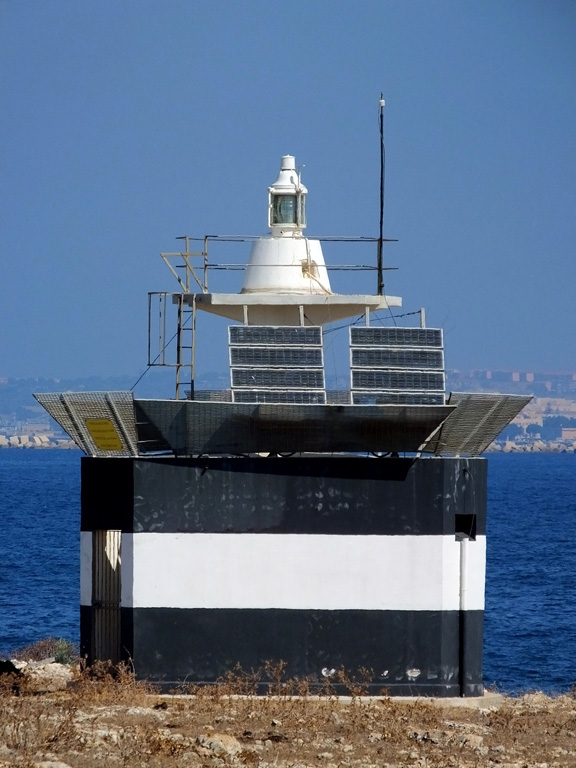
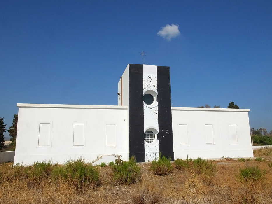
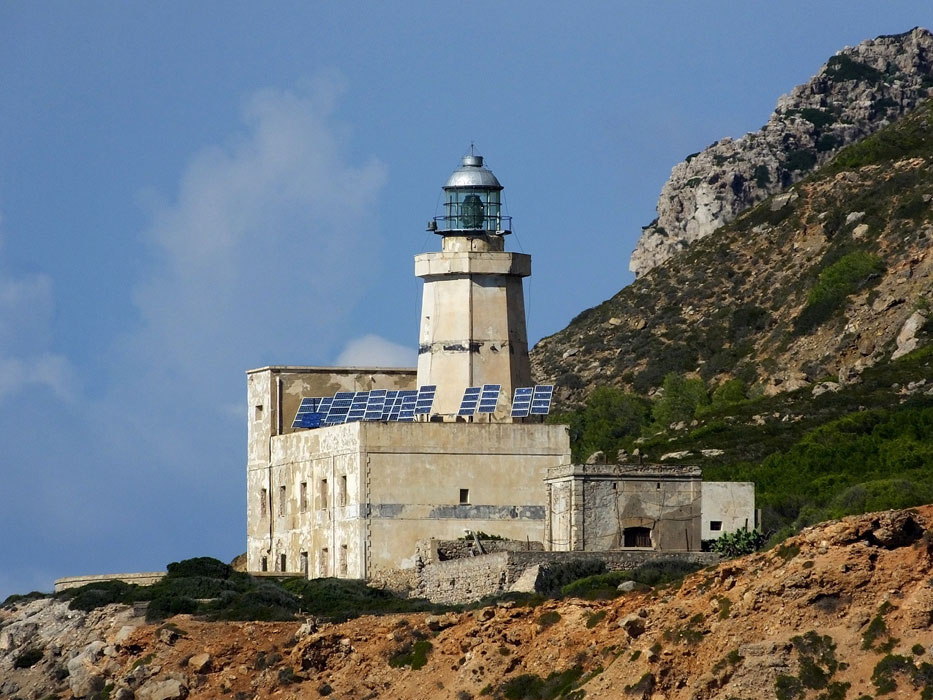
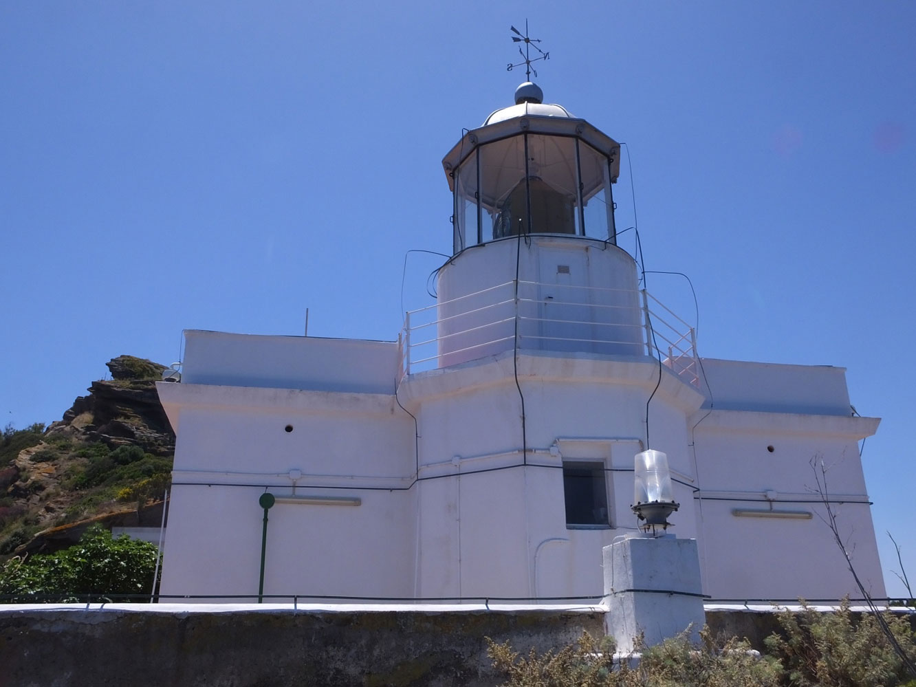
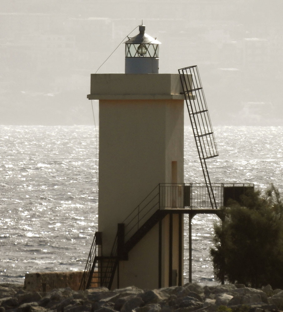
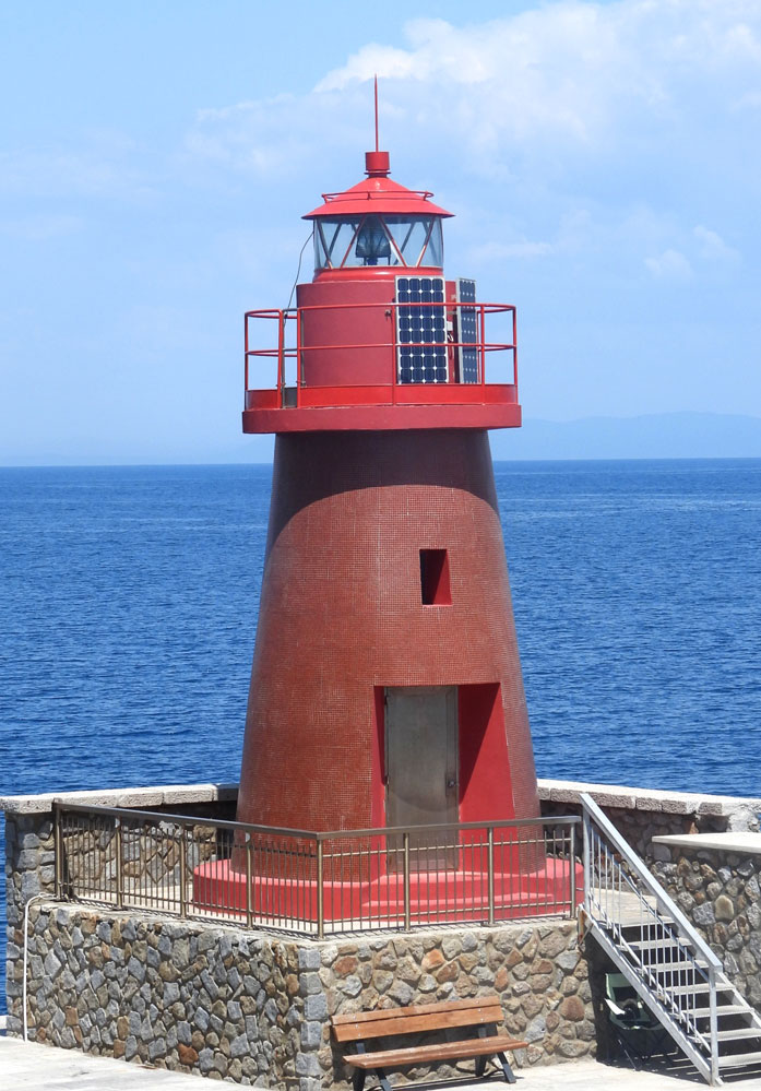
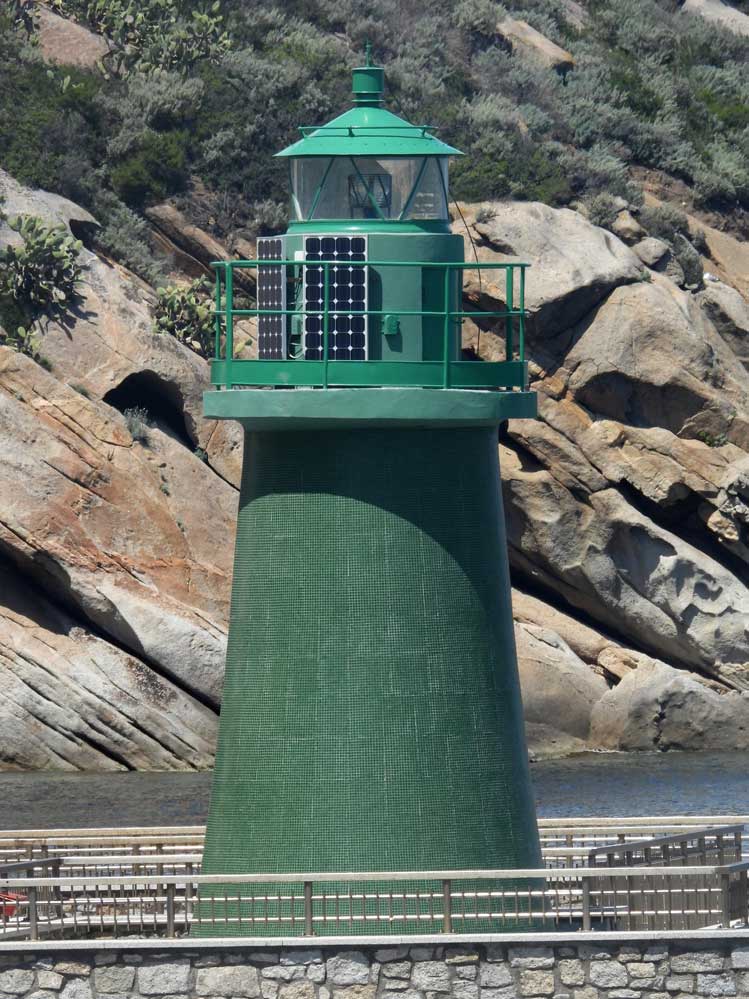
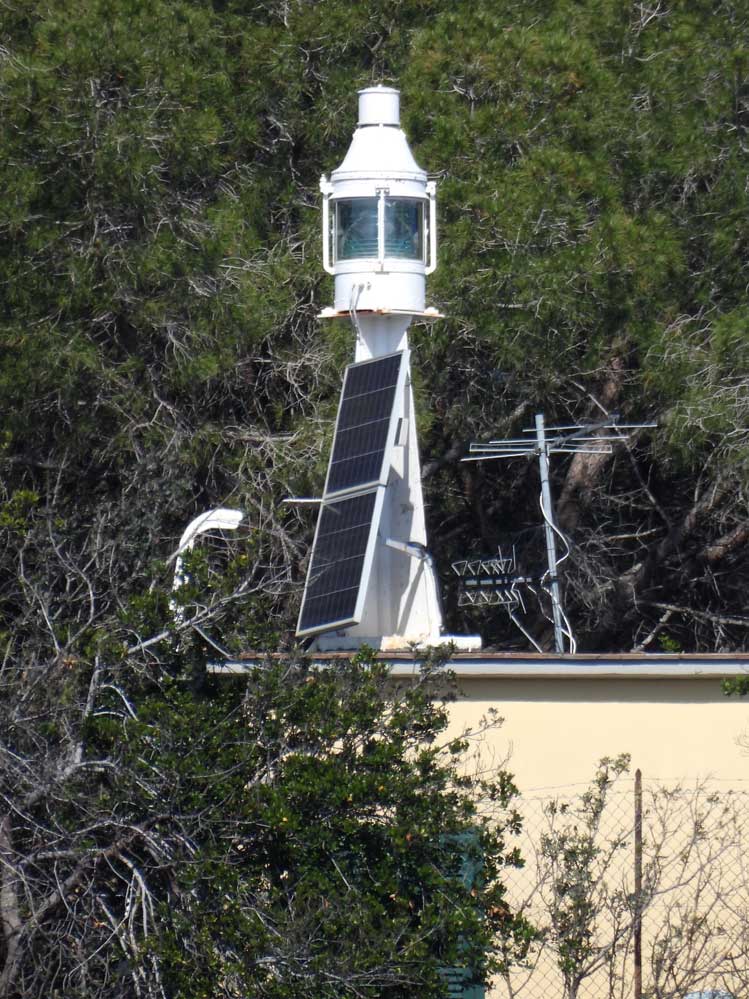
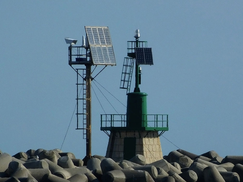
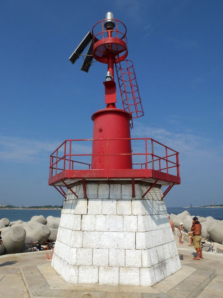
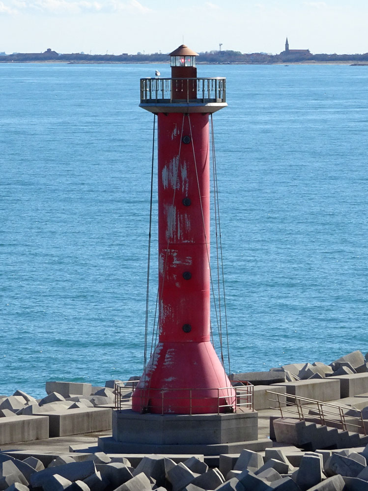
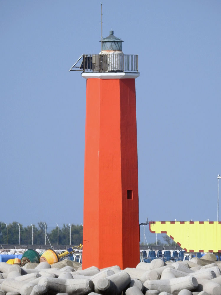
The following is a list of active lighthouses in Italy , sorted by region. [1]
This is a list of lighthouses in Abruzzo . [2] [3] [4]
| Name | Image | Year built | Location & coordinates | Class of Light | Focal height | NGA number | Admiralty number | Range nml |
|---|---|---|---|---|---|---|---|---|
| Giulianova Molo Nord Lighthouse | Image | n/a | Giulianova 42°45′18.4″N13°58′39.3″E / 42.755111°N 13.977583°E | Fl G 5s. | 8 metres (26 ft) | 11164 | E2326 | 4 |
| Giulianova Molo Sud Lighthouse | Image | n/a | Giulianova 42°45′19.4″N13°58′46.1″E / 42.755389°N 13.979472°E | Fl R 5s. | 8 metres (26 ft) | 11156 | E2324 | 4 |
| Ortona Lighthouse | | 1937 | Ortona 42°21′32.8″N14°24′30.71″E / 42.359111°N 14.4085306°E | Fl (2) W 6s. | 23 metres (75 ft) | 11128 | E2312 | 15 |
| Ortona Molo Guardiano Nord Lighthouse | 2012 | Ortona 42°21′17.82″N14°25′56.49″E / 42.3549500°N 14.4323583°E | Fl G 3s. | 9 metres (30 ft) | 11132 | E2313 | 7 | |
| Ortona Molo Martello Lighthouse | Image | 1923 est. | Ortona 42°21′17.6″N14°24′52.4″E / 42.354889°N 14.414556°E | F G | 8 metres (26 ft) | 11136 | E2315 | 3 |
| Ortona Molo Nord Lighthouse | Image | 1955 | Ortona 42°21′04.29″N14°25′25.38″E / 42.3511917°N 14.4237167°E | Fl G 3s. | 9 metres (30 ft) | 11132 | E2313 | 9 |
| Ortona Molo Sud Lighthouse | Image | 1955 | Ortona 42°20′55.66″N14°25′25.7″E / 42.3487944°N 14.423806°E | Fl R 3s. | 9 metres (30 ft) | 11140 | E2314 | 9 |
| Pescara Lighthouse | Image | 2006 | Pescara 42°27′59.4″N14°13′58.5″E / 42.466500°N 14.232917°E | Fl (3) W 20s. | 12 metres (39 ft) | 11146 | E2316.35 | 17 |
| Pescara Diga Paolucci Est Lighthouse | Image | 1997 | Pescara 42°28′19.84″N14°14′04.54″E / 42.4721778°N 14.2345944°E | Fl (2) G 10s. | 10 metres (33 ft) | 11143.5 | E2317.2 | 5 |
| Pescara Diga Paolucci Ovest Lighthouse | Image | 1997 | Pescara 42°28′25.58″N14°13′35.93″E / 42.4737722°N 14.2266472°E | Fl (2) R 10s. | 10 metres (33 ft) | 11143 | E2317 | 5 |
| Pescara Molo di Maestro Lighthouse | Image | 1912 est. | Pescara 42°28′10.74″N14°13′44.72″E / 42.4696500°N 14.2290889°E | Fl G 4s. | 13 metres (43 ft) | 11152 | E2320 | 8 |
| Pescara Molo di Scirocco Lighthouse | Image | 1910 est. | Pescara 42°28′10.35″N14°13′47.72″E / 42.4695417°N 14.2299222°E | Fl R 4s. | 13 metres (43 ft) | 11151 | E2319 | 8 |
| Pescara Molo Nuovo di Levante Lighthouse | Image | 2005 | Pescara 42°28′14.22″N14°13′59.41″E / 42.4706167°N 14.2331694°E | Fl G 5s. | 9 metres (30 ft) | 11145 | E2316 | 4 |
| Punta Penna Lighthouse | | 1948 | Vasto 42°10′15.9″N14°42′52.51″E / 42.171083°N 14.7145861°E | Fl W 5s. | 84 metres (276 ft) | 11100 | E2306 | 25 |
| Vasto Molo di Levante Lighthouse | Image | 1956 | Vasto 42°10′38.58″N14°42′41.85″E / 42.1773833°N 14.7116250°E | Fl R 3s. | 9 metres (30 ft) | 11104 | E2307 | 4 |
| Vasto Molo di Ponente Lighthouse | Image | 1968 | Vasto 42°10′48.31″N14°42′43.13″E / 42.1800861°N 14.7119806°E | Fl G 3s. | 9 metres (30 ft) | 11112 | E2307.5 | 7 |
| Vasto Molo Diporto Lighthouse | Image | 1956 | Vasto 42°10′31.59″N14°42′33.62″E / 42.1754417°N 14.7093389°E | Fl G 6s. | 9 metres (30 ft) | 11120 | E2307.7 | 4 |
| Vasto Molo Martello Lighthouse | | 1956 | Vasto 42°10′34.18″N14°42′39.48″E / 42.1761611°N 14.7109667°E | Fl R 6s. | 9 metres (30 ft) | 11108 | E2307.2 | 4 |
This is a list of lighthouses in Apulia . [3] [5] [6] [7] [8]
This is a list of lighthouses in Calabria . [3] [9] [10] [11]
This is a list of lighthouses in Campania . [3] [12] [13]
This is a list of lighthouses in Emilia-Romagna . [2] [3] [14]
| Name | Image | Year built | Location & coordinates | Class of Light | Focal height | NGA number | Admiralty number | Range nml |
|---|---|---|---|---|---|---|---|---|
| Cattolica Molo di Ponente Lighthouse | Image | 1868 est. | Cattolica 43°58′10.6″N12°45′02.0″E / 43.969611°N 12.750556°E | Fl G 3s. | 10 metres (33 ft) | 11316 | E2384 | 8 |
| Cervia Lighthouse | | 1875 | Cervia 44°15′59.4″N12°21′17.3″E / 44.266500°N 12.354806°E | Iso W 2s. | 16 metres (52 ft) | 11352 | E2411 | 11 |
| Cesenatico Lighthouse | | 1892 est. | Cesenatico 44°12′22.0″N12°24′05.8″E / 44.206111°N 12.401611°E | Fl (2) W 6s. | 18 metres (59 ft) | 11340 | E2404 | 15 |
| Cesenatico Molo Est Lighthouse | Image | 1910 est. | Cesenatico 44°12′31.6″N12°24′19.0″E / 44.208778°N 12.405278°E | Fl R 5s. | 8 metres (26 ft) | 11344 | E2405 | 8 |
| Cesenatico Molo Ovest Lighthouse | Image | 1908 est. | Cesenatico 44°12′31.5″N12°24′16.2″E / 44.208750°N 12.404500°E | Fl G 5s. | 8 metres (26 ft) | 11348 | E2406 | 8 |
| Porto Corsini Lighthouse | Image | 1862 est. | Ravenna 44°29′31.1″N12°17′03.2″E / 44.491972°N 12.284222°E | Fl W 5s. | 35 metres (115 ft) | 11376 | E2418 | 20 |
| Porto di Po di Goro Lighthouse | | 1950 | Goro 44°47′28.7″N12°23′47.5″E / 44.791306°N 12.396528°E | Fl (2) W 10s. | 22 metres (72 ft) | 11428 | E2434 | 17 |
| Porto Garibaldi Molo Nord Lighthouse | | 1959 | Comacchio 44°40′33.8″N12°14′40.3″E / 44.676056°N 12.244528°E | Fl (4) W 15s. | 14 metres (46 ft) | 11400 | E2426 | 15 |
| Rimini Lighthouse | | 1852 est. | Rimini 44°04′26.6″N12°34′26.2″E / 44.074056°N 12.573944°E | Fl (3) W 12s. | 27 metres (89 ft) | 11324 | E2394 | 15 |
| Rimini Darsena Turistica Lighthouse | Image | 1911 est. | Rimini 44°04′44.5″N12°34′28.2″E / 44.079028°N 12.574500°E | Fl G 3s. | 7 metres (23 ft) | n/a | n/a | 8 |
| Rimini Molo Est Lighthouse | Image | n/a | Rimini 44°04′54.0″N12°34′27.9″E / 44.081667°N 12.574417°E | Fl R 3s. | 7 metres (23 ft) | n/a | n/a | 8 |
| Rimini Molo di Levante Lighthouse | Image | 1914 est. | Rimini 44°04′54.3″N12°34′35.8″E / 44.081750°N 12.576611°E | Fl (2) Y 6s. | 8 metres (26 ft) | 11328 | E2396 | 3 |
| Rimini Scogliera Paraonde Lighthouse | Image | 2015 | Rimini 44°04′44.2″N12°34′14.4″E / 44.078944°N 12.570667°E (1) | Fl (2) Y 2s. | 8 metres (26 ft) | n/a | n/a | n/a |
(1) Light visible in the satellite view not in 3D
This is a list of lighthouses in Friuli-Venezia Giulia . [3] [15] [16]
| Name | Image | Year built | Location & coordinates | Class of Light | Focal height | NGA number | Admiralty number | Range nml |
|---|---|---|---|---|---|---|---|---|
| Grado Canale di Belvedre Lighthouse | Image | 1926 est. | Grado 45°41′01.2″N13°22′38.4″E / 45.683667°N 13.377333°E | F G | 7 metres (23 ft) | 11528 | E2536 | 3 |
| Grado Canale lato Sud Lighthouse | Image | 1926 est. | Grado 45°41′04.78″N13°22′31.97″E / 45.6846611°N 13.3755472°E | Fl G 3s. | 5 metres (16 ft) | 11620 | E2530 | 3 |
| Grado Canale lato Ovest Lighthouse | Image | 1926 est. | Grado 45°40′48.4″N13°22′07.85″E / 45.680111°N 13.3688472°E | Fl Wr 3s. | 5 metres (16 ft) | 11612 | E2526 | 7 |
| Grado congiunzione Canali San Pietro d’Orio Lighthouse | Image | 1926 est. | Grado 45°41′04.13″N13°22′20.49″E / 45.6844806°N 13.3723583°E | Fl (2) R 6s. | 5 metres (16 ft) | 11616 | E2528 | 4 |
| Grado Pontile Darsena Lighthouse | Image | 1911 est. | Grado 45°41′00.6″N13°22′36.7″E / 45.683500°N 13.376861°E | F R | 7 metres (23 ft) | 11624 | E2534 | 3 |
| Lignano Sabbiadoro Molo estremità Lighthouse | | 1928 est. | Lignano Sabbiadoro 45°41′54.23″N13°09′16.05″E / 45.6983972°N 13.1544583°E | Fl R 2s. | 7 metres (23 ft) | 11576 | E2521 | 8 |
| Porto Buso Diga lato Est Lighthouse | Image | 1980 | Marano lagoon 45°42′18.56″N13°15′15.36″E / 45.7051556°N 13.2542667°E | Fl G 5s. | 5 metres (16 ft) | 11596 | E2524.7 | 4 |
| Porto Buso Diga lato Ovest Lighthouse | Image | 1980 | Marano lagoon 45°42′26.54″N13°14′52.82″E / 45.7073722°N 13.2480056°E | Fl R 5s. | 5 metres (16 ft) | 11600 | E2524.5 | 4 |
| Punta Sdobba Lighthouse | Image | 1933 est. | Monfalcone 45°43′17.86″N13°34′17.89″E / 45.7216278°N 13.5716361°E | Fl R 5s. | 7 metres (23 ft) | 11634 | E2540 | 4 |
| Trieste Bacino Secchetta estremità Nord Lighthouse | Image | 1963 est. | Trieste 45°38′59.19″N13°45′34.07″E / 45.6497750°N 13.7594639°E | Fl (2) G 4s. | 7 metres (23 ft) | 11708 | E2576 | 5 |
| Trieste Diga Porto Franco Vecchio Lighthouse | Image | 1903 est. | Trieste 45°39′47.64″N13°45′32.14″E / 45.6632333°N 13.7589278°E | F G | 7 metres (23 ft) | 11684 | E2561 | 8 |
| Trieste Diga Porto Franco Vecchio estremità Nord Lighthouse | Image | 1891 est. | Trieste 45°39′50.75″N13°45′25.65″E / 45.6640972°N 13.7571250°E | Fl G 3s. | 8 metres (26 ft) | 11688 | E2562 | 8 |
| Trieste Diga Porto Franco Vecchio estremità Sud Lighthouse | Image | 1891 est. | Trieste 45°39′18.8″N13°45′44.4″E / 45.655222°N 13.762333°E | Fl R 3s. | 7 metres (23 ft) | 11680 | E2560 | 6 |
| Trieste Diga Luigi Rizzo di mezzo estremità Nord Lighthouse | Image | 1912 est. | Trieste 45°38′14.0″N13°44′12.5″E / 45.637222°N 13.736806°E | Fl G 3s. | 9 metres (30 ft) | 11724 | E2580 | 5 |
| Trieste Diga Luigi Rizzo di mezzo estremità Sud Lighthouse | Image | 1912 est. | Trieste 45°37′58.3″N13°44′16.2″E / 45.632861°N 13.737833°E | Iso R 2s. | 9 metres (30 ft) | 11728 | E2582 | 5 |
| Trieste Diga Luigi Rizzo Nord estremità Nord Lighthouse | Image | 1910 est. | Trieste 45°38′48.3″N13°44′14.2″E / 45.646750°N 13.737278°E | Fl (2) G 6s. | 9 metres (30 ft) | 11708 | E2576 | 5 |
| Trieste Diga Luigi Rizzo Nord estremità Sud Lighthouse | Image | 1907 est. | Trieste 45°38′19.2″N13°44′21.2″E / 45.638667°N 13.739222°E | Fl R 3s. | 9 metres (30 ft) | 11712 | E2578 | 8 |
| Trieste Diga Luigi Rizzo Sud estremità Nord Lighthouse | Image | 1921 est, | Trieste 45°37′53.1″N13°44′07.7″E / 45.631417°N 13.735472°E | Iso G 2s. | 6 metres (20 ft) | 11732 | E2586 | 5 |
| Trieste Diga Luigi Rizzo Sud estremità Sud Lighthouse | Image | 1912 est. | Trieste 45°37′02.2″N13°44′19.6″E / 45.617278°N 13.738778°E | Fl (3) R 10s. | 9 metres (30 ft) | 11736 | E2587 | 5 |
| Trieste Porto di Lido Lighthouse | Image | 1953 est. | Trieste 45°38′54.67″N13°45′04.01″E / 45.6485194°N 13.7511139°E | Fl R 5s. | 7 metres (23 ft) | n/a | n/a | 5 |
| Vittoria Light | | 1927 | Trieste 45°40′32.27″N13°45′25.16″E / 45.6756306°N 13.7569889°E | Fl (2) W 10s. | 115 metres (377 ft) | 11676 | E2558 | 22 |
This is a list of lighthouses in Lazio . [3] [12] [17]
| Name | Image | Year built | Location & coordinates | Class of Light | Focal height | NGA number | Admiralty number | Range nml |
|---|---|---|---|---|---|---|---|---|
| Anzio Molo Frangiflutti Lighthouse | Image | n/a | Anzio 41°26′37.0″N12°38′17.1″E / 41.443611°N 12.638083°E | Fl R 3s. | 10 metres (33 ft) | 9196 | E1540.5 | 5 |
| Anzio Molo Sottoflutto Lighthouse | Image | 1978 | Anzio 41°26′46.2″N12°38′04.8″E / 41.446167°N 12.634667°E | F G | 8 metres (26 ft) | n/a | n/a | n/a |
| Capo d'Anzio Lighthouse | | 1866 | Anzio 41°26′45.05″N12°37′18.5″E / 41.4458472°N 12.621806°E | Fl (2) W 10s. | 37 metres (121 ft) | 9192 | E1538 | 22 |
| Capo Circeo Lighthouse | | 1866 | San Felice Circeo 41°13′20.4″N13°04′06.6″E / 41.222333°N 13.068500°E | Fl W 5s. | 38 metres (125 ft) | 9244 | E1542 | 23 |
| Civitavecchia Antemurale Colombo Lighthouse | Image | n/a | Civitavecchia 42°06′23.1″N11°45′47.3″E / 42.106417°N 11.763139°E | Fl G 3s. | 15 metres (49 ft) | 9140 | E1509.5 | 8 |
| Civitavecchia Banchina Compagnia Roma Lighthouse | Image | 1965 | Civitavecchia 42°06′25.8″N11°46′05.4″E / 42.107167°N 11.768167°E | Fl R 4s. | 9 metres (30 ft) | 9148 | E1514 | 8 |
| Civitavecchia Banchina XIV Maggio Lighthouse | 1981 | Civitavecchia 42°06′25.8″N11°46′05.4″E / 42.107167°N 11.768167°E | F R | 8 metres (26 ft) | 9152 | E1513 | 3 | |
| Civitavecchia Molo Cialdi Lighthouse | Image | 2004 | Civitavecchia 42°05′28.8″N11°47′13.0″E / 42.091333°N 11.786944°E | F R | 8 metres (26 ft) | 9153 | E1518.2 | 3 |
| Civitavecchia Molo del Lazzeretto Lighthouse | Image | 1900 est. | Civitavecchia 42°05′34.9″N11°47′08.7″E / 42.093028°N 11.785750°E | F R | 8 metres (26 ft) | 9156 | E1518 | 3 |
| Civitavecchia Monte Cappuccini Lighthouse | Image | 1951 | Civitavecchia 42°05′54.34″N11°49′00.69″E / 42.0984278°N 11.8168583°E | Fl (2) W 10s. | 125 metres (410 ft) | 9132 | E1508 | 24 |
| Capo Negro Lighthouse | Image | 1884 | Zannone 40°58′24.18″N13°03′17.77″E / 40.9733833°N 13.0549361°E | Fl (3) W 10s. | 37 metres (121 ft) | 9216 | E1577 | 12 |
| Formia Molo Sopraflutto Lighthouse | Image | n/a | Formia 41°15′12.3″N13°36′53.6″E / 41.253417°N 13.614889°E | Fl WR 3s. | 11 metres (36 ft) | 9304 | E1573 | white: 11 red: 8 |
| Formia Molo Sottoflutto Lighthouse | Image | 1961 | Formia 41°15′16.9″N13°36′46.0″E / 41.254694°N 13.612778°E | Fl G 3s. | 9 metres (30 ft) | 9308 | E1572 | 7 |
| Gaeta Banchina Salvo D'Acquisto Lighthouse | Image | n/a | Gaeta 41°13′56.1″N13°34′23.8″E / 41.232250°N 13.573278°E | Fl (2) W 10s. | 10 metres (33 ft) | 9294 | E1568 | 7 |
| Gaeta Molo San Antonio Lighthouse | Image | 1920 est. | Gaeta 41°12′38.2″N13°35′21.7″E / 41.210611°N 13.589361°E | Fl R 3s. | 10 metres (33 ft) | 9272 | E1562 | 6 |
| Gaeta Porto Salvo Molo Lighthouse | Image | n/a | Gaeta 41°13′15.0″N13°34′21.9″E / 41.220833°N 13.572750°E | Fl G 3s. | 8 metres (26 ft) | 9276 | E1564 | 7 |
| Monte Orlando Lighthouse | Image | 1954 | Gaeta 41°12′24.2″N13°34′39.19″E / 41.206722°N 13.5775528°E | Fl (3) W 15s. | 185 metres (607 ft) | 9264 | E1558 | 23 |
| Ponza Scogliera di Protezione Lighthouse | Image | n/a | Ponza 40°53′46.8″N12°57′51.9″E / 40.896333°N 12.964417°E | Fl R 3s. | 8 metres (26 ft) | 9236 | E1583 | 8 |
| Porto di Ponza Lighthouse | Image | n/a | Ponza 40°53′44.09″N12°57′52.83″E / 40.8955806°N 12.9646750°E | Fl Y 3s. | 12 metres (39 ft) | 9232 | E1584 | 9 |
| Punta della Guardia Lighthouse | Image | 1886 | Ponza 40°52′40.2″N12°57′09.13″E / 40.877833°N 12.9525361°E | Fl (3) W 30s. | 112 metres (367 ft) | 9224 | E1588 | 24 |
| Punta dello Stendardo Lighthouse | Image | 1857 est. | Gaeta 41°12′38.2″N13°35′21.7″E / 41.210611°N 13.589361°E | Fl (2) R 10s. | 20 metres (66 ft) | 9268 | E1560 | 7 |
| Punta Varo Lighthouse | Image | 1975 | Zannone 40°57′56.0″N13°02′56.5″E / 40.965556°N 13.049028°E | L Fl W 8s. | 41 metres (135 ft) | 9220 | E1576 | 8 |
| Rotonda della Madonna Lighthouse | Image | 1959 | Ponza 40°53′42.92″N12°58′13.17″E / 40.8952556°N 12.9703250°E | Fl (4) W 15s. | 61 metres (200 ft) | 9228 | E1580 | 15 |
| Scoglio Ravia Lighthouse | Image Archived 2016-10-15 at the Wayback Machine | n/a | Ponza 40°53′59.87″N12°57′55.57″E / 40.8999639°N 12.9654361°E | Fl G 3s. | 26 metres (85 ft) | 9240 | E1582 | 6 |
| Terracina entrata Canale lato Nord Lighthouse | Image | n/a | Terracina 41°17′01.5″N13°15′24.2″E / 41.283750°N 13.256722°E | F G | 8 metres (26 ft) | 9260 | E1554 | 3 |
| Terracina entrata Canale lato Sud Lighthouse | Image | 1936 est. | Terracina 41°17′00.4″N13°15′24.3″E / 41.283444°N 13.256750°E | F G | 8 metres (26 ft) | 9256 | E1552 | 3 |
| Terracina Molo Gregoriano estremità Lighthouse | | 1948 est. | Terracina 41°16′57.2″N13°15′38.1″E / 41.282556°N 13.260583°E | Fl R 5s. | 12 metres (39 ft) | 9248 | E1550 | 9 |
| Terracina Molo Sopraflutto Lighthouse | Image | 1957 est. | Terracina 41°17′01.4″N13°15′31.9″E / 41.283722°N 13.258861°E | Fl G 5s. | 8 metres (26 ft) | 9252 | E1551 | 7 |
| Ventotene Lighthouse | | 1891 | Ventotene 40°47′48.74″N13°26′04.65″E / 40.7968722°N 13.4346250°E | Fl W 5s. | 21 metres (69 ft) | 9320 | E1592 | 15 |
This is a list of lighthouses in Liguria . [3] [18] [19]
| Name | Image | Year built | Location & coordinates | Class of Light | Focal height | NGA number | Admiralty number | Range nml |
|---|---|---|---|---|---|---|---|---|
| Camogli Foranea braccio Interno Lighthouse | Image | 1950 est. | Camogli 44°21′05.2″N9°09′02.1″E / 44.351444°N 9.150583°E | Fl G 5s. | 6 metres (20 ft) | 7628 | E1238 | 3 |
| Camogli Molo Interno Lighthouse | Image | 1950 est. | Camogli 44°21′05.2″N9°09′05.4″E / 44.351444°N 9.151500°E | Fl R 5s. | 6 metres (20 ft) | 7632 | E1237 | 3 |
| Camogli Molo Esterno Lighthouse | | 1950 | Camogli 44°21′06.42″N9°08′57.09″E / 44.3517833°N 9.1491917°E | Fl W 3s. | 11 metres (36 ft) | 7624 | E1236 | 9 |
| Capo dell'Arma Lighthouse | | 1948 | Bussana 43°49′02.32″N7°49′54.27″E / 43.8173111°N 7.8317417°E | Fl (2) W 15s | 50 metres (160 ft) | 7316 | E1152 | 24 |
| Capo Mele Lighthouse | | 1856 | Andora 43°57′19.14″N8°10′20.16″E / 43.9553167°N 8.1722667°E | Fl (3) W 15s. | 94 metres (308 ft) | 7356 | E1168 | 24 |
| Capo di Vado Lighthouse | | 1883 | Vado Ligure 44°15′29.14″N8°27′08.83″E / 44.2580944°N 8.4524528°E | Fl (4) W 15s. | 43 metres (141 ft) | 7396 | E1172 | 16 |
| Genoa Lighthouse La Lanterna | | 1543 | Genoa 44°24′16.3″N8°54′17.62″E / 44.404528°N 8.9048944°E | Fl (2) W 20s. | 117 metres (384 ft) | 7568 | E1206 | 25 |
| La Spezia Darsena Duca degli Abruzzi Anteriore Lighthouse | Image | 1915 est. | La Spezia 44°05′51.2″N9°48′54.7″E / 44.097556°N 9.815194°E | Fl WRG 3s. | 21 metres (69 ft) | 7744 | E1312 | white: 8 red: 6 green: 6 |
| La Spezia Diga Foranea estremità Est Lighthouse | | n/a | La Spezia 44°04′47.28″N9°52′43.55″E / 44.0798000°N 9.8787639°E | Fl (2) R 6s. | 10 metres (33 ft) | 7812 | E1270 | 8 |
| La Spezia Diga Foranea estremità Ovest Lighthouse | Image Archived 2015-04-19 at the Wayback Machine | n/a | La Spezia 44°04′08.01″N9°51′21.5″E / 44.0688917°N 9.855972°E | Fl G 4s. | 11 metres (36 ft) | 7724 | E1269 | 9 |
| La Spezia Molo Italia Lighthouse | | n/a | La Spezia 44°06′15.35″N9°50′02.27″E / 44.1042639°N 9.8339639°E | Fl R 4s. | 8 metres (26 ft) | 7764 | E1290 | 8 |
| Marina Fiera Molo Est Lighthouse | Image | n/a | Genoa 44°23′35.85″N8°56′06.06″E / 44.3932917°N 8.9350167°E | Fl G 4s. | 14 metres (46 ft) | 7584 | E1220 | 7 |
| Molo Duca di Galliera Lighthouse | Image | 1909 est. | Genoa 44°23′19.42″N8°56′16.99″E / 44.3887278°N 8.9380528°E | Fl R 4s. | 18 metres (59 ft) | 7580 | E1219 | 15 |
| Molo Vecchio Lighthouse | Image | n/a | Genoa 44°24′25.39″N8°55′07.75″E / 44.4070528°N 8.9188194°E | Fl G 3s. | 8 metres (26 ft) | 7604 | E1226 | 7 |
| Oneglia Molo di Ponente Lighthouse | Image | 1881 est. | Oneglia 43°53′06.5″N8°02′28.11″E / 43.885139°N 8.0411417°E | Fl (2) R 7s. | 8 metres (26 ft) | 7344 | E1164 | 8 |
| Oneglia Molo di Levante Lighthouse | Image | 1881 est. | Oneglia 43°52′57.6″N8°02′19.6″E / 43.882667°N 8.038778°E | Fl (2) G 7s. | 10 metres (33 ft) | 7340 | E1162 | 8 |
| Oneglia Molo di Sottoflutto Lighthouse | Image | 2015 | Oneglia 43°53′02.77″N8°02′20.47″E / 43.8841028°N 8.0390194°E | Fl (2) R 6s. | 9 metres (30 ft) | n/a | E1163 | 8 |
| Pegazzano Lighthouse | Image | 1911 est. | La Spezia 44°06′10.3″N9°48′18.6″E / 44.102861°N 9.805167°E | Iso W 4s. | 48 metres (157 ft) | 7748 | E1312.1 | 16 |
| Porto Maurizio Lighthouse | Image | 1881 est. | Porto Maurizio 43°52′31.39″N8°01′38.69″E / 43.8753861°N 8.0274139°E | Iso W 4s. | 11 metres (36 ft) | 7320 | E1156 | 16 |
| Porto Maurizio Molo di Levante Lighthouse | Image | n/a | Porto Maurizio 43°52′31.39″N8°01′38.69″E / 43.8753861°N 8.0274139°E | Fl G 3s. | 8 metres (26 ft) | 7332 | E1158 | 8 |
| Porto Maurizio Molo di Ponente Lighthouse | Image | 2009 | Porto Maurizio 43°52′31.13″N8°01′48.37″E / 43.8753139°N 8.0301028°E | Fl R 3s. | 9 metres (30 ft) | 7328 | E1157 | 8 |
| Portofino Lighthouse | | 1917 | Portofino 44°17′55.27″N9°13′06.65″E / 44.2986861°N 9.2185139°E | Fl W 5s. | 40 metres (130 ft) | 7636 | E1244 | 16 |
| Punta Santa Marinella Lighthouse | Image Archived 2016-04-09 at the Wayback Machine | 1913 | La Spezia 44°04′01.0″N9°51′04.0″E / 44.066944°N 9.851111°E | Fl R 4s. | 11 metres (36 ft) | 7720 | E1268 | 9 |
| Punta Santa Teresa Lighthouse | | n/a | Lerici 44°04′51.95″N9°52′52.26″E / 44.0810972°N 9.8811833°E | Fl (2) G 6s. | 10 metres (33 ft) | 7820 | E1274 | 8 |
| Punta Vagno Lighthouse | | 1931 | Genoa 44°23′31.19″N8°57′09.91″E / 44.3919972°N 8.9527528°E | L Fl (3) W 15s. | 26 metres (85 ft) | 7612 | E1230 | 16 |
| San Venerio Lighthouse | | 1884 | Isola del Tino 44°01′35.54″N9°50′59.37″E / 44.0265389°N 9.8498250°E | FI (3) W 15 s. | 117 metres (384 ft) | 7696 | E1262 | 25 |
| Sanremo estremità Molo Sud Lighthouse | Image | 1881 est | Sanremo 43°48′54.71″N7°47′13.34″E / 43.8151972°N 7.7870389°E | L Fl R 5s. | 11 metres (36 ft) | 7292 | E1149 | 8 |
| Savona Molo Miramare Lighthouse | Image | 1857 est. | Savona 44°18′49.01″N8°29′25.72″E / 44.3136139°N 8.4904778°E | F G | 10 metres (33 ft) | 7496 | E1197 | 3 |
| Savona Molo Nuovo Frangiflutti Lighthouse | Image | n/a | Savona 44°18′53.38″N8°30′18.05″E / 44.3148278°N 8.5050139°E | Fl R 2s. | 12 metres (39 ft) | 7490 | E1193 | 8 |
| Savona Molo Sottoflutto Lighthouse | Image | n/a | Savona 44°19′00.15″N8°29′44.22″E / 44.3167083°N 8.4956167°E | Fl G 2s. | 9 metres (30 ft) | 7500 | E1196 | 7 |
| Scoglio Torre della Scuola Lighthouse | | 1920s or 1930s | Isola della Palmaria 44°03′06.04″N9°51′30.87″E / 44.0516778°N 9.8585750°E | Fl (2) W 6s. | 16 metres (52 ft) | 7708 | E1263 | 10 |
| Vado Ligure Molo Sopraflutto Lighthouse | Image | n/a | Vado Ligure 44°16′03.15″N8°27′13.7″E / 44.2675417°N 8.453806°E | Fl R 4s. | 10 metres (33 ft) | 7400 | E1172.8 | 8 |
| Voltri Diga Foranea Lighthouse | Image Archived 2016-10-13 at the Wayback Machine | n/a | Voltri 44°24′57.71″N8°46′11.4″E / 44.4160306°N 8.769833°E | Iso WG 2s. | 16 metres (52 ft) | 7528 | E1202 | white: 11 green: 8 |
This is a list of lighthouses in Marche . [2] [3] [4] [14]
| Name | Image | Year built | Location & coordinates | Class of Light | Focal height | NGA number | Admiralty number | Range nml |
|---|---|---|---|---|---|---|---|---|
| Ancona Molo Foraneo Nord Lighthouse | | 1939 est. | Ancona 43°37′31.83″N13°29′38.1″E / 43.6255083°N 13.493917°E | Fl R 4s. | 11 metres (36 ft) | 11224 | E2346 | 8 |
| Ancona Molo Foraneo Sud Lighthouse | Image | 1940 est. | Ancona 43°37′20.83″N13°29′42.85″E / 43.6224528°N 13.4952361°E | Fl G 4s. | 11 metres (36 ft) | 11220 | E2349 | 7 |
| Ancona Molo Nord estremità Est Lighthouse | Image | 1868 est. | Ancona 43°37′25.6″N13°30′00.1″E / 43.623778°N 13.500028°E | Fl R 3s. | 8 metres (26 ft) | 11232 | E2348 | 8 |
| Ancona Molo Nord sperone Ovest Lighthouse | Image | n/a | Ancona 43°37′30.1″N13°29′51.6″E / 43.625028°N 13.497667°E | F R | 7 metres (23 ft) | 11228 | E2347 | 3 |
| Ancona Scogliera Nord Lighthouse | Image | 2013 | Ancona 43°37′41.4″N13°29′26.3″E / 43.628167°N 13.490639°E | Fl (2) G 6s. | 10 metres (33 ft) | 11226 | E2346.7 | 5 |
| Ancona Scogliera Sud Lighthouse | Image | 2008 | Ancona 43°37′15.2″N13°29′05.6″E / 43.620889°N 13.484889°E | Fl (2) R 6s. | 10 metres (33 ft) | 11225 | E2346.5 | 5 |
| Ancona Molo Sud Lighthouse | Image | 1868 est. | Ancona 43°37′21.6″N13°29′51.9″E / 43.622667°N 13.497750°E | Fl G 3s. | 11 metres (36 ft) | 11236 | E2350 | 8 |
| Civitanova Marche Lighthouse (Chiesa di Cristo Re) | | 1967 | Civitanova Marche 43°18′38.5″N13°43′40.9″E / 43.310694°N 13.728028°E | Mo (C) W 20s. | 42 metres (138 ft) | 11208 | E2336.7 | 11 |
| Civitanova Marche Molo Est Lighthouse | Image | 1971 | Civitanova Marche 43°18′55.67″N13°44′07.0″E / 43.3154639°N 13.735278°E | Fl R 5s. | 10 metres (33 ft) | 11200 | E2338 | 8 |
| Civitanova Marche Molo Est sperone Lighthouse | Image | 1970 | Civitanova Marche 43°18′46.5″N13°44′01.0″E / 43.312917°N 13.733611°E | Fl R 3s. | 7 metres (23 ft) | 11204 | E2338.2 | 4 |
| Civitanova Marche Molo Nord estremità Lighthouse | Image | 1959 | Civitanova Marche 43°18′51.12″N13°43′58.9″E / 43.3142000°N 13.733028°E | Fl G 5s. | 9 metres (30 ft) | 11196 | E2339 | 8 |
| Colle Cappuccini Lighthouse | | 1965 | Ancona 43°37′22.2″N13°30′56.7″E / 43.622833°N 13.515750°E | Fl (4) W 30s. | 118 metres (387 ft) | 11216 | E2344 | 25 |
| Fano Lighthouse | Image | 1903 est. | Fano 43°51′03.7″N13°00′55.8″E / 43.851028°N 13.015500°E | Fl W 5s. | 21 metres (69 ft) | 11280 | E2362 | 15 |
| Fano Molo Est Lighthouse | Image | 1917 est. | Fano 43°51′22.4″N13°01′00.1″E / 43.856222°N 13.016694°E | Fl R 3s. | 9 metres (30 ft) | 11284 | E2364 | 8 |
| Fano Molo Ovest Lighthouse | Image | 1895 est. | Fano 43°51′19.2″N13°00′55.6″E / 43.855333°N 13.015444°E | Fl G 3s. | 8 metres (26 ft) | 11288 | E2366 | 8 |
| Gabicce Mare Lighthouse | | 1960 | Gabicce 43°58′08.3″N12°45′04.1″E / 43.968972°N 12.751139°E | Mo (O) W 14s. | 17 metres (56 ft) | 11308 | E2381 | 15 |
| Monte San Bartolo Lighthouse | | 1952 | Pesaro 43°55′23.1″N12°52′54.7″E / 43.923083°N 12.881861°E | Fl (2) W 15s. | 175 metres (574 ft) | 11296 | E2372 | 25 |
| Pesaro Nuovo Molo di Sopraflutto Lighthouse | Image | 1891 est. | Pesaro 43°55′39.6″N12°54′20.3″E / 43.927667°N 12.905639°E | Fl R 5s. | 8 metres (26 ft) | 11300 | E2374 | 8 |
| Pesaro Nuovo Molo di Sottoflutto Lighthouse | Image | 1901 est. | Pesaro 43°55′35.6″N12°54′16.9″E / 43.926556°N 12.904694°E | Fl G 5s. | 8 metres (26 ft) | 11304 | E2376 | 8 |
| Pedaso Lighthouse | Image | 1950 | Pedaso 43°05′28.3″N13°50′42.5″E / 43.091194°N 13.845139°E | Fl (3) W 15s. | 51 metres (167 ft) | 11188 | E2326 | 16 |
| San Benedetto del Tronto Lighthouse | | 1957 | San Benedetto del Tronto 42°57′09.5″N13°53′10.1″E / 42.952639°N 13.886139°E | Fl (2) W 10s. | 31 metres (102 ft) | 11176 | E2332 | 22 |
| San Benedetto del Tronto Molo Nord Lighthouse | Image | 1910 est. | San Benedetto del Tronto 42°57′26.45″N13°53′26.15″E / 42.9573472°N 13.8905972°E | Fl G 3s. | 8 metres (26 ft) | 11180 | E2333 | 8 |
| San Benedetto del Tronto Molo Sud Lighthouse | Image | 1922 est. | San Benedetto del Tronto 42°57′35.86″N13°53′40.28″E / 42.9599611°N 13.8945222°E | Fl R 3s. | 8 metres (26 ft) | 11184 | E2334 | 8 |
| Senigallia Diga di Levante Lighthouse | Image | 1950 | Senigallia 43°43′11.8″N13°13′15.1″E / 43.719944°N 13.220861°E | L Fl (2) W 15s. | 17 metres (56 ft) | 11276 | E2358 | 15 |
| Senigallia Diga di Levante estremità Lighthouse | Image | 1864 est. | Senigallia 43°43′21.6″N13°13′21.4″E / 43.722667°N 13.222611°E | Fl Y 3s. | 9 metres (30 ft) | n/a | n/a | 8 |
| Senigallia Molo di Sopraflutto Lighthouse | Image | 2008 | Senigallia 43°43′26.1″N13°13′16.9″E / 43.723917°N 13.221361°E | Fl (2) R 6s. | 8 metres (26 ft) | 11268 | E2359 | 8 |
| Senigallia Molo di Sottoflutto Lighthouse | Image | 2008 | Senigallia 43°43′26.1″N13°13′16.9″E / 43.723917°N 13.221361°E | Fl (2) G 6s. | 9 metres (30 ft) | 11272 | E2360 | 8 |
This is a list of lighthouses in Molise . [2] [3] [4]
| Name | Image | Year built | Location & coordinates | Class of Light | Focal height | NGA number | Admiralty number | Range nml |
|---|---|---|---|---|---|---|---|---|
| Termoli Lighthouse | | 1963 | Termoli 42°00′20.3″N14°59′48.6″E / 42.005639°N 14.996833°E | Fl (2) W 10s. inactive since September 2016 [20] | 41 metres (135 ft) | 11080 | E2303 | 15 |
| Termoli Molo Nord Lighthouse | Image | n/a | Termoli 42°00′09.8″N15°00′33.59″E / 42.002722°N 15.0093306°E | Fl G 3s. | 9 metres (30 ft) | 11084 | E2304 | 8 |
| Termoli Molo Nord Vecchia Estremità Lighthouse | Image | 1935 est. | Termoli 42°00′16.69″N15°00′08.32″E / 42.0046361°N 15.0023111°E | F G | 9 metres (30 ft) | 11088 | E2305 | 3 |
| Termoli Molo Sud Lighthouse | Image | 1958 | Termoli 42°00′10.43″N15°00′13.28″E / 42.0028972°N 15.0036889°E | Fl (2) Y 6s. | 9 metres (30 ft) | 11092 | E2306 | 8 |
This is a list of lighthouses in Sardinia . [3] [21] [22] [23] [24]
This is a list of lighthouses in Sicily . [3] [25] [26] [27] [28] [29] [30]
| Name | Image | Year built | Location & coordinates | Class of Light | Focal height | NGA number | Admiralty number | Range nml |
|---|---|---|---|---|---|---|---|---|
| Augusta Diga Centrale Lighthouse | Image | 1937 est. | Augusta 37°10′30.8″N15°12′50.4″E / 37.175222°N 15.214000°E | Fl (2) R 10s. | 14 metres (46 ft) | 10324 | E1848 | 8 |
| Augusta Diga Settentrionale Lighthouse | Image | n/a | Augusta 37°10′37.6″N15°12′59.4″E / 37.177111°N 15.216500°E | Fl (2) G 10s. | 12 metres (39 ft) | 10320 | E1847 | 8 |
| Augusta Dromo Giggia Lighthouse | Image | 1939 | Augusta 37°12′03.4″N15°09′09.3″E / 37.200944°N 15.152583°E | Oc W 5s. | 79 metres (259 ft) | 10332 | E1846.1 | 17 |
| Augusta Terravecchia Lighthouse | Image | 1933 est. | Augusta 37°12′57.7″N15°13′21.5″E / 37.216028°N 15.222639°E | F R | 8 metres (26 ft) | 10336 | E1849 | 3 |
| Brucoli Lighthouse | Image Archived 2016-10-09 at the Wayback Machine | 1912 | Brucoli 37°17′09.0″N15°11′10.7″E / 37.285833°N 15.186306°E | Fl W 5s. | 13 metres (43 ft) | 10396 | E1836 | 11 |
| Capo Cefalù Lighthouse | | 1900 | Cefalù 38°02′23.3″N14°01′46.2″E / 38.039806°N 14.029500°E | Fl W 5s. | 80 metres (260 ft) | 9860 | E2036 | 25 |
| Capo d'Orlando Lighthouse | | 1904 | Capo d'Orlando 38°09′53.1″N14°44′48.7″E / 38.164750°N 14.746861°E | L Fl (2) W 12s. | 16 metres (52 ft) | 9856 | E2038 | 16 |
| Capo Faro Lighthouse | Image Archived 2016-10-10 at the Wayback Machine | 1884 est. | Salina 38°34′50.2″N14°52′17.6″E / 38.580611°N 14.871556°E | L Fl W 6s. | 56 metres (184 ft) | 9848 | E1798 | 18 |
| Capo Feto Lighthouse | Image | 1990 | Mazara del Vallo 37°39′39.4″N12°31′14.3″E / 37.660944°N 12.520639°E | L Fl W 10s. | 14 metres (46 ft) | 10076 | E1938 | 11 |
| Capo Gallo Lighthouse | | 1854 | Capo Gallo 38°13′24.6″N13°19′00.1″E / 38.223500°N 13.316694°E | L Fl (2) W 15s. | 40 metres (130 ft) | 9936 | E2004 | 16 |
| Capo Granitola Lighthouse | | 1865 | Campobello di Mazara 37°33′57.5″N12°39′43.5″E / 37.565972°N 12.662083°E | L Fl W 10s. | 37 metres (121 ft) | 10092 | E1930 | 18 |
| Capo Grecale Lighthouse | | 1855 | Lampedusa 35°31′03.5″N12°37′55.6″E / 35.517639°N 12.632111°E | Fl W 5s. | 82 metres (269 ft) | 10444 | E2088 | 22 |
| Capo Grosso Lighthouse | | 1858 | Levanzo 38°01′13.3″N12°20′03.0″E / 38.020361°N 12.334167°E | Fl (3) W 15s. | 68 metres (223 ft) | 10004 | E1962 | 11 |
| Capo Milazzo Lighthouse | | 1891 | Capo di Milazzo 38°16′13.7″N15°13′51.4″E / 38.270472°N 15.230944°E | L Fl W 6s. | 90 metres (300 ft) | 9796 | E2042 | 16 |
| Capo Molini Lighthouse | Image Archived 2016-10-10 at the Wayback Machine | 1919 | Acireale 37°34′36.8″N15°10′34.2″E / 37.576889°N 15.176167°E | Fl (3) W 15s. | 42 metres (138 ft) | 10432 | E1826 | 22 |
| Capo Murro di Porco Lighthouse | | 1959 | Siracusa 37°00′11.3″N15°20′06.2″E / 37.003139°N 15.335056°E | Fl W 5s. | 34 metres (112 ft) | 10240 | E1876 | 17 |
| Capo Passero Lighthouse | | 1871 | Capo Passero 36°41′18.4″N15°09′06.1″E / 36.688444°N 15.151694°E | Fl (2) W 10s. | 39 metres (128 ft) | 10228 | E1884 | 11 |
| Capo Peloro Lighthouse | | 1884 | Punta del Faro 38°16′05.6″N15°39′02.5″E / 38.268222°N 15.650694°E | Fl (2) W 10s. | 37 metres (121 ft) | 9784 | E1806 | 19 |
| Capo Ponente Lighthouse | Image | n/a | Lampedusa 35°31′12.9″N12°31′06.4″E / 35.520250°N 12.518444°E | Fl (3) W 15s. | 110 metres (360 ft) | 10464 | E2086 | 8 |
| Capo Rasocolmo Lighthouse | Image | n/a | Messina 38°17′44.6″N15°31′08.4″E / 38.295722°N 15.519000°E | Fl (3) W 10s. | 85 metres (279 ft) | 9792 | E2046 | 15 |
| Capo Rossello Lighthouse | Image | 1859 est. | Realmonte 37°17′41.7″N13°27′00.3″E / 37.294917°N 13.450083°E | Fl W 10s. | 89 metres (292 ft) | 10112 | E1922 | 22 |
| Capo San Marco Lighthouse | Image | 1992 | Sciacca 37°29′45.3″N13°01′15.4″E / 37.495917°N 13.020944°E | Fl (3) W 15s. | 25 metres (82 ft) | 10094 | E1928.5 | 18 |
| Capo Santa Croce Lighthouse | | 1859 | Augusta 37°14′36.3″N15°15′22.8″E / 37.243417°N 15.256333°E | L Fl (2) W 12s. | 39 metres (128 ft) | 10392 | E1838 | 16 |
| Capo Scaramia Lighthouse | | 1859 est. | Punta Secca 36°47′14.4″N14°29′38.5″E / 36.787333°N 14.494028°E | Fl (2) W 8s. | 37 metres (121 ft) | 10184 | E1896 | 16 |
| Capo Zafferano Lighthouse | | 1884 | Santa Flavia 38°06′43.7″N13°32′15.1″E / 38.112139°N 13.537528°E | Fl (3) WR 10s. | 34 metres (112 ft) | 9900 | E2023 | 16 |
| Castello Maniace Lighthouse | Image | 1858 est. | Siracusa 37°03′11.3″N15°17′42.9″E / 37.053139°N 15.295250°E | Fl G 3s. | 27 metres (89 ft) | 10248 | E1866 | 9 |
| Castello Normanno Lighthouse | | 1901 | Castellammare del Golfo 38°02′01.2″N12°53′05.4″E / 38.033667°N 12.884833°E | Fl (2) W 10s. | 19 metres (62 ft) | 9968 | E1992 | 10 |
| Catania Molo di Levante Lighthouse | | 1941 est. | Catania 37°29′12.8″N15°05′55.8″E / 37.486889°N 15.098833°E | L Fl G 5s. | 12 metres (39 ft) | 10420 | E1830 | 8 |
| Catania Molo di Levante Banchina Lighthouse | Image | 1932 est. | Catania 37°29′29.8″N15°05′55.″E / 37.491611°N 15.09861°E | Fl G 2s. | 11 metres (36 ft) | 10424 | E1831 | 5 |
| Catania Scogliera Estremità Lighthouse | Image | Catania 37°29′16″N15°05′43.6″E / 37.48778°N 15.095444°E | L Fl R 5s. | E1832.5 | ||||
| Cozzo Spadaro Lighthouse | | 1864 | Portopalo di Capo Passero 36°41′10.7″N15°07′53.9″E / 36.686306°N 15.131639°E | Fl (3) W 15s. | 82 metres (269 ft) | 10224 | E1882 | 24 |
| Favignana Molo Foraneo Lighthouse | Image | 1969 | Favignana 37°56′02.0″N12°19′28.1″E / 37.933889°N 12.324472°E | Fl R 4s. | 7 metres (23 ft) | 10024 | E1949 | 7 |
| Gela Molo di Levante Lighthouse | Image | n/a | Gela 37°03′46.6″N14°13′47.6″E / 37.062944°N 14.229889°E | Fl G 3s. | 8 metres (26 ft) | 10152 | E1902 | 8 |
| Gela Molo di Ponente Lighthouse | Image | 1964 | Gela 37°03′50.1″N14°13′44.8″E / 37.063917°N 14.229111°E | Fl R 3s. | 8 metres (26 ft) | 10156 | E1902.2 | 8 |
| Isola delle Correnti Lighthouse | | 1865 | Portopalo di Capo Passero 36°38′42.8″N15°04′38.7″E / 36.645222°N 15.077417°E | Fl W 4s. inactive | 16 metres (52 ft) | 10212 | E1886 | 11 |
| Isolotto Asinelli Lighthouse | Image | 1912 est. | Pizzolungo 38°03′51.8″N12°31′46.0″E / 38.064389°N 12.529444°E | Fl (2) W 6s. | 13 metres (43 ft) | 10040 | E1982 | 10 |
| Isolotto Formica Lighthouse | | 1858 | Aegadian Islands 37°59′21.1″N12°25′32.1″E / 37.989194°N 12.425583°E | Fl W 4s. | 28 metres (92 ft) | 10032 | E1966 | 11 |
| Lampione Lighthouse | | 1935 | Pelagie Islands 35°33′05.9″N12°19′54.1″E / 35.551639°N 12.331694°E | Fl (2) W 10s. | 40 metres (130 ft) | 10476 | E3064 | 7 |
| Licata Diga Antemurale estremità Lighthouse | n/a | Licata 37°05′05.1″N13°56′23.2″E / 37.084750°N 13.939778°E | Fl R 5s. | 11 metres (36 ft) | 10137 | E1907 | 8 | |
| Licata Diga Antemurale interno Lighthouse | Image | n/a | Licata 37°05′19.2″N13°56′18.4″E / 37.088667°N 13.938444°E | Fl R 5s. | 11 metres (36 ft) | 10136 | E1906 | 4 |
| Licata Diga di Levante Lighthouse | Image | n/a | Licata 37°05′05.6″N13°56′34.9″E / 37.084889°N 13.943028°E | Fl G 5s. | 10 metres (33 ft) | 10132 | E1908 | 8 |
| Licata Molo di Levante Lighthouse | Image | n/a | Licata 37°05′29.5″N13°56′16.8″E / 37.091528°N 13.938000°E | Fl G 3s. | 12 metres (39 ft) | 10144 | E1905 | 4 |
| Licata Molo di Ponente Lighthouse | Image | n/a | Licata 37°05′33.2″N13°56′06.5″E / 37.092556°N 13.935139°E | Fl R 3s. | 12 metres (39 ft) | 10140 | E1912 | 4 |
| Lipari Marina Corta Lighthouse | | 2014 | Lipari 38°27′53.2″N14°57′27.7″E / 38.464778°N 14.957694°E | Fl (3) W 15s. | 10 metres (33 ft) | 9836 | E1792 | 14 |
| Lipari Molo Pignataro Lighthouse | Image | 1928 est. | Lipari 38°28′36.7″N14°57′46.8″E / 38.476861°N 14.963000°E | Fl G 3s. | 11 metres (36 ft) | 9828 | E1788 | 7 |
| Marettimo Molo Nord Lighthouse | Image | n/a | Marettimo 37°58′12.8″N12°04′21.9″E / 37.970222°N 12.072750°E | Fl R 3s. | 8 metres (26 ft) | 10012 | E1958 | 5 |
| Marina di Ragusa Lighthouse | Image | 1912 | Marina di Ragusa 36°46′57.3″N14°33′07.6″E / 36.782583°N 14.552111°E | Fl W 5s. | 12 metres (39 ft) | 10188 | E1894 | 8 |
| Marsala Diga Foranea Lighthouse | Image | n/a | Marsala 37°47′00.5″N12°26′06.1″E / 37.783472°N 12.435028°E | Fl R 3s. | 11 metres (36 ft) | 10068 | E1942 | 8 |
| Marsala Molo di Levante Lighthouse | Image | n/a | Marsala 37°47′12.8″N12°26′21.7″E / 37.786889°N 12.439361°E | Fl G 3s. | 9 metres (30 ft) | 10072 | E1944 | 8 |
| Marsala Molo di Ponente Lighthouse | Image | 1885 | Marsala 37°47′14.9″N12°26′12.3″E / 37.787472°N 12.436750°E | Fl (2) W 10s. | 19 metres (62 ft) | 10064 | E1940 | 15 |
| Messina Capitaneria di Porto Lighthouse | Image | n/a | Messina 38°11′48.7″N15°33′29.1″E / 38.196861°N 15.558083°E | Fl (2) G 5s. | 16 metres (52 ft) | 9780 | E1818 | 8 |
| Milazzo Molo Eolie Lighthouse | Image | 1966 | Milazzo 38°13′01.4″N15°14′31.4″E / 38.217056°N 15.242056°E | Fl Y 3s. | 7 metres (23 ft) | 9804 | E2045.4 | 3 |
| Milazzo Molo Foraneo Lighthouse | Image | 1891 est. | Milazzo 38°12′57.6″N15°14′58.8″E / 38.216000°N 15.249667°E | L Fl G 5s. | 12 metres (39 ft) | 9800 | E2044 | 7 |
| Milazzo Molo Sottoflutto Lighthouse | Image | n/a | Milazzo 38°12′51.8″N15°14′48.2″E / 38.214389°N 15.246722°E | L Fl R 5s. | 12 metres (39 ft) | 9808 | E2044.2 | 6 |
| Palermo Lighthouse | Image [ permanent dead link ] | 1853 est. | Palermo 38°07′57.5″N13°22′12.7″E / 38.132639°N 13.370194°E | inactive | 18 metres (59 ft) (tower) | n/a | ex-E2008 | n/a |
| Palermo Diga Foranea gomito Lighthouse | Image | 1982 | Palermo 38°07′35.2″N13°22′30.7″E / 38.126444°N 13.375194°E | Fl (4) W 15s. | 15 metres (49 ft) | 9908 | E2008 | 15 |
| Palermo Diga Foranea estremità Lighthouse | Image | n/a | Palermo 38°07′20.5″N13°22′49.1″E / 38.122361°N 13.380306°E | L Fl G 5s. | 10 metres (33 ft) | 9910 | E2013 | 5 |
| Palermo Molo Bersagliere Lighthouse | Image Archived 2016-12-20 at the Wayback Machine | 1870 est. | Palermo 38°07′33.2″N13°22′18.3″E / 38.125889°N 13.371750°E | L Fl R 5s. | 9 metres (30 ft) | 9912 | E2014 | 8 |
| Pantelleria Diga Foranea Lighthouse | Image | 2010 | Pantelleria 36°50′15.8″N11°56′24.9″E / 36.837722°N 11.940250°E | Fl G 4s. | 8 metres (26 ft) | n/a | n/a | 5 |
| Pantelleria Molo Cidonio Lighthouse | Image | n/a | Pantelleria 36°50′01.2″N11°56′15.7″E / 36.833667°N 11.937694°E | F G | 7 metres (23 ft) | n/a | n/a | 3 |
| Pantelleria Molo Karol Wojtyla Lighthouse | Image | n/a | Pantelleria 36°50′05.2″N11°56′27.0″E / 36.834778°N 11.940833°E | Fl Y 2s. | 8 metres (26 ft) | n/a | n/a | 3 |
| Penisola Magnisi Lighthouse | Image | 1859 est. | Augusta 37°09′29.8″N15°14′02.9″E / 37.158278°N 15.234139°E | Fl (4) W 12s. | 10 metres (33 ft) | 10308 | E1860 | 11 |
| Porto Empedocle Molo di Levante Lighthouse | Image | n/a | Porto Empedocle 37°16′48.3″N13°31′40.9″E / 37.280083°N 13.528028°E | Fl G 3s. | 9 metres (30 ft) | 10116 | E1918 | 8 |
| Porto Empedocle Molo di Ponente Lighthouse | Image | 1955 | Porto Empedocle 37°16′29.6″N13°31′39.0″E / 37.274889°N 13.527500°E | Fl R 3s. | 12 metres (39 ft) | 10120 | E1920 | 8 |
| Porto Empedocle Molo Crispi Lighthouse | Image | n/a | Porto Empedocle 37°17′05.5″N13°31′47.6″E / 37.284861°N 13.529889°E | (2) F R | 6 metres (20 ft) | 10124 | E1920 | 3 |
| Pozzallo Diga Foranea Lighthouse | Image | n/a | Pozzallo 36°42′34.5″N14°49′52.7″E / 36.709583°N 14.831306°E | Fl (4) W 12s. | 18 metres (59 ft) | 10196 | E1889.05 | 15 |
| Pozzallo Diga Foranea estremità Lighthouse | Image | n/a | Pozzallo 36°42′33.3″N14°50′26.8″E / 36.709250°N 14.840778°E | Fl R 3s. | 11 metres (36 ft) | n/a | n/a | 5 |
| Pozzallo Molo Sottoflutto Lighthouse | Image | n/a | Pozzallo 36°42′45.6″N14°49′56.9″E / 36.712667°N 14.832472°E | Fl G 3s. | 8 metres (26 ft) | n/a | n/a | 5 |
| Punta Arena Bianca Lighthouse | Image | n/a | Linosa 35°51′23.5″N12°51′31.2″E / 35.856528°N 12.858667°E | Fl W 5s. | 9 metres (30 ft) | 10472 | E2080 | 9 |
| Punta Beppe Tuccio Lighthouse | | 1891 | Linosa 35°52′19.9″N12°52′43.0″E / 35.872194°N 12.878611°E | Fl (4) 20s. | 32 metres (105 ft) | 10468 | E2082 | 16 |
| Punta Castelluccio Lighthouse | Image Archived 2016-04-15 at the Wayback Machine | 1864 | Siracusa 37°02′33.3″N15°18′09.1″E / 37.042583°N 15.302528°E | Fl R 3s. | 21 metres (69 ft) | 10244 | E1867 | 9 |
| Punta Gavazzi Lighthouse | Image | 1885 | Ustica 38°41′39.0″N13°09′17.6″E / 38.694167°N 13.154889°E | Fl (4) W 12s. | 40 metres (130 ft) | 9964 | E2000 | 16 |
| Punta Gennalena Lighthouse | Image | 1939 | Augusta 37°11′57.4″N15°11′02.5″E / 37.199278°N 15.184028°E | Iso W 4s. | 16 metres (52 ft) | 10328 | E1846 | 12 |
| Punta Libeccio Lighthouse | Image | 1867 | Marettimo 37°57′24.2″N12°03′00.3″E / 37.956722°N 12.050083°E | Fl (2) W 15s. | 73 metres (240 ft) | 10004 | E1956 | 24 |
| Punta Limarsi Lighthouse | Image | 1941 est. | Pantelleria 36°44′19.4″N12°01′57.8″E / 36.738722°N 12.032722°E | Fl (3) W 15s. | 35 metres (115 ft) | 10492 | E2106 | 7 |
| Punta Lingua Lighthouse | | 1953 | Salina 38°32′13.9″N14°52′16.4″E / 38.537194°N 14.871222°E | Fl W 3s. | 13 metres (43 ft) | 9852 | E1796 | 11 |
| Punta Marsala Lighthouse | Image | 1859 est. | Favignana 37°54′24.3″N12°21′55.3″E / 37.906750°N 12.365361°E | Fl (4) W 15s. | 20 metres (66 ft) | 10016 | E1948 | 15 |
| Punta Omo Morto Lighthouse | Image | 1884 | Ustica 38°42′45.2″N13°11′54.9″E / 38.712556°N 13.198583°E | Fl (3) W 15s. | 100 metres (330 ft) | 9956 | E1996 | 25 |
| Punta Peppemaria Lighthouse | Image | 1937 est. | Panarea 38°38′12.3″N15°04′41.8″E / 38.636750°N 15.078278°E | Fl WR 5s. | 15 metres (49 ft) | 9840 | E1800 | 10 |
| Punta dei Porci Lighthouse | | 1887 | Vulcano 38°22′01.8″N14°59′29.8″E / 38.367167°N 14.991611°E | Fl (4) W 20s. | 35 metres (115 ft) | 9824 | E1786 | 16 |
| Punta San Leonardo Lighthouse | Image | 1988 | Pantelleria 36°50′07.1″N11°56′40.2″E / 36.835306°N 11.944500°E | Fl W 3s. | 21 metres (69 ft) | 10500 | E2098 | 15 |
| Punta San Leonardo Estremità Lighthouse | Image | n/a | Pantelleria 36°50′10.1″N11°56′38.0″E / 36.836139°N 11.943889°E | Fl Y 2s. | 8 metres (26 ft) | n/a | n/a | 5 |
| Punta San Ranieri Lighthouse | Imge Archived 2016-03-13 at the Wayback Machine | 1555 | Messina 38°11′36.7″N15°34′28.0″E / 38.193528°N 15.574444°E | Fl (3) W 15s. | 41 metres (135 ft) | 9768 | E1814 | 22 |
| Punta San Salvatore Lighthouse | Image | n/a | Messina 38°11′47.6″N15°33′45.7″E / 38.196556°N 15.562694°E | Fl (2) R 5s. | 16 metres (52 ft) | 9776 | E1817 | 8 |
| Punta Secca Lighthouse | Image | 1888 est. | Messina 38°11′49.8″N15°34′21.5″E / 38.197167°N 15.572639°E | Oc Y 3s. | 13 metres (43 ft) | 9772 | E1816 | 10 |
| Punta Solanto Lighthouse | Image | 1937 | San Vito Lo Capo 38°10′30.4″N12°46′14.6″E / 38.175111°N 12.770722°E | Fl WR 3s. | 25 metres (82 ft) | 9984 | E1990 | 10 |
| Punta Sottile Lighthouse | | 1904 | Favignana 37°56′06.2″N12°16′20.4″E / 37.935056°N 12.272333°E | FL W 8s. | 43 metres (141 ft) | 10020 | E1952 | 25 |
| Punta Tracino Lighthouse | Image Archived 2016-10-13 at the Wayback Machine | 1942 est. | Pantelleria 36°47′53.3″N12°02′58.1″E / 36.798139°N 12.049472°E | Fl (2) W 10s. | 49 metres (161 ft) | 10484 | E2107 | 10 |
| Riposto Molo Sopraflutto Lighthouse | Image | 1989 | Riposto 37°43′43.2″N15°12′39.6″E / 37.728667°N 15.211000°E | L Fl W 5s. | 15 metres (49 ft) | 10436 | E1822 | 11 |
| Riposto Molo Sopraflutto Estremità Lighthouse | n/a | Riposto 37°44′06.0″N15°12′36.3″E / 37.735000°N 15.210083°E | Fl R 3s. | 5 metres (16 ft) | 10440 | E1823 | 11 | |
| Riposto Molo Sottoflutto Lighthouse | n/a | Riposto 37°44′01.8″N15°12′32.6″E / 37.733833°N 15.209056°E | Fl G 3s. | 6 metres (20 ft) | 10442 | E1824 | 4 | |
| San Giacomo Lighthouse | | 1895 | Licata 37°05′46.7″N13°56′27.5″E / 37.096306°N 13.940972°E | Fl W 5s. | 40 metres (130 ft) | 10128 | E1904 | 21 |
| San Vito Lo Capo Lighthouse | | 1859 est. | San Vito Lo Capo 38°11′18.4″N12°44′00.3″E / 38.188444°N 12.733417°E | Fl W 5s. | 45 metres (148 ft) | 9988 | E1986 | 25 |
| Scauri Lighthouse | Image | 1942 est. | Pantelleria 36°46′05.9″N11°57′39.8″E / 36.768306°N 11.961056°E | Fl W 5s. | 18 metres (59 ft) | 10496 | E2096 | 10 |
| Sciacca Molo di Levante interno Lighthouse | Image | 1963 | Sciacca 37°30′08.1″N13°04′43.4″E / 37.502250°N 13.078722°E | Fl G 4s. | n/a | 10100 | E1926.2 | 2 |
| Sciacca Molo di Levante esterno Lighthouse | Image | n/a | Sciacca 37°30′02.7″N13°04′32.6″E / 37.500750°N 13.075722°E | L Fl G 6s. | 11 metres (36 ft) | 1018 | E1928 | 8 |
| Sciacca Molo di Ponente Lighthouse | Image | n/a | Sciacca 37°30′09.1″N13°04′35.8″E / 37.502528°N 13.076611°E | L Fl R 6s. | 9 metres (30 ft) | 10104 | E1927 | 8 |
| Sciacca Molo di Levante gomito Lighthouse | Image | n/a | Sciacca 37°30′13.2″N13°04′48.3″E / 37.503667°N 13.080083°E | Fl G 5s. | n/a | 10096 | E1925 | 2 |
| Sciara Biscari Lighthouse | | 1951 | Catania 37°29′20.4″N15°05′06.7″E / 37.489000°N 15.085194°E | Fl W 5s. | 31 metres (102 ft) | 10400 | E1828 | 22 |
| Scogli Porcelli Lighthouse | | 1904 | Trapani 38°02′38.0″N12°26′22.0″E / 38.043889°N 12.439444°E | Fl (2) W 10s. | 23 metres (75 ft) | 10036 | E1968 | 11 |
| Scogli i Porri Lighthouse | Image | n/a | Pozzallo 36°41′10.4″N14°55′54.5″E / 36.686222°N 14.931806°E | Fl (2) W 6s. | 7 metres (23 ft) | 10208 | E1888 | 7 |
| Scoglio Montenassari Lighthouse | | n/a | Filicudi 38°34′56.0″N14°31′37.5″E / 38.582222°N 14.527083°E | Fl (5) W 15s. | 2 metres (6.6 ft) | 9846 | E1785 | 12 |
| Scoglio Palumbo Lighthouse | | 1881 | Trapani 38°00′45.4″N12°29′19.0″E / 38.012611°N 12.488611°E | Fl W 5s. | 16 metres (52 ft) | 10044 | E1970 | 15 |
| Scogliitti Lighthouse | Image | 1904 | Vittoria 36°53′32.6″N14°25′39.8″E / 36.892389°N 14.427722°E | Fl (3) W 10s. | 15 metres (49 ft) | 10180 | E1898 | 8 |
| Strombolicchio Lighthouse | | 1925 | Stromboli 38°49′02.2″N15°15′07.6″E / 38.817278°N 15.252111°E | Fl (3) W 15s. | 57 metres (187 ft) | 9844 | E1802 | 11 |
| Termini Imerese Diga Foranea di Sopraflutto Lighthouse | n/a | Termini Imerese 37°59′12.9″N13°43′18.0″E / 37.986917°N 13.721667°E | Fl G 3s. | 6 metres (20 ft) | 9892 | E2025 | 3 | |
| Termini Imerese Molo di Sottoflutto Lighthouse | 1961 | Termini Imerese 37°59′08.7″N13°42′41.1″E / 37.985750°N 13.711417°E | Fl R 3s. | 7 metres (23 ft) | 9876 | E2030 | 5 | |
| Trapani Diga Pescherecci Lighthouse | Image | n/a | Trapani 38°00′47.9″N12°29′58.5″E / 38.013306°N 12.499583°E | Fl R 6s. | 7 metres (23 ft) | 10060 | E1979.2 | 4 |
| Trapani Diga Sopraflutto Lighthouse | Image | n/a | Trapani 38°00′18.8″N12°29′50.0″E / 38.005222°N 12.497222°E | Fl R 3s. | 7 metres (23 ft) | na | n/a | 8 |
| Trapani Diga Sottoflutto Lighthouse | Image | n/a | Trapani 38°00′18.7″N12°30′02.5″E / 38.005194°N 12.500694°E | Fl G 3s. | 7 metres (23 ft) | n/a | n/a | 8 |
| Trapani Molo del Ronciglio | Image | 1884 est. | Trapani 38°00′40.4″N12°30′19.6″E / 38.011222°N 12.505444°E | Fl G 3s. | 10 metres (33 ft) | 10052 | E1978 | 3 |
| Trapani Molo Sanità Lighthouse | Image | n/a | Trapani 38°00′47.4″N12°30′25.2″E / 38.013167°N 12.507000°E | F R | 6 metres (20 ft) | n/a | n/a | 3 |
This is a list of lighthouses in Tuscany . [31] [19] [3] [32]
This is a list of lighthouses in Veneto . [15] [3] [14] [16]
| Name | Image | Year built | Location & coordinates | Class of Light | Focal height | NGA number | Admiralty number | Range nml |
|---|---|---|---|---|---|---|---|---|
| Albarella Lighthouse | Image | 1971 | Rosolina 45°04′09.4″N12°20′41.9″E / 45.069278°N 12.344972°E | L Fl W 6s. | 55 metres (180 ft) | 11448 | E2443 | 15 |
| Caorle Lighthouse | | 1905 | Caorle 45°36′00.1″N12°53′34.8″E / 45.600028°N 12.893000°E | Fl (2) W 6s. | 12 metres (39 ft) | 11568 | E2508 | 14 |
| Chioggia Lighthouse | Image | 1996 | Chioggia 45°13′46.7″N12°17′51.2″E / 45.229639°N 12.297556°E | L Fl (2) W 10s. | 20 metres (66 ft) | 11452 | E2450 | 15 |
| Chioggia Diga Nord Lighthouse | Image | 1936 est. | Chioggia 45°14′01.2″N12°18′51.23″E / 45.233667°N 12.3142306°E | Fl G 3s. | 11 metres (36 ft) | 11468 | E2456 | 8 |
| Chioggia Diga Sud Lighthouse | Image | 1936 est. | Chioggia 45°13′43.08″N12°18′48.73″E / 45.2286333°N 12.3135361°E | Fl R 10s. | 11 metres (36 ft) | 11464 | E2453 | 8 |
| Lido Fanale Anteriore Lighthouse | | 1912 est. | Lido di Venezia 45°26′16.92″N12°23′24.1″E / 45.4380333°N 12.390028°E | Fl W 3s. | 13 metres (43 ft) | 11524 | E2486 | 11 |
| Lido Molo Nord Lighthouse | | 1908 | Lido di Venezia 45°25′21.9″N12°26′12.2″E / 45.422750°N 12.436722°E | L Fl (2) W 12s. | 26 metres (85 ft) | 11516 | E2480 | 15 |
| Lido Molo Sud Lighthouse | | 1913 | Lido di Venezia 45°25′04.44″N12°25′37.53″E / 45.4179000°N 12.4270917°E | Fl R 3s. | 14 metres (46 ft) | 11520 | E2484 | 7 |
| Malamocco Molo Nord Lighthouse | | 1874 est. | Malamocco 45°20′02.05″N12°20′35.73″E / 45.3339028°N 12.3432583°E | Fl G 5s. | 18 metres (59 ft) | 11500 | E2466 | 8 |
| Malamocco Molo Nuovo Foraneo Lighthouse | Image | 2006 | Malamocco 45°19′45.4″N12°20′41.69″E / 45.329278°N 12.3449139°E | Fl R 5s. | 18 metres (59 ft) | n/a | E2466.2 | 8 |
| Malamocco Molo Sud Lighthouse | Image | 1912 est. | Malamocco 45°19′39.71″N12°19′46.34″E / 45.3276972°N 12.3295389°E | Fl R 3s. | 16 metres (52 ft) | 11496 | E2467 | 8 |
| Murano Lighthouse | | 1912 | Murano 45°27′10.2″N12°21′16.4″E / 45.452833°N 12.354556°E | Ov W 6s. | 37 metres (121 ft) | 11528 | E2486.1 | 21 |
| Porto Piave Vecchia Lighthouse | | 1950 | Cavallino-Treporti 45°28′42.9″N12°34′59.5″E / 45.478583°N 12.583194°E | Fl (4) W 20s. | 48 metres (157 ft) | 11556 | E2504 | 15 |
| Punta della Maestra Lighthouse | Image | 1949 | Porto Tolle 44°58′07.3″N12°31′46.2″E / 44.968694°N 12.529500°E | Fl (3) W 20s. | 47 metres (154 ft) | 11436 | E2440 | 25 |
| Punta Tagliamento Lighthouse | | 1913 | San Michele al Tagliamento 45°38′10.6″N13°05′51.3″E / 45.636278°N 13.097583°E | Fl (3) W 10s. | 22 metres (72 ft) | 11572 | E2518 | 15 |
| Rocchetta Lighthouse | | 1855 est. | Lido di Venezia 45°20′21.7″N12°18′40.2″E / 45.339361°N 12.311167°E | Fl (3) W 12s. | 25 metres (82 ft) | 11488 | E2464 | 16 |
| Venezia Canale San Marco Lighthouse | Image | 1933 | Venetian Lagoon 45°25′13.17″N12°21′46.76″E / 45.4203250°N 12.3629889°E | Fl (2) R 10s. | 7 metres (23 ft) | 11548 | E2492 | 5 |