
Capo Peloro Lighthouse is an active lighthouse located in Punta del Faro on the Strait of Messina, the most north-eastern promontory of Sicily, settled in the Province of Messina, the place closest to Calabria.

San Vito Lo Capo Lighthouse is an active lighthouse located in the municipality of San Vito Lo Capo on the western coast of Sicily at the end of the promontory, with the same name, between the Gulf of Macari and that of Castellammare.

Strombolicchio Lighthouse is an active lighthouse placed on the summit of Strombolicchio, a sea stack 1 nautical mile to the north-east of Stromboli in the Aeolian Islands.

Ortona Lighthouse is an active lighthouse located in Ortona on the Adriatic Sea.
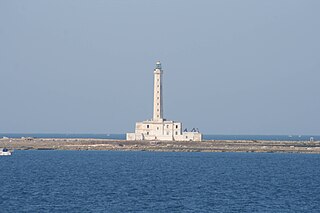
Isola Sant'Andrea Lighthouse is an active lighthouse located on a flat islet, the Isola Sant'Andrea, positioned at 0.8 nautical miles from Gallipoli on the Ionian Sea.

Manfredonia Lighthouse is an active lighthouse located at the debut of the east pier of the harbour of Manfredonia, in Apulia on the Adriatic Sea.
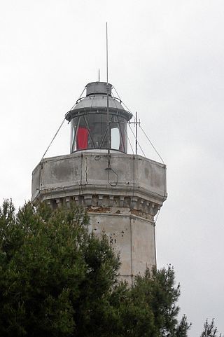
Capo Rizzuto Lighthouse is an active lighthouse located on the promontory with the same name in the municipality of Isola di Capo Rizzuto in Calabria on the Ionian Sea.

Ischia Porto Lighthouse is an active lighthouse located on the northern end of the western mole of the Port of Ischia, Campania on the Tyrrhenian Sea.
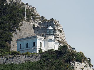
Punta Imperatore Lighthouse is an active lighthouse located atop an impressive overhanging promontory in the westernmost point of Ischia, Campania on the Tyrrhenian Sea. The lighthouse serves Naples as sighting approach.

Cesenatico Lighthouse is an active lighthouse located on the south-west of the entrance to the channel-harbour of Cesenatico, Emilia-Romagna on the Adriatic Sea.

Capo di Vado Lighthouse is an active lighthouse located on the prominent Capo di Vado, 1.5 kilometres (0.93 mi) south of Vado Ligure, Liguria on the Ligurian Sea.
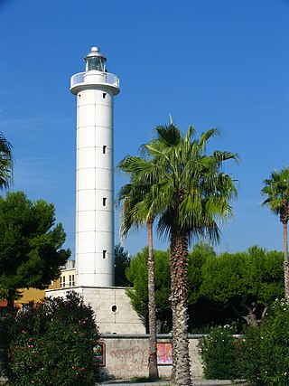
San Benedetto del Tronto Lighthouse is an active lighthouse located on the waterfront of San Benedetto del Tronto, Marche on the Adriatic Sea.

Capo Comino Lighthouse is an active lighthouse located on the easternmost promontory of Sardinia, in the municipality of Siniscola, on the Tyrrhenian Sea.
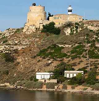
Capo Sant'Elia Lighthouse is an active lighthouse located on Capo Sant'Elia promontory, adjacent to Calamosca Bay which separates the Golfo degli Angeli from that of Quartu Sant'Elena. The structure is situated in the municipality of Quartu Sant'Elena, in the southern Sardinia on the Tyrrhenian Sea.
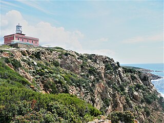
Capo Spartivento Lighthouse is an active lighthouse located on Cape Spartivento promontory which is the southernmost point of Sardinia and represents the eastern boundary of the Gulf of Teulada and the western limit of the Gulf of Cagliari on the Tyrrhenian Sea. The structure is situated in the municipality of Domus de Maria.

Isola dei Cavoli Lighthouse is an active lighthouse located on a small islet, 690 metres (2,260 ft) from Cape Carbonara, the southernmost tip of western Sardinia in the municipality of Villasimius on the Tyrrhenian Sea.

Punta Filetto Lighthouse is an active lighthouse located on the Isola Santa Maria, which makes part of the Maddalena archipelago, on the northern point of the island facing Barrettinelli di Fuori Lighthouse from which it is 1.4 kilometres (0.87 mi) away. The island is in the municipality of La Maddalena on the Tyrrhenian Sea.

Porto Conte Lighthouse is an active lighthouse located on a promontory, halfway on the east side of the bay of Porto Conte, opposite to Capo Caccia Lighthouse and west of Alghero on the Sea of Sardinia.

Porto Torres Lighthouse is an active lighthouse located on Monte Agellu dominating the harbour of Porto Torres in the Gulf of Asinara on the Sea of Sardinia.

Capo d'Orlando Lighthouse is an active lighthouse located at the foot of a rocky ridge, north of the municipality of Capo d'Orlando on the Tyrrhenian Sea.


