
Capo Carbonara Lighthouse is a light situated at the extremity of the granite promontory of Capo Carbonara, in the comune of Villasimius, on the eastern side of Gulf of Cagliari inside the Marine protected area of Capo Carbonara.

Punta Torre Canne Lighthouse is an active lighthouse in the homonymous village in the municipality of Fasano. The place takes the name from an ancient coastal tower built in the 16th century to protect the coast from the Turks, and from the presence of giant cane.
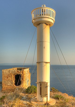
Punta del Diavolo Lighthouse is an active lighthouse located on the western point of Isola San Domino, one of the Tremiti in Apulia on the Adriatic Sea.
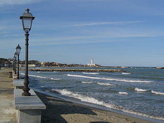
Punta San Cataldo di Lecce Lighthouse is an active lighthouse located on the eastern point of San Cataldo di Lecce in the Salentine Peninsula 12 kilometres (7.5 mi) from Lecce on the Adriatic Sea.
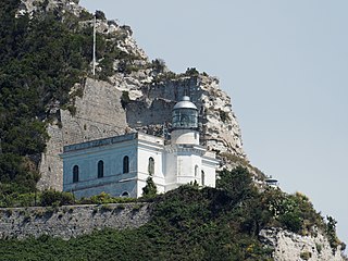
Punta Imperatore Lighthouse is an active lighthouse located atop an impressive overhanging promontory in the westernmost point of Ischia, Campania on the Tyrrhenian Sea. The lighthouse serves Naples as sighting approach.

Capo Comino Lighthouse is an active lighthouse located on the easternmost promontory of Sardinia, in the municipality of Siniscola, on the Tyrrhenian Sea.
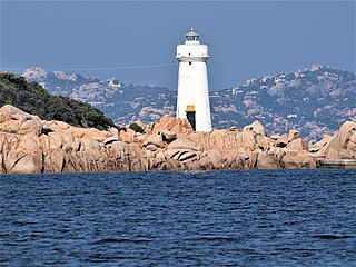
Capo d'Orso Lighthouse is an active lighthouse located on the tip of Capo d'Orso promontory in front of the Maddalena archipelago, in the municipality of Palau, in the north east of Sardinia on the Tyrrhenian Sea.
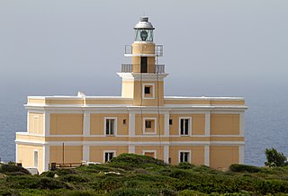
Capo San Marco Lighthouse is an active lighthouse located on Capo San Marco promontory, on the tip of Sinis peninsula overlooking the ruins below of Tharros. The structure is in the municipality of Cabras, in the west of the island on the Sea of Sardinia.
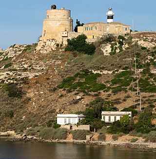
Capo Sant'Elia Lighthouse is an active lighthouse located on Capo Sant'Elia promontory, adjacent to Calamosca Bay which separates the Golfo degli Angeli from that of Quartu Sant'Elena. The structure is situated in the municipality of Quartu Sant'Elena, in the southern Sardinia on the Tyrrhenian Sea.
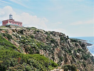
Capo Spartivento Lighthouse is an active lighthouse located on Cape Spartivento promontory which is the southernmost point of Sardinia and represents the eastern boundary of the Gulf of Teulada and the western limit of the Gulf of Cagliari on the Tyrrhenian Sea. The structure is situated in the municipality of Domus de Maria.

Capo Testa Lighthouse is an active lighthouse located on a promontory, which is the northernmost point of Sardinia, and represents the western entrance to the Strait of Bonifacio. Cape Testa promontory is connected to the mainland by an isthmus and the structure is situated in the municipality of Santa Teresa di Gallura on the Sea of Sardinia.

Isola della Bocca Lighthouse is an active lighthouse located on a small islet, at the southern entrance of the outer Port of Olbia, 250 metres (820 ft) from the mainland, in the municipality of Olbia on the Tyrrhenian Sea.

Isola dei Cavoli Lighthouse is an active lighthouse located on a small islet, 690 metres (2,260 ft) from Cape Carbonara, the southernmost tip of western Sardinia in the municipality of Villasimius on the Tyrrhenian Sea.

Isola Razzoli Lighthouse is an active lighthouse located on an islet, 2.45 kilometres (1.52 mi) long, in the Maddalena archipelago. The lighthouse is the northernmost in Sardinia, on the eastern approach to the Strait of Bonifacio, and is at 7.42 kilometres (4.61 mi) from the French Lavezzi archipelago. The island is in the municipality of La Maddalena on the Tyrrhenian Sea.

Punta Filetto Lighthouse is an active lighthouse located on the Isola Santa Maria, which makes part of the Maddalena archipelago, on the northern point of the island facing Barrettinelli di Fuori Lighthouse from which it is 1.4 kilometres (0.87 mi) away. The island is in the municipality of La Maddalena on the Tyrrhenian Sea.

Punta Palau Lighthouse is an active lighthouse located on the northern extremity of a granite promontory where, shaped by time, appears a natural sculpture that looks like a bear, symbol of Palau in front of the Maddalena archipelago on the Tyrrhenian Sea.

Torre Grande Lighthouse is an active lighthouse located atop a coastal tower on the sea front of Marina di Torre Grande, Sardinia on the Sea of Sardinia.

Capo Santa Croce Lighthouse is an active lighthouse located at the extreme tip of the cape, marking the northern end of the Gulf in the municipality of Augusta on the Ionian Sea.

Punta Lingua Lighthouse is an active lighthouse located on the south eastern tip of the island of Salina, which makes part of the Aeolian Islands, in the municipality of Santa Marina Salina on the Tyrrhenian Sea.

Punta Ferraione Lighthouse is an active lighthouse located on the eastern tip of a small bay which delimits the harbour of the island of Capraia in the Tuscan Archipelago on the Tyrrhenian Sea.


