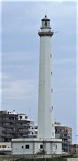
Bari Light, also known as Punta San Cataldo di Bari Lighthouse is an active lighthouse placed at the base of Molo San Cataldo, on the west side of the harbour of Bari on the Adriatic Sea, in the southern region of Apulia, Italy.

Barrettinelli di Fuori Lighthouse is a light situated on the granitic Barrettinelli rocks, 103 metres (338 ft) long and 62 metres (203 ft) wide, in the Maddalena archipelago at 1.35 kilometres (0.84 mi) east of Isola Santa Maria and 300 metres (980 ft) north of Isola Corcelli.

Portoferraio lighthouse, called Faro del Forte Stella Lighthouse since is placed on the northern rampart of Forte Stella built in 1548 by Cosimo I de' Medici in Portoferraio, Elba.
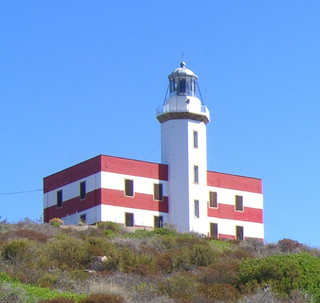
Punta di Capel Rosso lighthouse or Punta Rossa is an active lighthouse on Isola del Giglio on the Tyrrhenian Sea.

Torre Sant'Andrea di Missipezza Lighthouse is an active lighthouse in the frazione of Torre Sant'Andrea in the municipality of Melendugno.

Pianosa Lighthouse is an active lighthouse located on the east side of Pianosa Island.

Santa Maria di Leuca lighthouse is an active light located at the extremity of Santa Maria di Leuca nearby the same name Sanctuary.

Punta Torre Canne Lighthouse is an active lighthouse in the homonymous village in the municipality of Fasano. The place takes the name from an ancient coastal tower built in the 16th century to protect the coast from the Turks, and from the presence of giant cane.
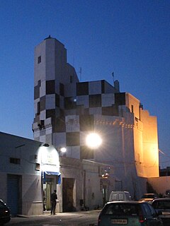
Torre San Giovanni di Ugento Lighthouse is an active lighthouse located in Torre San Giovanni, in front of the Marina, on the south-western coast of the Salento Peninsula, on the Ionian Sea.
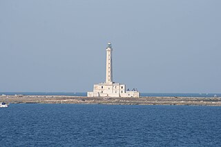
Isola Sant'Andrea Lighthouse is an active lighthouse located on a flat islet, the Isola Sant'Andrea, positioned at 0.8 nautical miles from Gallipoli on the Ionian Sea.

Manfredonia Lighthouse is an active lighthouse located at the debut of the east pier of the harbour of Manfredonia, in Apulia on the Adriatic Sea.

Molfetta Lighthouse is an active lighthouse located on the elbow of the east pier of the harbour of Molfetta, in Apulia on the Adriatic Sea.

Punta del Diavolo Lighthouse is an active lighthouse located on the western point of Isola San Domino, one of the Tremiti in Apulia on the Adriatic Sea.

Capo Rizzuto Lighthouse is an active lighthouse located on the promontory with the same name in the municipality of Isola di Capo Rizzuto in Calabria on the Ionian Sea.
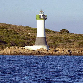
Isola delle Bisce Lighthouse is an active lighthouse located on a small islet, 590 metres (1,940 ft) from Capo Ferro Lighthouse, which make part of the Maddalena archipelago in the Strait of Bonifacio. The lighthouse guides the ships through the narrow Canale delle Bisce; the structure is situated in the municipality of Arzachena on the Tyrrhenian Sea.

Isola della Bocca Lighthouse is an active lighthouse located on a small islet, at the southern entrance of the outer Port of Olbia, 250 metres (820 ft) from the mainland, in the municipality of Olbia on the Tyrrhenian Sea.

Isola dei Cavoli Lighthouse is an active lighthouse located on a small islet, 690 metres (2,260 ft) from Cape Carbonara, the southernmost tip of western Sardinia in the municipality of Villasimius on the Tyrrhenian Sea.

Isola Razzoli Lighthouse is an active lighthouse located on an islet, 2.45 kilometres (1.52 mi) long, in the Maddalena archipelago. The lighthouse is the northernmost in Sardinia, on the eastern approach to the Strait of Bonifacio, and is at 7.42 kilometres (4.61 mi) from the French Lavezzi archipelago. The island is in the municipality of La Maddalena on the Tyrrhenian Sea.

Punta Filetto Lighthouse is an active lighthouse located on the Isola Santa Maria, which makes part of the Maddalena archipelago, on the northern point of the island facing Barrettinelli di Fuori Lighthouse from which it is 1.4 kilometres (0.87 mi) away. The island is in the municipality of La Maddalena on the Tyrrhenian Sea.

Isola delle Correnti Lighthouse is an active lighthouse located on an islet, 277 metres (909 ft) long and 152 metres (499 ft) wide, connected to mainland by a rocky isthmus on the southernmost tip of Sicily in the municipality of Portopalo di Capo Passero on the Malta Channel.


