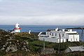
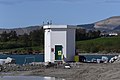
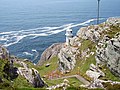
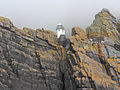
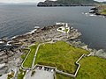
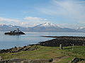
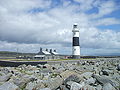
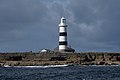
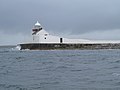
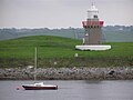
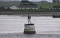
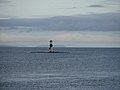
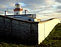
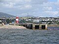
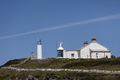
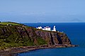
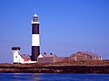
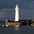
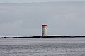
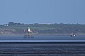
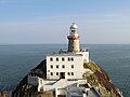
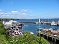
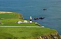
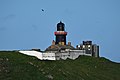
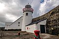
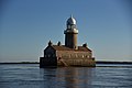
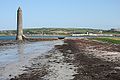
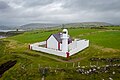
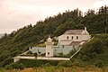
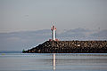
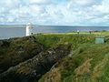
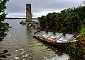
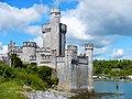
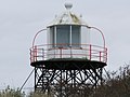
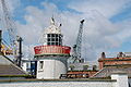
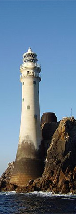
Name Image Location County Water body Year built Tower height Focal height Range Crookhaven Lighthouse Crookhaven 51°28′37″N 9°42′18″W / 51.477°N 9.705°W / 51.477; -9.705 Cork Celtic Sea 1843 14 m (46 ft) 20 m (66 ft) 13 nmi (24 km) Mizen Head Lighthouse Mizen Head 51°27′N 9°49′W / 51.45°N 9.82°W / 51.45; -9.82 Cork Celtic Sea 1959 4 m (13 ft) 55 m (180 ft) 15 nmi (28 km) Roancarrigmore Lighthouse Roancarrigmore Island 51°39′11″N 9°44′49″W / 51.653°N 9.747°W / 51.653; -9.747 Cork Bantry Bay 1847 7 m (23 ft) 18 m (59 ft) 11 nmi (20 km) Castletownbere Light Castletownbere 51°38′49″N 9°54′18″W / 51.647°N 9.905°W / 51.647; -9.905 Cork Bantry Bay 1965 5 m (16 ft) 7 m (23 ft) 15 nmi (28 km) Ardnakinna Lighthouse Bere Island 51°37′05″N 9°55′05″W / 51.618°N 9.918°W / 51.618; -9.918 Cork Bantry Bay 1850/1965 20 m (66 ft) 62 m (203 ft) 17 nmi (31 km) Sheep's Head Lighthouse Sheep's Head 51°32′35″N 9°50′56″W / 51.543°N 9.849°W / 51.543; -9.849 Cork Bantry Bay 1968 7 m (23 ft) 83 m (272 ft) 18 nmi (33 km) Bull Rock Lighthouse Bull Rock 51°35′31″N 10°18′04″W / 51.592°N 10.301°W / 51.592; -10.301 Cork North Atlantic 1889 15 m (49 ft) 91 m (299 ft) 18 nmi (33 km) Skelligs Lighthouse Skellig Michael 51°46′05″N 10°32′31″W / 51.768°N 10.542°W / 51.768; -10.542 Kerry North Atlantic 1826/1967 12 m (39 ft) 53 m (174 ft) 12 nmi (22 km) Valentia Light Valentia Island 51°55′30″N 10°18′25″W / 51.925°N 10.307°W / 51.925; -10.307 Kerry North Atlantic 1913 6 m (20 ft) 25 m (82 ft) 11 nmi (20 km) Cromwell Point Lighthouse Valentia Island 51°56′02″N 10°19′16″W / 51.934°N 10.321°W / 51.934; -10.321 Kerry North Atlantic 1841 15 m (49 ft) 16 m (52 ft) 17 nmi (31 km) Inishtearaght Lighthouse Tearaght Island 52°04′34″N 10°39′40″W / 52.076°N 10.661°W / 52.076; -10.661 Kerry North Atlantic 1870 17 m (56 ft) 84 m (276 ft) 19 nmi (35 km) Little Samphire Island Lighthouse Fenit 52°16′16″N 9°52′55″W / 52.271°N 9.882°W / 52.271; -9.882 Kerry Tralee Bay 1854 12 m (39 ft) 17 m (56 ft) 14 nmi (26 km) Inis Cathaig Lighthouse Scattery Island 52°36′22″N 9°31′05″W / 52.606°N 9.518°W / 52.606; -9.518 Clare Shannon 1872 12 m (39 ft) 15 m (49 ft) 10 nmi (19 km) Corlis Point rear (Querrin Quay) leading light Carrigaholt 52°37′41″N 9°35′20″W / 52.628°N 9.589°W / 52.628; -9.589 Clare Shannon 1998 25 m (82 ft) 27 m (89 ft) 10 nmi (19 km) Corlis Point front leading light Carrigaholt 52°37′05″N 9°36′22″W / 52.618°N 9.606°W / 52.618; -9.606 Clare Shannon 1998 4 m (13 ft) 9 m (30 ft) 10 nmi (19 km) Loop Head Loop Head 52°33′40″N 9°55′55″W / 52.561°N 9.932°W / 52.561; -9.932 Clare North Atlantic 1854 23 m (75 ft) 84 m (276 ft) 23 nmi (43 km) Inisheer Lighthouse Inisheer 53°02′49″N 9°31′37″W / 53.047°N 9.527°W / 53.047; -9.527 Galway North Atlantic 1857 34 m (112 ft) 34 m (112 ft) 20 nmi (37 km) Black Head Lighthouse, County Clare Fanore 53°09′14″N 9°15′50″W / 53.154°N 9.264°W / 53.154; -9.264 Clare Galway Bay 1936 8 m (26 ft) 20 m (66 ft) 11 nmi (20 km) Cashla Bay Lighthouse Casla 53°15′50″N 9°33′58″W / 53.264°N 9.566°W / 53.264; -9.566 Galway Galway Bay 1984 4 m (13 ft) 6 m (20 ft) 8 nmi (15 km) Straw Island Lighthouse Aran Islands 53°07′05″N 9°37′52″W / 53.118°N 9.631°W / 53.118; -9.631 Galway North Atlantic 1878 11 m (36 ft) 11 m (36 ft) 15 nmi (28 km) Eeragh Lighthouse Aran Islands 53°08′53″N 9°51′25″W / 53.148°N 9.857°W / 53.148; -9.857 Galway North Atlantic 1857 31 m (102 ft) 35 m (115 ft) 18 nmi (33 km) Slyne Head Lighthouse Slyne Head lighthouse 53°24′00″N 10°14′02″W / 53.4°N 10.234°W / 53.4; -10.234 Galway North Atlantic 1836 24 m (79 ft) 35 m (115 ft) 19 nmi (35 km) Inishgort Lighthouse Clew Bay 53°49′37″N 9°40′16″W / 53.827°N 9.671°W / 53.827; -9.671 Mayo Clew Bay 1827 8 m (26 ft) 11 m (36 ft) 10 nmi (19 km) Achillbeg Lighthouse Achillbeg 53°51′29″N 9°56′49″W / 53.858°N 9.947°W / 53.858; -9.947 Mayo Clew Bay 1965 9 m (30 ft) 56 m (184 ft) 18 nmi (33 km) Blacksod Lighthouse Blacksod Bay 54°05′56″N 10°03′36″W / 54.099°N 10.06°W / 54.099; -10.06 Mayo North Atlantic 1864 12 m (39 ft) 13 m (43 ft) 12 nmi (22 km) Blackrock Mayo Lighthouse Blacksod Bay 54°04′05″N 10°19′16″W / 54.068°N 10.321°W / 54.068; -10.321 Mayo North Atlantic 1864 15 m (49 ft) 86 m (282 ft) 20 nmi (37 km) Eagle Island lighthouse Eagle Island 54°17′02″N 10°05′35″W / 54.284°N 10.093°W / 54.284; -10.093 Mayo North Atlantic 1835 11 m (36 ft) 67 m (220 ft) 18 nmi (33 km) Broadhaven Lighthouse Broadhaven Bay 54°16′05″N 9°53′20″W / 54.268°N 9.889°W / 54.268; -9.889 Mayo North Atlantic 1848 15 m (49 ft) 27 m (89 ft) 17 nmi (31 km) Oyster Island Lighthouse Rosses Point 54°18′07″N 8°34′16″W / 54.302°N 8.571°W / 54.302; -8.571 Sligo Sligo Bay 1837/1893 12 m (39 ft) 13 m (43 ft) 7 nmi (13 km) Metal Man Sligo Lighthouse Rosses Point 54°18′14″N 8°34′34″W / 54.304°N 8.576°W / 54.304; -8.576 Sligo Sligo Bay 1821 5 m (16 ft) 3 m (10 ft) 7 nmi (13 km) Lower Rosses Lighthouse Rosses Point 54°19′44″N 8°34′23″W / 54.329°N 8.573°W / 54.329; -8.573 Sligo Sligo Bay 1908 8 m (26 ft) 8 m (26 ft) 13 nmi (24 km) Blackrock Sligo Lighthouse Sligo Bay 54°18′29″N 8°37′05″W / 54.308°N 8.618°W / 54.308; -8.618 Sligo Sligo Bay 1835 25 m (82 ft) 24 m (79 ft) 10 nmi (19 km) Rotten Island lighthouse Rotten Island 54°36′54″N 8°26′28″W / 54.615°N 8.441°W / 54.615; -8.441 Donegal Donegal Bay 1838 14 m (46 ft) 20 m (66 ft) 15 nmi (28 km) St John's Point Lighthouse, County Donegal Dunkineely 54°34′08″N 8°27′40″W / 54.569°N 8.461°W / 54.569; -8.461 Donegal Donegal Bay 1831 14 m (46 ft) 30 m (98 ft) 14 nmi (26 km) Rathlin O'Birne Lighthouse Glencolmcille 54°39′50″N 8°49′59″W / 54.664°N 8.833°W / 54.664; -8.833 Donegal North Atlantic 1856 20 m (66 ft) 35 m (115 ft) 12 nmi (22 km) Ballagh Rocks Lighthouse Arranmore 54°59′56″N 8°28′52″W / 54.999°N 8.481°W / 54.999; -8.481 Donegal North Atlantic 1982 10 m (33 ft) 13 m (43 ft) 5 nmi (9 km) Arranmore Lighthouse Arranmore 55°00′54″N 8°33′40″W / 55.015°N 8.561°W / 55.015; -8.561 Donegal North Atlantic 1798/1865 23 m (75 ft) 71 m (233 ft) 27 nmi (50 km) Tory Island Lighthouse Tory Island 55°16′23″N 8°14′56″W / 55.273°N 8.249°W / 55.273; -8.249 Donegal North Atlantic 1832 27 m (89 ft) 40 m (131 ft) 18 nmi (33 km) Buncrana Light Buncrana 55°07′37″N 7°27′54″W / 55.127°N 7.465°W / 55.127; -7.465 Donegal Lough Swilly 1876/2009 6 m (20 ft) 11 m (36 ft) 13 nmi (24 km) Dunree Lighthouse Dunree 55°11′53″N 7°33′14″W / 55.198°N 7.554°W / 55.198; -7.554 Donegal Lough Swilly 1876 6 m (20 ft) 46 m (151 ft) 12 nmi (22 km) Fanad Head Lighthouse Fanad 55°16′34″N 7°37′55″W / 55.276°N 7.632°W / 55.276; -7.632 Donegal North Atlantic 1817/1886 22 m (72 ft) 39 m (128 ft) 18 nmi (33 km) Inishtrahull Lighthouse Inishtrahull Island 55°25′52″N 7°14′38″W / 55.431°N 7.244°W / 55.431; -7.244 Donegal North Atlantic 1812/1958 23 m (75 ft) 59 m (194 ft) 19 nmi (35 km) Inishowen Lighthouse Inishowen 55°13′34″N 6°55′44″W / 55.226°N 6.929°W / 55.226; -6.929 Donegal North Atlantic 1837 23 m (75 ft) 29 m (95 ft) 18 nmi (33 km) Rathlin West Lighthouse Rathlin Island 55°18′04″N 6°16′52″W / 55.301°N 6.281°W / 55.301; -6.281 Antrim North Channel 1917 18 m (59 ft) 62 m (203 ft) 22 nmi (41 km) Rathlin East (Altacarry Head) Lighthouse Rathlin Island 55°18′07″N 6°10′19″W / 55.302°N 6.172°W / 55.302; -6.172 Antrim North Channel 1856 27 m (89 ft) 74 m (243 ft) 26 nmi (48 km) Rue Point Lighthouse Rathlin Island 55°15′32″N 6°11′28″W / 55.259°N 6.191°W / 55.259; -6.191 Antrim North Channel 1915/1921 11 m (36 ft) 16 m (52 ft) 14 nmi (26 km) Maidens Lighthouse The Maidens 54°55′44″N 5°43′41″W / 54.929°N 5.728°W / 54.929; -5.728 Antrim North Channel 1829 23 m (75 ft) 29 m (95 ft) 23 nmi (43 km) Blackhead Lighthouse, County Antrim Whitehead 54°46′01″N 5°41′20″W / 54.767°N 5.689°W / 54.767; -5.689 Antrim North Channel 1902 16 m (52 ft) 45 m (148 ft) 27 nmi (50 km) Mew Island Lighthouse Mew Island 54°41′56″N 5°30′50″W / 54.699°N 5.514°W / 54.699; -5.514 Down North Channel 1884 37 m (121 ft) 37 m (121 ft) 24 nmi (44 km) Donaghadee Lighthouse Donaghadee 54°38′42″N 5°31′52″W / 54.645°N 5.531°W / 54.645; -5.531 Down North Channel 1836 16 m (52 ft) 17 m (56 ft) 17 nmi (31 km) Angus Rock Lighthouse Strangford Lough 54°19′52″N 5°31′30″W / 54.331°N 5.525°W / 54.331; -5.525 Down Strangford Lough 1983 13 m (43 ft) 15 m (49 ft) 5 nmi (9 km) St John's Point Lighthouse, County Down Killough 54°13′37″N 5°39′36″W / 54.227°N 5.66°W / 54.227; -5.66 Down Irish Sea 1844/1893 39 m (128 ft) 37 m (121 ft) 25 nmi (46 km) Green Island Leading Light Carlingford Lough 54°01′59″N 6°05′46″W / 54.033°N 6.096°W / 54.033; -6.096 Down Carlingford Lough 1873 14 m (46 ft) 13 m (43 ft) 11 nmi (20 km) Vidal Bank Leading Light Carlingford Lough 54°01′48″N 6°05′28″W / 54.03°N 6.091°W / 54.03; -6.091 Down Carlingford Lough 1873 8 m (26 ft) 7 m (23 ft) 11 nmi (20 km) Haulbowline Lighthouse Carlingford Lough 54°01′12″N 6°04′44″W / 54.02°N 6.079°W / 54.02; -6.079 Down Irish Sea 1824 34 m (112 ft) 32 m (105 ft) 10 nmi (19 km) Dundalk Lighthouse Dundalk 53°58′34″N 6°17′42″W / 53.976°N 6.295°W / 53.976; -6.295 Louth Irish Sea 1855 10 m (33 ft) 10 m (33 ft) 10 nmi (19 km) Rockabill Lighthouse Rockabill 53°35′49″N 6°00′18″W / 53.597°N 6.005°W / 53.597; -6.005 Dublin Irish Sea 1860 32 m (105 ft) 45 m (148 ft) 18 nmi (33 km) Baily Lighthouse Howth Head 53°21′43″N 6°03′11″W / 53.362°N 6.053°W / 53.362; -6.053 Dublin Dublin Bay 1814 13 m (43 ft) 41 m (135 ft) 18 nmi (33 km) Dún Laoghaire West Lighthouse Dún Laoghaire 53°18′11″N 6°07′52″W / 53.303°N 6.131°W / 53.303; -6.131 Dublin Dublin Bay 1852 9 m (30 ft) 11 m (36 ft) 7 nmi (13 km) Dún Laoghaire East Lighthouse Dún Laoghaire 53°18′11″N 6°07′37″W / 53.303°N 6.127°W / 53.303; -6.127 Dublin Dublin Bay 1847 12 m (39 ft) 16 m (52 ft) 17 nmi (31 km) Muglins Lighthouse Dalkey Island 53°16′30″N 6°04′34″W / 53.275°N 6.076°W / 53.275; -6.076 Dublin Dublin Bay 1906 9 m (30 ft) 14 m (46 ft) 11 nmi (20 km) Kish Lighthouse Kish Bank 53°18′40″N 5°55′34″W / 53.311°N 5.926°W / 53.311; -5.926 Dublin Dublin Bay 1965 31 m (102 ft) 29 m (95 ft) 22 nmi (41 km) Wicklow Head Lighthouse Wicklow Head 52°57′58″N 5°59′53″W / 52.966°N 5.998°W / 52.966; -5.998 Wicklow St George's Channel 1781/1818 14 m (46 ft) 37 m (121 ft) 23 nmi (43 km) Tuskar Rock Lighthouse Tuskar Rock 52°12′11″N 6°12′25″W / 52.203°N 6.207°W / 52.203; -6.207 Wexford St George's Channel 1815 34 m (112 ft) 33 m (108 ft) 24 nmi (44 km) Dunmore East Lighthouse Dunmore East 52°08′56″N 6°59′24″W / 52.149°N 6.99°W / 52.149; -6.99 Waterford Celtic Sea 1825 16 m (52 ft) 13 m (43 ft) 17 nmi (31 km) Hook Lighthouse Hook Head 52°07′26″N 6°55′48″W / 52.124°N 6.93°W / 52.124; -6.93 Wexford Celtic Sea 1172 35 m (115 ft) 46 m (151 ft) 23 nmi (43 km) Ballinacourty Point Lighthouse Dungarvan 52°04′41″N 7°33′11″W / 52.078°N 7.553°W / 52.078; -7.553 Waterford Celtic Sea 1858 13 m (43 ft) 16 m (52 ft) 10 nmi (19 km) Mine Head Lighthouse Mine Head 51°59′35″N 7°35′13″W / 51.993°N 7.587°W / 51.993; -7.587 Waterford Celtic Sea 1851 21 m (69 ft) 87 m (285 ft) 12 nmi (22 km) Ballycotton lighthouse Ballycotton 51°49′30″N 7°59′10″W / 51.825°N 7.986°W / 51.825; -7.986 Cork Celtic Sea 1851 15 m (49 ft) 59 m (194 ft) 21 nmi (39 km) Roche's Point Lighthouse Cork Harbour 51°47′35″N 8°15′18″W / 51.793°N 8.255°W / 51.793; -8.255 Cork Cork Harbour 1817/1835 15 m (49 ft) 30 m (98 ft) 20 nmi (37 km) Charlesfort Lighthouse Charlesfort 51°41′46″N 8°30′00″W / 51.696°N 8.5°W / 51.696; -8.5 Cork Kinsale Harbour Unknown 5 m (16 ft) 18 m (59 ft) 9 nmi (17 km) Old Head of Kinsale Lighthouse Old Head of Kinsale 51°36′18″N 8°32′02″W / 51.605°N 8.534°W / 51.605; -8.534 Cork Celtic Sea 1665/1853 30 m (98 ft) 72 m (236 ft) 20 nmi (37 km) Galley Head Lighthouse Galley Head 51°31′48″N 8°57′14″W / 51.53°N 8.954°W / 51.53; -8.954 Cork Celtic Sea 1878 21 m (69 ft) 53 m (174 ft) 23 nmi (43 km) Copper Point Lighthouse Long Island 51°30′14″N 9°32′02″W / 51.504°N 9.534°W / 51.504; -9.534 Cork Celtic Sea 1864 15 m (49 ft) 16 m (52 ft) 8 nmi (15 km) Fastnet Lighthouse Fastnet Rock 51°23′20″N 9°36′11″W / 51.389°N 9.603°W / 51.389; -9.603 Cork Celtic Sea 1854/1904 54 m (177 ft) 49 m (161 ft) 27 nmi (50 km)