John Rennie was a Scottish civil engineer who designed many bridges, canals, docks and warehouses, and a pioneer in the use of structural cast-iron.

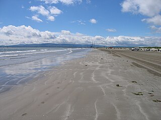
Dublin Bay is a C-shaped inlet of the Irish Sea on the east coast of Ireland. The bay is about 10 kilometres wide along its north–south base, and 7 km in length to its apex at the centre of the city of Dublin; stretching from Howth Head in the north to Dalkey Point in the south. North Bull Island is situated in the northwest part of the bay, where one of two major inshore sand banks lay, and features a 5 km long sandy beach, Dollymount Strand, fronting an internationally recognised wildfowl reserve. Many of the rivers of Dublin reach the Irish Sea at Dublin Bay: the River Liffey, with the River Dodder flow received less than 1 km inland, River Tolka, and various smaller rivers and streams.

Sandymount is a coastal suburb in the Dublin 4 district on the Southside of Dublin in Ireland.

Ringsend is a southside inner suburb of Dublin, Ireland. It is located on the south bank of the River Liffey and east of the River Dodder, about two kilometres east of the city centre. It is the southern terminus of the East Link Toll Bridge. Areas included in Ringsend are the south side of the Dublin Docklands, and at the west end is the area of South Lotts and part of the Grand Canal Dock area. Neighbouring areas include Irishtown, Sandymount and the Beggars Bush part of Ballsbridge to the south, and the city centre to the west. A key feature of the area is the chimneys of Poolbeg power station.

Dublin Port is the seaport of Dublin, Ireland, of both historical and contemporary economic importance. Approximately two-thirds of Ireland's port traffic travels via the port, which is by far the busiest on the island of Ireland.

Howth is an affluent peninsular village and outer suburb of Dublin, Ireland. The district as a whole occupies the greater part of the peninsula of Howth Head, which forms the northern boundary of Dublin Bay, and includes the island of Ireland's Eye, which holds multiple natural protection designations.

Howth Head is a peninsula northeast of the city of Dublin in Ireland, within the governance of Fingal County Council. Entry to the headland is at Sutton while the village of Howth and the harbour are on the north-eastern face. Most of Howth Head is occupied by the Hill of Howth, though there are other regions, such as the tombolo at Sutton, extensive beaches on the northern shores, and small ones in other parts. The Baily Lighthouse is on the southeastern part of Howth Head. Nearby are the districts of Baldoyle and Portmarnock, and adjacent is the nature reserve of North Bull Island.
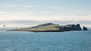
Ireland's Eye Anciently called 'Adros' by Ptolemy, 'Adrea Deserta' by Pliny, and 'Andros' and 'Edria' by other early navigators. is a small long-uninhabited island off the coast of County Dublin, Ireland. Situated directly north of Howth village and harbour, the island is easily reached by regular seasonal tourist boats, which both circumnavigate it and drop off day trippers. There is a yacht anchorage to the north of it, and kayakers also land.
Bull Island, more properly North Bull Island, is an island located in Dublin Bay in Ireland, about 5 km long and 800 m wide, lying roughly parallel to the shore off Clontarf, Raheny, Kilbarrack, and facing Sutton. The island, with a sandy beach known as Dollymount Strand running its entire length, is a relatively recent, and inadvertent, result of human intervention in the bay. The island lies within the jurisdiction of, and is mostly owned by, Dublin City Council, and is managed by the Council's Parks and Landscape Division.
The Commissioners of Irish Lights, often shortened to Irish Lights or CIL, is the body that serves as the general lighthouse authority for Northern Ireland and the Republic of Ireland and their adjacent seas and islands. As the lighthouse authority for the island of Ireland it oversees the coastal lights and navigation marks provided by the local lighthouse authorities, the county councils and port authorities.

An ordnance datum (OD) is a vertical datum used by an ordnance survey as the basis for deriving altitudes on maps. A spot height may be expressed as above ordnance datum (AOD). Usually mean sea level (MSL) at a particular place is used for the datum.

The Baily Lighthouse is a lighthouse on the southeastern part of Howth Head in County Dublin, Ireland. It is maintained by the Commissioners of Irish Lights.

Poolbeg is an artificial peninsula extending from Ringsend, Dublin, into Dublin Bay.

The Bull Wall, or North Bull Wall, at the Port of Dublin, extending from the estuary of the River Tolka and the district of Clontarf out nearly 3 km into Dublin Bay, is one of the two defining sea walls of the port, and faces the earlier-constructed Great South Wall. It has one of a trio of port lighthouses at the end of its extension breakwater, and a statue of Realt na Mara partway along, and was responsible for the formation of North Bull Island with its nearly 5 km of beach.

The Great South Wall, at the Port of Dublin, extends from the tip of the Poolbeg peninsula more than four kilometres out into Dublin Bay. It was the world's longest sea wall at the time of its construction and remains one of the longest in Europe. It faces the newer Bull Wall, and has one of four port lighthouses at its end.
George Halpin (Sr.), was a prominent civil engineer and lighthouse builder, responsible for the construction of much of the Port of Dublin, several of Dublin's bridges, and a number of lighthouses; he is considered the founding father of the Irish lighthouse service. His son, George Halpin , was also a well-known lighthouse builder.

The North Bull Lighthouse, is an active aid to navigation located at the mouth of the River Liffey, near Dublin, Ireland. It is one of four lighthouses that help guide shipping into the Liffey, and the Port of Dublin, all of which are operated and maintained by the Dublin Port Company.

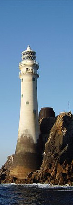
Eeragh Lighthouse is an active lighthouse located on Rock Island, one of the Brannock Islands, part of the Aran Islands archipelago in County Galway, Ireland. It marks the north-western entrance to Galway Bay and the port of Galway known as the North Sound. Due to its location it is also known as the Aran North Lighthouse. The lighthouse on Inisheer at the south-eastern end of the islands was also constructed at the same time. Eeragh and Inisheer both became operational in 1857.
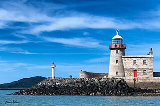
The Harbour lighthouse in Howth is a historic aid to navigation situated on the East pier of the harbour. It was built in the early 19th century to help guide shipping into the newly constructed harbour, which acted as the terminus for the packet service between Ireland and England. In 1982 it was decommissioned and replaced by a modern pole light on an adjacent extension of the pier.

The North Bank or Northbank Lighthouse, is an active aid to navigation located at the mouth of the River Liffey, near Dublin, Ireland. It is one of four lighthouses that help guide shipping into the Liffey, and the Port of Dublin, all of which are operated and maintained by the Dublin Port Company. Built in 1882, it also affectionately called The Tea Caddy due to its architecture, and has also been described as "resembling a giant mailbox on stilts".