Irish round towers are early medieval stone towers of a type found mainly in Ireland, with two in Scotland and one on the Isle of Man. As their name Cloigtheach indicates, they were originally bell towers, though they may have been later used for additional purposes.
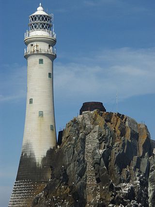
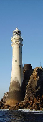
Fastnet Lighthouse is a 54-metre-tall (177 ft) lighthouse situated on the remote Fastnet Rock in the Atlantic Ocean. It is the most southerly point of Ireland and lies 6.5 kilometres (4.0 mi) southwest of Cape Clear Island and 13 kilometres (8.1 mi) from County Cork on the Irish mainland. The current lighthouse is the second to be built on the rock and is the tallest in Ireland.

Larne Lough, historically Lough Larne, is a sea loch or inlet in County Antrim, Northern Ireland. It lies between the Islandmagee peninsula and the mainland. At its mouth is the town of Larne. It is designated as an area of special scientific interest, a special protection area, and a Ramsar site to protect the wetland environment, particularly due to the presence of certain bird species and shellfish.

The Macquarie Lighthouse, also known as South Head Upper Light, is the first, and is the longest serving, lighthouse site in Australia. It is located on Dunbar Head, on Old South Head Road, Vaucluse in the Municipality of Woollahra local government area of New South Wales, Australia. The lighthouse is situated approximately 2 kilometres (1 mi) south of South Head near the entrance to Sydney Harbour. There has been a navigational aid in this vicinity since 1791 and a lighthouse near the present site since 1818. The current heritage-listed lighthouse was completed in 1883. The lighthouse and associated buildings were designed by James Barnet and built from 1881 to 1883.
The Commissioners of Irish Lights, often shortened to Irish Lights or CIL, is the body that serves as the general lighthouse authority for Northern Ireland and the Republic of Ireland and their adjacent seas and islands. As the lighthouse authority for the island of Ireland it oversees the coastal lights and navigation marks provided by the local lighthouse authorities, the county councils and port authorities.

The Baily Lighthouse is a lighthouse on the southeastern part of Howth Head in County Dublin, Ireland. It is maintained by the Commissioners of Irish Lights.

The Hook Lighthouse is a building situated on Hook Head at the tip of the Hook Peninsula in County Wexford, in Ireland. It is one of the oldest lighthouses in the world and the second oldest operating lighthouse in the world, after the Tower of Hercules in Spain. It is operated by the Commissioners of Irish Lights, the Irish lighthouse authority, and marks the eastern entrance to Waterford Harbour. The current structure has stood for over 800 years.
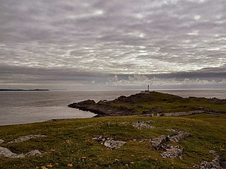
Inishtrahull Lighthouse is the northerly most lighthouse in Ireland located on the Inishtrahull Island off the coast of County Donegal. Coupled with the lighthouse on Tory Island they form the two main landfall lights for shipping from the Atlantic rounding the north coast of Ireland, and navigation to local shipping. Work on the first lighthouse, situated at the east end of the island began in 1812, primarily due to Royal Navy ships using Lough Foyle.

Hurst Point Lighthouse is located at Hurst Point in the English county of Hampshire, and guides vessels through the western approaches to the Solent.
James Chaine was an Irish shipping businessman and a Conservative Party politician in the Imperial Parliament of Great Britain and Ireland where he represented County Antrim, Ulster from 1874 to 1885..

Roche's Point Lighthouse is situated at the entrance to Cork Harbour, Ireland. A lighthouse was first established on 4 June 1817 to guide ships into Cork Harbour. The original tower was deemed too small and in 1835 was replaced by the larger present tower which is 49 feet high with a diameter of 12 feet. Roche's Point Lighthouse, and a number of other structures, are located on a headland of the same name.
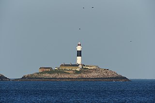
Rockabill Lighthouse is an active 19th century lighthouse, on the larger of the two islands that form Rockabill. The islands lie some 5 kilometres (3.1 mi) off the east coast of Ireland, north-east of Skerries, in County Dublin. It is operated and maintained by the Commissioners of Irish Lights.

The Haulbowline Lighthouse is an active 19th century lighthouse. Described as an "elegant, tapering stone tower" it is located at the entrance to Carlingford Lough, near Cranfield Point in County Down, Northern Ireland. The lighthouse was built on the eastern part of the Haulbowline rocks, one of a number of navigation hazards at the seaward end of Carlingford Lough, which include a notable rocky shoal or bar across the mouth of the lough. The multi-purpose light was designed to help mark the rocks and, when first built, the depth of water over the bar, as well as acting as a landfall light for ships entering from the Irish Sea. Associated with the lighthouse are the leading lights at Green Island and Vidal Bank which mark the safe channel along Carlingford Lough, with Haulbowline displaying a reserve light in case of problems with these leading lights.

Blackhead Lighthouse is a listed lighthouse built at the turn of the 20th century, near Whitehead in County Antrim, Northern Ireland. It marks the very northern end of Belfast Lough where it opens out into the North Channel that separates Northern Ireland and Scotland. The active lighthouse is managed by the Commissioners of Irish Lights, where it is named as the Blackhead Antrim Lighthouse to distinguish it from the more modern Blackhead lighthouse in County Clare.

Scarborough Pier Lighthouse is an active aid to navigation on Vincent Pier in Scarborough, North Yorkshire, owned and operated by Scarborough Borough Council. The lighthouse dates from 1806, but it had to be rebuilt following damage sustained in the German bombardment of 1914.

The Inisheer, Inis Oírr or Fardurris Point Lighthouse, is an active 19th century lighthouse located on the island of Inisheer, the smallest of the Aran Islands, in County Galway, Ireland. It marks the south-eastern entrance to Galway bay and the port of Galway known as the South Sound, with a red sector of the light marking the Finnis Rock. The Eeragh Lighthouse which marks the North Sound entrance to the bay on the north-western side of the islands, was also constructed at the same time. Inisheer and Eeragh both became operational in 1857.

Straw Island Lighthouse is an active aid to navigation on an islet of the same name in Killeany Bay, northeast of Inishmore in County Galway, Ireland. Completed in 1878, it was the last of four lighthouses built in the 19th century on the Aran Islands. The commissioning of Straw Island marked the culmination of a lengthy 24 year campaign by the local islanders to have a lighthouse for safe passage into Killeany Bay and the harbour at Kilronan.
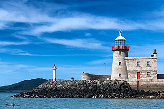
The Harbour lighthouse in Howth is a historic aid to navigation situated on the East pier of the harbour. It was built in the early 19th century to help guide shipping into the newly constructed harbour, which acted as the terminus for the packet service between Ireland and England. In 1982 it was decommissioned and replaced by a modern pole light on an adjacent extension of the pier.
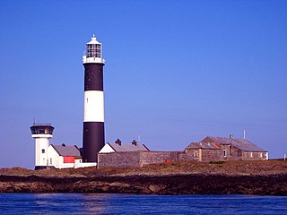
Mew Island Lighthouse is an active lighthouse within the Copeland Islands of County Down in Northern Ireland. The current 19th-century tower is the most recent in a series of lighthouses that have been built in the islands, which have helped to guide shipping around the archipelago and into Belfast Lough.

The Matiu / Somes Island lighthouse is a harbour navigation light located on Matiu / Somes Island in Wellington Harbour, New Zealand. It is a sector light, marking a safe approach through the harbour channel. The first lighthouse on the site was established in 1866. It was the first inner harbour lighthouse in New Zealand, and one of only eight lighthouses nationwide at that time. However, by 1895 there were multiple complaints that it was inadequate. A replacement lighthouse with a more powerful light was built on an adjacent site and commissioned on 21 February 1900. The light was automated on 1 April 1924 and converted to electricity after 1945. The lighthouse is currently operated and maintained by the Greater Wellington Regional Council.


