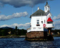
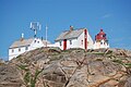
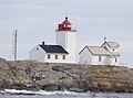
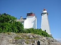
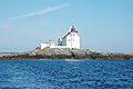
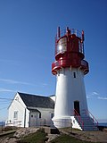
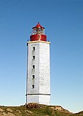
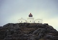
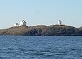
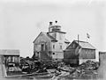
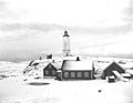
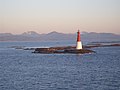
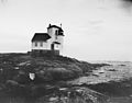
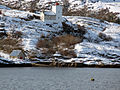
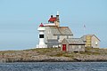
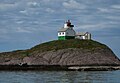
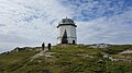
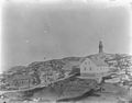
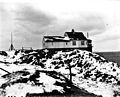
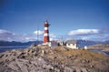
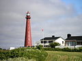
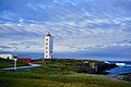
Name Image Status Municipality Year Year Tower Focal Range (nm) Owned by Protected Coordinates Torbjørnskjær Active Hvaler 1872 1990 17.9 25.7 15 Kystverket Yes 58°59′46″N 10°46′57″E / 58.995975°N 10.78248°E / 58.995975; 10.78248 Homlungen Active Hvaler 1867 1952 12 13.5 12 Kystverket Yes 59°00′58″N 11°01′28″E / 59.016085°N 11.024394°E / 59.016085; 11.024394 Strømtangen F Active Fredrikstad 1859 1977 6.9 11.3 11.5 Kystverket No 59°09′04″N 10°49′46″E / 59.151115°N 10.829515°E / 59.151115; 10.829515 Struten Active Fredrikstad 1907 1985 13.5 20.07 14.2 Kystverket No 59°07′04″N 10°44′27″E / 59.117869°N 10.740852°E / 59.117869; 10.740852 Guldholmen Active Moss 1894 1985 6 17.6 13.5 Kystverket No 59°26′07″N 10°34′38″E / 59.4353°N 10.577087°E / 59.4353; 10.577087 Digerudgrunnen Demolished Frogn 1871 1975 7 7.5 10.3 Kystverket No 59°43′10″N 10°35′10″E / 59.719515°N 10.586057°E / 59.719515; 10.586057 Dyna Active Oslo 1875 1956 12.4 5.6 9.5 Oslo No 59°53′41″N 10°41′18″E / 59.894752°N 10.688388°E / 59.894752; 10.688388 Kavringen Active Oslo 1892 12m Oslo Yes 59°53′59″N 10°43′19″E / 59.899808°N 10.722013°E / 59.899808; 10.722013 Heggholmen Active Oslo 1826 1972 15.2 6.3 8.9 Oslo Yes 59°53′06″N 10°42′50″E / 59.885113°N 10.713875°E / 59.885113; 10.713875 Filtvet Active Asker 1840 1985 13 13 12 Kystverket Yes 59°34′15″N 10°37′04″E / 59.57083°N 10.61778°E / 59.57083; 10.61778 Rødtangen Active Asker 1840 1897 2 11 7 Private No 59°31′42″N 10°25′00″E / 59.528312°N 10.41667°E / 59.528312; 10.41667 Bastøy Active Horten 1840 1986 14 16 14 Kystverket No 59°23′12″N 10°32′13″E / 59.386607°N 10.53705°E / 59.386607; 10.53705 Hollenderbåen Active Færder 1986 1986 13 13 12 Kystverket No 59°09′39″N 10°37′34″E / 59.16095°N 10.62599°E / 59.16095; 10.62599 Fulehuk Active Færder 1821 1989 15 16.3 13 Kystverket No 59°10′31″N 10°35′58″E / 59.175357°N 10.599318°E / 59.175357; 10.599318 Store Færder In ruins Færder 1696 NA Kystverket In ruins 59°04′25″N 10°31′23″E / 59.073698°N 10.522928°E / 59.073698; 10.522928 Lille Færder Active Færder 1857 2005 43 47 19 Kystverket Yes 59°01′33″N 10°31′20″E / 59.02576°N 10.522327°E / 59.02576; 10.522327 Svenner Active Larvik 1874 2003 18.7 40.3 17.8 Kystverket Yes 58°58′09″N 10°08′53″E / 58.969172°N 10.148191°E / 58.969172; 10.148191 Tvistein Active Larvik 1908 1987 6 17 13.2 Kystverket No 58°56′17″N 9°56′12″E / 58.938009°N 9.936790°E / 58.938009; 9.936790 Stavernsodden Active Larvik 1855 1984 8.5 43.9 14.9 Kystverket Yes 58°59′15″N 10°03′09″E / 58.987573°N 10.052404°E / 58.987573; 10.052404 Langøytangen Active Bamble 1839 1990 14.5 18.5 13.5 Kystverket No 58°59′38″N 9°45′50″E / 58.993914°N 9.763791°E / 58.993914; 9.763791 Jomfruland Active Kragerø 1839 1991 31 48 19 Kystverket Yes 58°52′00″N 9°35′59″E / 58.866668°N 9.599612°E / 58.866668; 9.599612 Strømtangen K Active Kragerø 1874 1962 8.8 7.6 10.4 Kystverket Yes 58°50′14″N 9°27′57″E / 58.837135°N 9.465722°E / 58.837135; 9.465722 Stavseng Active Kragerø 1874 1968 16.7 25.7 12 Kystverket Yes 58°51′07″N 9°27′20″E / 58.851887°N 9.455445°E / 58.851887; 9.455445 Stangholmen Active Risør 1855 1949 9.1 10.4 8.5 Risør No 58°42′35″N 9°14′42″E / 58.709804°N 9.245136°E / 58.709804; 9.245136 Lyngør Active Tvedestrand 1879 2004 16.9 21.3 14 Kystverket Yes 58°38′11″N 9°08′59″E / 58.636338°N 9.149713°E / 58.636338; 9.149713 Ytre Møkkalasset 1986 Arendal 1888 1946 17.2 17.1 11.8 Kystverket Yes 58°32′28″N 9°00′16″E / 58.541035°N 9.004498°E / 58.541035; 9.004498 Sandvikodden Active Arendal 1844 1934 10.7 17 11.5 Private Yes 58°26′12″N 8°47′02″E / 58.436634°N 8.784016°E / 58.436634; 8.784016 Lille Torungen 1914 Arendal 1844 NA 28.9 42.5 18 Kystverket Yes 58°25′14″N 8°49′18″E / 58.420547°N 8.821602°E / 58.420547; 8.821602 Store Torungen Active Arendal 1844 2004 34.3 43.3 18.5 Kystverket Yes 58°23′59″N 8°47′31″E / 58.399651°N 8.79186°E / 58.399651; 8.79186 Rivingen Active Grimstad 1886 1925 10 12.3 11.5 Kystverket No 58°18′16″N 8°35′09″E / 58.304491°N 8.585794°E / 58.304491; 8.585794 Homborsund Active Grimstad 1879 1992 20.1 22.3 14.5 Kystverket Yes 58°15′17″N 8°31′55″E / 58.254739°N 8.531807°E / 58.254739; 8.531807 Saltholmen 1952 Lillesand 1882 NA 11 14 12 Private Yes 58°13′55″N 8°24′18″E / 58.231872°N 8.404894°E / 58.231872; 8.404894 Oksøy Active Kristiansand 1832 2004 36 47 19 Kystverket Yes 58°04′30″N 8°03′38″E / 58.074986°N 8.060445°E / 58.074986; 8.060445 Grønningen Active Kristiansand 1878 1980 14 18.7 13.5 Kystverket Yes 58°05′28″N 8°06′59″E / 58.091142°N 8.116423°E / 58.091142; 8.116423 Odderøya Active Kristiansand 1832 1984 7.8 19.1 13.8 Kystverket Yes 58°07′54″N 8°00′13″E / 58.131742°N 8.003650°E / 58.131742; 8.003650 Songvår Active Kristiansand 1888 1987 10 23.2 14.5 Kystverket No 58°01′01″N 7°48′48″E / 58.016832°N 7.813263°E / 58.016832; 7.813263 Ryvingen Active Lindesnes 1867 2002 22.5 52 19.5 Kystverket Yes 57°58′40″N 7°31′10″E / 57.977772°N 7.519576°E / 57.977772; 7.519576 Hatholmen Active Lindesnes 1867 1984 7.2 19 9.6 Kystverket Yes 58°00′14″N 7°27′03″E / 58.003903°N 7.450864°E / 58.003903; 7.450864 Lindesnes Active Lindesnes 1655 2003 16.1 50.1 19.4 Kystverket Yes 57°58′59″N 7°02′53″E / 57.982986°N 7.048015°E / 57.982986; 7.048015 Søndre Katland Active Farsund 1878 1948 14.5 19.4 8.9 Kystverket No 58°04′00″N 6°52′07″E / 58.066751°N 6.868474°E / 58.066751; 6.868474 Lista Active Farsund 1836 2003 34 39.5 17.5 Kystverket Yes 58°06′36″N 6°34′08″E / 58.110038°N 6.568939°E / 58.110038; 6.568939 Lille Presteskjær Active Sokndal 1895 1973 20.8 23.5 11.2 Kystverket Yes 58°19′23″N 6°15′30″E / 58.322921°N 6.258269°E / 58.322921; 6.258269 Eigerøy Active Eigersund 1854 1989 32.9 46.5 18.8 Kystverket Yes 58°25′52″N 5°52′07″E / 58.431053°N 5.868547°E / 58.431053; 5.868547 Viberodden Active Eigersund 1855 1977 9.1 22 14.4 Kystverket No 58°25′12″N 5°59′30″E / 58.420069°N 5.991576°E / 58.420069; 5.991576 Kvassheim Active Hå 1912 1990 12 16 13 Kystverket No 58°33′11″N 5°42′37″E / 58.552992°N 5.710229°E / 58.552992; 5.710229 Obrestad Active Hå 1873 1991 16.5 39 17.6 Kystverket Yes 58°39′30″N 5°33′18″E / 58.658424°N 5.555113°E / 58.658424; 5.555113 Flatholmen Active Sola 1862 1984 8 17.5 13.3 Kystverket No 58°55′57″N 5°35′02″E / 58.932566°N 5.583973°E / 58.932566; 5.583973 Feistein Active Klepp 1859 1990 25 34 16.8 Kystverket Yes 58°49′36″N 5°30′21″E / 58.826703°N 5.505782°E / 58.826703; 5.505782 Tungenes Active Randaberg 1828 1984 12 17.5 13.8 Kystverket Yes 59°02′12″N 5°34′58″E / 59.036735°N 5.582841°E / 59.036735; 5.582841 Fjøløy Active Stavanger 1849 1977 6.9 17.5 13.8 Kystverket No 59°05′24″N 5°34′13″E / 59.089897°N 5.570193°E / 59.089897; 5.570193 Kvitsøy Active Kvitsøy 1700 1969 27 45.2 18.5 Kystverket Yes 59°03′46″N 5°24′16″E / 59.062892°N 5.404392°E / 59.062892; 5.404392 Skudenes 1924 Karmøy 1799 1924 6.5 22 12.5 Private Yes 59°08′29″N 5°17′40″E / 59.141394°N 5.294403°E / 59.141394; 5.294403 Høgevarde Lighthouse 1902 Karmøy 1700 Geitungen Active Karmøy 1924 1999 11.2 41 17.8 Kystverket Yes 59°07′55″N 5°14′39″E / 59.132006°N 5.244134°E / 59.132006; 5.244134 Røværsholmen Active Haugesund 1892 1975 15.5 22.5 14.6 Kystverket Yes 59°27′07″N 5°04′12″E / 59.451912°N 5.070019°E / 59.451912; 5.070019 Utsira Active Utsira 1844 2003 13.3 78.2 23 Kystverket Yes 59°18′27″N 4°52′27″E / 59.307453°N 4.874084°E / 59.307453; 4.874084 Ryvarden Active Sveio 1849 1984 6.9 22.3 13.4 Kystverket No 59°31′39″N 5°13′38″E / 59.527528°N 5.227107°E / 59.527528; 5.227107 Slåtterøy Active Bømlo 1859 2003 25.1 45.8 18.5 Kystverket Yes 59°54′32″N 5°04′13″E / 59.909002°N 5.070315°E / 59.909002; 5.070315 Marstein Active Austevoll 1877 2002 17.3 38 17.5 Kystverket No 60°08′26″N 5°02′24″E / 60.140499°N 5.039908°E / 60.140499; 5.039908 Hellisøy Active Fedje 1855 1992 32.3 46.5 18.8 Kystverket Yes 60°51′30″N 4°54′24″E / 60.858276°N 4.906617°E / 60.858276; 4.906617 Holmengrå Active Fedje 1892 1986 16 35.5 17.1 Kystverket No 60°51′11″N 4°40′49″E / 60.852954°N 4.680139°E / 60.852954; 4.680139 Utvær Active Solund 1900 2004 31 45 18.6 Kystverket Yes 61°02′20″N 4°31′08″E / 61.039002°N 4.518927°E / 61.039002; 4.518927 Geita Active Askvoll 1897 1982 31 42.8 16.9 Kystverket Yes 61°16′45″N 4°50′32″E / 61.279159°N 4.842136°E / 61.279159; 4.842136 Stabben Active Kinn 1867 1975 15.6 16.2 13 Kystverket Yes 61°36′04″N 4°57′24″E / 61.601129°N 4.956565°E / 61.601129; 4.956565 Kvanhovden Active Kinn 1895 1980 10 40.3 17.7 Kystverket No 61°41′52″N 4°50′02″E / 61.697715°N 4.833867°E / 61.697715; 4.833867 Ytterøyane Active Kinn 1881 2004 31 57.5 20.4 Kystverket Yes 61°34′17″N 4°40′57″E / 61.571272°N 4.682366°E / 61.571272; 4.682366 Hendanes Active Kinn 1914 1952 12 48.5 19 Kystverket No 61°57′55″N 5°02′11″E / 61.965227°N 5.03634°E / 61.965227; 5.03634 Skongenes Active Kinn 1870 1985 10 19.5 13.9 Kystverket No 62°01′59″N 5°07′30″E / 62.033029°N 5.125022°E / 62.033029; 5.125022 Kråkenes Active Kinn 1906 1986 10.5 45.2 17.5 Kystverket No 62°02′07″N 4°59′15″E / 62.035164°N 4.987435°E / 62.035164; 4.987435 Ulvesund Active Kinn 1870 1985 10 16 13 Kystverket No 61°59′40″N 5°12′06″E / 61.994434°N 5.201704°E / 61.994434; 5.201704 Haugsholmen Active Sande 1876 1980 10 19.7 14 Kystverket No 62°10′40″N 5°21′59″E / 62.177847°N 5.366266°E / 62.177847; 5.366266 Flåvær Active Herøy 1870 1979 13.8 16.8 13.2 Kystverket No 62°18′57″N 5°35′08″E / 62.315854°N 5.585521°E / 62.315854; 5.585521 Svinøy Active Herøy 1905 2004 10.8 46.2 18.5 Kystverket No 62°19′42″N 5°16′18″E / 62.328394°N 5.271794°E / 62.328394; 5.271794 Runde Active Herøy 1767 2002 10 49.5 19 Kystverket No 62°24′52″N 5°35′24″E / 62.414331°N 5.589925°E / 62.414331; 5.589925 Grasøyane Active Ulstein 1886 1986 20.5 28.8 15.6 Kystverket Yes 62°26′26″N 5°47′32″E / 62.440427°N 5.792251°E / 62.440427; 5.792251 Hogsteinen 1905 Giske 1857 Kystverket Yes 62°28′14″N 6°00′12″E / 62.4705°N 6.0033°E / 62.4705; 6.0033 Ålesund Active Giske 1858 1889 6 6 Kystverket No 62°28′33″N 6°10′00″E / 62.475702°N 6.166698°E / 62.475702; 6.166698 Storholmen Active Giske 1920 1980 22 35.6 17 Kystverket No 62°38′37″N 5°55′35″E / 62.643596°N 5.926359°E / 62.643596; 5.926359 Erkna Active Giske 1870 1991 10.5 49.5 17.5 Kystverket No 62°33′36″N 5°58′23″E / 62.559892°N 5.97306°E / 62.559892; 5.97306 Alnes Active Giske 1853 1982 22.5 36 16.4 Kystverket Yes 62°29′28″N 5°58′21″E / 62.491139°N 5.97245°E / 62.491139; 5.97245 Lepsøyrev Active Haram 1879 1956 11.5 10.8 4 Kystverket No 62°35′22″N 6°15′51″E / 62.58949°N 6.264282°E / 62.58949; 6.264282 Rødholmen Active Haram 1893 1954 11.5 13.7 12 Kystverket No 62°47′54″N 6°58′45″E / 62.7983°N 6.979228°E / 62.7983; 6.979228 Hellevik Active Haram 1880 1973 9 28.2 15.7 Kystverket No 62°38′50″N 6°12′17″E / 62.647153°N 6.204692°E / 62.647153; 6.204692 Ulla Active Haram 1874 1975 10.5 21.5 14.2 Kystverket Yes 62°41′42″N 6°11′54″E / 62.694972°N 6.198419°E / 62.694972; 6.198419 Ona Active Ålesund 1867 1971 14.7 40 15 Kystverket No 62°51′58″N 6°33′06″E / 62.86614°N 6.551539°E / 62.86614; 6.551539 Flatflesa Active Ålesund 1902 1988 22.6 25.3 15 Kystverket No 62°50′53″N 6°43′22″E / 62.848066°N 6.722879°E / 62.848066; 6.722879 Bjørnsund Active Hustadvika 1871 1993 5 26 15.3 Kystverket No 62°53′48″N 6°49′09″E / 62.896563°N 6.819267°E / 62.896563; 6.819267 Kvitholmen Active Hustadvika 1842 1980 12 25 15.1 Kystverket Yes 63°01′27″N 7°14′32″E / 63.024302°N 7.242144°E / 63.024302; 7.242144 Stavenes Active Averøy 1842 1976 4 21.7 14.3 Kystverket No 63°06′56″N 7°40′07″E / 63.115631°N 7.668657°E / 63.115631; 7.668657 Skalmen Active Smøla 1907 2002 15.5 24 14.8 Kystverket No 63°28′55″N 7°47′28″E / 63.48199°N 7.791236°E / 63.48199; 7.791236 Hestskjær Lighthouse Active Smøla 1879 1986 Haugjegla Active Smøla 1922 1988 28 26.5 15.3 Kystverket Yes 63°32′07″N 7°58′16″E / 63.535412°N 7.971088°E / 63.535412; 7.971088 Tyrhaug Lighthouse Active Smøla 1833 Grip Active Kristiansund 1888 1977 44 47 19 Kystverket Yes 63°14′37″N 7°38′34″E / 63.243641°N 7.642802°E / 63.243641; 7.642802 Terningen Active Hitra 1833 1991 12 17.3 13.4 Kystverket No 63°29′45″N 9°02′43″E / 63.495724°N 9.045335°E / 63.495724; 9.045335 Børøyholmen 1970 Hitra 1874 1970 8 13.3 9.9 Kystverket No 63°34′19″N 9°13′21″E / 63.5719°N 9.2225°E / 63.5719; 9.2225 Agdenes 1984 Orkland 1804 NA 14.5 37.8 16.9 Kystverket No 63°38′50″N 9°44′45″E / 63.647269°N 9.745769°E / 63.647269; 9.745769 Skansen Lighthouse Trondheim Lade molo, nordre fyrlykt Trondheim Sletringen Active Frøya 1899 1993 45 46 18.5 Kystverket Yes 63°40′00″N 8°15′53″E / 63.666656°N 8.264735°E / 63.666656; 8.264735 Sula Active Frøya 1909 1974 13 43.5 18 Kystverket Yes 63°51′26″N 8°29′14″E / 63.857321°N 8.487169°E / 63.857321; 8.487169 Vingleia Active Frøya 1921 1985 15 16 13 Kystverket No 63°55′02″N 8°40′36″E / 63.917214°N 8.676773°E / 63.917214; 8.676773 Finnvær Active Frøya 1912 1985 15 23 14.5 Kystverket Yes 64°04′14″N 9°06′55″E / 64.070574°N 9.115365°E / 64.070574; 9.115365 Halten Active Frøya 1875 2004 29.5 39 17.5 Kystverket Yes 64°10′24″N 9°24′32″E / 64.173385°N 9.40877°E / 64.173385; 9.40877 Kjeungskjær Active Ørland 1880 1987 20.6 17.5 13.1 Kystverket Yes 63°43′40″N 9°32′06″E / 63.727901°N 9.535026°E / 63.727901; 9.535026 Kaura Active Åfjord 1931 1959 22 30 16 Kystverket Yes 64°14′24″N 10°10′03″E / 64.23994°N 10.167589°E / 64.23994; 10.167589 Asenvågøy Active Ørland 1921 1975 14 30 16 Kystverket No 63°57′07″N 9°48′22″E / 63.951846°N 9.80622°E / 63.951846; 9.80622 Buholmråsa Active Osen 1917 1994 23.5 36 17.2 Kystverket Yes 64°24′09″N 10°27′24″E / 64.40246°N 10.456782°E / 64.40246; 10.456782 Kya Active Osen 1920 1958 22.5 29 15.6 Kystverket Yes 64°28′26″N 10°14′49″E / 64.473927°N 10.246873°E / 64.473927; 10.246873 Villa 1890 Flatanger 1839 NA 14.7 39.2 18 Kystverket Yes 64°36′45″N 10°55′27″E / 64.612442°N 10.924216°E / 64.612442; 10.924216 Ellingråsa Active Flatanger 1888 1959 10.7 22.5 14.5 Kystverket No 64°34′33″N 10°48′16″E / 64.575828°N 10.80441°E / 64.575828; 10.80441 Grinna Active Nærøysund 1904 1987 19 23 14.7 Kystverket No 64°45′20″N 10°58′51″E / 64.755561°N 10.980834°E / 64.755561; 10.980834 Gjeslingene Active Nærøysund 1877 1987 24.3 23.3 14.7 Kystverket Yes 64°44′12″N 10°53′21″E / 64.736757°N 10.889181°E / 64.736757; 10.889181 Nordøyan Active Nærøysund 1890 2004 24.3 23.3 14.7 Kystverket Yes 64°48′01″N 10°33′13″E / 64.800362°N 10.553601°E / 64.800362; 10.553601 Nærøysund 1984 Nærøysund 1904 NA 13.3 13.3 15 Kystverket Yes 64°50′36″N 11°11′48″E / 64.843335°N 11.196545°E / 64.843335; 11.196545 Sklinna Active Leka 1910 2004 14.3 45 18.5 Kystverket Yes 65°12′18″N 11°00′21″E / 65.20496°N 11.005889°E / 65.20496; 11.005889 Bremstein Active Vega 1925 1980 27 41.5 18 Kystverket Yes 65°36′23″N 11°19′25″E / 65.606402°N 11.323492°E / 65.606402; 11.323492 Ytterholmen Active Herøy 1912 2001 8 47.4 19 Kystverket No 66°01′23″N 11°43′29″E / 66.023004°N 11.724834°E / 66.023004; 11.724834 Åsvær Active Dønna 1876 1980 18.5 24.5 15 Kystverket Yes 66°16′29″N 12°20′02″E / 66.274819°N 12.333918°E / 66.274819; 12.333918 Træna Active Træna 1877 1974 22.5 36.7 17 Kystverket No 66°25′56″N 11°58′23″E / 66.432128°N 11.973018°E / 66.432128; 11.973018 Myken Active Rødøy 1918 1975 12.5 40.3 16.8 Kystverket Yes 66°46′28″N 12°30′55″E / 66.774333°N 12.5153°E / 66.774333; 12.5153 Kalsholmen Active Meløy 1919 1994 14.3 45 18.5 Kystverket No 66°55′25″N 13°07′50″E / 66.923592°N 13.13064°E / 66.923592; 13.13064 Støtt 1954 Meløy 1867 NA 12.5 15 12.5 Kystverket No 66°55′34″N 13°27′03″E / 66.926032°N 13.45087°E / 66.926032; 13.45087 Nyholmen Active Bodø 1875 1907 9.7 18.2 12 Kystverket Yes 67°17′14″N 14°22′03″E / 67.287145°N 14.367536°E / 67.287145; 14.367536 Tennholmen Active Bodø 1901 2003 14.4 27.3 15.5 Kystverket No 67°18′43″N 13°32′15″E / 67.311827°N 13.537571°E / 67.311827; 13.537571 Bjørnøy 1972 Bodø 1890 NA 9 45.7 16.8 Kystverket No 67°25′47″N 14°28′06″E / 67.429628°N 14.468408°E / 67.429628; 14.468408 Landegode Active Bodø 1902 1993 29.3 40.8 17.8 Kystverket Yes 67°26′55″N 14°23′05″E / 67.448661°N 14.384652°E / 67.448661; 14.384652 Grytøy Active Bodø 1865 1959 12.5 33 14.5 Kystverket No 67°23′27″N 13°51′01″E / 67.390879°N 13.850179°E / 67.390879; 13.850179 Måløy-Skarholmen Active Steigen 1922 1979 34.5 42.3 18 Kystverket Yes 67°46′10″N 14°24′21″E / 67.769313°N 14.405871°E / 67.769313; 14.405871 Flatøy Active Steigen 1882 1966 13 47 17.6 Kystverket Yes 67°55′48″N 14°48′31″E / 67.93009°N 14.808557°E / 67.93009; 14.808557 Tranøy Active Hamarøy 1864 1991 27.3 28 15.6 Kystverket Yes 68°11′05″N 15°36′09″E / 68.184841°N 15.602631°E / 68.184841; 15.602631 Barøy Active Narvik 1903 1980 10 28.5 15.5 Kystverket No 68°21′17″N 16°05′02″E / 68.354704°N 16.083801°E / 68.354704; 16.083801 Skomvær Active Røst 1887 1978 31.7 47 18.9 Kystverket Yes 67°24′44″N 11°52′44″E / 67.412129°N 11.879002°E / 67.412129; 11.879002 Værøy Active Værøy 1880 1984 13.8 14.5 12.5 Kystverket No 67°39′06″N 12°43′38″E / 67.651795°N 12.727346°E / 67.651795; 12.727346 Glåpen Active Moskenes 1857 1985 7.2 40 17.5 Kystverket No 67°53′50″N 13°04′35″E / 67.897322°N 13.076487°E / 67.897322; 13.076487 Moholmen Active Vågan 1914 1974 12.5 23.1 14.4 Kystverket No 68°10′03″N 14°26′50″E / 68.167635°N 14.447203°E / 68.167635; 14.447203 Skrova Active Vågan 1922 2005 24.5 41 18 Kystverket Yes 68°09′13″N 14°39′07″E / 68.153631°N 14.651908°E / 68.153631; 14.651908 Rotvær Active Lødingen 1914 1985 13.4 22 14 Kystverket No 68°22′39″N 15°59′07″E / 68.37757°N 15.985182°E / 68.37757; 15.985182 Litløy Active Bø 1912 2004 10.9 55.5 20 Kystverket and private No 68°36′12″N 14°21′01″E / 68.60338°N 14.350348°E / 68.60338; 14.350348 Anda Active Øksnes 1932 1987 16 50 18.2 Kystverket Yes 69°04′05″N 15°10′39″E / 69.068189°N 15.177611°E / 69.068189; 15.177611 Sjåberget Lighthouse Active Andøy Andenes Active Andøy 1859 1978 40 40 17.8 Govt and private Yes 69°19′30″N 16°07′13″E / 69.325136°N 16.1203°E / 69.325136; 16.1203 Hekkingen Active Senja 1859 2004 9.8 22.8 14.6 Kystverket Yes 69°36′10″N 17°50′05″E / 69.602829°N 17.834818°E / 69.602829; 17.834818 Torsvåg Active Karlsøy 1916 2006 9.6 32.5 15.8 Kystverket No 70°15′19″N 19°32′37″E / 70.255213°N 19.543689°E / 70.255213; 19.543689 Fugløykalven Active Karlsøy 1920 2003 8.5 41.1 17.4 Kystverket Yes 70°19′35″N 20°11′50″E / 70.326366°N 20.19718°E / 70.326366; 20.19718 Fruholmen Active Måsøy 1866 2006 18 47.7 19 Kystverket No 71°06′12″N 24°01′41″E / 71.103345°N 24.028149°E / 71.103345; 24.028149 Helnes Active Nordkapp 1908 2004 10 37.5 17.2 Kystverket No 71°04′16″N 26°16′02″E / 71.071055°N 26.26724°E / 71.071055; 26.26724 Kjølnes Active Berlevåg 1916 1994 22 25.7 15 Kystverket Yes 70°51′15″N 29°14′41″E / 70.854218°N 29.244668°E / 70.854218; 29.244668 Slettnes Active Gamvik 1905 2005 39 44 17.6 Kystverket Yes 71°05′25″N 28°13′30″E / 71.090306°N 28.22508°E / 71.090306; 28.22508 Makkaur Active Båtsfjord 1928 2005 13.5 39 17.6 Kystverket Yes 70°43′00″N 30°07′53″E / 70.716531°N 30.131351°E / 70.716531; 30.131351 Vardø Active Vardø 1896 1991 20.5 77.2 23 Kystverket Yes 70°23′54″N 31°12′49″E / 70.398434°N 31.213652°E / 70.398434; 31.213652 Bøkfjord Active Sør-Varanger 1910 2006 10 33 16 Kystverket Yes 69°53′12″N 30°13′44″E / 69.886587°N 30.228802°E / 69.886587; 30.228802