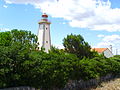
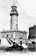
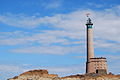
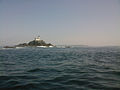
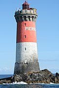
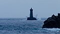
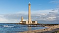
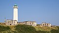
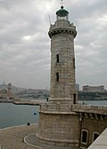
Name Image Water body Département Location & Year built Notes Phare du Cap Leucate Gulf of Lion Aude Cap Leucate 42°54′5″N 003°03′3″E / 42.90139°N 3.05083°E / 42.90139; 3.05083 1950 Planier Light Gulf of Lion Bouches-du-Rhône Île du Planier (Planier island) 43°11′54.83″N 5°13′51.29″E / 43.1985639°N 5.2309139°E / 43.1985639; 5.2309139 1959 The first tower was built in this location in 1320 by Robert d'Anjou. Giraglia Ligurian Sea Haute-Corse Giraglia Island, north off Cap Corse 1848 [ 1] Héaux de Bréhat Lighthouse Atlantic Ocean Côtes-d'Armor Île-de-Bréhat 48°54′30″N 3°5′15″W / 48.90833°N 3.08750°W / 48.90833; -3.08750 1840 Ploumanac'h Lighthouse Atlantic Ocean Côtes-d'Armor Perros-Guirec 48°50′15″N 3°29′0″W / 48.83750°N 3.48333°W / 48.83750; -3.48333 1946 An older lighthouse dating from 1860 was destroyed in 1944 and replaced by the current structure. Roches-Douvres Light Atlantic Ocean Côtes-d'Armor Roches-Douvre reef between Île-de-Bréhat and Guernsey 49°6′18″N 2°48′50″W / 49.10500°N 2.81389°W / 49.10500; -2.81389 1954 At a height of 213 feet (65 m) it is the eleventh-tallest "traditional lighthouse" in the world. [ 2] Sept-Îles Lighthouse Atlantic Ocean Côtes-d'Armor Perros-Guirec 48°52′43″N 3°29′24″W / 48.87861°N 3.49000°W / 48.87861; -3.49000 1854 The first lighthouse, a round tower, was illuminated in May 1835, and then replaced in 1854 by a square tower 16 ft (5 m) taller. Destroyed 4 August 1944, it was rebuilt in 1949 and relit in July 1952. Triagoz Lighthouse Atlantic Ocean Côtes-d'Armor Triagoz archipelago 48°52′17″N 3°38′47″W / 48.87139°N 3.64639°W / 48.87139; -3.64639 1864 Ar Men Atlantic Ocean Finistère West of Île de Sein 48°3′0″N 4°59′54″W / 48.05000°N 4.99833°W / 48.05000; -4.99833 1881 Phare d'Eckmühl Atlantic Ocean Finistère Penmarc'h 47°47′19.55″N 4°22′22.23″W / 47.7887639°N 4.3728417°W / 47.7887639; -4.3728417 1897 The current tower replaced an older lighthouse constructed in 1835. La Vieille Atlantic Ocean Finistère Raz de Sein 48°02′26″N 4°45′23″W / 48.04056°N 4.75639°W / 48.04056; -4.75639 1887 Phare du Créac'h Atlantic Ocean Finistère Ushant island 48°27′34.23″N 5°7′45.4″W / 48.4595083°N 5.129278°W / 48.4595083; -5.129278 1863 Saint-Mathieu Lighthouse Atlantic Ocean Finistère Pointe Saint-Mathieu 48°19′48″N 4°46′15″W / 48.33000°N 4.77083°W / 48.33000; -4.77083 1835 The lighthouse was classified as a monument historique [ 3] [ 4] Île Vierge Lighthouse Atlantic Ocean Finistère Île Vierge 48°38′19.9″N 4°34′03.0″W / 48.638861°N 4.567500°W / 48.638861; -4.567500 1902 The current tower replaced an older lighthouse from 1845. The island is open to the public from April to September, as is the lighthouse, by appointment. [ 5] La Jument Atlantic Ocean Finistère Off Ushant island 48°25′0″N 5°7′59″W / 48.41667°N 5.13306°W / 48.41667; -5.13306 1911 Jean Guichard 's 1989 dramatic storm photo shots of the Jument Lighthouse became an instant hit and earned him the 2nd place in the 1991 World Press Photo award. [ 6] Petit Minou Lighthouse Atlantic Ocean Finistère Roadstead of Brest 48°20′12″N 4°36′51″W / 48.33667°N 4.61417°W / 48.33667; -4.61417 1848 Together with the Phare du Portzic , Petit Minou Lighthouse forms a range of lights into the roadstead. [ 7] Phare du Portzic Atlantic Ocean Finistère Roadstead of Brest 48°21′30″N 4°32′03″W / 48.35833°N 4.53417°W / 48.35833; -4.53417 1848 Together with the Petit Minou Lighthouse , Portzic Lighthouse forms a range of lights into the roadstead. [ 7] Tourelle de la Plate Atlantic Ocean Finistère Raz de Sein 48°2′21″N 4°45′35″W / 48.03917°N 4.75972°W / 48.03917; -4.75972 1910 [ 7] Phare de Tévennec Atlantic Ocean Finistère Raz de Sein 1875 [ 7] Phare de Nividic Atlantic Ocean Finistère Ouessant 48°26′44″N 5°09′03″W / 48.44556°N 5.15083°W / 48.44556; -5.15083 1936 At a longitude of 5°09.1' W, this is France's westernmost lighthouse. [ 8] Phare de l'île aux Moutons [ de ; fr ] Atlantic Ocean Finistère On an islet 11 kilometres (6.8 mi) southeast of Bénodet 1879 [ 7] Phare de l'île Tristan [ fr ] Atlantic Ocean Finistère Tristan Island off Douarnenez 1865 [ 7] Phare du Millier [ de ; fr ] Atlantic Ocean Finistère On a headland in the southern part of the Baie de Douarnenez [ 7] 1881 Phare des Pierres Noires [ br ; de ; fr ; it ; lb ] Atlantic Ocean Finistère On an islet 9 kilometres (5.6 mi) west off Pointe Saint-Mathieu [ 8] 1872 Phare de Penfret [ br ; de ; fr ] Atlantic Ocean Finistère Penfret, Glénan islands [ 7] 1837 Phare de Roscoff [ de ; fr ] Atlantic Ocean Finistère Roscoff 1917 [ 8] Phare de l'île de Batz [ fr ] Atlantic Ocean Finistère Île de Batz 1836 The lighthouse replaced an earlier building from 1705. [ 8] Phare de Pontusval [ br ; fr ] Atlantic Ocean Finistère 2 kilometres (1.2 mi) northwest of Brignogan-Plages [ 8] 1869 Phare du Four Atlantic Ocean Finistère At the northern entrance to the Chenal du Four [ 8] 1874 Phare de Kéréon Atlantic Ocean Finistère Situated on a rock called Men Tensel NW of Ile de Bannec 1916 The most beautiful[ citation needed ] Phare de l'Espiguette Gulf of Lion Gard Pointe de l'Espiguette 43°29′16″N 4°8′31″E / 43.48778°N 4.14194°E / 43.48778; 4.14194 1869 Cordouan Lighthouse Bay of Biscay Gironde Gironde estuary 45°35′10.84″N 1°10′24.48″W / 45.5863444°N 1.1734667°W / 45.5863444; -1.1734667 1611 The original tower was raised to 68 metres (223 ft) in the late 18th century. Phare de Gatteville English Channel Manche Barfleur 49°41′47.12″N 1°15′57.29″W / 49.6964222°N 1.2659139°W / 49.6964222; -1.2659139 1774 At a height of 75 metres (246 ft) it is the third tallest "traditional lighthouse" in the world. [ 2] Goulphar Lighthouse Bay of Biscay Morbihan Belle-Île-en-Mer 47°18′40″N 3°13′39″W / 47.31111°N 3.22750°W / 47.31111; -3.22750 1836 [ 9] Phare de La Teignouse [ de ; fr ] Bay of Biscay Morbihan Quiberon 47°27′27″N 3°2′45″W / 47.45750°N 3.04583°W / 47.45750; -3.04583 1845 Cap d'Antifer Lighthouse English Channel Seine-Maritime La Poterie-Cap-d'Antifer 49°41′01″N 0°09′55″E / 49.6835°N 0.1654°E / 49.6835; 0.1654 1955 Dunkirk Lighthouse English Channel Nord Near Dunkirk 51°02′56″N 02°21′51″E / 51.04889°N 2.36417°E / 51.04889; 2.36417 1843 Phare de Sainte Marie Gulf of Lion Provence-Alpes-Côte d'Azur Marseille harbour 1855 The lighthouse is now inactive. Île d'Yeu Lighthouse Bay of Biscay Vendée Île d'Yeu 46°43′03″N 2°22′56″W / 46.71750°N 2.38222°W / 46.71750; -2.38222 1950 The structure, designed by Maurice Durand , is the third serving the site; the original tower, constructed in 1830, was destroyed by German troops near the close of World War II . [ 10] L'Armendèche Lighthouse Bay of Biscay Vendée Les Sables-d'Olonne 46°29′23″N 01°48′17″W / 46.48972°N 1.80472°W / 46.48972; -1.80472 1968 The lighthouse was designed by Maurice Durand . Pointe des Corbeaux Lighthouse Bay of Biscay Vendée Île d'Yeu 46°41′24″N 2°17′06″W / 46.69000°N 2.28500°W / 46.69000; -2.28500 1950 The lighthouse was designed by Maurice Durand . Pointe du Grouin du Cou Lighthouse Bay of Biscay Vendée Pointe du Grouin du Cou 46°20′40″N 1°27′49″W / 46.34444°N 1.46361°W / 46.34444; -1.46361 1953 The lighthouse was designed by Maurice Durand .