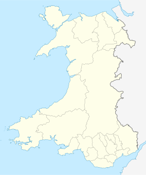
Major lighthouses of Wales, Smalls Lighthouse not shown.
This is a list of lighthouses in Wales . The list runs anticlockwise from north-east to south-east Wales. [1] [2] [3]
This is a list of lighthouses in Wales . The list runs anticlockwise from north-east to south-east Wales. [1] [2] [3]
| Name | Image | Location | Year built | Decommissioned | Tower height (in metres) |
|---|---|---|---|---|---|
| Point of Ayr Lighthouse |  | Llanasa | 1844 | 18 | |
| Great Orme Lighthouse |  | Gwynedd, Llandudno | 1985 | 11 | |
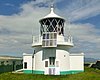
| Amlwch Lighthouse | 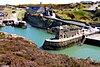 | Amlwch Community | 1817 | 1972 | 11 |
| Holyhead Mail Pier Lighthouse |  | Holyhead, Holyhead | 15 | ||
| Twr Mawr Llanddwyn Lighthouse |  | Rhosyr | 1975 | 10 | |
| St. Ann's Head Lighthouse |  | Pembrokeshire | 1844 | 1910 | 13 |
| Whiteford Lighthouse |  | Llangennith, Llanmadoc and Cheriton | 1865 | 1926 | 14 |
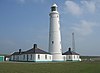
| Old Nash Point Lighthouse |  | St Donats | 1900s | 20 | |
| West Usk Lighthouse |  | Wentlooge | 1922 | 17 |

The history of the many lightvessel stations of Great Britain goes back over 250 years to the placement of the world's first lightship at the Nore in the early 18th century.
Watwick Point Beacon is a leading light, which is a type of lighthouse, located near Dale, Pembrokeshire, in Wales. It is designed to lead ships into Milford Haven in conjunction with the West Blockhouse Point Beacons. It is situated about half a mile to the north-east of West Blockhouse Point.

Büsum Lighthouse is an active 20th century lighthouse located in Büsum a fishing and tourist town, which lies on North Sea coast of Schleswig-Holstein, in Germany. The current lighthouse is the second to be built in the town, two other separate breakwater lights mark the entrance of the small harbour from the North Sea.
| Active |
|
|---|---|
| Inactive | |
Lighthouses and lightvessels in Europe | |
|---|---|
| Sovereign states |
|
Dependencies and other territories | |
| Styles | |
|---|---|
| Buildings and structures | |
| Other | |