Related Research Articles
Larkhall Thistle Football Club is a football club from Larkhall, in South Lanarkshire, Scotland. Formed in 1878, "the Jags" are Scotland's oldest continuous Junior football club and currently compete in the West of Scotland League Second Division. The team plays in red and white stripes and its home ground since 1881 has been Gasworks Park.

Cumbernauld and Kilsyth was one of nineteen local government districts in the Strathclyde region of Scotland between 1975 and 1996.

Clydesdale was a local government district in the Strathclyde region of Scotland from 1975 to 1996. The district was initially called Lanark when created in 1975, but changed its name to Clydesdale in 1980. Clydesdale was an old name for the county of Lanarkshire, one of the historic counties of Scotland. Both the names Clydesdale and Strathclyde reference the area's position in the valley of the River Clyde.

Birkenshaw is a village in North Lanarkshire, Scotland, to the east of Glasgow, and in proximity to Uddingston, Tannochside and Viewpark. Historically it is part of Lanarkshire. Largely a residential area, it is more widely known for the Birkenshaw Trading Estate which contains a range of DIY, electrical and furniture stores. It is sometimes considered as part of Viewpark and is contained within the Greater Glasgow conurbation.

Cumbernauld, Kilsyth and Kirkintilloch East is a constituency of the House of Commons of the Parliament of the United Kingdom. It was created for the 2005 general election, replacing Cumbernauld and Kilsyth and part of Strathkelvin and Bearsden.

Coatbridge, Chryston and Bellshill is a constituency of the House of Commons of the Parliament of the United Kingdom. It elects one Member of Parliament (MP) using the first-past-the-post voting system.

The Central Belt of Scotland is the area of highest population density within Scotland. Depending on the definition used, it has a population of between 2.4 and 4.2 million, including multiple Scottish cities; Greater Glasgow, Ayrshire, Falkirk, Edinburgh, Lothian and Fife.
Lanarkshire was a Scottish county constituency of the House of Commons of the Parliament of the United Kingdom (Westminster) from 1708 to 1868. It elected one Member of Parliament (MP) by the first past the post voting system.
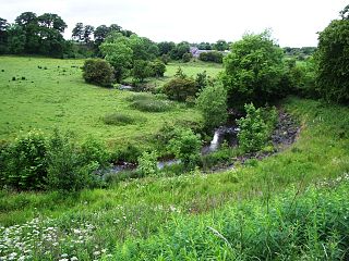
The North Calder Water is a river in North Lanarkshire, Scotland. It flows for 12 miles (19 km) from the Black Loch via the Hillend Reservoir, Caldercruix, Plains, Airdrie, Calderbank, Carnbroe and Viewpark to the River Clyde at Daldowie, south-east of Glasgow. For the last two miles of its course, it forms part of the boundary between North Lanarkshire and Glasgow. The name Calder is thought to be Brythonic and to mean 'hard cold flowing' water.

The lands of Daldowie in Glasgow, Scotland lie astride the River Clyde on the south and the North Calder Water to the east, and stretch to the present area of Broomhouse in the north.

Upperton is a village in North Lanarkshire, Scotland, near Airdrie and Cumbernauld, about 20 miles (32 km) north-east of Glasgow. It lies close to the B803 between Greengairs and Slamannan. Other nearby roads include Hulks Road towards the A73, Fannyside Road to Abronhill and the road to Caldercruix via Longriggend. The Avon Water flows through the village and meets the Shielhill Burn, a tributary of the River Avon, just outside the village. William Forrest's 1816 map of Lanarkshire shows the site as Upper Town. The Ordnance Survey map sites "Uppertown" on Shiel Hill.

Tannochside is a settlement approximately 8 miles (13 km) south-east of Glasgow, Scotland. Although historically considered part of Uddingston, it lies within a separate local authority area: Tannochside is contained within the boundaries of North Lanarkshire council, whereas the original village of Uddingston is in South Lanarkshire.

Hamilton was a local government district in the Strathclyde region of Scotland from 1975 to 1996, lying to the south-east of the regional capital Glasgow.

Summerlee Museum of Scottish Industrial Life is an industrial and social history museum in Coatbridge, North Lanarkshire, Scotland. It is situated on the site of the Victorian Summerlee Iron Works and the former Hydrocon Crane factory. The main Hydrocon factory building became the museum’s exhibition hall but it has been substantially changed and adapted since. The museum aims to show Lanarkshire's contribution to engineering, mining, steel working, weaving and farming, and also show the lives of the people of the area. It includes interactive displays and a temporary exhibition space. Entry is free of charge.
Forrestfield is a small settlement in North Lanarkshire, Scotland. It is located on the A89 road, 3 kilometres (1.9 mi) east of Caldercruix and 4 kilometres (2.5 mi) west of Blackridge. Until 1956 the settlement had a railway station on the former Bathgate and Coatbridge Railway. This line reopened in 2010 as the Airdrie–Bathgate rail link, although Forrestfield station was not reopened. Cairneyhill Quarry, a whinstone quarry operated by Tarmac, lies 0.5 kilometres (0.31 mi) to the south of Forrestfield.

The North Lanarkshire Heritage Centre is a four star heritage centre located near the town centre of Motherwell, North Lanarkshire, Scotland. The centre is seen as the main repository for archives and modern records for the whole of North Lanarkshire.
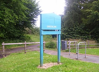
The Greenlink Cycle Path is a cycle path in North Lanarkshire that is a direct route running from Strathclyde Country Park to Motherwell Town Centre. The path is 7 kilometres in length. The Greenlink project was established in 2005, and was part of a 3-year partnership between many organisations, such as North Lanarkshire Council, Scottish Natural Heritage and Forestry Commission Scotland.
Haryshaw is a small village in North Lanarkshire, Scotland.
Carnbroe railway station served the ironworks in the neighbourhood of Carnbroe, North Lanarkshire, Scotland, from 1843 to 1846 on the Wishaw and Coltness Railway.
References
- ↑ "Carnbroe: North Lanarkshire". Gazetteer for Scotland. Retrieved 22 November 2023.
55°50′49″N4°00′07″W / 55.847°N 4.002°W

| | This North Lanarkshire location article is a stub. You can help Wikipedia by expanding it. |