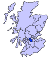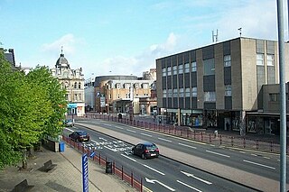
Hamilton is a large town in South Lanarkshire, Scotland. It serves as the main administrative centre of the South Lanarkshire council area. It sits 10 miles (16 km) south-east of Glasgow, 37 miles (60 km) south-west of Edinburgh and 74 miles (120 km) north of Carlisle. It is situated on the south bank of the River Clyde at its confluence with the Avon Water. Hamilton is the county town of the historic county of Lanarkshire and is the location of the headquarters of the modern local authority of South Lanarkshire.

Lanarkshire, also called the County of Lanark, is a historic county, lieutenancy area and registration county in the Central Lowlands and Southern Uplands of Scotland. The county is no longer used for local government purposes, but gives its name to the two modern council areas of North Lanarkshire and South Lanarkshire.

East Kilbride is the largest town in South Lanarkshire in Scotland, and the country's sixth-largest locality by population. It was also designated Scotland's first new town on 6 May 1947. The area lies on a raised plateau to the south of the Cathkin Braes, about eight miles southeast of Glasgow and close to the boundary with East Renfrewshire.
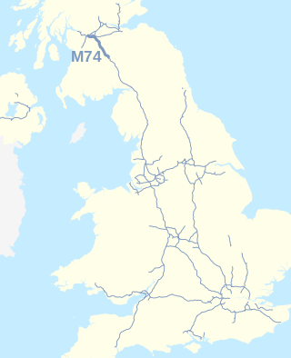
The A74(M) and M74 form a major motorway in Scotland, connecting it to England. The routes connect the M8 motorway in central Glasgow to the Scottish-English border at Gretna. They are part of the unsigned international E-road network E05. Although the entire route is colloquially referred to as the M74, for more than half its length, south of Abington, the road is officially the A74(M); see naming confusion below.

Motherwell is a town and former burgh in North Lanarkshire, Scotland, United Kingdom, south east of Glasgow. It has a population of around 32,120. Historically in the parish of Dalziel and part of Lanarkshire, Motherwell is the headquarters for North Lanarkshire Council. Geographically the River Clyde separates Motherwell from Hamilton to the west whereas the South Calder Water separates Motherwell from Carfin to the north-east and New Stevenston and Bellshill towards the north.

The A74, also known historically as the Glasgow to Carlisle Road, is a formerly major road in the United Kingdom, linking Glasgow in Scotland to Carlisle in North West England, passing through Clydesdale, Annandale and the Southern Uplands. It formed part of the longer route between Glasgow and London. A road has existed in this area since Roman Britain, and it was considered one of the most important roads in Scotland, being used as a regular mail service route.

Uddingston is a small town in South Lanarkshire, Scotland. It is on the north side of the River Clyde, south-east of Glasgow city centre, and acts as a dormitory suburb for the city.

Birkenshaw is a village in North Lanarkshire, Scotland, to the east of Glasgow, and in proximity to Uddingston, Tannochside and Viewpark. Historically it is part of Lanarkshire. Largely a residential area, it is more widely known for the Birkenshaw Trading Estate which contains a range of DIY, electrical and furniture stores. It is sometimes considered as part of Viewpark and is contained within the Greater Glasgow conurbation.

Uddingston railway station serves the small town of Uddingston, South Lanarkshire, Scotland. ScotRail provides passenger services to this station on the Argyle Line and Shotts Line.
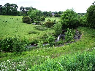
The North Calder Water is a river in North Lanarkshire, Scotland. It flows for 12 miles (19 km) from the Black Loch via the Hillend Reservoir, Caldercruix, Plains, Airdrie, Calderbank, Carnbroe and Viewpark to the River Clyde at Daldowie, south-east of Glasgow. For the last two miles of its course, it forms part of the boundary between North Lanarkshire and Glasgow. The name Calder is thought to be Brythonic and to mean 'hard cold flowing' water.

The A725 road in Scotland is a major route which is a trunk road dual carriageway for almost its whole length, connecting several of the large towns of North Lanarkshire and South Lanarkshire, linking the M8 and M74 motorways; it has been upgraded frequently since its construction, with the most recent major work completed in 2017. In combination with the A726 road which meets the M77 motorway, it forms a southern and eastern bypass for the city of Glasgow.

The A726 road in Scotland is a major route with several distinct sections with different characteristics and names; owing to its stages of construction, since 2005 it has two separate parts, the first running between Strathaven in South Lanarkshire and Junction 5 of the M77 motorway south of Newton Mearns in East Renfrewshire via East Kilbride, and the other running between Junction 3 of the M77 and the M898 motorway near the Erskine Bridge, via Paisley and Junction 29 of the M8 motorway near Glasgow International Airport.

The A730 road in Scotland runs between the centre of Glasgow and the south-eastern edge of the city's urban area at Cathkin.

Cardinal Newman High School is a Roman Catholic, co-educational, comprehensive secondary school located in Bellshill, North Lanarkshire, Scotland. The school was formed by the amalgamation of Elmwood Secondary, St. Saviour's High School and St. Catherine's. The school's catchment area includes Bellshill, Mossend, Viewpark, Birkenshaw and Tannochside. The feeder primary schools are St Gerard's, Sacred Heart, Holy Family and John Paul II.

Uddingston Grammar School is a mainstream state school in Uddingston, South Lanarkshire, Scotland. It is one of 17 secondary schools operated by South Lanarkshire Council. Its motto is 'Virtute Crescam' which means 'May I grow in moral excellence'.

The A749 road in Scotland connects East Kilbride with Glasgow city centre via Rutherglen and Bridgeton.

Viewpark is an area in North Lanarkshire, Scotland. Situated immediately north-east of Uddingston, Viewpark is two kilometres west of Bellshill. It has an estimated population of 13,916 in 2016, a figure which also includes the smaller adjoining neighbourhoods of Birkenshaw, Bellziehill, Calderbraes, Fallside and Tannochside under the Thorniewood ward of the local council.

Broomhouse is a residential area in Glasgow, Scotland. It is about six miles east of the city centre. Historically a small mining village and later the site of the Glasgow Zoo, in the early 21st century it grew substantially as an affluent commuter suburb.

The A724 road in Scotland runs within South Lanarkshire between Rutherglen and Hamilton. It follows an ancient route which is marked on William Roy's Lowland Map of Scotland (1755) with only minor deviations from its modern course.

