Hartwood

Last updated

Cottages in Hartwood Cottages, Hartwood - geograph.org.uk - 1538353.jpg
Cottages in Hartwood

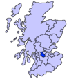
Hartwood (Scots : Hertwid, [1] Scottish Gaelic : Coille an Daimh) [2] is a village in North Lanarkshire, Scotland. Nearby settlements include Shotts, Allanton and Bonkle. The area is rural, with fewer than 50 houses. Transport is provided at Hartwood railway station, operated by Network Rail, with an hourly service Monday - Saturday every hour between Glasgow Central and Edinburgh Waverley on the Shotts Line.

Contents

Hartwood Hospital

The derelict clock towers of Hartwood Hospital Hartwood Asylum Towers - geograph.org.uk - 372199.jpg
The derelict clock towers of Hartwood Hospital

The remains of Hartwood Hospital, a 19th-century psychiatric hospital with imposing twin clock towers, are the main feature of the village, even after its closure under the direction of the Lanarkshire Health Board in 1998. On the morning of 28 June 2004, a fire broke out in the disused Hartwood buildings. This involved the destruction of the admin offices, dining hall and clock towers. After it closed in 1998, it was used as a studio by Lanarkshire Television, but Lanarkshire Television was closed down in 2002. After LTV left, the hospital fell victim to vandalism and fire. Security men regularly patrol the site to fend off vandals.

Like many other Victorian institutions in the area such as Gartloch Hospital, Stonyetts, Lennox Castle and Kirklands, the inception of the Community Care Act 1990 gave rise to a more community-based focus for long-term mental health care, and the consequent closure of long-term psychiatric hospitals. An annex of the main hospital, Hartwoodhill Hospital, still exists one mile to the north east of the village, along the unclassified road which forms the main thoroughfare.

The original hospital was overseen by Dr Archibald Campbell Clark, the medical superintendent, and was involved with the inception of modern psychiatric therapies such as occupational therapy, ECT and industrial involvement. In the hospital style of the time, Hartwood was entirely self-sustaining, with its own farm, gardens, reservoir, graveyard, staff houses, etc.

Hartwood also contributed to the growth of nurse education, and had its own College of Nursing, which was annexed to Bell College (which merged with the University of Paisley to form the University of the West of Scotland in August 2007). It was the last part of the original Hartwood site to close in 2000 when educational services were transferred to Bell College's purpose-built facility (the Caird Building) on its Hamilton site.

Related Research Articles

Airdrie, North Lanarkshire Town in North Lanarkshire, Scotland

Airdrie is a town in North Lanarkshire, Scotland. It lies on a plateau roughly 400 ft above sea level, and is approximately 12 miles (19 km) east of Glasgow city centre. As of 2012, the town had a population of around 37,130. Historically part of Lanarkshire, Airdrie forms part of a conurbation with its neighbour Coatbridge, in what is commonly known as the Monklands, formerly a district..

North Lanarkshire Council area of Scotland

North Lanarkshire is one of 32 council areas of Scotland. It borders the northeast of the City of Glasgow and contains many of Glasgow's suburbs and commuter towns and villages. It also borders East Dunbartonshire, Falkirk, Stirling, South Lanarkshire and West Lothian. The council covers parts of the traditional counties of Dunbartonshire, Lanarkshire and Stirlingshire.

Lanarkshire Historic county in Scotland

Lanarkshire, also called the County of Lanark, is an historic county, lieutenancy area and registration county in the central Lowlands of Scotland.

Motherwell Town and administrative centre in Scotland

Motherwell is a large town and former burgh in North Lanarkshire, Scotland, United Kingdom, south east of Glasgow. It has a population of around 32,120. Historically in the parish of Dalziel and part of Lanarkshire, Motherwell is the headquarters for North Lanarkshire Council. Geographically the River Clyde separates Motherwell from Hamilton to the west whereas the South Calder Water separates Motherwell from Carfin to the north-east and New Stevenston and Bellshill towards the north.

Wishaw Town North Lanarkshire, Scotland

Wishaw is a large town in North Lanarkshire, Scotland, on the edge of the Clyde Valley, 15 miles (24 km) south-east of Glasgow city centre. The Burgh of Wishaw was formed in 1855 within Lanarkshire. it formed a joint large burgh with its neighbour Motherwell from 1920 until its dissolution when Scottish local authorities were restructured in 1975, and was then in Motherwell district within the Strathclyde region until 1996. The town is part of the Motherwell and Wishaw constituency. It has the postal code of ML2 and the dialling code 01698.

Cleland, North Lanarkshire Village in Scotland

Cleland is a village near Motherwell and Wishaw in North Lanarkshire, Scotland. As of 2018, it has a population of about 3,000. The village has a strong coal mining heritage, and is a typical example of a working class village in North Lanarkshire and the Glasgow area. Due to its location, despite being at the heart of North Lanarkshire, the village is isolated, geographically and culturally, from surrounding towns such as Motherwell, Shotts and Wishaw.

Shotts Human settlement in Scotland

Shotts is a town in North Lanarkshire, Scotland. It is located almost halfway between Glasgow and Edinburgh. The town has a population of about 8,840. A local story has Shotts being named after the legendary giant highwayman Bertram de Shotts, though toponymists give the Anglo-Saxon scēots as the real source of the name. Shotts is the home of the 2015 world champion pipe band, Shotts and Dykehead Caledonia Pipe Band.

University Hospital Monklands Hospital in North Lanarkshire, Scotland

University Hospital Monklands is a district general hospital in Airdrie, North Lanarkshire, Scotland. It serves a population of approximately 260,000 people of North and South Lanarkshire council areas and is managed by NHS Lanarkshire.

Hartwood railway station

Hartwood railway station is a railway station serving Hartwood in North Lanarkshire, Scotland. It is on the Shotts Line, 19 miles (31 km) east of Glasgow Central towards Edinburgh Waverley. The station has two platforms, connected by a stairway footbridge. It is managed by Abellio ScotRail.

Kirk o Shotts transmitting station

The Kirk o' Shotts transmitting station is a broadcasting and telecommunications site at The Hirst which lies just outside the village of Salsburgh which is near the town of Shotts in North Lanarkshire central Scotland.

Bargeddie railway station

Bargeddie railway station is located in the village of Bargeddie, North Lanarkshire, Scotland, situated between the city of Glasgow and the town of Coatbridge. It opened in 1993 under British Rail and SPTE, and is on the site of an earlier station called 'Drumpark'. It is on the Whifflet Line, 9¼ miles (15 km) east of Glasgow Central railway station. Train services are provided by Abellio ScotRail.

South Calder Water

The South Calder Water, known locally as "The Cawder", or simply "Calder", is a river in Scotland. It runs west from the high plateau between Shotts and Fauldhouse to its joining with the much larger River Clyde.

Douglas, South Lanarkshire Human settlement in Scotland

Douglas is a village in South Lanarkshire, Scotland. It is located on the south bank of the Douglas Water and on the A70 road that links Ayr, on the West coast of Scotland, to Edinburgh on the East, around 12 miles south west of Lanark. The placename is of Gaelic origin, derived from the Old Gaelic dub and glais, meaning "dark stream", in reference to the Douglas Water. The Douglas family took this name when their ancestors settled here in the 12th century.

Carstairs Human settlement in Scotland

Carstairs is a village in South Lanarkshire, Scotland. Carstairs is located 5 miles east of the county town of Lanark and the West Coast Main Line runs through the village. The village is served by Carstairs railway station, which is served by the Caledonian Sleeper to and from London Euston. Carstairs is best known as the location of the State Hospital. Carstairs is applied to the places Carstairs Village and the village of Carstairs Junction where the railway station is situated. The two places are two completely different villages divided by 1 mile of land, a parkland area and the railway line.

Salsburgh Human settlement in Scotland

Salsburgh is a semi rural former coal mining village in greenbelt farmland within the district of North Lanarkshire, Scotland. The closest major town to the village is Shotts 3 miles (5 km) to the south east and Airdrie 6 miles (10 km) to the north west.

Motherwell (district) Former local government district in Strathclyde, Scotland

Motherwell was a local government district in the Strathclyde region of Scotland from 1975 to 1996, lying to the south-east of the regional capital Glasgow.

Glenboig

Glenboig is a village in North Lanarkshire, Scotland lying north of Coatbridge and to the south east of Kirkintilloch and is approximately 10 miles from Glasgow City Centre. According to a 2016 estimate, the population of Glenboig was 2,820

Shotts Line

The Shotts Line is a suburban railway line linking Glasgow Central and Edinburgh Waverley via Shotts in Scotland. It is one of the five rail links between the two cities.

Hartwood Hospital Hospital in Scotland

Hartwood Hospital was a psychiatric hospital located in the village of Hartwood near the town of Shotts in Scotland.

Campbell Clark

Dr Archibald Campbell Clark FFPSG (1852–1901) was a nineteenth-century Scottish physician who made major advances in mental health care philosophies.

References

A full history of Hartwood Hospital can be found at these websites:

And some photographs taken after the hospital's closure can be found here:

And video footage of the old Nurses Home and hospital:

Coordinates: 55°48′41″N3°50′19″W / 55.8113°N 3.8387°W / 55.8113; -3.8387