Cartago (canton)

Last updated
Cartago
Old-ruins-in-cartago-daniel-vargas19.jpg
Ruins of Santiago Apóstol Church, a still standing monument in Cartago.
Bandera de Cartago (Costa Rica).svg
Escudo de Cartago (Costa Rica).svg
Cartago (canton)
Cartago canton
Costa Rica location map.svg
Red pog.svg
Cartago
Cartago canton location in Costa Rica
Coordinates: 9°47′20″N83°55′34″W / 9.7889852°N 83.9261136°W / 9.7889852; -83.9261136
Country Flag of Costa Rica.svg  Costa Rica
Province Cartago
Creation7 December 1848
Head city Oriental
Districts
Government
  Type Municipality
  BodyMunicipalidad de Cartago
   Mayor Mario Redondo Poveda (PAY)
Area
  Total278.66 km2 (107.59 sq mi)
Elevation
1,575 m (5,167 ft)
Population
 (2011)
  Total147,898
  Estimate 
(2022)
165,417
  Density530/km2 (1,400/sq mi)
Time zone UTC−06:00
Canton code301
Website www.muni-carta.go.cr

Cartago is a canton in the Cartago province of Costa Rica. [1] [2] The head city is Cartago.

Contents

History

Cartago was created on 7 December 1848 by decree 167. [3]

Geography

Cartago has an area of 278.66 km2 (107.59 sq mi) [4] and a mean elevation of 1,575 m (5,167 ft). [1]

Cartago is a T-shaped canton stretching southeast from its capital city to encompass a thin swatch of the Cordillera de Talamanca (Talamanca Mountain Range), and including portions of the Pan-American Highway.

Government

Mayor

According to Costa Rica's Municipal Code, mayors are elected every four years by the population of the canton. [5] As of the latest municipal elections in 2024, the Let's Act Now Party (Partido Actuemos Ya) candidate, Mario Redondo Poveda, was elected mayor of the canton with 43.51% of the votes, with Silvia María Navarro Gómez and Marco Andrés Brenes Tinoco as first and second vice mayors, respectively. [6]

Mayors of Cartago since the 2002 elections [7]
PeriodNameParty
2002–2006 Harold Humberto Góngora Fuentes [lower-alpha 1] Bandera del Partido Unidad Social Cristiana.svg PUSC
2006–2010 Rolando Alberto Rodríguez Brenes Bandera de Partido Liberacion Nacional.svg PLN
2010–2016
2016–2020
2020–2024 Mario Redondo Poveda Bandera Partido Alianza Democrata Cristiana Costa Rica.svg ADC
2024–2028 Bandera Partido Actuemos Ya Costa Rica.svg PAY

Municipal Council

Like the mayor and vice mayors, members of the Municipal Council (called regidores) are elected every four years. Cartago's Municipal Council has 9 seats for regidores and their substitutes, who can participate in meetings but not vote unless the owning regidor (regidor propietario) is absent. [5] The current president of the Municipal Council is the Let's Act Now Party member, Alonso Picado Chacón. [8] The Municipal Council's composition for the 2024–2028 period is as follows:

Current composition of the Municipal Council of Cartago after the 2024 municipal elections [9]
Costa Rica Cartago Concejo Municipal 2024.svg
Political parties in the Municipal Council of Cartago
Political partyRegidores
OwnerSubstitute
Bandera Partido Actuemos Ya Costa Rica.svg Let's Act Now Party (PAY)4Alonso Picado Chacón(P)Roberto Carlos Solano Ortega
Franci Noheli Camacho VargasMónica Machado Barquero
Andrés Damián Zúñiga OrozcoJorge Armando Brenes Calderón
Grettel Quesada MoyaNatalia Isabel Serrano Redondo
Bandera de Partido Liberacion Nacional.svg National Liberation Party (PLN)3Jonathan Arce MoyaBraulio José Martínez Rojas
Marcela Quesada CerdasStephannie Melissa Meneses Quirós
Caleb Andrés Pichardo AguilarLuis Martín Martínez Rojas
Bandera Partido Agenda Democratica Nacional Costa Rica (2020-Presente).svg National Democratic Agenda (ADN)1Marvin Alvarado MéndezManuel Enrique González Espinoza
Bandera Partido Liberal Progresista Costa Rica.svg Progressive Liberal Party (PLP)1Alberto Acevedo GutiérrezArmando José Canno Díaz

Districts

The canton of Cartago is subdivided into the following districts:

  1. Oriental
  2. Occidental
  3. Carmen
  4. San Nicolás
  5. Aguacaliente
  6. Guadalupe
  7. Corralillo
  8. Tierra Blanca
  9. Dulce Nombre
  10. Llano Grande
  11. Quebradilla

Demographics

Historical population
Census Pop.±% p.a.
186416,780    
188320,398+1.03%
189225,898+2.69%
192726,909+0.11%
195030,763+0.58%
196346,722+3.27%
197365,310+3.41%
198487,125+2.65%
2000132,057+2.63%
2011147,898+1.04%
2022166,204+1.07%
Source: Instituto Nacional de Estadística y Censos [10]
Centro Centroamericano de Población [11]

Cartago had a population of 165,417 inhabitants in 2022, up from 147,898 people at the time of the 2011 census. [12] [13]

In 2022, Cartago had a Human Development Index of 0.791, the 3rd highest in its province, behind El Guarco and La Unión, and 18th in the country. [14]

Transportation

Road transportation

The canton is covered by the following road routes:

Rail transportation

The Interurbano Line operated by Incofer goes through this canton.

Notes

  1. Also legally named Carlos Humberto Góngora Fuentes.

Related Research Articles

<span class="mw-page-title-main">San José, Costa Rica</span> Capital and largest city of Costa Rica

San José is the capital and largest city of Costa Rica, and the capital of the province of the same name. It is in the center of the country, in the mid-west of the Central Valley, within San José Canton. San José is Costa Rica's seat of national government, focal point of political and economic activity, and major transportation hub. San José is simultaneously one of Costa Rica's cantons, with its municipal land area covering 44.62 square kilometers and having within it an estimated population of 352,381 people in 2022. Together with several other cantons of the central valley, including Alajuela, Heredia and Cartago, it forms the country's Greater Metropolitan Area, with an estimated population of over 2 million in 2017. The city is named in honor of Joseph of Nazareth.

<span class="mw-page-title-main">Escazú (canton)</span> Canton in San José province, Costa Rica

Escazú is the second canton in the province of San José in Costa Rica.

Desamparados is the 3rd canton in the province of San José in Costa Rica. The canton covers an area of 118.89 km2 (45.90 sq mi), and had a population of 223,226 in 2022, making it the third most populated among the 81 cantons of Costa Rica. The canton's capital city is also called Desamparados.

<span class="mw-page-title-main">San Carlos (canton)</span> Canton in Alajuela province, Costa Rica

San Carlos is a canton in the Alajuela province of Costa Rica. The capital city of the canton is Ciudad Quesada.

Pococí is a canton in the Limón province of Costa Rica. The head city is in Guápiles district, which houses many of the canton's services and businesses.

<span class="mw-page-title-main">Cantons of Costa Rica</span> Political subdivision of Costa Rica

Costa Rica is administratively divided into seven provinces which are subdivided into 84 cantons, and these are further subdivided into districts. Cantons are the only administrative division in Costa Rica that possess local government in the form of municipalities. Each municipality has its own mayor and several representatives, all of them chosen via municipal elections every four years.

<span class="mw-page-title-main">Alajuela (canton)</span> Canton in Alajuela province, Costa Rica

Alajuela is a canton in the Alajuela province of Costa Rica. Its head city is the provincial capital city of Alajuela.

El Guarco is a canton in the Cartago province of Costa Rica. The head city is in Tejar district.

<span class="mw-page-title-main">Heredia (canton)</span> Canton in Heredia province, Costa Rica

Heredia is a canton in the Heredia province of Costa Rica. The head city is in Heredia district, and is also the provincial capital of Heredia Province.

Pérez Zeledón is the nineteenth canton of the province of San José in Costa Rica, located in the Brunca region. The capital city of the canton is San Isidro de El General.

<span class="mw-page-title-main">Santa Ana (canton)</span> Canton in San José province, Costa Rica

Santa Ana is the ninth canton in the San José province of Costa Rica. It is located in the Central Valley. It borders with the Alajuela canton to the north, the Mora canton to the south and west, the Escazú canton to the east, as well as the Belén canton to the north east. As of 2022, the canton has the highest Human Development Index of any region in Costa Rica with a score of 0.871.

Goicoechea is a canton in the San José province of Costa Rica.
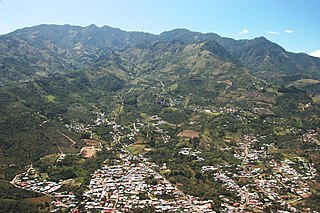
<span class="mw-page-title-main">Aserrí (canton)</span> Canton in San José province, Costa Rica

Aserrí is the sixth canton in the San José province of Costa Rica. The head city of the canton is the homonymous Aserrí.

El Tejar is a district and the head city of the El Guarco canton, in the Cartago province of Costa Rica.

Quitirrisí is a district of the Mora canton, in the San José province of Costa Rica.

Oriental is a district of the Cartago canton, in the Cartago province of Costa Rica.

Occidental is a district of the Cartago canton, in the Cartago province of Costa Rica.

Aguacaliente, also known as San Francisco, is a district of the Cartago canton, in the Cartago province of Costa Rica.

Guadalupe, also known as Arenilla, is a district of the Cartago canton, in the Cartago province of Costa Rica.

Corralillo is a district of the Cartago canton, in the Cartago province of Costa Rica.

References

  1. 1 2 "Declara oficial para efectos administrativos, la aprobación de la División Territorial Administrativa de la República N°41548-MGP". Sistema Costarricense de Información Jurídica (in Spanish). 19 March 2019. Retrieved 26 September 2020.
  2. División Territorial Administrativa de la República de Costa Rica (PDF) (in Spanish). Editorial Digital de la Imprenta Nacional. 8 March 2017. ISBN   978-9977-58-477-5.
  3. Hernández, Hermógenes (1985). Costa Rica: evolución territorial y principales censos de población 1502 - 1984 (in Spanish) (1 ed.). San José: Editorial Universidad Estatal a Distancia. pp. 164–173. ISBN   9977-64-243-5 . Retrieved 5 October 2020.
  4. Instituto Geográfico Nacional de Costa Rica (20 June 2024). "División Territorial Administrativa, 2024 – Totales de Provincias, Cantones y Distritos de Costa Rica" [Administrative Territorial Division, 2024 – Totals of Provinces, Cantons and Districts of Costa Rica](PDF) (in Spanish).
  5. 1 2 Asamblea Legislativa de la República de Costa Rica (13 May 2024). "Código Municipal" [Municipal Code]. Sistema Costarricense de Información Jurídica (in Spanish).
  6. Tribunal Supremo de Elecciones (8 March 2024). "N.° 2157-E11-2024 - Declaratoria de elección de alcaldías y vicealcaldías de las municipalidades de los cantones de la provincia de Cartago, para el período comprendido entre el primero de mayo de dos mil veinticuatro y el treinta de abril de dos mil veintiocho" (in Spanish). Retrieved 31 July 2024.
  7. Tribunal Supremo de Elecciones. "Resoluciones declaratorias de elección". Tribunal Supremo de Elecciones (in Spanish). Retrieved 21 July 2024.
  8. "Orden del Día - Martes 23 de Julio de 24 - Sesión Ordinaria 019-2024" (PDF). Municipalidad de Cartago (in Spanish). 23 July 2024. Retrieved 31 July 2024.
  9. Tribunal Supremo de Elecciones (12 March 2024). "N.° 2220-E11-2024 - Declaratoria de elección de regidurías de las municipalidades de los cantones de la provincia de Cartago, para el período comprendido entre el primero de mayo de dos mil veinticuatro y el treinta de abril de dos mil veintiocho" (in Spanish). Retrieved 31 July 2024.
  10. "Instituto Nacional de Estadística y Censos" (in Spanish).
  11. Centro Centroamericano de Población de la Universidad de Costa Rica. "Sistema de Consulta a Bases de Datos Estadísticas" (in Spanish).
  12. Instituto Nacional de Estadística y Censos (July 2023). Estimación de Población y Vivienda 2022 : Resultados Generales [2022 Population and Housing Estimate : General Results](PDF) (in Spanish). ISBN   9789930525753 . Retrieved 31 July 2024.
  13. "Censo. 2011. Población total por zona y sexo, según provincia, cantón y distrito". Instituto Nacional de Estadística y Censos (in Spanish). Retrieved 26 September 2020.
  14. Sistema Nacional de Información y Registro Único de Beneficiarios del Estado; Escuela de Estadística de la Universidad de Costa Rica; Programa de las Naciones Unidas para el Desarrollo (9 June 2023). "Atlas de Desarrollo Humano Cantonal en Costa Rica, 2022" . Retrieved 31 July 2024.