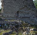
Manfrino Castle | |
---|---|
Castel Manfrino | |
Valle Castellana | |
Type | Castle |
Site history | |
Built | 12th century |
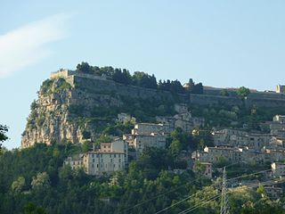
Castel Manfrino (Italian for Manfrino Castle) is a ruined Middle Ages castle located in Sella di Castel Manfrino, near the hamlet of Macchia da Sole, within the municipality of Valle Castellana in the province of Teramo, inside the Gran Sasso e Monti della Laga National Park. [1]
The castle was built on the remains of an ancient Roman fortress, [2] constructed to defend the road that branched off from the Via Salaria near Amatrice and, through the so-called Pass of Hannibal, reached the plain of Campovalano. [3] Built in the late Middle Ages between the 12th and 13th centuries, [2] [4] it owes its name to Manfred of Swabia, son of Frederick II. [2] [4] The historian from Ascoli, Secondo Balena, also cites the names "Castello di re Manfredi" and "Castel Manfredino," which over time became Castel Manfrino. [5] In documents, it is also mentioned as Castrum Maccle, [6] the castle of Macchia. In the Catalogus Baronum, it is indicated as the fief of Macclam in Asculo. [7]
The fort served as a lookout and observation point to control the route that climbed up the southern slope of Montagna dei Fiori and, from the locality of Civitella del Tronto, reached the mountain from which it was possible to observe the northern slope where the city of Ascoli Piceno is located.
The castle was erected at the behest of Manfred of Sicily [2] [4] [6] on earlier fortified constructions to control, along with the fortress of Civitella del Tronto, the only roads crossing the mountains that connected Ascoli Piceno to Teramo, better known as the "routes of Abruzzo Ascolano."
During the 13th century, after the disappearance of Manfred, the fort passed to Armellino di Macchia di Giacomo, [4] [5] who was later expelled and considered a rebel. He was succeeded by Pietro d'Isola, [5] an Angevin, who was killed during the attack launched against him by the Ascoli inhabitants, commanded by his predecessor Armellino. [4] [8] The Ascoli inhabitants launched the attack following numerous conflicts generated with Charles of Anjou, and the castle was the subject of bitter disputes for long periods to assert "ancient rights". [9] In 1273, it was granted as a fief to Riccardo di Agello.
In 1280 [4] – 1281, [2] Charles I commissioned the Master Pierre d'Angicourt, [4] the same architect who designed the castle of Barletta, then active in Abruzzo, [2] to design a defensive tower to be built within the Castro di Macchia and to study appropriate restoration works. The tower was to serve as a guard tower and be located near the entrance to the enclosure. Inside, it was to feature a cistern for collecting rainwater on the ground floor, an air chamber on the upper floor, and the last two floors above for residential use. [2] The entrance door to the Angevin tower was to be on the south side, at a safe height above the ground level.
From 1361, after the defeat of Manfred and Conradin of Swabia and the betrayal and disappearance of the Ghibelline lord Cola di Macchia, Castel Manfrino no longer belonged to Ascoli subjugation and came under the jurisdiction of the ruling house of Naples of the Angevin dynasty. [2]
The ruins are located at an altitude of 963 meters, [10] on a rocky spur overlooking the top of the cliff that dominates the course of the Salinello river, on the border between the province of Ascoli Piceno and the province of Teramo.
The height rises between the Monti Gemelli, that is, between the Montagna dei Fiori and the "Montagna di Campli". The strategic and panoramic location offers a wide view of the underlying valleys, suitable for controlling and spotting the routes that wind through the territory between the Salinello valley and the Rivolta gorge. [6] The site is accessible via the "Strada statale 81 Piceno Aprutina" which connects the cities of Ascoli Piceno and Teramo. Then proceed along the provincial road 52 and follow the signs for the hamlet of Macchia da Sole. From this village, a dirt path climbs along the side of the mountain and, after about 20 minutes on foot, leads to the remains of the castle.
The layout of the castle develops with a longitudinal orientation from north to south. The outer walls of the fortification were built using the natural defensibility of the site, following the profile of the rocky spur that hosts them. They have no other openings besides the single entrance to the enclosure.
Made of river stones cemented and smoothed only on the outer side, they extend for about 120 meters, and the width of the enclosed area varies from 8 to 20 meters. The thickness of the walls ranges from 50 cm to one meter. The structure does not have bastions, perhaps originally present only near the north-facing entrance.
Diametrically opposite the entrance, still partially preserved and visible, is the tower, which had no access openings at the base. It was divided into several floors with wooden balconies and used both as the residence of the castellan and as a place of defense in case of need. [2] Of this tower, with a quadrangular base measuring about 10 meters per side, only the first floor and the cistern remain, while the upper part consists of a few wall stumps on the east and west sides and an exposed west wall. Beyond its base, there are also the outlines of other rooms reaching the base of a second tower, the central one, about ten meters high. The exterior of this tower shows a sooty cap, indicating it was the place where oil was boiled to pour on enemies. [4] To support this hypothesis, two cauldrons were found in the underlying Rivolta stream. [4]
Inside the enclosure walls are the remains of a probable small chapel with a quadrangular plan, near the south tower. [6] A document from 1277 reports the stable presence of a chaplain in the castle, supporting the hypothesis of a place of worship. [2] At the base of the wall, faint traces of frescoes are visible.
The construction of Castel Manfrino is very similar to that of other fortified works in the province of L'Aquila such as San Pio delle Camere. [2] [6]
From excavations conducted at different times, the technical report of the studies carried out by the Consorzio Aprutino Patrimonio Storico e Artistico of Teramo [4] lists the following findings:
Ascoli Piceno is a comune (municipality) and capital of the province of Ascoli Piceno, in the Italian region of Marche.
The province of Teramo is a province in the Abruzzo region of Italy. Its capital is the city of Teramo. The province has an area of 1,948 square kilometres (752 sq mi), a population of 313,029 (2012), and is subdivided into 47 comuni, see comunes of the province of Teramo. The province of Teramo shares its northern border with the province of Ascoli Piceno in the Marche region, southern and southwestern borders with the province of L'Aquila in the Abruzzo region, and a western border with the province of Rieti in the Lazio region. To the south is the province of Pescara in the Abruzzo region and to the east is the Adriatic Sea.
Frondarola is a small town in the province of Teramo in the Abruzzo region of Italy, population about 200. It lies at an altitude of 1502 feet above sea level and is located about 5 miles from Teramo, of which it is a frazione.
Monti della Laga is a mountain range in the central Apennines of Italy. Their ruggedness and inaccessibility makes them one of the lesser known areas of the Italian peninsula.
Civitella Casanova is an Italian town of inland mountain of 1,950 inhabitants in the province of Pescara in Abruzzo and belongs to the mountain community Vestina. Listed on the National Park of Gran Sasso and Monti della Laga and the Regional Reserve Voltigno and Valle d'Angri, a regional reserve included in the National Park, the country bases its economy mainly on agriculture. It has pre-Roman origins of repute, the sources of the historian Livy emerges as the town of Civitella was called Cutina or Cingilia.
Campli is a town and comune in the province of Teramo, in the Abruzzo region of central Italy. It is located in the natural park known as the Gran Sasso e Monti della Laga National Park. It is one of I Borghi più belli d'Italia.
Civitella del Tronto is a town and comune in the province of Teramo, within the Abruzzo region of central Italy. It is in the Gran Sasso e Monti della Laga National Park. It is one of I Borghi più belli d'Italia.
Colonnella is a comune in the Province of Teramo in the Italian region Abruzzo of eastern Italy. It is part of the Unione dei comuni Città Territorio-Val Vibrata.
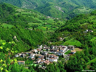
Valle Castellana is a village and comune in the Province of Teramo, in the Abruzzo region of central Italy. It is a member of the Italian community of surrounding mountain villages, Monti della Laga. It is located in the natural park known as the Gran Sasso e Monti della Laga National Park.
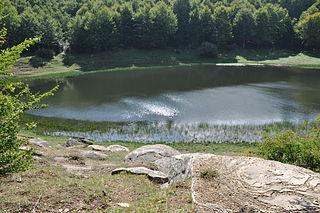
Accumoli is a comune (municipality) in the Province of Rieti in the Italian region of Lazio, located about 110 kilometres (68 mi) northeast of Rome and about 45 kilometres (28 mi) northeast of Rieti. It is located in the natural park known as the "Gran Sasso e Monti della Laga National Park".
The Gran Sasso and Monti della Laga National Park is a natural park in central Italy. Established in 1991, it covers an area of 2,014 square kilometres (778 sq mi), mostly within the provinces of Teramo, L'Aquila, and Pescara in Abruzzo, with small areas in the provinces of Rieti in Lazio and Ascoli Piceno in Marche. The terrain is predominantly mountainous with alpine plains.
The Tronto is a 115-kilometre (71 mi) long Italian river that arises at Monti della Laga and ends in the Adriatic Sea at Porto d'Ascoli, San Benedetto del Tronto. It traverses the Lazio, Marche, and Abruzzo regions of Italy.
Montagna dei Fiori is a mountain group in the Abruzzo, central Italy, forming the Monti Gemelli massif, together with the Montagna di Campli. It is located nearby the boundary between the province of Teramo and the Marche region; due to its proximity to Ascoli Piceno, it is also known as Montagna d'Ascoli.
Tourism in Abruzzo has become one of the most prosperous sectors in the economy of Abruzzo, and in recent years has seen a remarkable growth attracting numerous tourists from Italy and Europe. According to statistics, in 2021 arrivals totaled 1,330,887. A total of 5,197,765 arrivals were tourists, a figure that puts the region seventeenth among the Italian regions for numbers of tourists per year. A moderate support to tourism is also given to the Abruzzo Airport with many low cost and charter flights connecting the entire region with the rest of Europe.
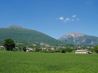
Monti Gemelli is the name given to two similar mountains, Montagna dei Fiori and Montagna di Campli, in the Abruzzo region of Italy. They are located in the Province of Teramo.
Monsampietro is a frazione (hamlet) of the comune (municipality) of Venarotta in the province of Ascoli Piceno in the Italian region Marche. The territory is part of Diocese of Ascoli Piceno.
The Salinello is a river in Italy. It is located in the province of Teramo in the Abruzzo region of southern Italy. The source of the river is in the Monti della Laga range southwest of Montagna dei Fiori. The river flows eastward and curves northeast near Civitella del Tronto. The river then curves southeast near Sant'Egidio alla Vibrata and the border with the province of Ascoli Piceno. Finally, the river flows east near Sant'Omero and enters the Adriatic Sea near Giulianova and Tortoreto Lido.
The Castellano is a river in Italy. Its source is in the Monti della Laga mountains near the border between the province of Teramo and the province of Rieti north of Monte Gorzano. It flows northeast through the mountains in the province of Teramo and eventually forms the border between the province of Teramo and the province of Ascoli Piceno. The river flows west of Monte dei Fiori before entering the province of Ascoli Piceno. The river joins the Tronto at Ascoli Piceno.
Fortezza di Civitella del Tronto is a fortress in Civitella del Tronto, Province of Teramo (Abruzzo).
The Abbey of Montesanto or Abbazia di Santa Maria in Montesanto is Romanesque-style Benedictine monastery located in the rural hills outside the town of Civitella del Tronto, in the province of Teramo, Abruzzo, Italy.