
Molise is a region of Southern Italy. Until 1963, it formed part of the region of Abruzzi e Molise, alongside the region of Abruzzo. The split, which did not become effective until 1970, makes Molise the youngest region in Italy. Covering 4,438 square kilometres (1,714 sq mi), it is the second smallest region in the country after the Aosta Valley, and has a population of 313,348.

The Province of L'Aquila is the largest, most mountainous and least densely populated province of the Abruzzo region of Southern Italy. It comprises about half the landmass of Abruzzo and occupies the western part of the region. It has borders with the provinces of Teramo to the north, Pescara and Chieti to the east, Isernia to the south and Frosinone, Rome and Rieti to the west. Its capital is the city of L'Aquila.

The Province of Campobasso is a province in the Molise region of southern Italy. Its capital is the city of Campobasso.

The province of Isernia is a province in the region of Molise in Italy. The provincial capital is the city Isernia and the president of the province is Alfredo Ricci. The province of Isernia has an area of 1,535.24 square kilometres (592.76 sq mi) and a population of 86,405 inhabitants as of 2016. It contains 52 comunes in the province, listed at comunes of the Province of Isernia.
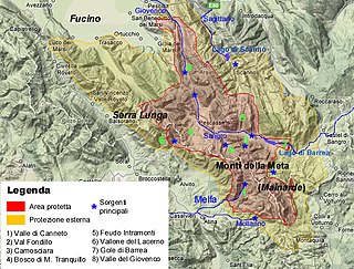
Abruzzo, Lazio and Molise National Park is an Italian national park founded in 1922. The majority of the park is located in the Abruzzo region, with smaller parts in Lazio and Molise. It is sometimes called by its former name Abruzzo National Park. The park headquarters are in Pescasseroli in the Province of L'Aquila. The park's area is 496.80 km2 (191.82 sq mi).

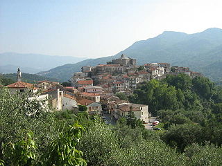
Scapoli is a town and comune located in province of Isernia, which is part of the region of Molise, southern Italy. As of 2011 it had a population of was of 758.

Ogliastro Cilento is a town and comune in the province of Salerno in the Campania region of south-western Italy. As of 2011 its population was of 2,241.
Rofrano is a town and comune of the province of Salerno in the Campania region of south-west Italy. It is located in the southern Cilento. In 2015 its population was 1,539.
Poggio Catino is a comune (municipality) in the Province of Rieti in the Italian region Latium, located about 45 kilometres (28 mi) northeast of Rome and about 20 kilometres (12 mi) southwest of Rieti. As of 31 December 2011, it had a population of 1,335 and an area of 15.0 square kilometres (5.8 sq mi).

Picinisco is a comune (municipality) in the Province of Frosinone in the Italian region Lazio, located about 120 kilometres (75 mi) east of Rome and about 45 kilometres (28 mi) east of Frosinone. It is included in the Valle di Comino and National Park of Abruzzo, Lazio e Molise.

Filignano is an Italian comune (municipality) of the Province of Isernia, in the region Molise.

Pizzone is a comune (municipality) in the Province of Isernia in the Italian region Molise, about 50 kilometres (31 mi) west of Campobasso and about 20 kilometres (12 mi) northwest of Isernia near the Monti della Meta chain.

Pozzilli is an Italian comune (municipality) of the Province of Isernia, in the region Molise, located about 50 kilometres (31 mi) west of Campobasso and about 15 kilometres (9 mi) southwest of Isernia.
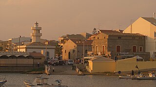
Scoglitti is a southern Italian fishing village and hamlet (frazione) of Vittoria, a municipality in the Province of Ragusa, Sicily. In 2011 it had a population of 4,175.

Passo Corese is an Italian town and hamlet (frazione) of Fara in Sabina, a municipality in the province of Rieti, Lazio. In 2011 it had a population of 3,573.

Lancusi is a southern Italian village and hamlet (frazione) of Fisciano, a municipality in the province of Salerno, Campania. With a population of circa 4,000 (2011), it is the most populated settlement of its municipality, including the administrative town.

Case del Conte, sometimes also spelled Casa del Conte, is a southern Italian village and hamlet (frazione) of Montecorice, a municipality in the province of Salerno, Campania. As of 2009 its population was of 235.

Marina di Casalvelino, also spelled Casalvelino Marina, is a southern Italian village and hamlet (frazione) of Casal Velino, a municipality in the province of Salerno, Campania. With a population of 1,263 (2009), it is the most populated hamlet of its municipality.

Roccapipirozzi is an Italian village, hamlet (frazione) of the municipality of Sesto Campano in the Province of Isernia, Molise. As of 2009 its population was of 1,045.

Quattromiglia, also known as Quattromiglia di Rende, is an inhabited area of the municipality of Rende in the province of Cosenza, Calabria. With a population of 8,813, it is the most populated district of its municipality.

