Champneuf, Quebec

Last updated
Champneuf
Municipality
Champneuf QC.JPG
Champneuf Quebec location diagram.png
Location within Abitibi RCM.
Canada Western Quebec location map.png
Red pog.svg
Champneuf
Location in western Quebec.
Coordinates: 48°35′N77°30′W / 48.583°N 77.500°W / 48.583; -77.500 Coordinates: 48°35′N77°30′W / 48.583°N 77.500°W / 48.583; -77.500 [1]
CountryFlag of Canada.svg  Canada
Province Flag of Quebec.svg  Quebec
Region Abitibi-Témiscamingue
RCM Abitibi
Settled 1938
Constituted January 1, 1964
Government [2]
  Mayor Rosaire Guénette
   Federal riding Abitibi—Témiscamingue
   Prov. riding Abitibi-Ouest
Area [2] [3]
  Total 240.50 km2 (92.86 sq mi)
  Land 242.39 km2 (93.59 sq mi)
 There is an apparent
contradiction between two
authoritative sources
Population (2011) [3]
  Total 127
  Density 0.5/km2 (1/sq mi)
  Pop 2006-2011Decrease2.svg 2.3%
  Dwellings 56
Time zone EST (UTC−5)
  Summer (DST) EDT (UTC−4)
Postal code(s) J0Y 1E0
Area code(s) 819
Highways No major routes

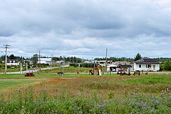
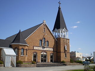
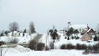
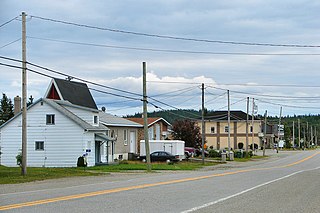
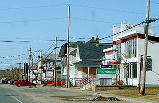
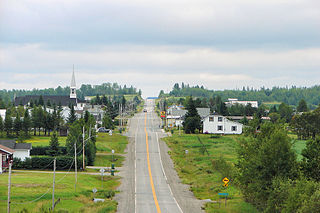
Champneuf is a municipality in the Canadian province of Quebec, located in the Abitibi Regional County Municipality. It is the smallest incorporated place in terms of population in the Abitibi-Témiscamingue region.

Provinces and territories of Canada Top-level subdivisions of Canada

The provinces and territories of Canada are the sub-national governments within the geographical areas of Canada under the authority of the Canadian Constitution. In the 1867 Canadian Confederation, three provinces of British North America—New Brunswick, Nova Scotia, and the Province of Canada —were united to form a federated colony, becoming a sovereign nation in the next century. Over its history, Canada's international borders have changed several times, and the country has grown from the original four provinces to the current ten provinces and three territories. Together, the provinces and territories make up the world's second-largest country by area.
Quebec Province of Canada

Quebec is one of the thirteen provinces and territories of Canada. It is bordered to the west by the province of Ontario and the bodies of water James Bay and Hudson Bay; to the north by Hudson Strait and Ungava Bay; to the east by the Gulf of Saint Lawrence and the province of Newfoundland and Labrador; and to the south by the province of New Brunswick and the U.S. states of Maine, New Hampshire, Vermont, and New York. It also shares maritime borders with Nunavut, Prince Edward Island, and Nova Scotia. Quebec is Canada's largest province by area and its second-largest administrative division; only the territory of Nunavut is larger. It is historically and politically considered to be part of Central Canada.

Abitibi Regional County Municipality Regional county municipality in Quebec, Canada

Abitibi Regional County Municipality is a regional county municipality in the Abitibi-Témiscamingue region of Quebec. The seat is Amos.

Contents

History

In 1938, the settlement was founded, first called Colonie Bertrand, after its first parish priest Achille-Augustin Bertrand. In 1941, it was renamed to Champneufs (French for "new fields"), but also known by the parish name of Saint-François-d'Assise-de-Champneufs during the 1950s. At one point and for unknown reasons, the name was changed from the plural to the singular Champneuf. In 1964, the place was incorporated as a municipality. [1]

Demographics

Population trend: [4]

Private dwellings occupied by usual residents: 50 (total dwellings: 56)

Mother tongue: [5]

Municipal council

Climate

Climate type is dominated by the winter season, a long, bitterly cold period with short, clear days, relatively little precipitation mostly in the form of snow, and low humidity. The Köppen Climate Classification subtype for this climate is "Dfc"(Continental Subarctic Climate).

Subarctic climate

The subarctic climate is a climate characterised by long, usually very cold winters, and short, cool to mild summers. It is found on large landmasses, away from the moderating effects of an ocean, generally at latitudes from 50° to 70°N poleward of the humid continental climates. These climates represent Köppen climate classification Dfc, Dwc, Dsc, Dfd, Dwd and Dsd. In very small areas at high altitudes around the Mediterranean Basin, Iran, Kyrgyzstan, Tajikistan, Turkey, Alaska and other parts of the northwestern United States and Russian South-Eastern regions the climate is classified as Dsc with a dry summer climate, such as in Seneca, Oregon or Atlin, British Columbia.

Related Research Articles

Ville-Marie, Quebec City in Quebec, Canada

Ville-Marie is a town on Lake Temiscaming in western Quebec, Canada. It is the largest city and seat of the Témiscamingue Regional County Municipality, Quebec. As one of the oldest towns in the Abitibi-Témiscamingue region, it is considered the cradle of north-western Quebec and nicknamed "Pearl of Témiscamingue".

Barraute, Quebec Municipality in Quebec, Canada

Barraute is a municipality in the Canadian province of Quebec, located in the Abitibi Regional County Municipality.

Rochebaucourt, Quebec Municipality in Quebec, Canada

Rochebaucourt is a municipality in the Canadian province of Quebec, located in the Abitibi Regional County Municipality.

Sainte-Gertrude-Manneville, Quebec Municipality in Quebec, Canada

Sainte-Gertrude-Manneville is a municipality in the Canadian province of Quebec, located in Abitibi Regional County Municipality. It includes the population centres of Sainte-Gertrude-de-Villeneuve and Manneville.

Saint-Félix-de-Dalquier, Quebec Municipality in Quebec, Canada

Saint-Félix-de-Dalquier is a municipality in the Canadian province of Quebec, located in the Abitibi Regional County Municipality.

Launay, Quebec Township municipality in Quebec, Canada

Launay is a township municipality in the Canadian province of Quebec, located in the Abitibi Regional County Municipality.

Saint-Marc-de-Figuery Parish municipality in Quebec, Canada

Saint-Marc-de-Figuery is a parish municipality in the Canadian province of Quebec, located in the Abitibi Regional County Municipality. It is part of the census agglomeration of Amos.

Macamic, Quebec City in Quebec, Canada

Macamic is a ville in northwestern Quebec, Canada, in the Abitibi-Ouest Regional County Municipality. It covers 202.34 km² and had a population of 2,734 in the Canada 2011 Census.

Authier, Quebec Municipality in Quebec, Canada

Authier is a municipality in northwestern Quebec, Canada, in the Abitibi-Ouest Regional County Municipality. It had a population of 282 in the Canada 2011 Census.

Clerval, Quebec Municipality in Quebec, Canada

Clerval is a municipality in northwestern Quebec, Canada, in the Abitibi-Ouest Regional County Municipality. It covers 101.6 km² and had a population of 364 as of the Canada 2011 Census.

Palmarolle Municipality in Quebec, Canada

Palmarolle is a municipality in northwestern Quebec, Canada, in the Abitibi-Ouest Regional County Municipality. It covers 118.36 km² and had a population of 1,465 as of the Canada 2011 Census. It is considered to have the best agricultural land of the entire Abitibi region.

Poularies, Quebec Municipality in Quebec, Canada

Poularies is a municipality in northwestern Quebec, Canada in the Abitibi-Ouest Regional County Municipality. It covers 164.95 km² and had a population of 679 as of the Canada 2011 Census.

Rapide-Danseur, Quebec Municipality in Quebec, Canada

Rapide-Danseur is a municipality in northwestern Quebec, Canada, in the Abitibi-Ouest Regional County Municipality. It covers 185.18 km² and had a population of 312 as of the Canada 2011 Census.

Roquemaure, Quebec Municipality in Quebec, Canada

Roquemaure is a municipality in northwestern Quebec, Canada in the MRC d'Abitibi-Ouest. It covers 121.67 km² and had a population of 414 as of the Canada 2011 Census.

Sainte-Germaine-Boulé, Quebec Municipality in Quebec, Canada

Sainte-Germaine-Boulé is a municipality in northwestern Quebec, Canada, in the Abitibi-Ouest Regional County Municipality. It covers 108.46 square kilometres (41.88 sq mi) and had a population of 895 as of the Canada 2011 Census.

Taschereau, Quebec Municipality in Quebec, Canada

Taschereau is a municipality in northwestern Quebec, Canada in the Abitibi-Ouest Regional County Municipality. It covers 265.62 km² and had a population of 981 as of the Canada 2011 Census.

Sainte-Hélène-de-Mancebourg, Quebec Parish municipality in Quebec, Canada

Sainte-Hélène-de-Mancebourg is a parish municipality in northwestern Quebec, Canada in the Abitibi-Ouest Regional County Municipality. It covers 68.29 km² and had a population of 354 as of the Canada 2011 Census.

Béarn, Quebec Municipality in Quebec, Canada

Béarn is a municipality in northwestern Quebec, Canada in the Témiscamingue Regional County Municipality.

Rémigny, Quebec Municipality in Quebec, Canada

Rémigny is a municipality in northwestern Quebec, Canada, in the Témiscamingue Regional County Municipality.

LAscension-de-Notre-Seigneur, Quebec Parish municipality in Quebec, Canada

L'Ascension-de-Notre-Seigneur is a parish municipality in Quebec, Canada, located within the regional county municipality of Lac-Saint-Jean-Est in the Saguenay-Lac-Saint-Jean region. Its name is French for "the Ascension of Our Lord".

References

  1. 1 2 "Champneuf (Municipalité)" (in French). Commission de toponymie du Québec. Retrieved 2011-01-12.
  2. 1 2 "Champneuf". Répertoire des municipalités (in French). Ministère des Affaires municipales, des Régions et de l'Occupation du territoire. Retrieved 2011-01-12.
  3. 1 2 "Champneuf census profile". 2011 Census data . Statistics Canada. Retrieved 2011-01-12.
  4. Statistics Canada: 1996, 2001, 2006, 2011 census
  5. "Champneuf community profile". 2006 Census data . Statistics Canada. Retrieved 2011-01-12.