Rochebaucourt | |
---|---|
Municipality | |
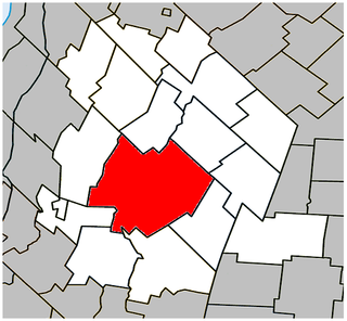
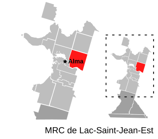
![]() Location within Abitibi RCM. | |
Coordinates: 48°41′N77°30′W / 48.683°N 77.500°W Coordinates: 48°41′N77°30′W / 48.683°N 77.500°W [1] | |
Country | ![]() |
Province | ![]() |
Region | Abitibi-Témiscamingue |
RCM | Abitibi |
Settled | 1935 |
Constituted | January 1, 1983 |
Government [2] | |
• Mayor | Gaby Chiasson Yergeau |
• Federal riding | Abitibi—Témiscamingue |
• Prov. riding | Abitibi-Ouest |
Area [2] [3] | |
• Total | 183.30 km2 (70.77 sq mi) |
• Land | 184.60 km2 (71.27 sq mi) |
There is an apparent contradiction between two authoritative sources | |
Population (2011) [3] | |
• Total | 161 |
• Density | 0.9/km2 (2/sq mi) |
• Pop 2006-2011 | ![]() |
• Dwellings | 73 |
Time zone | EST (UTC−5) |
• Summer (DST) | EDT (UTC−4) |
Postal code(s) | J0Y 2J0 |
Area code(s) | 819 |
Highways | ![]() ![]() |
Website | www.municipalite- rochebaucourt.org |
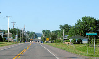
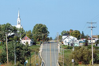
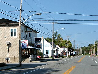
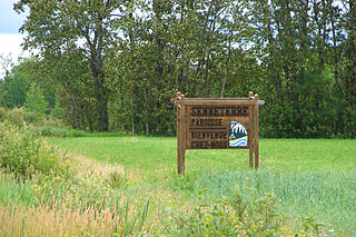
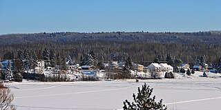
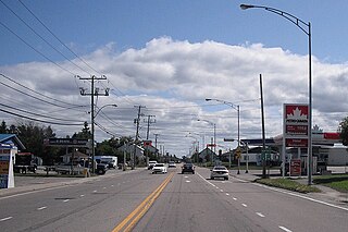
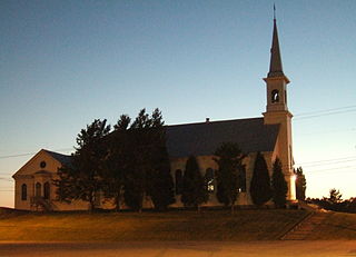
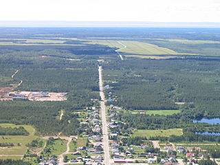
Rochebaucourt is a municipality in the Canadian province of Quebec, located in the Abitibi Regional County Municipality.
The provinces and territories of Canada are the sub-national governments within the geographical areas of Canada under the authority of the Canadian Constitution. In the 1867 Canadian Confederation, three provinces of British North America—New Brunswick, Nova Scotia, and the Province of Canada —were united to form a federated colony, becoming a sovereign nation in the next century. Over its history, Canada's international borders have changed several times, and the country has grown from the original four provinces to the current ten provinces and three territories. Together, the provinces and territories make up the world's second-largest country by area.
Quebec is one of the thirteen provinces and territories of Canada. It is bordered to the west by the province of Ontario and the bodies of water James Bay and Hudson Bay; to the north by Hudson Strait and Ungava Bay; to the east by the Gulf of Saint Lawrence and the province of Newfoundland and Labrador; and to the south by the province of New Brunswick and the U.S. states of Maine, New Hampshire, Vermont, and New York. It also shares maritime borders with Nunavut, Prince Edward Island, and Nova Scotia. Quebec is Canada's largest province by area and its second-largest administrative division; only the territory of Nunavut is larger. It is historically and politically considered to be part of Central Canada.
Abitibi Regional County Municipality is a regional county municipality in the Abitibi-Témiscamingue region of Quebec. The seat is Amos.
In 1935 as part of the Vautrin Settlement Plan, the place was colonized by pioneers from Saint-Antoine-sur-Richelieu, Saint-Hyacinthe, and Salaberry-de-Valleyfield. It was first known as Colonie-33 but this was quickly replaced by Rochebaucourt, the name of the geographic township in which it is located. La Rochebaucourt was a cavalry captain of the Languedoc Regiment in General Montcalm's army. In 1940, the Parish of Saint-Antoine-de-Rochebaucourt was established. [1]
Saint-Hyacinthe is a city in southwestern Quebec east of Montreal on the Yamaska River. The population as of the Canada 2011 Census was 53,236. The city is located in Les Maskoutains Regional County Municipality of the Montérégie region, and is traversed by the Yamaska River which flows perpendicular to Quebec Autoroute 20. Saint-Hyacinthe is the seat of the judicial district of the same name.
Salaberry-de-Valleyfield is a city in southwestern Quebec, Canada, in the Regional County Municipality of Beauharnois-Salaberry.
Louis-Joseph de Montcalm-Grozon, marquis de Montcalm de Saint-Veran was a French soldier best known as the commander of the forces in North America during the Seven Years' War.
Not until 1983 was the place incorporated as a municipality. [1]
Population trend: [4]
Private dwellings occupied by usual residents: 70 (total dwellings: 73)
Mother tongue: [5]
Saint-Eugène-d'Argentenay is a municipality in the Canadian province of Quebec, located within the regional county municipality of Maria-Chapdelaine. The municipality had a population of 546 as of the Canada 2011 Census. Prior to 1997 it was known simply as Saint-Eugène.
Péribonka is a municipality in the Canadian province of Quebec, located in the Maria-Chapdelaine Regional County Municipality. It is situated at the mouth of the Peribonka River where it forms a bay on the north shore of Lac Saint-Jean.
Champneuf is a municipality in the Canadian province of Quebec, located in the Abitibi Regional County Municipality. It is the smallest incorporated place in terms of population in the Abitibi-Témiscamingue region.
Saint-Félix-de-Dalquier is a municipality in the Canadian province of Quebec, located in the Abitibi Regional County Municipality.
Palmarolle is a municipality in northwestern Quebec, Canada, in the Abitibi-Ouest Regional County Municipality. It covers 118.36 km² and had a population of 1,465 as of the Canada 2011 Census. It is considered to have the best agricultural land of the entire Abitibi region.
Béarn is a municipality in northwestern Quebec, Canada in the Témiscamingue Regional County Municipality.
Rémigny is a municipality in northwestern Quebec, Canada, in the Témiscamingue Regional County Municipality.
Saint-Bruno-de-Guigues, often shortened to Guigues, is a municipality in northwestern Quebec, Canada, in the Témiscamingue Regional County Municipality.
Saint-Eugène-de-Guigues, often shortened to Saint-Eugène, is a municipality in northwestern Quebec, Canada, in the Témiscamingue Regional County Municipality.
Saint-Édouard-de-Fabre is a parish municipality in western Quebec, Canada, in the Témiscamingue Regional County Municipality.
Belcourt is a municipality in northwestern Quebec, Canada, in the La Vallée-de-l'Or Regional County Municipality.
Senneterre is a parish municipality in northwestern Quebec, Canada, in the La Vallée-de-l'Or Regional County Municipality. The parish is mostly a rural municipality that almost completely surrounds the actual population centre of the neighbouring City of Senneterre.
Saint-Aimé-du-Lac-des-Îles is a municipality in the Laurentides region of Quebec, Canada, part of the Antoine-Labelle Regional County Municipality.
Lac-Saint-Paul is a municipality in the Laurentides region of Quebec, Canada, part of the Antoine-Labelle Regional County Municipality.
Saint-André-du-Lac-Saint-Jean is a village municipality in Quebec, Canada.
Saint-François-de-Sales is a municipality in Quebec, Canada.
Chambord is a municipality in Le Domaine-du-Roy Regional County Municipality in the Saguenay–Lac-Saint-Jean region of Quebec, Canada. The Chambord meteorite was found near here in 1904.
Saint-Nazaire is a municipality in Quebec, Canada.
Saint-Henri-de-Taillon is a municipality in Quebec, Canada.
Saint-Ludger-de-Milot is a municipality in Quebec, Canada.