External links
35°12′40″N80°48′14″W / 35.211°N 80.804°W / 35.211; -80.804
This article about a location in Mecklenburg County, North Carolina is a stub. You can help Wikipedia by expanding it. |
Chantilly | |
|---|---|
| Country | United States |
| State | North Carolina |
| County | Mecklenburg |
| City | Charlotte |
| Area | |
| • Total | 0.438 sq mi (1.134 km2) |
| Population (2009) | |
| • Total | 1,335 |
| according to City-Data.com | |
| Zip Code | |
The Chantilly Neighborhood is located between the Elizabeth and Plaza-Midwood neighborhoods, in Charlotte, North Carolina. The neighborhood was established in 1913, with later construction of many homes through the mid-1940s. Additional streets were added in the 1950s. Neighborhood boundaries consist of Independence Boulevard (NC Hwy 74) to the northeast, CSX Railroad Tracks to the west and south, and Briar Creek to the east. Chantilly is positioned adjacent to the northeast of Elizabeth, and south of Plaza-Midwood business district, featuring art galleries, funky stores, and restaurants. Chantilly contains a seven-acre public park called Chantilly Park. Maintained by Mecklenburg County, Chantilly Park is accessed at the southern end of Wyanoke Avenue in the southeastern portion of the neighborhood.
35°12′40″N80°48′14″W / 35.211°N 80.804°W

Midwood is a neighborhood in the south-central part of the New York City borough of Brooklyn. It is bounded on the north by the Bay Ridge Branch tracks just above Avenue I and by the Brooklyn College campus of the City University of New York, and on the south by Avenue P and Kings Highway. The eastern border consists of parts of Nostrand Avenue, Flatbush Avenue, and Coney Island Avenue; parts of McDonald Avenue and Ocean Parkway mark the western boundary.
Fiske Terrace is a planned community and neighborhood in the New York City borough of Brooklyn. Fiske Terrace is located in south central Brooklyn in the southern edge of the community of Flatbush and north of the community of Midwood. It is bounded by Foster Avenue on the north, Ocean Avenue on the east, the Bay Ridge Branch of the Long Island Rail Road/New York and Atlantic Railway right-of-way on the south, and the New York City Subway BMT Brighton Line subway line on the west.

SouthPark is an upscale shopping mall in the affluent SouthPark neighborhood in Charlotte, North Carolina. The mall is located approximately five miles (8 km) south of Uptown Charlotte, at the corner of Sharon and Fairview Roads. With 1,688,480 square feet (160,000 m2), It is one of the most profitable malls in the country with sales at over $700 per square foot. It is the 10th largest on the East Coast and is the 28th largest in the United States. SouthPark is the most congested shopping area in the United States during Black Friday weekend. The mall is visited by more than 12 million visitors a year.

Meadowbrook is a Syracuse, New York neighborhood, located in the southeastern corner of the city. It corresponds to Onondaga County Census Tract 46. It is named after Meadow Brook, which runs through it and into Butternut Creek.
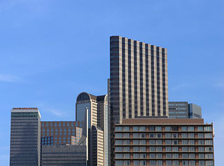
The City Center District is an area in north-central downtown Dallas, Texas (USA). It lies south of the Arts District, north of the Main Street District, northwest of Deep Ellum, southwest of Bryan Place and east of the West End Historic District. The district contains a large concentration of downtown commercial space which prior to 1950 had been concentrated along Main Street. The district also contains remnants of Theatre Row, the historical entertainment area along Elm Street which contained theatres such as the Majestic Theatre.
Vanderbilt Avenue is the name of three thoroughfares in the New York City boroughs of Brooklyn, Manhattan, and Staten Island. They were named after Cornelius Vanderbilt (1794–1877), the builder of Grand Central Terminal in Midtown Manhattan.
Metrolina Speedway was an auto racing track located in northeast Charlotte, North Carolina on the Metrolina Fairgrounds.
Dayton is a neighborhood within the city of Newark in Essex County, in the U.S. state of New Jersey. It is part of the city's south ward
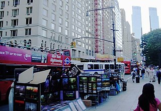
59th Street is a crosstown street in the New York City borough of Manhattan, running from York Avenue and Sutton Place on the East Side of Manhattan to the West Side Highway on the West Side. The three-block portion between Columbus Circle and Grand Army Plaza is known as Central Park South, since it forms the southern border of Central Park. There is a gap in the street between Ninth Avenue/Columbus Avenue and Columbus Circle, where the Deutsche Bank Center is located. While Central Park South is a bidirectional street, most of 59th Street carries one-way traffic.
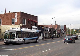
Plaza-Midwood is a neighborhood located approximately one mile to the northeast of Uptown in Charlotte, North Carolina. The neighborhood is roughly bound by Hawthorne Lane to the west, The Plaza to the north, Briar Creek Road and the Charlotte Country Club to the east and Central Avenue to the south.
Brandon Oaks is a neighborhood located in Union County, North Carolina. Its main road is Brandon Oaks Parkway.

Mid-Govans is a community in northeast Baltimore, Maryland and part of the development of York Road, a historic Baltimore route to Pennsylvania. As the name suggests, Mid-Govans is located in the center of the larger neighborhood, Govans, with the rough boundaries of York Road to the west, Belvedere Avenue to the north, Midwood Avenue to the east, and Woodbourne Avenue to the south.

Virginia Village is a neighborhood of Denver, Colorado, roughly five miles southeast of downtown. The neighborhood consists of a mixture of town homes, single-family homes, shopping plazas, and mid to high-rise apartment and office buildings. It is served by the Colorado Station on the E, F, and H RTD light rail lines. The neighborhood is bounded on the west by Colorado Boulevard; on the southwest by Interstate 25; on the south by Evans Avenue; on the east by Quebec Street; on the northeast by Cherry Creek; and on the north by Mississippi Avenue. Holly Street divides the Virginia Village neighborhood into two areas, each represented by a neighborhood association. The area west of Holly Street comprises the Virginia Village Ellis Community Association, while the area to the east of Holly comprises the Cook Park Neighborhood Association.

Victorian Flatbush is the western section of the Flatbush section of Brooklyn, New York, bordering Midwood, that is characterized by Victorian houses.
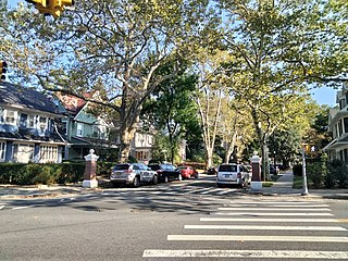
West Midwood is a planned community and historic enclave in the New York City borough of Brooklyn. West Midwood is located in central Brooklyn in the southern edge of the community of Victorian Flatbush, abutting the northern boundary of the community of Midwood. It is bordered by Foster Avenue to the north, the BMT Brighton subway line to the east, Avenue H to the south, and Coney Island Avenue to the west. West Midwood is located south of Prospect Park within what is sometimes referred to as Ditmas Park.

Elizabeth H. Berger Plaza is a public park in the Financial District of Manhattan, New York City. formed by the triangular junction of Trinity Place, Greenwich Street and Edgar Street. It faces the Manhattan exit ramp from the Brooklyn–Battery Tunnel. Formerly known as the Edgar Street Greenstreet, this park honors civic advocate Elizabeth H. Berger (1960-2013). In her role as president of the Downtown Alliance, she advocated for the fusion of two traffic triangles at this location into an expanded park. The park is located on the site of a former neighborhood known as Little Syria, a bustling immigrant community displaced by the construction of the tunnel in 1953.
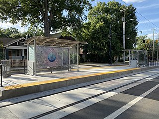
Sunnyside Avenue is a streetcar station in Charlotte, North Carolina. The at-grade island platform on Hawthorne Lane is the eastern terminus of the CityLynx Gold Line and serves the Elizabeth neighborhood.