Chapman Township | |
|---|---|
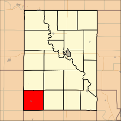 Location in Clay County | |
| Coordinates: 39°10′45″N097°19′01″W / 39.17917°N 97.31694°W | |
| Country | United States |
| State | Kansas |
| County | Clay |
| Area | |
• Total | 35.91 sq mi (93 km2) |
| • Land | 35.88 sq mi (92.92 km2) |
| • Water | 0.03 sq mi (0.08 km2) 0.09% |
| Elevation | 1,352 ft (412 m) |
| Population (2000) | |
• Total | 202 |
| • Density | 5.6/sq mi (2.2/km2) |
| GNIS feature ID | 0476299 |
Chapman Township is a township in Clay County, Kansas, United States. As of the 2000 census, its population was 202.
