
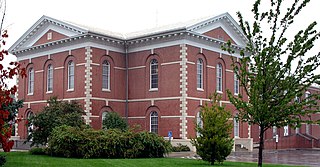
Clay County is a county located in the U.S. state of Kansas. Its county seat and most populous city is Clay Center. As of the 2020 census, the county population was 8,117. The county was named for Henry Clay, an influential U.S. Senator from Kentucky.

Clay County is located in the U.S. state of Missouri and is part of the Kansas City metropolitan area. As of the 2020 census, the county had a population of 253,335, making it the fifth-most populous county in Missouri. Its county seat is Liberty. The county was organized January 2, 1822, and named in honor of U.S. Representative Henry Clay from Kentucky, later a member of the United States Senate and United States Secretary of State.
Platte County is a county located in the northwestern portion of the U.S. state of Missouri and is part of the Kansas City metropolitan area. As of the 2020 census, the population was 106,718. Its county seat is Platte City. The county was organized December 31, 1838, from the Platte Purchase, named for the Platte River. The Kansas City International Airport is located in the county, approximately one mile west of Interstate 29 between mile markers 12 and 15. The land for the airport was originally in an unincorporated portion of Platte County before being annexed by Platte City, and eventually Kansas City.

Cloud County is a county located in the U.S. state of Kansas. Its county seat and most populous city is Concordia. As of the 2020 census, the county population was 9,032. The county was named after William Cloud, an officer in the American Civil War.
Clay Center is a city in and the county seat of Clay County, Kansas, United States. As of the 2020 census, the population of the city was 4,199.

Green is a city in Clay County, Kansas, United States. As of the 2020 census, the population of the city was 95.
Longford is a city in Clay County, Kansas, United States. As of the 2020 census, the population of the city was 73.

Morganville is a city in Clay County, Kansas, United States. As of the 2020 census, the population of the city was 180.
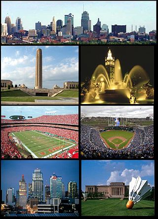
The Kansas City metropolitan area is a bi-state metropolitan area anchored by Kansas City, Missouri. Its 14 counties straddle the border between the U.S. states of Missouri and Kansas. With 8,472 square miles (21,940 km2) and a population of more than 2.2 million people, it is the second-largest metropolitan area centered in Missouri and is the largest metropolitan area in Kansas, though Wichita is the largest metropolitan area centered in Kansas. Alongside Kansas City, Missouri, these are the suburbs with populations above 100,000: Overland Park, Kansas; Kansas City, Kansas; Olathe, Kansas; Independence, Missouri; and Lee's Summit, Missouri.
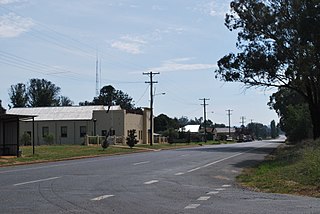
Ladysmith is a village approximately 19 km east of Wagga Wagga in the Riverina region of New South Wales, Australia. At the 2016 census, Ladysmith had a population of 352 people.

Cloud County Community College is a public community college with campuses in Concordia and Junction City, Kansas.

Industry is an unincorporated community in Clay and Dickinson counties in the U.S. state of Kansas. It is located approximately 13 miles north of Abilene.

Ladysmith is an unincorporated community in Caroline County, in the U.S. state of Virginia. It is located along US 1 and SR 639, northwest of Ruther Glen and 1 mile (1.6 km) west of I-95 exit 110. The community contains attractions such as the Pendleton Golf Club, which is addressed as being in Ruther Glen.

Idana is an unincorporated community in Clay County, Kansas, United States. As of the 2020 census, the population of the community and nearby areas was 54. It is located approximately 6.5 miles west of Clay Center, and 1.5 miles south of US Route 24 along 16th Rd.
Elkhorn is an unincorporated community in southwest Ray County, in the U.S. state of Missouri and part of the Kansas City metropolitan area.
Vibbard is an unincorporated community in northwest Ray County, in the U.S. state of Missouri and part of the Kansas City metropolitan area.
Broughton is a ghost town in Clay County, Kansas, United States. It is located a few miles southeast of Clay Center.
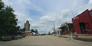
Clay County USD 379 is a public unified school district headquartered in Clay Center, Kansas, United States. The district includes the communities of Clay Center, Green, Longford, Morganville, Oak Hill, Wakefield, Idana, Ladysmith, and nearby rural areas.


