Longford, Kansas

Last updated

Longford, Kansas
Longford, Kansas, circa July 2017.jpg
Downtown Longford (2017)
Clay County Kansas Incorporated and Unincorporated areas Longford Highlighted.svg
Location within Clay County and Kansas
Map of Clay Co, Ks, USA.png
Coordinates: 39°10′20″N97°19′45″W / 39.17222°N 97.32917°W / 39.17222; -97.32917 [1]
Country United States
State Kansas
County Clay
Area
[2]
  Total0.15 sq mi (0.40 km2)
  Land0.15 sq mi (0.40 km2)
  Water0.00 sq mi (0.00 km2)
Elevation
[1]
1,362 ft (415 m)
Population
 (2020) [3]
  Total73
  Density490/sq mi (180/km2)
Time zone UTC-6 (CST)
  Summer (DST) UTC-5 (CDT)
ZIP code
67458
Area code 785
FIPS code 20-42575
GNIS ID 2395759 [1]
Website longfordks.org

Longford is a city in Clay County, Kansas, United States. [1] As of the 2020 census, the population of the city was 73. [3]

Contents

History

Longford was founded in 1870. [4] The first post office in Longford was established in 1875. [5]

In 1887, Atchison, Topeka and Santa Fe Railway built a branch line from Neva (3 mi (4.8 km) west of Strong City) through Longford to Superior, Nebraska. In 1996, the Atchison, Topeka and Santa Fe merged with Burlington Northern Railroad and was renamed to the current BNSF Railway. Most locals still refer to this railroad as the "Santa Fe".

Geography

According to the United States Census Bureau, the city has a total area of 0.15 square miles (0.39 km2), all land. [6]

Climate

The climate in this area is characterized by hot, humid summers and generally mild to cool winters. According to the Köppen Climate Classification system, Longford has a humid subtropical climate, abbreviated "Cfa" on climate maps. [7]

Demographics

Historical population
CensusPop.Note
1920 155
1930 20029.0%
1940 160−20.0%
1950 17811.3%
1960 146−18.0%
1970 99−32.2%
1980 10910.1%
1990 68−37.6%
2000 9438.2%
2010 79−16.0%
2020 73−7.6%
U.S. Decennial Census

2020 census

The 2020 United States census counted 73 people, 39 households, and 25 families in Longford. [8] [9] The population density was 514.1 per square mile (198.5/km2). There were 47 housing units at an average density of 331.0 per square mile (127.8/km2). [9] [10] The racial makeup was 89.04% (65) white or European American (89.04% non-Hispanic white), 0.0% (0) black or African-American, 0.0% (0) Native American or Alaska Native, 0.0% (0) Asian, 0.0% (0) Pacific Islander or Native Hawaiian, 0.0% (0) from other races, and 10.96% (8) from two or more races. [11] Hispanic or Latino of any race was 0.0% (0) of the population. [12]

Of the 39 households, 48.7% had children under the age of 18; 43.6% were married couples living together; 17.9% had a female householder with no spouse or partner present. 28.2% of households consisted of individuals and 15.4% had someone living alone who was 65 years of age or older. [9] The average household size was 2.9 and the average family size was 3.6. [13] The percent of those with a bachelor’s degree or higher was estimated to be 17.8% of the population. [14]

21.9% of the population was under the age of 18, 11.0% from 18 to 24, 21.9% from 25 to 44, 21.9% from 45 to 64, and 23.3% who were 65 years of age or older. The median age was 44.3 years. For every 100 females, there were 78.0 males. [9] For every 100 females ages 18 and older, there were 72.7 males. [9]

The 2016-2020 5-year American Community Survey estimates show that the median household income was $40,938 (with a margin of error of +/- $10,248) and the median family income was $44,583 (+/- $18,683). [15] Males had a median income of $24,375 (+/- $20,722). [16] Approximately, 7.4% of families and 10.7% of the population were below the poverty line, including 6.1% of those under the age of 18 and 0.0% of those ages 65 or over. [17] [18]

2010 census

As of the census [19] of 2010, there were 79 people, 34 households, and 17 families living in the city. The population density was 526.7 inhabitants per square mile (203.4/km2). There were 49 housing units at an average density of 326.7 per square mile (126.1/km2). The racial makeup of the city was 97.5% White, 1.3% Native American, and 1.3% from two or more races. Hispanic or Latino people of any race were 6.3% of the population.

There were 34 households, of which 26.5% had children under the age of 18 living with them, 44.1% were married couples living together, 2.9% had a female householder with no husband present, 2.9% had a male householder with no wife present, and 50.0% were non-families. 41.2% of all households were made up of individuals, and 14.7% had someone living alone who was 65 years of age or older. The average household size was 2.32 and the average family size was 3.41.

The median age in the city was 39.5 years. 32.9% of residents were under the age of 18; 1.3% were between the ages of 18 and 24; 21.6% were from 25 to 44; 29.2% were from 45 to 64; and 15.2% were 65 years of age or older. The gender makeup of the city was 49.4% male and 50.6% female.

2000 census

As of the census [20] of 2000, there were 94 people, 41 households, and 25 families living in the city. The population density was 619.8 inhabitants per square mile (239.3/km2). There were 54 housing units at an average density of 356.1 per square mile (137.5/km2). The racial makeup of the city was 96.81% White, 2.13% African American, and 1.06% from two or more races.

There were 41 households, out of which 26.8% had children under the age of 18 living with them, 58.5% were married couples living together, and 36.6% were non-families. 31.7% of all households were made up of individuals, and 22.0% had someone living alone who was 65 years of age or older. The average household size was 2.29 and the average family size was 2.88.

In the city, the population was spread out, with 24.5% under the age of 18, 7.4% from 18 to 24, 27.7% from 25 to 44, 19.1% from 45 to 64, and 21.3% who were 65 years of age or older. The median age was 37 years. For every 100 females, there were 88.0 males. For every 100 females age 18 and over, there were 97.2 males.

The median income for a household in the city was $20,833, and the median income for a family was $24,375. Males had a median income of $22,500 versus $10,000 for females. The per capita income for the city was $12,072. There were 11.1% of families and 13.6% of the population living below the poverty line, including no under eighteens and 33.3% of those over 64.

Culture

Longford is known for their annual PRCA-sanctioned rodeo. [21] The Longford Rodeo started in 1955. [22]

There is a mural paying homage to the local rodeo clowns in downtown Longford as a part of the local "Mural Movement". [23]

Education

The community is served by Clay County USD 379 public school district. [24]

Longford schools were closed through school unification. The Longford High School mascot was Longford Lions. [25]

Notable people

Related Research Articles

<span class="mw-page-title-main">Clay Center, Kansas</span> City in Clay County, Kansas

Clay Center is a city in and the county seat of Clay County, Kansas, United States. As of the 2020 census, the population of the city was 4,199.

<span class="mw-page-title-main">Green, Kansas</span> City in Clay County, Kansas

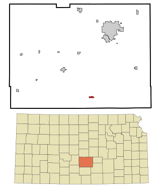
Green is a city in Clay County, Kansas, United States. As of the 2020 census, the population of the city was 95.

<span class="mw-page-title-main">Morganville, Kansas</span> City in Clay County, Kansas

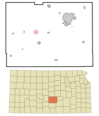
Morganville is a city in Clay County, Kansas, United States. As of the 2020 census, the population of the city was 180.

<span class="mw-page-title-main">Waverly, Kansas</span> City in Coffey County, Kansas

Waverly is a city in Coffey County, Kansas, United States. As of the 2020 census, the population of the city was 574.

<span class="mw-page-title-main">Hepler, Kansas</span> City in Crawford County, Kansas

Hepler is a city in Crawford County, Kansas, United States. As of the 2020 census, the population of the city was 90.

<span class="mw-page-title-main">Norcatur, Kansas</span> City in Decatur County, Kansas

Norcatur is a city in Decatur County, Kansas, United States. As of the 2020 census, the population of the city was 159.

<span class="mw-page-title-main">Moline, Kansas</span> City in Elk County, Kansas

Moline is a city in Elk County, Kansas, United States. As of the 2020 census, the population of the city was 345. Moline is located in south central Elk County at the intersection of U.S. Highway 160 and K-99.

<span class="mw-page-title-main">Hoyt, Kansas</span> City in Jackson County, Kansas

Hoyt is a city in Jackson County, Kansas, United States. As of the 2020 census, the population of the city was 593.

<span class="mw-page-title-main">Mission, Kansas</span> City in Kansas, United States

Mission is a city in Johnson County, Kansas, United States, and part of the Kansas City Metropolitan Area. As of the 2020 census, the population of the city was 9,954.

<span class="mw-page-title-main">Meade, Kansas</span> City in Meade County, Kansas

Meade is a city in and the county seat of Meade County, Kansas, United States. As of the 2020 census, the population of the city was 1,505.

<span class="mw-page-title-main">Ness City, Kansas</span> City in Ness County, Kansas

Ness City is a city in and the county seat of Ness County, Kansas, United States. As of the 2020 census, the population of the city was 1,329. Ness City is famous for its four-story Old Ness County Bank Building located downtown, and nicknamed Skyscraper of the Plains.

<span class="mw-page-title-main">Lyndon, Kansas</span> City in Osage County, Kansas

Lyndon is a city in, and the county seat of Osage County, Kansas, United States. As of the 2020 census, the population of the city was 1,037.

<span class="mw-page-title-main">Phillipsburg, Kansas</span> City in Phillips County, Kansas

Phillipsburg is a city in, and the county seat of, Phillips County, Kansas, United States. As of the 2020 census, its population was 2,337.

<span class="mw-page-title-main">Abbyville, Kansas</span> City in Reno County, Kansas

Abbyville is a city in Reno County, Kansas, United States. As of the 2020 census, the population of the city was 83.

<span class="mw-page-title-main">Pretty Prairie, Kansas</span> City in Reno County, Kansas, United States

Pretty Prairie is a city in Reno County, Kansas, United States. As of the 2020 census, the population of the city was 660.

<span class="mw-page-title-main">Belleville, Kansas</span> City in Republic County, Kansas

Belleville is a city in and the county seat of Republic County, Kansas, United States. As of the 2020 census, the population of the city was 2,007.

<span class="mw-page-title-main">Bel Aire, Kansas</span> City in Sedgwick County, Kansas

Bel Aire is a city in Sedgwick County, Kansas, United States, and a suburb of Wichita. As of the 2020 census, the population of the city was 8,262.

<span class="mw-page-title-main">Mount Hope, Kansas</span> City in Sedgwick County, Kansas

Mount Hope is a city in Sedgwick County, Kansas, United States. As of the 2020 census, the population of the city was 806.

<span class="mw-page-title-main">Clifton, Kansas</span> City in Clay and Washington Counties in Kansas

Clifton is a city in Clay and Washington counties in the U.S. state of Kansas. As of the 2020 census, the population of the city was 454.

<span class="mw-page-title-main">Clayton, Kansas</span> City in Decatur and Norton Counties of Kansas

Clayton is a city in Decatur and Norton counties in the U.S. state of Kansas. As of the 2020 census, the population of the city was 44.

References

  1. 1 2 3 4 U.S. Geological Survey Geographic Names Information System: Longford, Kansas
  2. "2019 U.S. Gazetteer Files". United States Census Bureau. Retrieved July 24, 2020.
  3. 1 2 "Profile of Longford, Kansas in 2020". United States Census Bureau. Archived from the original on April 17, 2022. Retrieved April 17, 2022.
  4. Kansas State Historical Society (1916). Biennial Report of the Board of Directors of the Kansas State Historical Society. Kansas State Printing Plant. pp.  161.
  5. "Kansas Post Offices, 1828-1961 (archived)". Kansas Historical Society. Archived from the original on October 9, 2013. Retrieved June 7, 2014.
  6. "US Gazetteer files 2010". United States Census Bureau. Archived from the original on July 2, 2012. Retrieved July 6, 2012.
  7. Climate Summary for Longford, Kansas
  8. "US Census Bureau, Table P16: HOUSEHOLD TYPE". data.census.gov. Retrieved January 3, 2024.
  9. 1 2 3 4 5 "US Census Bureau, Table DP1: PROFILE OF GENERAL POPULATION AND HOUSING CHARACTERISTICS". data.census.gov. Retrieved January 3, 2024.
  10. Bureau, US Census. "Gazetteer Files". Census.gov. Retrieved December 30, 2023.
  11. "US Census Bureau, Table P1: RACE". data.census.gov. Retrieved January 3, 2024.
  12. "US Census Bureau, Table P2: HISPANIC OR LATINO, AND NOT HISPANIC OR LATINO BY RACE". data.census.gov. Retrieved January 3, 2024.
  13. "US Census Bureau, Table S1101: HOUSEHOLDS AND FAMILIES". data.census.gov. Retrieved January 3, 2024.
  14. "US Census Bureau, Table S1501: EDUCATIONAL ATTAINMENT". data.census.gov. Retrieved January 3, 2024.
  15. "US Census Bureau, Table S1903: MEDIAN INCOME IN THE PAST 12 MONTHS (IN 2020 INFLATION-ADJUSTED DOLLARS)". data.census.gov. Retrieved January 3, 2024.
  16. "US Census Bureau, Table S2001: EARNINGS IN THE PAST 12 MONTHS (IN 2020 INFLATION-ADJUSTED DOLLARS)". data.census.gov. Retrieved January 3, 2024.
  17. "US Census Bureau, Table S1701: POVERTY STATUS IN THE PAST 12 MONTHS". data.census.gov. Retrieved January 3, 2024.
  18. "US Census Bureau, Table S1702: POVERTY STATUS IN THE PAST 12 MONTHS OF FAMILIES". data.census.gov. Retrieved January 3, 2024.
  19. "U.S. Census website". United States Census Bureau . Retrieved July 6, 2012.
  20. "U.S. Census website". United States Census Bureau . Retrieved January 31, 2008.
  21. "Longford Rodeo | Clay County | Kansas | Travel & Tourism".
  22. "Longford Rodeo | Clay County | Kansas | Travel & Tourism". claycokansas. Retrieved November 17, 2021.
  23. "Mural Movement"
  24. "Clay County USD 379". USD 379. Retrieved January 4, 2017.
  25. "Final Quarter Is Key To Longford Win Over Bombers", The Manhattan Mercury, 21 January 1962, p.9.
  26. The Guardian by Whitney Kerr III (2021)

Further reading