Cherokee, Texas

Last updated

Cherokee, Texas
USA Texas location map.svg
Red pog.svg
Cherokee
Usa edcp location map.svg
Red pog.svg
Cherokee
Coordinates: 30°58′57″N98°42′27″W / 30.98250°N 98.70750°W / 30.98250; -98.70750
Country United States
State Texas
County San Saba
Elevation
1,496 ft (456 m)
Time zone UTC-6 (Central (CST))
  Summer (DST) UTC-5 (CDT)
Area code 325
GNIS feature ID1354343 [1]

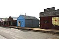
Cherokee is an unincorporated community in San Saba County in western Central Texas. [1] According to the Handbook of Texas , the community had an estimated population of 175 in 2000. [2]

Contents

Geography

Cherokee is located at the junction of State Highway 16 and RM 501 in southern San Saba County, about 15 miles south of San Saba and 18 miles north of Llano. [3]

History

Named for nearby Cherokee Creek, the community was established in the early 1850s, when P.P. "Pop" Woodard settled at a site five miles west of the present location. [2] A post office opened in 1858 and changed its location several times before ending up in James Samuel Hart's store in July 1879. The permanent town site was laid out by David Seth Hanna in 1878. The community had an estimated population of 500 by the mid-1890s and supported several businesses. The community population was approximately 250 during the 1920s and had a bank and two newspapers. With no rail connection, Cherokee remained small and the number of residents held steady at around 250 throughout most of the 20th century. [3] That figure had fallen to 175 by 1990 and remained at that level in 2000. Farmers raised sheep, poultry, and pecans. [2]

Today, the community has a post office (zip code: 76832), [4] a general store, and a volunteer fire department. Ranching and hunting are the primary business activities in the area. During the fall, seasonal hunting brings in additional revenue that supports a feed store, as well as taxidermy and restaurant operations. The Cherokee Home for Children, a non-profit Christian-based basic-care residential children's facility, is located just north of the community.

On June 12, 2009, two tornadoes struck Cherokee. Several tree limbs were knocked off and a few oak trees were snapped. [5]

Education

Cherokee became a county center of higher education when Francis Marion Behrns established the Cherokee Academy in 1894. Two years later, the name was changed to West Texas Normal and Business College. [6] A building that originally belonged to the college was purchased from Behrns on April 4, 1911, to house Cherokee Junior College. [7] In 1921, it was sold to the county school district to serve as a high school. [3] Cherokee High School's main building was destroyed in a 1945 fire. It was rebuilt using the original facade. [2]

Public education in the community of Cherokee is provided by the Cherokee Independent School District. The district has one campus, Cherokee School, that serves students in grades kindergarten through 12.

Climate

The climate in this area is characterized by hot, humid summers and generally mild to cool winters. According to the Köppen climate classification system, Cherokee has a humid subtropical climate, Cfa on climate maps. [8]

Notable people

Related Research Articles

<span class="mw-page-title-main">London, Texas</span> Place in Texas, United States

London is an unincorporated community in northeast Kimble County, Texas, United States. According to the Handbook of Texas, the community had an estimated population of 180 in 2000.

<span class="mw-page-title-main">San Saba County, Texas</span> County in Texas, United States

San Saba County is a county located on the Edwards Plateau in western Central Texas, United States. As of the 2020 census, its population was 5,730. Its county seat is San Saba. The county is named after the San Saba River, which flows through the county.

<span class="mw-page-title-main">Sarita, Texas</span> County seat & Unincorporated community in Texas, United States

Sarita is a census-designated place (CDP) in, and the county seat of Kenedy County, Texas, United States. It is the only settlement of note in the county, and as of the 2010 census had a population of 238. Sarita has been ranked the most politically liberal town in Texas.

Vanderpool is a small unincorporated community in Bandera County in the Texas Hill Country, which is part of the Edwards Plateau. It is considered part of the San Antonio Metropolitan Statistical Area. Although it is unincorporated, Vanderpool has a post office, with the ZIP code of 78885. According to the Handbook of Texas, Vanderpool had a population of 22 in 1990. Hunting, ranching and tourism are prime contributors to the regional economy.

Wadsworth is an unincorporated community in Matagorda County, Texas, United States. According to the Handbook of Texas, the community had an estimated population of 180 in 2000.

<span class="mw-page-title-main">Neches, Texas</span> Unincorporated community in Texas, United States

Neches is an unincorporated community in east central Anderson County, in the U.S. state of Texas. According to the Handbook of Texas, the community had a population of 175 in 2000. It is located within the Palestine, Texas micropolitan area.

Veribest is an unincorporated community in Tom Green County, Texas, United States. According to the Handbook of Texas, the community had an estimated population of 40 in 2000. It is part of the San Angelo, Texas, Metropolitan Statistical Area.

Talpa is an unincorporated community in Coleman County, Texas, United States. According to the Handbook of Texas, the community had an estimated population of 127 in 2000.

<span class="mw-page-title-main">Star, Texas</span> Unincorporated community in Texas, United States

Star is an unincorporated community in Mills County in Central Texas, United States. According to the Handbook of Texas, the community had an estimated population of 85 in 2000.

May is an unincorporated community in Brown County, Texas, United States. According to the Handbook of Texas, the community had an estimated population of 285 in 2000. May was designated a Recorded Texas Historic Landmark in 1981, with marker number 5377. In 2001, historical marker 12532 was added for May United Methodist Church, commemorating the church's presence in the community for over 100 years. The May Cemetery was designated a Historic Texas Cemetery in 2016.

Medina is an unincorporated community in Bandera County, Texas, United States. It is part of the San Antonio Metropolitan Statistical Area. Medina is famous for its apples. The community's population was estimated to be 515 in 2000.

Pontotoc is an unincorporated community on Pontotoc Creek, in northeastern Mason County, Texas, United States. The community is located at the junction of State Highway 71 and Ranch to Market Road 501.

<span class="mw-page-title-main">Lajitas, Texas</span> Unincorporated community in Texas, United States

Lajitas is an unincorporated community in Brewster County, Texas, United States, near the Big Bend National Park. According to the Handbook of Texas, the community had a population of 75 in 2010.

<span class="mw-page-title-main">Umbarger, Texas</span>

Umbarger is an unincorporated community and census-designated place in Randall County, Texas, United States. According to the Handbook of Texas, the community had an estimated population of 327 in 2000. The community is part of the Amarillo, Texas Metropolitan Statistical Area.

<span class="mw-page-title-main">DeBerry, Texas</span>

DeBerry is an unincorporated community in Panola County, Texas, United States. The community has an estimated population of 3,305.

Wingate is an unincorporated community in Runnels County, Texas, United States. According to the Handbook of Texas, the community had an estimated population of 216 in 1990 and 132 in 2000.

Flomot is an unincorporated community in Motley County, Texas, United States. According to the Handbook of Texas, the community had an estimated population of 181 in 2000.

Garwood is an unincorporated community in Colorado County, Texas, United States. It is located on State Highway 71 at virtually the geographic midpoint between Columbus, Texas and El Campo, Texas. Nearly 1,000 people lived in Garwood in 2000.

Judson is an unincorporated community in Gregg County, Texas, United States. According to the Handbook of Texas, the community had an estimated population of 650 in 2000. It is part of the Longview, Texas Metropolitan Statistical Area.

<span class="mw-page-title-main">Morris Ranch, Texas</span> Ghost town in Texas, United States

Morris Ranch is a ghost town, located 8.5 miles (13.7 km) southwest of Fredericksburg in Gillespie County, in the U.S. state of Texas. The area was begun as a thoroughbred horse ranch by New Yorker Francis Morris in 1856, and the town grew up around it. In 1962, the school district was merged with Fredericksburg Independent School District, and the Morris Ranch school ceased operations. The Morris Ranch school was designated a Recorded Texas Historic Landmark in 1980, Marker number 10086. The school was added to the National Register of Historic Places listings in Texas, on March 29, 1983, NRHP Reference #:83003142.

References

  1. 1 2 U.S. Geological Survey Geographic Names Information System: Cherokee, Texas
  2. 1 2 3 4 "Cherokee, Texas". The Handbook of Texas online. Retrieved October 4, 2009.
  3. 1 2 3 "Cherokee, Texas". Texas Escapes Online Magazine. Retrieved October 4, 2009.[ dead link ]
  4. Zip Code Lookup Archived 2011-06-15 at the Wayback Machine
  5. SPC Storm Reports for June 12, 2009, NWS Memphis, NWS Norman, NWS Little Rock, NWS Dallas-Fort Worth (PNS), NCDC Storm Data|}
  6. "West Texas Normal and Business College". The Handbook of Texas online. Retrieved October 4, 2009.
  7. "Cherokee Junior College". The Handbook of Texas online. Retrieved October 4, 2009.
  8. Climate Summary for Cherokee, Texas
  9. Keates, Nancy (November 5, 2010). "Inside Kelcy Warren's Dallas Mansion - WSJ". Online.wsj.com. Retrieved November 7, 2015.
  10. "Kuykendall Will Speak". The Jackson Sun. May 13, 1969. p. 7. Archived from the original on December 26, 2019 via Newspapers.com.
  11. "Biography Dr. Ronnie W. Floyd" (PDF). Ronnie Floyd. Archived from the original (PDF) on July 15, 2011. Retrieved August 20, 2010.