Uniontown is a city in Perry County, Alabama, in west-central Alabama. As of the 2020 census, the population of the city is 2,107, up 18.7% over 2010. Of the 573 cities in Alabama, Uniontown is the 207th most populous.

Cannelton is a city in Troy Township, Perry County, in the U.S. state of Indiana, along the Ohio River. The population was 1,563 at the 2010 census. Cannelton, which was the smallest incorporated city in the state until 2010, was formerly the county seat of Perry County until the seat was relocated to Tell City.

Mardela Springs is a town in Wicomico County, Maryland, United States. The population was 356 at the 2020 census. It is included in the Salisbury, Maryland-Delaware Metropolitan Statistical Area.

Abercrombie is a city in Richland County, North Dakota, United States. The population was 244 at the 2020 census. Abercrombie was founded in 1884.

Hankinson is a city in Richland County, North Dakota, United States. The population was 921 at the 2020 census. Hankinson was founded in 1886. It is part of the Wahpeton, ND–MN Micropolitan Statistical Area.

Lidgerwood is a city in Richland County, North Dakota, United States. The population was 600 at the 2020 census. Lidgerwood was founded in 1886. It is part of the Wahpeton, ND–MN Micropolitan Statistical Area.

Richland is a city in Baker County, Oregon, United States. The population was 156 at the 2010 census.

Converse is a city in Bexar County, Texas, United States, 15 miles (24 km) northeast of downtown San Antonio. As of the 2020 census, it had a population of 27,466. It is part of the San Antonio Metropolitan Statistical Area.

Bertram is a city in Burnet County, Texas, United States. The population was 1,764 at the 2021 estimate.

Santa Anna is a town in Coleman County in Central Texas, United States. Its population was 1,014 at the 2020 census.

Paint Rock is a town in and the county seat of Concho County, Texas, United States. The population was 237 at the 2020 census.

Trenton is a city in Fannin and Grayson counties, Texas, United States. The population is currently 854.

Lampasas is a city in Lampasas County, Texas, United States. Its population was 7,291 at the 2020 census. It is the seat of Lampasas County.

Kerens is a city in Navarro County, Texas, United States. The population was 1,505 at the 2020 census.

Richland is a town in Navarro County, Texas, United States. The population was 255 at the 2020 census.

Taft is a city in San Patricio County, Texas, United States. The population was 2,801 at the 2020 census.

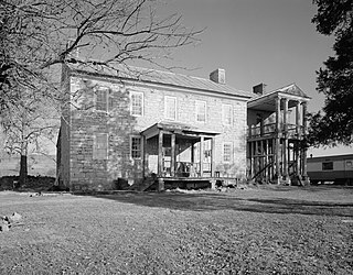
Glen Rose is a city in and the county seat of Somervell County, Texas, United States. As of the 2020 census, the city population was 2,659.
Falling Spring is a town in Greenbrier County, West Virginia, United States. It is also known as Renick from the name of its post office. The population was 171 at the 2020 census.

Lone Rock is a village in Richland County, Wisconsin, United States. The population was 888 at the 2010 census. The village is named after a sandstone outcrop.

Evant is a town in Coryell and Hamilton counties in central Texas, United States. The population was 426 at the 2010 census. The Coryell County portion of Evant is part of the Killeen–Temple–Fort Hood Metropolitan Statistical Area.