Related Research Articles

Mount Erebus is the southernmost active volcano on Earth, located on Ross Island in the Ross Dependency in Antarctica. With a summit elevation of 3,792 metres (12,441 ft), it is the second most prominent mountain in Antarctica and the second-highest volcano in Antarctica. It is the highest point on Ross Island, which is also home to three inactive volcanoes: Mount Terror, Mount Bird, and Mount Terra Nova. It makes Ross Island the sixth-highest island on Earth.

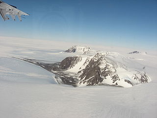
The Nimrod Glacier is a major glacier about 85 nautical miles long, flowing from the polar plateau in a northerly direction through the Transantarctic Mountains into the Ross Ice Shelf, Antarctica.
The Geologists Range is a mountain range about 55 km (34 mi) long, standing between the heads of Lucy and Nimrod Glaciers in Antarctica. Seen by the northern party of the New Zealand Geological Survey Antarctic Expedition (NZGSAE) (1961–62) and named to commemorate the work of geologists in Antarctic exploration. The Churchill Mountains are to the north, the Queen Elizabeth Range to the east and the Miller Range to the southeast

The Shackleton Range is a mountain range in Antarctica that rises to 1,875 metres (6,152 ft) and extends in an east–west direction for about 100 miles (160 km) between the Slessor and Recovery Glaciers.
The Thiel Mountains are isolated, mainly snow-capped mountains of the Transantarctic Mountains System, located in the Ellsworth Land region of Antarctica. The mountain range is 45 nautical miles long, is located roughly between the Horlick Mountains and the Pensacola Mountains, and extends from Moulton Escarpment on the west to Nolan Pillar on the east. Major components include Ford Massif, Bermel Escarpment and a group of eastern peaks near Nolan Pillar.
The Reedy Glacier is a major glacier in Antarctica, over 100 nautical miles long and 6 to 12 nautical miles wide, descending from the polar plateau to the Ross Ice Shelf between the Michigan Plateau and Wisconsin Range in the Transantarctic Mountains. It marks the limits of the Queen Maud Mountains on the west and the Horlick Mountains on the east.
The Tapley Mountains is a range of mountains fronting on the eastern side of the Scott Glacier, extending eastward for 35 nautical miles between Leverett Glacier and Albanus Glacier in the Queen Maud Mountains of Antarctica.
Odom Inlet is an ice-filled inlet 9 nautical miles long, between Cape Howard and Cape MacDonald along the east coast of Palmer Land, Antarctica.
Minna Bluff is a narrow, bold peninsula, 25 nautical miles long and 3 nautical miles wide, projecting southeast from Mount Discovery into the Ross Ice Shelf, Antarctica. It was discovered by the British National Antarctic Expedition (1901-04) which named it for Minna, the wife of Sir Clements Markham, the "father" of the expedition. It culminates in a south-pointing hook feature, and is the subject of research into Antarctic cryosphere history, funded by the National Science Foundation, Office of Polar Programs.

Shotton Snowfield is a large snowfield between Herbert Mountains and Pioneers Escarpment on the north and Read Mountains on the south, in the Shackleton Range of Antarctica.
All-Blacks Nunataks is a group of conspicuous nunataks lying midway between Wallabies Nunataks and Wilhoite Nunataks at the southeast margin of the Byrd Névé in Antarctica. Named by the New Zealand Geological Survey Antarctic Expedition (1960–61) after the well-known New Zealand national rugby union team.
Aronson Corner is the cliffed extremity of a snow-capped ridge between Mummery Cliff and Chevreul Cliffs in Pioneers Escarpment, Shackleton Range. It was photographed from the air by the U.S. Navy, 1967, and surveyed by the British Antarctic Survey, 1968–71. In association with the names of pioneers of polar life and travel, it was named by the United Kingdom Antarctic Place-Names Committee after Louis V. Aronson, American founder of the Ronson Corporation, who in about 1910 developed the first practical petrol lighter, known originally as the "trench match."
Clarkson Cliffs are ice-covered cliffs marked by rock exposures, rising to 1,400 metres (4,600 ft) at the northeast edge of Fuchs Dome, Shackleton Range. They were photographed from the air by the U.S. Navy, 1967, and surveyed by the British Antarctic Survey (BAS), 1968–71. They were named by the UK Antarctic Place-Names Committee after Peter D. Clarkson, BAS geologist, Halley Research Station, 1968–70, who worked in the area for four seasons, 1968–71, 1977–78; Head, BAS Mineralogy, Geology and Geochemistry Section, 1976–89; at Scott Polar Research Institute from 1989.
Mummery Cliff is a cliff situated in Antarctica rising to about 1,250 m to the southeast of Whymper Spur in the Pioneers Escarpment, Shackleton Range. In association with the names of pioneers of polar life and travel grouped in this area, named by the United Kingdom Antarctic Place-Names Committee (UK-APC) in 1971 after Albert F. Mummery (1855–95), English mountaineer and designer of the Mummery tent.
Mount Dewar is a mountain rising to about 1,600 metres (5,200 ft) to the southwest of Aronson Corner in the Pioneers Escarpment, Shackleton Range. It was photographed from the air by the U.S. Navy in 1967 and surveyed by the British Antarctic Survey from 1968 to 1971. In association with the names of pioneers of polar life and travel grouped in this area, it was named in 1971 by the UK Antarctic Place-Names Committee after Sir James Dewar, a Scottish chemist and physicist who invented the thermos flask about 1892.
Pioneers Escarpment is a mostly snow-covered north-facing escarpment in Antarctica, interrupted by occasional bluffs and spurs, between Slessor Glacier on the north and Shotton Snowfield on the south, in the Shackleton Range.

Polar Club Glacier is a broad glacier east-northeast of Stranger Point, King George Island, in Antaratica. South of it is Bransfield Strait. Named by the Polish Antarctic Expedition, 1980, after the Polish Polar Club.
Sauria Buttress is a rock buttress situated in Coats Land, Antarctica, rising to about 1,300 m lying to the southeast of Lundstrom Knoll in Pioneers Escarpment, Shackleton Range. The buttress was photographed from the air by the U.S. Navy in 1967. Surveyed by the British Antarctic Survey from 1968 to 1971. In association with the names of pioneers of polar life and travel grouped in this area, named by the United Kingdom Antarctic Place-Names Committee in 1971 after Charles-Marc Sauria, French inventor of the first practical friction match in 1831.
Stephenson Bastion is a mountain massif with steep rock cliffs on its south side, rising to 1,850 metres (6,070 ft) in the south-central part of the Shackleton Range. It was first mapped in 1957 by the Commonwealth Trans-Antarctic Expedition, and it was photographed by U.S. Navy aircraft in 1967. It was named by the United Kingdom Antarctic Place-Names Committee (UK-APC) for Philip J. Stephenson, an Australian geologist with the transpolar party of the CTAE in 1956–58.
Lundström Knoll is a rock knoll rising to about 1,400 metres (4,600 ft) to the northeast of the Chevreul Cliffs in Pioneers Escarpment, Shackleton Range, Antarctica. It was photographed from the air by the U.S. Navy, 1967, and surveyed by the British Antarctic Survey, 1968–71. The knoll was named by the UK Antarctic Place-Names Committee in association with the names of pioneers of polar life and travel grouped in this area, after Johan E. Lundström, the Swedish inventor of the first true "strike-on-box safety match" in 1855.
References
 This article incorporates public domain material from "Chevreul Cliffs". Geographic Names Information System . United States Geological Survey.

| | This Coats Land location article is a stub. You can help Wikipedia by expanding it. |