This article needs additional citations for verification .(January 2025) |
Chiautla | |
|---|---|
Town and municipality | |
 Coat of arms | |
 | |
 Chiautla  Chiautla | |
| Coordinates: 19°34′00″N98°52′48″W / 19.56667°N 98.88000°W | |
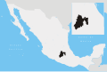
| Country | Mexico |
| State | State of Mexico |
| Founded | 12th century AD |
| Population (2020) | |
• Total | 30,045 |
| Time zone | UTC-6 (Zona Centro) |
| Website | chiautlaedomex.gob.mx |
Chiautla is a settlement in the State of Mexico in Mexico. It serves as the municipal seat for the surrounding small municipality of the same name. It is located in the north-east of the state.
In the 2020 Census, the municipality reported a population of 30,045, up 14.7% from the 2010 figure. [1] The sources disagree on its surface area, with figures of between 20.13km2 and 30.32km2 being given. [2]
The settlement was founded by Toltec–Chichimeca settlers in the 12th century AD. [2]