Tonanitla | |
|---|---|
 | |
| Coordinates: 19°41′17″N99°03′14″W / 19.68806°N 99.05389°W | |
| Country | |
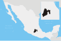
| State | Mexico (state) |
| Municipal Seat | Santa María Tonanitla |
| Created | July 25, 2003 |
| Population (2020) | |
• Total | 14,883 |
| Time zone | UTC-6 (Central Standard Time) |
Tonanitla is one of 125 municipalities in Mexico State in Mexico. It is municipal seat is the town of Santa Maria Tonanitla. It is a new municipality created in 2003. [1]