Zacazonapan

Last updated
Zacazonapan
Coordinates: 19°04′22″N100°15′18″W / 19.07278°N 100.25500°W / 19.07278; -100.25500 Coordinates: 19°04′22″N100°15′18″W / 19.07278°N 100.25500°W / 19.07278; -100.25500
Country Mexico
State State of Mexico
Municipal SeatZacazonapan
Government
  Municipal presidentJosé Luis Narciso Cabrera (2006-2009) (PAN)
Time zone UTC-6 (CST)
  Summer (DST) UTC-5 (CDT)
Website(in Spanish)

Zacazonapan (pronounced sah-kah-soh-NAH-pahn) is a municipality near Mexico City. It's municipal seat is the village of Zacazonapan. The name comes from Nahuatl and roughly translates to "in the River of the Dry Corn plants" [1]

Contents

The village

The area was settled by the Matlatzincas who were conquered by the Aztecs, making the area a border zone between the Aztec Empire and Purépecha lands. After the fall of the Aztec Empire by the Spaniards, the area was subdued by Andrés de Tapia and Gonzalo de Sandoval. They, among other conquistadors they exploited the area's mineral deposits making it part of the “Real de Minas de Temascaltepec” (today Valle de Bravo). Large haciendas dedicated to growing crops and raising cattle were established here as well. Evangelization was carried out by Franciscans, who were followed by Spanish families bringing sugar cane and fruit trees to plant. In 1521, Zacazonapan was included in the Indian Republic of Tmascaltepec. The modern village of Zacazonapan has its roots in a hacienda known as Santa Maria. It was very important to the development of the area because of the irrigation system it constructed on its lands, which constituted much of what is now the municipality. [1]

The village of Zacazonapan originally belonged to the municipality of Otzoloapan. After arriving in the late 19th century, and receiving a warm welcome, General Juan N. Mirafuentes started a movement to make the village a municipal seat separate from Otzoloapan. This was accomplished on April 5, 1879 with C. Juan de Dios Villafaña Salinas as the first municipal president. [1]

The area saw fighting during the Mexican Revolution, but many families hid or moved away during the conflict. During the Cristero War, the area saw fighting as well including the capture and execution of three prominent Cristero priests. [1]

As a municipal seat in the State of Mexico, Zacazonapan was remodeled by Carlos Hank González in 1974. [1]

The population of the modern town as of 2005 was 2,718. [2] The nearby ex-hacienda of Santa Maria, constructed in the 16th century was declared a historic monument by the National Institute of Anthropology and History in 1994 as well as the house of Victoriano Arroyo Garibay, constructed in 1900 due to its architecture. There are also unexplored archeological sites in the surrounding municipality. [1]

The town has a song written about it, written by Rubén Méndez del Castillo, which won second place in a song contest in the state capital of Toluca in 1972. [1]

The municipality

As municipal seat, the village of Zacazonapan is the governing authority for the following communities: Alcantarilla, La Cañada, Naranjo, El Potrero, Santa María, Tizapa, Temascal, Arrastradero, El Puente, El Puerto, and Cerro Pelón along with 15 unnamed settlements. The population of the entire municipality is 3,836. [2]

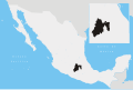
It is bordered by the municipalities of Otzoloapan, Tejupilco Temascaltepec and Valle de Bravo. The municipality has a territory of 67.14 square km. [1]

The municipality borders the edge of the Sierra Madre del Sur giving it an uneven landscape with elevations such as the Cerro(hill) de La Pila, Cerro Sombrero, and Cerro Pelón. However, to the north there are also notable cerros such as El Xomil, Peña Colorada, and Peñas del Fraile. The most important river is the Temascaltepec, because of its year-round flow and as it receives the seasonal flow from arroyos such as the Zacazonapan, La Papaya and San José. There is also a series of freshwater springs. [1]

In the mid 20th century, the economy of the municipality was based on fishing, agriculture and the production of piloncillo, a sugar cane product used for seasoning. Agriculture (corn, tomato and husk tomato) and fish farming are still the main occupations. The only other significant economic activity, providing a significant number of jobs, is realized by Minera Tizapa, S.A. de C.V., which mines zinc, lead and copper, with small amounts of gold and silver. [1]

Related Research Articles

State of Mexico State of central Mexico

The State of Mexico, officially only Mexico, is one of the 32 federal entities of the United Mexican States. Commonly known as Edomex to distinguish it from the name of the whole country, it is the most populous, as well as the most densely populated, state in the country.

Xico is a city in the State of Mexico, Mexico. It serves as the municipal seat of Valle de Chalco municipality, with which it is, for all practical purposes, coterminous. The municipality lies adjacent to the east side of the Federal District and is part of the Mexico City metropolitan area. The city and municipality lie on the old lakebed of Lake Chalco, which was drained like much of the Basin of Mexico. The city name comes from the nearby Xico hill and the name of the municipality comes from the old lake plus a reference to the "Programa Nacional de Solidaridad" which was initiated here. The municipality's glyph and shield make reference to both names. It is a distinct entity from the city and municipality of Chalco, which is nearby. "Chalco" in both names refers to the Chalca tribe that were one of the original inhabitants of the area.

Comala Town & Municipality in Colima, Mexico

Comala is a town and municipality located in the Mexican state of Colima, near the state capital of Colima. It has been nicknamed the “White Village of America” as the facades of the buildings in town have all been painted white since the 1960s. The historic center of the town was declared a Historic Monument Zone and the town became a Pueblo Mágico in 2002. It is the municipal seat of the Comala Municipality, the local governing authority for over 400 other communities, including the former Nogueras Hacienda, the home of artist Alejandro Rangel Hidalgo.

Tenancingo, State of Mexico Municipality in State of Mexico, Mexico

Tenancingo is one of 125 municipalities in the State of Mexico, Mexico. The municipal seat is the town of Tenancingo de Degollado. The municipality is located in the south of the state, in the Tenancingo Valley, just outside the Toluca Valley. The official name of the municipality is only Tenancingo but the town is Tenancingo de Degollado and is often confused with Tenancingo, Tlaxcala, which is a town in a different state.

Valle de Bravo Municipality in Mexico

Valle de Bravo is one of 125 municipalities in State of Mexico, Mexico. The largest town and municipal seat is the town of Valle de Bravo. It is located on the shore of Lake Avándaro, approximately 156 km southwest of Mexico City and west of Toluca on highways 15, 134 or 1. It takes about two hours to drive from Mexico City to Valle de Bravo, making it a popular weekend getaway for the capital's affluent upper class.

Jerécuaro

Jerécuaro is a Mexican city located in the lowlands of the state of Guanajuato. The municipality has an area of 828.3 square kilometres and is bordered to the north by Apaseo el Alto, to the east by Coroneo and the state of Querétaro, to the south by Tarandacuao, to the southwest with Acámbaro, and to the northwest with Tarimoro. The municipality had 55,311 inhabitants according to the 2005 census. The municipal president of Jerécuaro and its many smaller outlying communities is C.Jaime García Cardona.

Tenango del Valle Municipality in State of Mexico, Mexico

The municipality of Tenango del Valle is located in the southern portion of the Valley of Toluca in Mexico State, about 72 km southwest of Mexico City and 25 km south of Toluca. The municipal seat is the city of Tenango de Arista. While the seat is officially named Tenango de Arista, it is more commonly referred to as Tenango del Valle, as this was the original name of the town. Tenango del Valle is best known as the site of the Teotenango archeological site, which was a walled city inhabited from about 900 C.E. to 1550 C.E.

Ixtapan del Oro is a town and municipality in the State of Mexico, in Mexico. The name “Ixtapan” comes from Nahuatl and means 'in the place of little salt'. "del Oro" is Spanish, meaning 'of the gold'. This name was added in 1894 when some veins of gold were found here.

Tlatlaya is one of 125 municipalities of the State of Mexico in Mexico. The municipal seat is the town of Tlatlaya which is the eleventh largest town in the municipality. The word “Tlatlaya” means when the hearth is black and red.

Jiquipilco Municipality is one of the municipalities of the State of Mexico in Mexico. It is north of the Toluca Valley, part of the region consisting of the southern and western slopes of Cerro La Catedral, which has a concentration of speakers of the Otomi language. It is about 40 km from Toluca, the state capital. The name is a corruption of Nahuatl “Xiquipilli”, meaning “the place of saddlebags”. Jiquipilco is situated on the transversal volcanic axis that crosses Mexico in an area surrounded by lakes and volcanoes. This portion is called "Anahuac”.

Huautla de Jimenez is a town and municipality in the Mexican state of Oaxaca. It is part of the Teotitlán District in the north of the Cañada Region.

San Jose Villa de Allende is a town and municipal seat of the municipality of Villa de Allende. It is the fifth largest town in the municipality. It is located 70 kilometers to the west of the city of Toluca. Villa de Allende was named in honor of Ignacio Allende, a hero of the Mexican War of Independence.

Texcaltitlán is a town and a municipality of the State of Mexico in Mexico. It is located 65 km from Toluca on the high plains south of the Nevado de Toluca volcano. The name Texcaltitlán comes from the Nahuatl: texcalli = “rock”; titla= "among", with the complete meaning as “among rocks”.

Otzoloapan Municipality is a municipality located at the southeast of the State of Mexico. The name is from the Náhuatl 'Oceloapan' which means "river of lynxes". It is located in the southwest part of the state bordering the state of Michoacán.

Tejupilco Municipality Municipality in State of Mexico, Mexico

Tejupilco is a municipality in the State of Mexico, Mexico, located approximately 100 kilometres (62 mi) southwest of the state capital Toluca, along Federal Highway 134. Its municipal seat is Tejupilco de Hidalgo. The municipality has a total area of about 1,327 km2 (512 sq mi), with a contrasting topography ranging from deep ravines and canyons to high ridges; the highest elevation within the municipality reaches some 1,117 metres (3,660 ft) asl. The 2005 census recorded a population of 62,547 inhabitants.

Temascalcingo Municipality in State of Mexico, Mexico

Temascalcingo is one of 125 municipalities in the State of Mexico, Mexico. The municipal seat is the town of Temascalcingo de José María Velasco. It is located in the northeast of the state. The temazcal was very common in Temascalcingo. The name Temascalcingo has its roots in Nahuatl. It means place of the little temazcal. The town is one of the "Pueblo con Encanto" of the State of Mexico.

Luvianos is a small town and municipality located in the southwest of the State of Mexico. It gained municipal status in 2000. People can access Luvianos by driving Federal Road 134 south from Toluca, and then take a detour about 25 minutes north of Tejupilco. The name is derived from a hacienda what was established during colonial times.

Amanalco Municipality and town in Mexico, Mexico

Amanalco is a municipality, in Mexico State in Mexico. The municipal seat is the town of Amanalco de Becerra and includes several larger towns including San Juan, San Jerónimo, San Bartolo, and San Mateo. The municipality covers an area of 219.49 km².

Apaxco Municipality and town in Mexico, Mexico

Apaxco is a municipality located in the Zumpango Region in Mexico. The municipal territory is located at a southern pass leading out of the Mezquital Valley about 288 km (179 mi) northeast of the state capital of Toluca. The name Apaxco comes from Nahuatl.

Villa del Carbón Municipality in State of Mexico, Mexico

Villa del Carbón is a municipality located in the northern part of Mexico State, just northwest of Mexico City. While the town and munipal seat of Villa del Carbón is the largest in the municipality, it is not the oldest. The municipality contains a number of villages of Otomí and Nahua origins, in which much of the indigenous culture still survives. The municipality's territory was defined in 1714 when a region known as Chiapan, split into what is now Chapa de Mota and Villa del Carbón. At that time, however, the community which is now a municipal seat did not have an official name; it was known first only by the name of its church Nuestra Señora de la Peña de Francia, and later by being a major supplier of charcoal. This would lead to the name of Villanueva del Carbón de Nuestra Señora Santa María de la Peña de Francia, which eventually shortened to Villa del Carbón. The major portions of the municipality's glyph, which serves as it coat-of-arms, does not reflect the town of Villa del Carbón but rather two of its oldest communities: Taxhimay and San Lorenzo Pueblo Nuevo.

References

  1. 1 2 3 4 5 6 7 8 9 10 "Enciclopedia de los Municipios Estado de Mexico Zacazonapan" . Retrieved 2008-05-15.
  2. 1 2 "Principales resultados por localidad 2005 (ITER)" . Retrieved 2008-03-08.