Acambay

Last updated
Acambay
Town & Municipality
Centro-Acambay.jpg
Mexico States blank map.svg
Red pog.svg
Acambay
Location of the town of Acambay
Coordinates: 19°57′14″N99°50′35″W / 19.95389°N 99.84306°W / 19.95389; -99.84306 Coordinates: 19°57′14″N99°50′35″W / 19.95389°N 99.84306°W / 19.95389; -99.84306
CountryFlag of Mexico.svg  Mexico
State State of Mexico
Municipal Status1824
Government
  Municipal PresidentAriel Peña Colin (2006-2009)
Area
  Municipality492.13 km2 (190.01 sq mi)
Elevation
(of seat)
2,550 m (8,370 ft)
Population
 (2005) Municipality
  Municipality56,847
  Seat
3,724
Time zone UTC-6 (Central (US Central))
  Summer (DST) UTC-5 (Central)
Postal code (of seat)
50301
Website Official site

Acambay is a town and municipio (municipality) located in northern State of Mexico. The township of Acambay is the municipal seat of the municipio of the same name.

Municipalities are the second-level administrative divisions of Mexico, where the first-level administrative division is the state. As of the establishment of two new municipalities in Chiapas in September 2017, there are 2,448 municipalities in Mexico, not including the 16 delegaciones of Mexico City. The internal political organization and their responsibilities are outlined in the 115th article of the 1917 Constitution and detailed in the constitutions of the states to which they belong. Municipalities are distinct from cities, a form of Mexican locality, some municipalities as large as states, while cities can be measured in city blocks.

State of Mexico State of Mexico

The State of Mexico is one of the 32 federal entities of Mexico. It is the most populous, as well as the most densely populated state. It is divided into 125 municipalities and its capital city is Toluca de Lerdo.

Municipal seat term for an administrative center used in several Spanish-speaking countries

A municipal seat or cabecera municipal is an administrative center, seat of government, or capital city of a municipality or civil parish with other villes or towns subordinated. The term is used in Brazil, Colombia, Mexico, Guatemala and Venezuela, countries of Latin-America.

Contents

History

The origins of Acambay date back to the settlement of the area by the Otomis who founded a ceremonial center called Huamango, which was occupied from 850 to 1350. It was the most important cultural center before the rise of the Tula civilization. The area is now known as the San Miguel plateau. While the cause of the center's abandonment is not absolutely known, some legends indicate that it was destroyed by an earthquake, forcing the population to move. The nearby town of Benguitú, which was subsequently named Cabayé or Acambay was founded by the same tribe of Otomis soon after the abandonment of Huamango. [1]

Huamango human settlement in Mexico

Huamango is an early Postclassical archaeological site located about 4 kilometers northwest of the modern city of Acambay in the State of Mexico. The archaeological area is on the San Miguel plateau, in the vicinity of the Peña Picuda hill, at an approximate altitude of 2,850, it is rich in legends, stories and ancestral traditions.

Toltec Pre-columbian civilization

The Toltec culture is an archaeological Mesoamerican culture that dominated a state centered in Tula, Hidalgo, Mexico in the early post-classic period of Mesoamerican chronology. The later Aztec culture saw the Toltecs as their intellectual and cultural predecessors and described Toltec culture emanating from Tōllān[ˈtoːlːaːn] as the epitome of civilization; in the Nahuatl language the word Tōltēcatl[toːlˈteːkat͡ɬ] (singular) or Tōltēcah[toːlˈteːkaʔ] (plural) came to take on the meaning "artisan". The Aztec oral and pictographic tradition also described the history of the Toltec Empire, giving lists of rulers and their exploits.

After the Spanish conquest, the area now known as Acambay was originally entrusted to Capt. Juan Jaramillo de Salvatierra, who belonged to Hernán Cortés's army. Later the area was granted to Don Mateo de San Juan Chimalpopoca Izcóatl of San Miguel Cambay and descendant of Cuauhtémoc. "Acambay" is derived from "San Miguel Cambay". The area was then evangelized by the Franciscans, building the parish church, and the monastery of San Miguel in 1623. [1] The location of the Parroquia de San Miguel (Parish of Saint Michael) has been a church for the town since the 17th century; however, nothing of the original structure remains. In 1912, an earthquake devastated the town, and it, like everything else was completely rebuilt. [2] The fault system that triggered is known as the Acambay-Tixmadejé Fault System.

Hernán Cortés Spanish conquistador

DonHernán Cortés de Monroy y Pizarro Altamirano, Marquis of the Valley of Oaxaca was a Spanish Conquistador who led an expedition that caused the fall of the Aztec Empire and brought large portions of what is now mainland Mexico under the rule of the King of Castile in the early 16th century. Cortés was part of the generation of Spanish colonizers who began the first phase of the Spanish colonization of the Americas.

Cuauhtémoc Tlatoani of Tenochtitlan

Cuauhtémoc was the Aztec ruler (tlatoani) of Tenochtitlan from 1520 to 1521, making him the last Aztec Emperor. The name Cuauhtemōc means "one who has descended like an eagle", and is commonly rendered in English as "Descending Eagle", as in the moment when an eagle folds its wings and plummets down to strike its prey. This is a name that implies aggressiveness and determination.

Franciscans group of religious orders within the Catholic Church

The Franciscans are a group of related mendicant religious orders within the Catholic Church, founded in 1209 by Saint Francis of Assisi. These orders include the Order of Friars Minor, the Order of Saint Clare, and the Third Order of Saint Francis. They adhere to the teachings and spiritual disciplines of the founder and of his main associates and followers, such as Clare of Assisi, Anthony of Padua, and Elizabeth of Hungary, among many others.

Aside from the town church, the Otomi Ceremonial Center is without a doubt the most important venue in Acambay; it is influenced by Mexica and Toltec prehispanic cultures. It is located in the "Casa de Cultura Dr. Maximiliano Ruiz Castañeda" [1]

Mexica indigenous people of the Valley of Mexico

The Mexica (Nahuatl: Mēxihcah, Nahuatl pronunciation: [meːˈʃiʔkaʔ] or Mexicas were a Nahuatl-speaking indigenous people of the Valley of Mexico who were the rulers of the Aztec Empire. This group was also known as the Culhua-Mexica in recognition of its kinship alliance with the neighboring Culhua, descendants of the revered Toltecs, who occupied the Toltec capital of Tula from the tenth through twelfth centuries. The Mexica were additionally referred to as the "Tenochca", a term associated with the name of their altepetl, Tenochtitlan, and Tenochtitlan's founding leader, Tenoch. The Mexica established Mexico Tenochtitlan, a settlement on an island in Lake Texcoco. A dissident group in Mexico-Tenochtitlan separated and founded the settlement of Mexico-Tlatelolco with its own dynastic lineage. The name Aztec was coined by Alexander von Humboldt who combined "Aztlan", their mythic homeland, and "tec ", 'people of'. The term Aztec is often used very broadly to refer not only to the Mexica, but also to the Nahuatl-speaking peoples or Nahuas of the Valley of Mexico and neighboring valleys.

The municipality

As municipal seat, the town of Acambay has governmental jurisdiction over the following communities:

Agostadero (San José Agostadero), Agua Limpia, Barrancas, Barrio de Candeje, Boshi Chiquito, Boshi Grande, Boshindo, Boti (Boti Agostadero), Botidi, Bovini, Buenavista, Cañada del Gallo, Cerrito de Tixmadeje, Chanteje, Conejeras, Dateje, Deshpe, Detiña (San Antonio Detiña), Detiña Ejido, Dongu (Dongu Centro), Dongu Barrio Dos, Dongu Barrio Uno, Dongu Puerto, Doxteje Barrio Dos, Doxteje Barrio Primero, Doxteje Centro, Ejido Tixmadeje, El Capulín (Barrio el Capulín la Loma), El Ermitaño, El Fresadero, El Medrano, El Pedregal Tixmadeje, Endeje, Esdoca, Gando, Ganzda, Hacienda Toto, Hondiga, Juando, La Caridad, La Cumbre, La Estancia Sector Dos, La Estancia Sector Uno (La Estancia), La Florida, La Huerta, La Laguna, La Loma (Santa María la Loma), La Manga, La Nopalera, La Palma, La Providencia Doxteje, La Soledad, La Teresa (Santa Teresa), La Terquedad, La Venta (Barrio la Venta), Las Arenas (San Agustín), Las Chivas (El Cerro), Las Golondrinas, Las Mangas, Las Pomas Ejido de Dateje, Las Trojes, Loma de Emmedio, Loma de San Ángel, Loma del Fresno, Loma Linda, Los Charcos, Los Pilares, Los Sauces, Los Toriles, Mado Sector Dos, Mado Sector Uno, Muyteje, Pathé, Pueblo Nuevo, Puentecillas, Rancho Castilla de las Águilas, Rancho la Venta, Rancho Lucero, Rincón de Juando, San Agustín la Loma, San Antonio las Palmas, San Francisco Shaxni, San Francisco Shaxni Ejido, San Ildefonso (San Ildefonso Yolotepec), San José Bocto, San Juanico Sector Dos, San Juanico Sector Uno, San Nicolás Acambay, San Pedro de los Metates, Santa María las Arenas, Santa María las Arenas Dos, Tixmadeje Barrio Dos, Tixmadeje Chiquito, Tixmadeje Grande (Santa María Tixmadeje). The total population of the municipality is 56,849. [3]

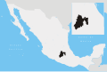
It borders the state of Querétaro and Aculco to the north, to the east with Aculco and Timilpan, to the south with Timilpan, Atlacomulco and Temascalcingo, and to the west with Temascalcingo and the state of Querétaro. The municipality covers an area of 492.13 square kilometres (190.01 sq mi), representing 2.21% of the state's territory. [1]

Querétaro State of Mexico

Querétaro, officially the Free and Sovereign State of Querétaro, is one of the 32 federal entities of Mexico. It is divided into 18 municipalities. Its capital city is Santiago de Querétaro.

Aculco Town and municipality in State of Mexico, Mexico

Aculco de Espinoza is a town and the seat of the municipality called Aculco in Mexico State.

Timilpan is a town and municipality in Mexico State in Mexico. The municipality covers an area of 179.82 km².

The area is quite irregular, with hills, and steep mountainous formations, deep gullies and valleys. The mountains and plateaus occupy nearly two thirds of the total area of the municipality. Some of the most significant mountains include Las Palomas, El Colmilludo, San Antonio, Dongú, La Cumbre, and La Manga. The major river is called Las Adjuntas. [1]

Farming is the most important activity in the municipality. The main crops are corn, potatoes, oats, beans, and vegetables. Almost every community raises domestic farm animals like cattle, horses, goats and pigs. Retail business is another economic activity including corner stores, open air markets, pharmacies, clothing stores, shoe stores, furniture shops, retail stores, fruit and vegetables stands. [4]

There are 8,100 speakers of Otomi and Náhuatl, most of whom are located in ethnic communities outside the municipal seat, representing only 30% of the total population. The rest are monolingual Spanish speakers. [3]

The municipality provides education to a total of 16,724 students at different levels of education imparted by 808 teachers in 222 schools.

The literacy rate has increased in recent years with 78% of the total population over 15 years able to read. It is predicted that this percentage will increase to 90%. [1]

Of the total population residing in the town, 2.04% receive medical services by the IMSS, 27.73% from ISSSTE and 3.92% by ISSEMYM. The remaining 66.32% receive care from the private and public health as ISEM and DIFEM. [1]

These are some of the regional holidays and celebrations:

Related Research Articles

Almoloya de Juárez Town & Municipality in State of Mexico, Mexico

Almoloya de Juárez is a town in the State of Mexico and the seat of the municipality of Almoloya de Juárez. The name Almoloya comes from the Nahuatl, that is properly Almoloyan, composed of: atl, "water"; molo "impersonal voice of moloni, to flow the source" and yan, "place"; that it means "place where flows the water source".

Ixtapaluca Town & Municipality in State of Mexico, Mexico

Ixtapaluca is a city and a municipality in the eastern part of the State of Mexico in Mexico. It lies between the Federal District and the western border of the state of Puebla. The name Ixtapaluca means "Where the salt gets wet".

Ciudad Nicolás Romero Town & Municipality in State of Mexico ----, Mexico

Ciudad Nicolás Romero is the largest city and municipal seat of the municipality of Nicolás Romero in State of Mexico, Mexico. It is located 58 km from the city of Toluca, the state capital and lies in the north-central part of the state, just northwest of the Federal District. The seat/municipality's current name is to honor Nicolás Romero, who fought for Benito Juárez during the Reform War and the French intervention in Mexico. He was executed there by the French. The town adopted this name in 1898. The area was settled by the Otomi and named Azcapotzaltongo by the Aztecs after conquering it. During colonial times, it was known as San Pedro Azcapotzaltongo. It was then called Monte Bajo from 1821 to 1898, when the current name was adopted. Both the municipality and city are commonly referred to as Nicolás Romero.

Huixquilucan de Degollado Municipality in State of Mexico, Mexico

Huixquilucan Municipality is one of the municipalities in State of Mexico, Mexico. It lies adjacent to the west side of the Federal District and is part of Greater Mexico City but independent of. The name "Huixquilucan" comes from Nahuatl meaning, "place full of edible thistles."

Jiquipilco Municipality in State of Mexico, Mexico

Jiquipilco Municipality is one of the municipalities of the State of Mexico in Mexico. It is north of the Toluca Valley, part of the region consisting of the southern and western slopes of Cerro La Catedral, which has a concentration of speakers of the Otomi language. It is about 40 km from Toluca, the state capital. The name is a corruption of Nahuatl “Xiquipilli”, meaning “the place of saddlebags”. Jiquipilco is situated on the transversal volcanic axis that crosses Mexico in an area surrounded by lakes and volcanoes. This portion is called "Anahuac”.

Chapa de Mota Town & Municipality in State of Mexico, Mexico

Chapa de Mota is a village and municipality located in the northwest of Mexico State. It is located in the north part of the State of Mexico. It is 2 hours away by car from Mexico City.

San Jose Villa de Allende is a town and seat of the municipality of Villa de Allende located 70 kilometers to the west of the city of Toluca. Villa de Allende was named in honor of Ignacio Allende, a hero of the Mexican War of Independence.

Texcaltitlán Town & Municipality in State of Mexico, Mexico

Texcaltitlán is a town and a municipality of the State of Mexico in Mexico. It is located 65 km from Toluca on the high plains south of the Nevado de Toluca volcano. The name Texcaltitlán comes from the Nahuatl: texcalli = “rock”; titla= "among", with the complete meaning as “among rocks”.

El Oro de Hidalgo Town & Municipality in State of Mexico, Mexico

The name El Oro de Hidalgo, is not from Nahuatl, like most other municipality names in the state, but from Spanish, and simply means "the gold." It has subsequently been given an alternative Nahuatl name of "Teocuitlatl," meaning "sacred excrement," referring to gold. Its seal, in the form of an Aztec glyph, contains elements referring to gold and to caves, of which there are many in the municipality. The municipality is located in the northwest of the State of Mexico, 96 km from the state capital of Toluca, and is bounded by the municipalities of Temascalcingo to the north, Jocotitlán to the east, San Felipe del Progreso and San José del Rincón to the south, and by the state of Michoacán to the west. As of 2005, the municipal seat with the formal name of El Oro de Hidalgo had a population of 5,797, and the municipality of El Oro had a population of 31,847. While it made its name as a major gold and silver mining town from the 17th to the early 20th centuries, the mines have since been tapped out and the town is turning to tourism for economic development.

Ixtlahuaca de Rayón is a city and municipality north of Toluca in the northwest part of the State of Mexico, in Mexico. The distance between Mexico City and Ixtlahuaca is 32 km. The name Ixthahuaca comes from Náhuatl and means plains without trees. The city and municipality were officially established by decree on November 14, 1816 by the Congress of the State of Mexico.

Tejupilco Municipality Municipality in State of Mexico, Mexico

Tejupilco is a municipality in the State of Mexico, Mexico, located approximately 100 kilometres (62 mi) southwest of the state capital Toluca, along Federal Highway 34. Its municipal seat is Tejupilco de Hidalgo. The municipality has a total area of about 1,327 km2 (512 sq mi), with a contrasting topography ranging from deep ravines and canyons to high ridges; the highest elevation within the municipality reaches some 1,117 metres (3,660 ft) asl. The 2005 census recorded a population of 62,547 inhabitants.

Temascalcingo Town & Municipality in State of Mexico, Mexico

Temascalcingo de José María Velasco is a town and seat of the municipality of Temascalcingo in the State of Mexico, Mexico. It is located in the northeast of the state. The temazcal was very common in Temascalcingo. The name Temascalcingo has its roots in Nahuatl. It means place of the little temazcal. The town is one of the "Pueblo con Encanto" of the State of Mexico.

Putla Villa de Guerrero Place in Oaxaca, Mexico

Putla Villa de Guerrero or simply Putla, is a town and municipality in the State of Oaxaca, Mexico. It is part of Putla District in the west of the Sierra Sur Region.

Tepetlaoxtoc de Hidalgo is a town and the seat of the municipality of Tepetlaoxtoc, which contains the archeological site of Tepetlaoxtoc, in the State of Mexico in Mexico. The name Tepetlaoxtoc comes from Náhuatl and means in limestone caves, and is used interchangeably to refer to the town, the municipality and the archeological ruins. 'de Hidalgo' was added to the town's name to honor Miguel Hidalgo who began the Mexican War of Independence. It is located about 100 km northeast of Mexico City.

Luvianos Town & Municipality in State of Mexico, Mexico

Luvianos is a small town and municipality located in the southwest of the State of Mexico. It gained municipal status in 2000. People can access Luvianos by driving Federal Road 134 south from Toluca, and then take a detour about 25 minutes north of Tejupilco. The name is derived from a hacienda what was established during colonial times.

Tenango del Aire Town & Municipality in State of Mexico, Mexico

Tenango del Aire is a town and municipality located in the southeast portion of the State of Mexico and is about 42 km southeast of Mexico City. The municipality is bordered by Temamatla, Tlalmanalco, Juchitepec, and Ayapango. Despite the fact that this municipality is distinctly rural, it falls within the Mexico City Metropolitan Area. The name “Tenango del Aire” came about in two parts. Originally and until 1890, the town was known as Tenango de Topopula. “Tenango” means “walled in” or “fenced by stones.” The second part is due to visits by President Porfirio Diaz, who commented on the winds that are prevalent here. “del Aire” means “of the air.”

Otumba is a municipio (municipality) of State of Mexico in Mexico. The municipal seat and largest settlement is Otumba de Gómez Farías. The municipality of Otumba has a land area of some 143.42 square kilometres (55 sq mi), and a population recorded in the intermedial 2005 census, the Conteo de Población y Vivienda, of 29,873.

References

  1. 1 2 3 4 5 6 7 8 "Enciclopedia de los municipios de Mexico Estado de Mexico Acambay". Archived from the original on 2007-09-27. Retrieved 2008-03-05.
  2. "Turista Estado de Mexico Acambay" . Retrieved 2008-03-05.
  3. 1 2 "Principales resultados por localidad 2005 (ITER)". Archived from the original on 2011-06-13. Retrieved 2008-03-08.
  4. "mapa digital de mexico". Archived from the original on 2008-02-05. Retrieved 2008-01-29.