Luvianos

Last updated
Luvianos
Town & Municipality
Mexico States blank map.svg
Red pog.svg
Luvianos
Coordinates: 18°55′12″N100°17′54″W / 18.92000°N 100.29833°W / 18.92000; -100.29833 Coordinates: 18°55′12″N100°17′54″W / 18.92000°N 100.29833°W / 18.92000; -100.29833
CountryFlag of Mexico.svg  Mexico
State State of Mexico
Municipal Status2000
Government
  Municipal PresidentAnibal Martinez (2015-present)
Elevation
(of seat)
1,130 m (3,710 ft)
Population
 (2005) Municipality
  Municipality28,215
  Seat
8,146
Time zone UTC-6 (Central (US Central))
  Summer (DST) UTC-5 (Central)
Postal code (of seat)
51440
Website(in Spanish) http://www.luvianos.gob.mx/

Luvianos is a small town and municipality located in the southwest of the State of Mexico. It gained municipal status in 2000. [1] People can access Luvianos by driving Federal Road 134 south from Toluca, and then take a detour about 25 minutes north of Tejupilco. The name is derived from a hacienda what was established during colonial times. [2]

State of Mexico State of Mexico

The State of Mexico is one of the 32 federal entities of Mexico. It is the most populous, as well as the most densely populated state. It is divided into 125 municipalities and its capital city is Toluca de Lerdo.

Toluca City and municipality in Mexico, Mexico

Toluca[toˈluka], officially called Toluca de Lerdo[toˈluka ðe ˈleɾðo], is the state capital of the State of Mexico as well as the seat of the Municipality of Toluca. It is the center of a rapidly growing urban area, now the fifth largest in Mexico. It is located 63 kilometres (39 mi) west-southwest of Mexico City, about 40 minutes by car to the western edge of the city. According to the 2010 census, the city of Toluca has a population of 819,561. The city is the fifth largest in Mexico by population. The municipality of Toluca, along with thirteen other municipalities, make up the metropolitan population of 2,116,506 in Greater Toluca as of 2015, making it the fifth most populous metropolitan area in Mexico.

A hacienda, in the colonies of the Spanish Empire, is an estate, similar to a Roman latifundium. Some haciendas were plantations, mines or factories. Many haciendas combined these activities. The word is derived from the Spanish word "hacer" or "haciendo", which means: to make or be making, respectively; and were largely business enterprises consisting of various money making ventures including raising farm animals and maintaining orchards.

Contents

The town

The town has a total population of 8,146 as of 2005. [3]

One of the popular tourists destinations in Luvianos is the water park "Las Lomas". Many travel for hours to visit this attraction.

Every Tuesday locals and visitors gather around the central business district for shopping at the Plaza.

Like many towns in the region, Luvianos does not have an airport and is therefore accessible only via terrestrial means.

The municipality

The formation of this municipality was long in coming. Residents of the Luvianos ranch area petitioned for such status as early as 1874, again in 1974 but the petition was not granted until it was presented yet again in 2000. [4] The first municipal president did not take power until 2003. [1]

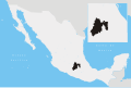
As municipal seat, the town of Luvianos has governing jurisdiction over 235 communities, which are organized into 70 delegations. The municipality encompasses 702.129 km 2 and is bordered by the states of Michoacán to the west and Guerrero to the south, and by the municipalities of Otzoloapan, Zacazonapan, Temascaltepec and Tejupilco. The highest elevations, up to 1,900 meters are in the Sierra de Nanchititla. The Rio de Acatitlan river forms its northern border. [5] Total population of the municipality is 28,213 as of 2005. [3]

Michoacán State of Mexico

Michoacán, formally Michoacán de Ocampo, officially the Free and Sovereign State of Michoacán de Ocampo, is one of the 31 states which, with the Federal District, comprise the 32 Federal Entities of Mexico. The State is divided into 113 municipalities and its capital city is Morelia. The city was named after José María Morelos, one of the main heroes of the Mexican War of Independence.

Guerrero State of Mexico

Guerrero, officially the Free and Sovereign State of Guerrero, is one of the 31 states which, with the Federal District, comprise the 32 Federal Entities of Mexico. It is divided in 81 municipalities and its capital city is Chilpancingo and its largest city is Acapulco.

Otzoloapan Place in Mexico State, Mexico

Otzoloapan Municipality is a municipality located at the southeast of the State of Mexico. The name is from the Náhuatl 'Oceloapan' which means "river of lynxes". It is located in the southwest part of the state bordering the state of Michoacán.

Luvianos, like some nearby towns, are considered to located in the Tierra Caliente.

Tierra Caliente (Mexico)

Tierra Caliente is a cultural and geographical region in southern Mexico that comprises some low-elevation areas of the states of Michoacán, Guerrero and Mexico. As the name suggests, the region is characterized by a hot climate. The overall precipitation is also low - around 600 mm/year, but can be as low as 400 mm in some low-lying areas of Michoacán and Guerrero.

Communities of the municipality of Luvianos

Agua Colorada, El Aguacate, Alborejo (Puerto Alborejo), La Angostura Dos, La Angostura Uno (Cerro de la Angostura Uno), Las Anonas, La Antena (Nariz del Cerro), Arrayán, Los Arrayanes, Los Arrayanes (Los Arrayanes Verdes), Arroyo Seco, Avellaneda, Los Bancos (1), Los Bancos (2), Los Bancos (2), Barranca del Fraile, El Brasil, Buenavista, Caja de Agua (1), Caja de Agua (2), Calabazos (Las Pilas), Calaveras, La Camelina, El Campanario, La Candelaria, La Canoa, Capire, El Capire, El Capire de Acatitlán, Capulín Chico, Carbajales, Carrizal, El Carrizal, Cañada del Campanario, Cañadas de Nanchititla, Ceiba Obscura (Peña del Águila), Cerro de Castelanes, Cerro de la Culebra, Cerro del Agua, Cerro del Venado (Comunidad del Pueblito), El Cerro, La Chaqueta, Ciprianes, El Cirián de Hermiltepec, Colcomeca, Corral del Barro, Corral Nuevo, El Crucillo, Cruz de Clavos, Cruz de Piedra. Cuadrilla de Benítez, Cuadrilla de Sánchez, Cuadrilla de Lopez, Cuahuilote, Cuahuilotes (Cuajilotes), Los Curindales, La Estancia de Nanchititla (La Estancia), Estancia Grande (San José Estancia Grande), El Estanco, Gabazos (El Bagaso), Guayabos (El Guayabo), Hermiltepec (Peña Blanca), Hilamache, Hormigueros, El Huizache, Huiztepec, Iglesia Vieja, Jalpan, Jocoleche, La Laguna (1), La Laguna (2), Las Lajas, Las Lajitas, El Limón (1), El Limón (2), Los Llanitos, Magadán, Majada de los Encinos(Majada de Encinos), El Mamey Acatitlán, Mango Solo, El Manguito, El Manguito (La Parotilla), Mesa Colorada, Mesa de los Espinos (Mesa de las Escobas), Mesa de Nietos, Mesa del Capulín (Mesa de los Nanches), Mesa la Trampa, La Mesa, La Minita, Monte Verde, El Naranjito, El Naranjo, El Naranjo de San Isidro (El Naranjo Primero), Navarrete, Los Ocotes, Ojo de Agua, El Ojo de Agua, Ojo de Agua-Palo Gordo, La Palma, Las Palmas, Palo Gordo, Palo Verde, Palos Prietos, El Paso de Vigas, Las Paredes, La Parota, Las Parotas, Paso de la Arena, Paso del Agua (Cristo Rey), Los Pericones (Ranchería los Pericones), Peña Calva, El Pie de la Loma, Piedra Colorada, Piedra Grande, Los Pinzanes (1), Los Pinzanes (2), Los Piñones (El Sauz), Plan de Chihuahua, El Plátano, Playa el Guayabo, Potrero de Palmarillos, Potrero Vallecitos (El Potrero), El Pueblito (1), El Pueblito (2), El Pueblito (3), Puerta de Golpe, El Puerto de la Sosa, Puerto de los Duraznos, Puerto de los Terreros, Puerto de los Zacatones, Puerto del Higo, Puerto del Salitre, Puerto la Estancia, Pungarancho, El Ranchito (El Limoncito), Rancho Viejo, El Reparo de Nanchititla (El Reparo), Rincón Cruz de Clavos, Rincón de Alambre, Rincón de Arrayanes, Rincón de Ciprianes, Rincón de González, Rincón de Martínez, Rincón de Rodríguez, Rincón de San Lucas, Rincón de Vargas, Rincón del Hilamache, Rincón del Naranjo la Presa, El Rincón Piedra Grande, Río Frío Estancia Grande, El Rodeo, Salitre de Rodríguez, Salitre del Puente (Puente del Salitre), Salitre Piedra Grande, Salitrillo, El Salto de San Jerónimo, San Antonio Luvianos (San Antonio), San Juan Acatitlán (Acatitlán), San Nicolás, San Sebastián (Rincón de San Sebastián), San Simón Piedra Grande (San Simón), Santa Cruz, Santa Rosa-Estancia Grande, Santa Rosa-Hermiltepec, Sauz-Palo Gordo (El Sauz), Sesteadero, Sesteadero de Arriba, El Tanque, El Tecuán, Los Tejocotes, Los Tequereques, Toma de Agua, La Toma, Tremesinos, Tres Encinos, Las Trojas, Trojes, La Unidad (Los Ciruelos)and Vallecitos-Hermiltepec (Vallecito)

Related Research Articles

Santa Bárbara, Honduras Municipality in Santa Bárbara, Honduras

Santa Bárbara is the capital city of the Santa Bárbara Department of Honduras.

Minas de Oro Place in Comayagua, Honduras

Minas de Oro is a municipality in the Honduran department of Comayagua.

Almoloya de Juárez Town & Municipality in State of Mexico, Mexico

Almoloya de Juárez is a town in the State of Mexico and the seat of the municipality of Almoloya de Juárez. The name Almoloya comes from the Nahuatl, that is properly Almoloyan, composed of: atl, "water"; molo "impersonal voice of moloni, to flow the source" and yan, "place"; that it means "place where flows the water source".

San Juan Bautista Tuxtepec Place in Oaxaca, Mexico

San Juan Bautista Tuxtepec, or simply referred to as Tuxtepec, is the head of the municipality by the same name and is the second most populous city of the Mexican state of Oaxaca. It is part of the Tuxtepec District of the Papaloapan Region. As of the 2005 census, the city is home to a population of 94,209 and 144,555 in the municipality, though census data are often under reported for various reasons. The municipality resides in the region called La Cuenca, is located 36 feet above sea level, and occupies an area of approximately 580 square miles (1,500 km2). The city itself is surrounded by the Papaloapan River, and lies a few kilometers south of the Cerro de Oro Dam on its tributary the Santo Domingo River. The municipality is bordered by the state of Veracruz in the north, the municipalities of Loma Bonita to the east and San José Chiltepec to the south. It is almost 100 miles (160 km) to the port of Veracruz, 130 miles (210 km) to Oaxaca City, the state capital, and 310 miles (500 km) to Mexico City.

Jerécuaro municipality in Guanajuato, Mexico

Jerécuaro is a Mexican city located in the lowlands of the state of Guanajuato. The municipality has an area of 828.3 square kilometres and is bordered to the north by Apaseo el Alto, to the east by Coroneo and the state of Querétaro, to the south by Tarandacuao, to the southwest with Acámbaro, and to the northwest with Tarimoro. The municipality had 55,311 inhabitants according to the 2005 census. The municipal president of Jerécuaro and its many smaller outlying communities is C.Jaime García Cardona.

Tlatlaya Place in Mexico State, Mexico

Tlatlaya is a small town and municipality located in the southeast of the State of Mexico in Mexico. The word “Tlatlaya” means when the hearth is black and red.

Acambay Town & Municipality in State of Mexico, Mexico

Acambay is a town and municipio (municipality) located in northern State of Mexico. The township of Acambay is the municipal seat of the municipio of the same name.

San Jose Villa de Allende is a town and seat of the municipality of Villa de Allende located 70 kilometers to the west of the city of Toluca. Villa de Allende was named in honor of Ignacio Allende, a hero of the Mexican War of Independence.

Santo Tomás de los Plátanos Municipality and town in Mexico State, Mexico

Santo Tomás de los Plátanos also known as Nuevo Santo Tomás de los Plátanos is a town and governmental seat of the municipality of Santo Tomás, located in the center-west of Mexico State, in Mexico. It is approximately 185 km from Mexico City, and 107 km from Toluca.

Temascaltepec is a city and seat of the municipality of Temascaltepec located in south of the State of Mexico in Mexico. It is 66 km (41 mi) southeast of Toluca and 140 km (87 mi), from Mexico City. Temascaltepec comes from the Náhuatl "temazcalli," which means "steam bath," and "tepetl," which means "hill." The Matlatzincas named the area "Cocalostoc," which means 'cave of crows'.

Tejupilco Municipality Municipality in State of Mexico, Mexico

Tejupilco is a municipality in the State of Mexico, Mexico, located approximately 100 kilometres (62 mi) southwest of the state capital Toluca, along Federal Highway 34. Its municipal seat is Tejupilco de Hidalgo. The municipality has a total area of about 1,327 km2 (512 sq mi), with a contrasting topography ranging from deep ravines and canyons to high ridges; the highest elevation within the municipality reaches some 1,117 metres (3,660 ft) asl. The 2005 census recorded a population of 62,547 inhabitants.

Ejutla de Crespo Municipality in Oaxaca, Mexico

Ejutla de Crespo is a city and a municipality of the same name, in the central valleys of the Mexican state of Oaxaca. It is part of the Ejutla District in the south of the Valles Centrales Region.

Temascal, Oaxaca Place in Oaxaca, Mexico

Temascal is a town in the Mexican state of Oaxaca which is the seat of the municipality of San Miguel Soyaltepec. It is part of the Tuxtepec District of the Papaloapan Region. The name Soyaltepec means "hill of palm trees" in Náhuatl but the area also carries the Mazatec name of Naxhingee which means “ragged hill”.

Santiago Papasquiaro Municipality Municipality in Durango, Mexico

Santiago Papasquiaro is one of the 39 municipalities of Durango, in north-western Mexico. The municipal seat lies at Santiago Papasquiaro. The municipality covers an area of 7,238.4 km². Santiago Papasquiaro municipality is at an average height of 1,730 m (5,675 ft) over the sea-level. The municipality lies east from Sierra Madre Occidental Mountain Range. It neighbors with other municipalities: Canelas and Tepehuanes municipalities at the north; San Dimas and Otáez, south; Nuevo Ideal to the east, Tamazula to the west and El Oro located northeast.

Junín Department, San Luis Department in San Luis, Argentina

Junín is a Department of San Luis Province, Argentina.

Libertador General San Martín Department, San Luis Department in San Luis, Argentina

Libertador General San Martín is a Department of San Luis Province, Argentina.

East Caracas Municipalities of East Caracas in Miranda, Venezuela

East Caracas generally refers to the eastern portions of Caracas, and may refer specifically to the municipalities from the Metropolitan District of Caracas located in Miranda State: Chacao, Baruta, Sucre, and El Hatillo. It concentrates the 34.8% population of the Metropolitan District of Caracas, and the 21.7% population of the Greater Caracas Area. Caracas Country Club, the richest neighborhood of the city, is located between El Recreo and Chacao districts.

References

  1. 1 2 "Enciclopedia de los Municipios de Mexico - Estado de Mexico - Luvianos". Archived from the original on May 22, 2007. Retrieved 2008-08-20.
  2. "Luvianos-Nomenclatura". Archived from the original on 2008-02-24. Retrieved 2008-08-20.
  3. 1 2 "Principales resultados por localidad 2005 (ITER)". Archived from the original on 2011-06-13. Retrieved 2008-08-20.
  4. "Luvianos-Historia". Archived from the original on 2008-02-24. Retrieved 2008-08-20.
  5. "Luvianos-Medio físico". Archived from the original on 2008-04-11. Retrieved 2008-08-20.