Hueypoxtla Municipality

Last updated
Hueypoxtla
Glifo Hueypoxtla.png
Mexico Estado de Mexico Hueypoxtla location map.svg
Country Mexico
State Mexico State
Municipal seat Hueypoxtla
Population
  Total39,864 [1]
Time zone UTC-6 (CST)
  Summer (DST) UTC-5 (CDT)

Hueypoxtla is a municipality situated in the Zumpango Region, which is located in the northeastern part of the state of Mexico in Mexico. The municipality is positioned at a northern pass that serves as an exit from the Valley of Mexico and Mezquital Valley. The name "Hueypoxtla" originates from Nahuatl and translates to "place of great merchants". [2]

Contents

Geography

Mexico Estado de Mexico Hueypoxtla communities map.svg

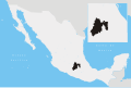
It is located between the parallels 99° 27’ 51” and 99° 37’ 32” west longitude, and 18° 41’ 35” and 18° 55’ 22” north latitude. Hueypoxtla borders Zumpango. It covers a total surface area of 201.54 km2 at an altitude of 6,634 ft. In the 2005 census by INEGI, it reported a population of 39,864. [1]

The municipal seat of Hueypoxtla, governs the following communities or towns: Santa María Ajolopan, San Francisco Zacacalco, Tinguistongo, Guadalupe Nopala, Emiliano Zapata, and Casa Blanca. [3] The municipality borders the municipalities of Apaxco, Tequixquiac, Zumpango, as well as the state of Hidalgo (Tizayuca, Tolcayuca, San Agustín Tlaxiaca, and Ajacuba).

The Río Salado of Hueypoxtla river is connected to the Gran Canal  [ es ]. [4]

While the municipal seat is located in a small, elongated valley, most of the municipality transitions from the Valley of Mexico to the Mezquital Valley. [5] The highest mountain in the area is Picacho in the Sierra Tezontlalpa, rising 2,800 metres (9,200 ft) above sea level. [6] It is situated on the border between the municipalities of Hueypoxtla and Apaxco.

Flora and fauna

Salado river, born in Hueypoxtla. Rio Salado, Hueypoxtla (2).jpg
Salado river, born in Hueypoxtla.

Hueypoxtla is a large municipality that encompasses various geographical features. It includes a portion of the Sierra de Tetzontlalpan  [ es ] , a mountainous region characterized by the presence of oak, yucca, huizache, mesquite and pirul trees. The municipality also has semi-desert plains known as Lomas de España (Spain plains), which are shared with the Zumpango municipality.

The flora in the area consists of fruit trees such as capulin, white zapote, avocado, tejocote, as well as various types of cacti including prickly pears and chollas. During the colonial period, settlers introduced olive trees, pomegranates, figs, and vineyards to the region, taking into account the soil acidity. [7]

As for the fauna, Hueypoxtla is home to a diverse range of animals. Some of the notable species include the cacomistle, skunk, opossum, bobcat, coyote, rabbit, hare, tand a variety of bird species such as the turkey vulture, falcon, eagle, quail, owl, roadrunner and crow. Additionally, the area is inhabited by various types of insects and reptiles. [8]

History

Hueypoxtla has a rich geological and archaeological history. Fossils of plants and animal species from the Cretaceous period have been discovered in the area, indicating its ancient past. While there is no direct evidence of human presence in the municipality, the proximity to Tequixquiac, where significant archaeological findings such as the sacrum bone of Tequixquiac have been made, suggests that humans may have inhabited the region. [9]

Around 1219 the altepetl (city-state) of Hueypoxtla was established by Chichimecas a group of indigenous people. The settlement was founded in a location called Iztatzacuala by a Chichimeca man named Huitzitl. [9] [10] Subsequently, the Nahuas and Otomis, two other indigenous groups, founded Teotlalpan in the same region. It is believed that the name Teotlalpan may have been derived from the lime-rich areas found there, which were used for constructing teocallis , structures used for religious activities in ancient Mesoamerican cultures. [10]

Communication and transport

The Arco Norte is a major highway that runs near Hueypoxtla and connects Atlacomulco to San Martín Texmelucan. Santa María Ajoloapan provides toll access to the highway. [11]

Politics

MayorTime
Diego Vargas Colin20092012
Francisco Santillán Santillán20122015
Adrián Reyes Oropeza2016

Economy

The economy of Hueypoxtla is primarily based on farming, cattle rearing, and small businesses, with a focus on the production of corn, beans, and fruit. The municipality attracts tourists with its favorable climate, notable churches, and ecotourism attractions. Additionally, there is an unexplored archaeological zone in the area.[ citation needed ]

Demography

Populated places in Hueypoxtla

TownPopulation
Total39,864
Santa María Ajoloapan 9,185
San Marcos Jilotzingo 8,523
San Francisco Zacacalco 7,420
Hueypoxtla 3,989
Guadalupe Nopala
San José Bata (Emiliano Zapata)
Tianguistongo
Tezontlalpa de Zapata

Culture

Saint Bartholomew Parish in Hueypoxtla. Hueypoxtla 8.JPG
Saint Bartholomew Parish in Hueypoxtla.

Monuments

Ximbo Ximbo de Hueypoxtla.JPG
Ximbó

People

See also

Related Research Articles

<span class="mw-page-title-main">State of Mexico</span> State of central Mexico

The State of Mexico, officially just Mexico, is one of the 32 federal entities of the United Mexican States. Commonly known as Edomex to distinguish it from the name of the whole country, it is the most populous, as well as the most densely populated, state in the country.

<span class="mw-page-title-main">Cuautitlán Izcalli</span> City & Municipality in State of Mexico, Mexico

Cuautitlán Izcalli is a city and one of the 125 municipalities that make up the State of Mexico. Its municipal seat is Cuautitlán Izcalli. It is located in the Valley of Mexico area, and is part of the Metropolitan area of Mexico City. It borders to the north and northwest with Tepotzotlán, to the northeast and to the east with Cuautitlán, to the south with Tlalnepantla de Baz, to the southeast with Tultitlán, to the southwest with Atizapán de Zaragoza and to the west with the municipality of Nicolás Romero.

<span class="mw-page-title-main">Chalco de Díaz Covarrubias</span> Town and municipality in the State of Mexico

Chalco de Díaz Covarrubias is a city that is municipal seat of the surrounding municipality of Chalco. It lies in the eastern part of the State of Mexico just east of the Federal District of Mexico and is considered part of the Mexico City metropolitan area.

<span class="mw-page-title-main">Zumpango</span> Municipality in State of Mexico, Mexico

Zumpango is a municipality located to northeastern part of the state of Mexico in Zumpango Region. It lies directly north of the Mexico City within the Greater Mexico City urban area. The city of Zumpango lies near Lake Zumpango, the last of the five interconnected lakes which covered much of the Valley of Mexico in the pre Hispanic period. The name Zumpango is derived from the Nahuatl word “Tzompanco” which means string of scalps.

<span class="mw-page-title-main">Atlacomulco</span> Municipality in State of Mexico, Mexico

Atlacomulco is one of 125 municipalities in the State of Mexico located in the northwest of the State of Mexico in central Mexico, 63 kilometres (39 mi) from the state capital of Toluca. The municipal seat is the city of Atlacomulco de Fabela. The name is derived from the Nahuatl phrase "atlacomulli" which means "where there are wells." The city, with a population of 109,384 is surrounded by rural area in which 75% of the rest of the municipality lives. The municipality has a sizable percentage of indigenous language speakers, mostly Mazahua. The Mazahua name for the area is Embaró, which means "colored rock." Agriculture is still the main economic activity, but the development of a number of industrial parks, such as Atlacomulco 2000, which allowed the seat to reach city statues by 1987. Atlacomulco is also the origin of a political organization called the "Atlacomulco Group" made up of powerful political figures who deny its existence.

<span class="mw-page-title-main">Tequixquiac</span> Municipality in State of Mexico, Mexico

Tequixquiac is a municipality located in the Zumpango Region of the State of Mexico in Mexico. The municipality is located 84 kilometres (52 mi) north of Mexico City within the valley that connects the Valley of Mexico with the Mezquital Valley. The name comes from Nahuatl and means "place of tequesquite waters". The municipal seat is the town of Santiago Tequixquiac, although both the town and municipality are commonly referred to as simply "Tequixquiac".

<span class="mw-page-title-main">Toluca</span> State capital in Mexico, Mexico

Toluca, officially Toluca de Lerdo, is the state capital of the State of Mexico as well as the seat of the Municipality of Toluca. Toluca has a population of 910,608 as of the 2020 census. The city forms the core of the Greater Toluca metropolitan area, which with a combined population of 2,347,692 forms the fifth most populous metropolitan area in the country. Located 63 kilometres (39 mi) southwest of Mexico City, the city's rapid growth stems largely from its proximity to the capital.

<span class="mw-page-title-main">Ajacuba</span> Municipality in Hidalgo, Mexico

Ajacuba is a town and one of the 84 municipalities of Hidalgo, in central Mexico. The municipality covers an area of 192.7 km².

<span class="mw-page-title-main">Atotonilco de Tula</span> Municipality and city in Hidalgo, Mexico

Atotonilco de Tula is one of the 84 municipalities of Hidalgo. It is located in the southwestern part of the state of Hidalgo in Mexico. The municipal seat is Atotonilco de Tula. The municipality is located at a southern pass leading out of the Mezquital Valley to 86 kilometers north of Mexico City and about 180 km northeast of the state capital of Pachuca de Soto. The name comes from Nahuatl and means "place of hot springs" and otomi language is Padehe. The municipality covers an area of 31 km².

<span class="mw-page-title-main">Huamango</span> Archaeological site in Mexico

Huamango is an early Postclassical archaeological site located about 4 kilometers northwest of the modern city of Acambay in the State of Mexico. The archaeological area is on the San Miguel plateau, in the vicinity of the Peña Picuda hill, at an approximate altitude of 2,850 meters above sea level. It is rich in legends, stories and ancestral traditions.

<span class="mw-page-title-main">Apaxco</span> Municipality and town in Mexico, Mexico

Apaxco is a municipality located in the Zumpango Region in Mexico. The municipal territory is located at a southern pass leading out of the Mezquital Valley about 288 km (179 mi) northeast of the state capital of Toluca. The name Apaxco comes from Nahuatl.

<span class="mw-page-title-main">Jaltenco</span> Municipality and town in Mexico, Mexico

Jaltenco is the municipality located in Zumpango Region, a small municipality on this region, covers an area of 4.7 km², this territory is in the northeastern part of the state of Mexico in Mexico. The municipal seat is San Andrés Jaltenco, although both are commonly called only San Andrés. The municipality is located at a northern pass leading out of the Valley of Mexico to 60 kilometers north of Mexico City and about 200 km northeast of the state capital of Toluca.

<span class="mw-page-title-main">Tecámac</span> Town & Municipality in State of Mexico ----, Mexico

Tecámac is a municipality in State of Mexico in Mexico. The municipality covers an area of 157.34 km². The municipal seat lies in the town (locality) of Tecámac de Felipe Villanueva. Its largest town, Ojo de Agua, with a population of 242,283 inhabitants, is the largest locality in Mexico that is not a municipal seat.

<span class="mw-page-title-main">Santiago Apóstol Parish (Tequixquiac)</span> Church in Santiago Tequixquiac, Mexico

Santiago Apóstol parish is the Catholic church and parish house of the people of downtown Santiago Tequixquiac, in the Diocese of Cuautitlán in Mexico It is dedicated to Saint James Apostle and includes a sanctuary where the image of Lord of the Chapel is venerated. It is located in the center of town, near Plaza Cuautémoc, by Juárez Avenue. The colonial building in the municipality of Tequixquiac is a monument of great architectural importance, remaining intact to this day.

<span class="mw-page-title-main">Tlapanaloya</span> Town in State of Mexico, Mexico

Tlapanaloya is a town in the municipality of Tequixquiac in Mexico State in Mexico. The town is bordered on the north La Heredad Ranch ranching The Homestead, south to the Tajo de Tequixquiac, east village Hueypoxtla and west by the town of Santiago Tequixquiac. The name Tlapanaloya is a Nahuatl toponymy, means Place where is broken stones, te- is stone, tlapana is to brake, loyan is place.

<span class="mw-page-title-main">Zumpango Region</span>

Zumpango is a region, located in the north of the State of Mexico in the country of the same name. It is also known as the Region XVI Zumpango and has seen major population growth. It has a surface area of 8.305 km2 and occupies 12.8% of the state's territory. The seat of Zumpango Region is Zumpango de Ocampo city.

<span class="mw-page-title-main">Santiago Tequixquiac</span> Municipal Seat in State of Mexico, Mexico

Santiago Tequixquiac, is a town and municipal seat from municipality of Tequixquiac in the State of Mexico, in Mexico. As of 2010, the village had a total population of 22,676.

<span class="mw-page-title-main">Cerro Mesa Ahumada</span>

Cerro Mesa Ahumada, also known as Cerro Colorado, is a hill located in the northern region of the State of Mexico. It is located between the municipalities of Tequixquiac and Apaxco.

Teotlalpan was the pre-Columbian name of a region in the north of Valley of Mexico comprising what is today the Mezquital Valley in the state of Hidalgo and adjacent areas in the State of Mexico. The region was one of two regions settled by Otomí people, the other being the region around Jilotepec and Tula, Hidalgo. In the 18th century the name of the main part of the region came to be known as Mezquital.

<span class="mw-page-title-main">El Crucero, Tequixquiac</span> Town in State of Mexico, Mexico

El Crucero is a village in the Tequixquiac municipality, Mexico State in Mexico. The town is bordered on the north La Heredad Ranch, south to the town of Santiago Tequixquiac, east town of Tlapanaloya and west by the Apaxco municipality.

References

  1. 1 2 Hueypoxtla municipality SEDESOL, Catálogo de localidades.
  2. INAFED Municipality of Hueypoxtla.
  3. INEGI. "Link to tables of population data from Census of 2005 INEGI: Instituto Nacional de Estadística, Geografía e Informática". Archived from the original on 2007-03-28. Retrieved 2008-10-25.
  4. Tequixquiac municipality Archived 2016-08-08 at the Wayback Machine INEGI, 2009.
  5. "Datos Generales". Microrregiones.gob.mx. Retrieved 29 June 2018.
  6. "Medio Físico – Ayuntamiento de Tequixquiac". Tequixquiac.gob.mx. Archived from the original on 29 November 2016. Retrieved 29 June 2018.
  7. Ramos Duarte, Sonia, Monografía municipal de Hueypoxtla, Instituto Mexiquense de Cultura, Toluca de Lerdo, 1999. p.p. 23.
  8. Ramos Duarte, Sonia, Monografía municipal de Hueypoxtla, Instituto Mexiquense de Cultura, Toluca de Lerdo, 1999. p.p. 24.
  9. 1 2 INADEF Municipality of Hueypoxtla.
  10. 1 2 Monografía municipal de Hueypoxtla Ramos Duarte, Sonia. Instituto Mexiquense de Cultura, Toluca, Mexico 1999, pp. 77.
  11. "Autopista Arco Norte - Tarifas". Arconorte.com.mx. Retrieved 29 June 2018.
  12. Nadime (17 January 2010). "Na-dime de Historia y su enseñanza 2: La historia de la gente". Na-dimedehistoriaysuenseanza2.blogspot.com. Retrieved 29 June 2018.

19°55′N99°03′W / 19.917°N 99.050°W / 19.917; -99.050