Chinle Unified School District

Last updated

Chinle Unified School District No. 24 (CUSD) is a public unified school district headquartered in Chinle, a census-designated place in Apache County, Arizona, on the Navajo Nation, United States. [1] It is managed by a five-member elected school board, each of whom is Navajo, and operates by state rules. As of 2020, nearly all of the district's 3600 students are Navajo. [2]

Contents

CUSD serves several unincorporated areas in Apache County, including Chinle, Del Muerto, Lukachukai, Many Farms, Nazlini, Rough Rock, Sehili, Tsaile, and small portions of Round Rock and Sawmill. [3]

The district has an area of 4,200 square miles (11,000 km2). Its buses travel 6000 miles per day to transport students to and from the schools. [2] [4] It is within the Navajo Nation.

History

Chinle Unified School District was organized by the state of Arizona and Apache County in 1958. It celebrated its 50th anniversary in 2008. A district gathering at the Wildcat Den, the community arena, on July 25, 2008 celebrated this milestone event.[ citation needed ]

In July 1983 the Red Mesa Unified School District was formed, splitting from the Chinle School District. [5]

Demographics

In 2016 the district had 3,300 students. [4] As of 2020 the district had about 3,600 students, with about 99% being Navajo people, a.k.a. Diné. [6] In 1998 the district had more than 4,500 students, with 95% being Navajo. [7]

Schools

Sign for Chinle High School Chinlehighschool.jpg
Sign for Chinle High School
High school
K-8 schools
Junior high/middle schools
Primary schools (K–6)

Former schools

The following were reassigned when the Red Mesa Unified School District formed: [5]

Other facilities

The district operates multiple housing complexes for employees. CKC Phase II Homes and CKC Phase III Homes are next to the district headquarters in Chinle. CJHS Bobcat Homes is adjacent to 
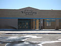
Chinle Elementary School and Chinle Junior High School. Many Farms Homes and Tsaile Homes are in those respective communities. [9]

Transportation

As of 2016 over 60% of the bus routes include unpaved roads, something that increases wear and tear on the buses. [4]

H1B

Related Research Articles

<span class="mw-page-title-main">Apache County, Arizona</span> County in Arizona, United States

Apache County is in the northeast corner of the U.S. state of Arizona. Shaped in a long rectangle running north to south, as of the 2020 census, its population was 66,021. The county seat is St. Johns.

<span class="mw-page-title-main">Chinle, Arizona</span> CDP in Apache County, Arizona

Chinle is a census-designated place (CDP) in Apache County, Arizona, United States. The name in Navajo means "flowing out" and is a reference to the location where the water flows out of the Canyon de Chelly. The population was 4,518 at the 2010 census.

<span class="mw-page-title-main">Dennehotso, Arizona</span> CDP in Apache County, Arizona

Dennehotso is a census-designated place (CDP) in Apache County, Arizona, United States. The population was 746 at the 2010 census.

<span class="mw-page-title-main">Lukachukai, Arizona</span> CDP in Apache County, Arizona

Lukachukai is a census-designated place (CDP) in Apache County, Arizona, United States. The population was 1,701 at the 2010 census. It is within the Navajo Nation.

<span class="mw-page-title-main">Many Farms, Arizona</span> CDP in Apache County, Arizona

Many Farms is a census-designated place (CDP) in Apache County, Arizona, United States. The population was 1,348 at the 2010 census.

<span class="mw-page-title-main">Red Mesa, Arizona</span> CDP in Apache County, Arizona

Red Mesa is a census-designated place (CDP) in Apache County, Arizona, United States. The population was 480 at the 2010 census.

<span class="mw-page-title-main">Rock Point, Arizona</span> CDP in Apache County, Arizona

Rock Point is a census-designated place (CDP) in Apache County, Arizona, United States. The population was 642 at the 2010 census. Its name is descriptive of the point where Chinle Creek enters high sandstone walls.

<span class="mw-page-title-main">Round Rock, Arizona</span> CDP in Apache County, Arizona

Round Rock is a Navajo community and census-designated place (CDP) in Apache County, Arizona, United States. The population was 789 at the 2010 census. It is named after a nearby mesa.

<span class="mw-page-title-main">Sawmill, Arizona</span> CDP in Apache County, Arizona

Sawmill is a census-designated place (CDP) in Apache County, Arizona, United States. Sawmill is a part of Fort Defiance Agency, which is on the Navajo Nation. The population was 748 at the 2010 census. It is named after and developed around a sawmill. A trading post has been present since 1907.

<span class="mw-page-title-main">Teec Nos Pos, Arizona</span> Census-designated place in Arizona, United States

Teec Nos Pos is a census-designated place (CDP) in Apache County, Arizona, United States. The population was 507 at the 2020 census. It is the western terminus of U.S. Route 64.

<span class="mw-page-title-main">Tsaile, Arizona</span> Census-designated place in Arizona, United States

Tsaile is a census-designated place (CDP) in Apache County, Arizona, United States, on the Navajo Nation. The population was 1,205 at the 2010 census.

<span class="mw-page-title-main">Diné College</span> Tribal college on the Navajo Nation

Diné College is a public tribal land-grant college in Tsaile, Arizona, serving the 27,000-square-mile (70,000 km2) Navajo Nation. It offers associate degrees, bachelor's degrees, and academic certificates.

<span class="mw-page-title-main">Chinle High School</span> Public high school in Apache County, Arizona

Chinle High School is a public high school in Chinle, an unincorporated area of Apache County, Arizona, United States. The school is the only high school in the Chinle Unified School District, and all of the district's elementary and middle schools feed into it. Chinle High School serves several unincorporated areas in Apache County, including Chinle, Lukachukai, Many Farms, Rough Rock, Tsaile, and some areas considered to be Nazlini. The areas the school serves are within the Navajo Nation.

Many Farms High School (MFHS) is located in the heart of the Navajo reservation in Many Farms, Arizona, and 15 miles (24 km) northeast of Canyon De Chelly National Monument. It has 445 students and 35 faculty members along with a large support staff. It is a boarding school operated by the US Department of the Interior Bureau of Indian Education, with separate dormitories for male and female students. It opened its doors in 1969.

Red Mesa Unified School District #27 is a public school district headquartered in Red Mesa, unincorporated Apache County, Arizona, near Teec Nos Pos on the Navajo Nation. It has a five-member elected school board, who oversee operations of schools that are regulated by state standards.

<span class="mw-page-title-main">Bureau of Indian Education</span> United States government agency

The Bureau of Indian Education (BIE), headquartered in the Main Interior Building in Washington, D.C., and formerly known as the Office of Indian Education Programs (OIEP), is a division of the U.S. Department of the Interior under the Assistant Secretary for Indian Affairs. It is responsible for the line direction and management of all BIE education functions, including the formation of policies and procedures, the supervision of all program activities, and the approval of the expenditure of funds appropriated for BIE education functions.

Red Mesa High School is a high school in Red Mesa in an unincorporated area of Apache County, Arizona, near Teec Nos Pos. It is one of two high schools under the jurisdiction of the Red Mesa Unified School District, along with Red Valley/Cove High School.

Del Muerto is a census-designated place (CDP) in Apache County, Arizona, United States. The population was 329 at the 2010 census.

Sehili is a census-designated place (CDP) in Apache County, Arizona, United States. The population was 135 at the 2010 census.

<span class="mw-page-title-main">Many Farms Community School</span> Navajo tribal school in Arizona

Many Farms Community School, Inc. (MFCS), is a tribally controlled K-8 school in Many Farms, Arizona, operated by the Navajo Nation. It is funded by the Bureau of Indian Education (BIE). MFCS has a boarding program to serve students who live at a distance from this community.

References

  1. "Contacts". Chinle Unified School District. Retrieved 2020-04-08. Express Carrier Address: Chinle Unified School District #24 Personnel Department US 191 & Navajo Route #7 Chinle, Arizona 86503
  2. 1 2 "About Us". Chinle Unified School District #24. 2021. Retrieved 24 July 2021.
  3. "School District Reference Map(2010 Census): Apache County, AZ" (PDF). 2010 U.S. Census . U.S. Census Bureau . Retrieved 2020-04-08. – Chinle USD is depicted on pages 1 and 2.
  4. 1 2 3 Cano, Ricardo (2016-09-14). "Rural Arizona school district: 'Buses weren't made to run on these roads'". The Arizona Republic . Retrieved 2021-07-15.
  5. 1 2 "History of Red Mesa Schools" Red Mesa Unified School District. Retrieved on September 20, 2010.
  6. "About Our Schools". Chinle Unified School District. Retrieved 2020-04-08.
  7. "Home". Chinle Unified School District. 1998-12-12. Archived from the original on 1998-12-12. Retrieved 2020-04-08.
  8. "Tsaile Campus Area Map" (Archive). Diné College. Retrieved on June 16, 2015.
  9. "Housing Developments". Chinle Unified School District. Retrieved 2023-03-17.
  10. Chinle Unified School District h1b data