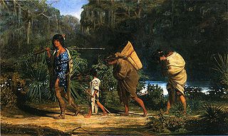
The Choctaw are a Native American people originally occupying what is now the Southeastern United States. Their Choctaw language belongs to the Muskogean language family group. Hopewell and Mississippian cultures, who lived throughout the east of the Mississippi River valley and its tributaries. About 1,700 years ago, the Hopewell people built Nanih Waiya, a great earthwork mound located in what is central present-day Mississippi. It is still considered sacred by the Choctaw. The early Spanish explorers of the mid-16th century in the Southeast encountered Mississippian-culture villages and chiefs. The anthropologist John R. Swanton suggested that the Choctaw derived their name from an early leader. Henry Halbert, a historian, suggests that their name is derived from the Choctaw phrase Hacha hatak.
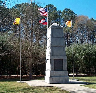
The Trail of Tears was a series of forced relocations of Native Americans in the United States from their ancestral homelands in the Southeastern United States, to areas to the west that had been designated as Indian Territory. The forced relocations were carried out by government authorities following the passage of the Indian Removal Act in 1830. The relocated peoples suffered from exposure, disease, and starvation while en route to their new designated reserve, and many died before reaching their destinations. The forced removals included members of the Cherokee, Muscogee (Creek), Seminole, Chickasaw, Choctaw, and Ponca nations, as well as their African slaves. The phrase "Trail of Tears" originates from a description of the removal of many Native American tribes, including the infamous Cherokee Nation relocation in 1838.

Choctaw County is a county of the U.S. state of Alabama. As of the 2010 census, the population was 13,859. The county seat is Butler. The county was established on December 29, 1847 and named for the Choctaw tribe of American Indians.

Choctaw County is a county located in the U.S. state of Oklahoma. As of the 2010 census, the population was 15,205. Its county seat is Hugo. The county was created in 1907, at the time of Oklahoma statehood. According to the Encyclopedia of Oklahoma History and Culture, the name is derived from Chahta, the mythical founder of the Choctaw people.

Choctaw County is a county located in the central part of U.S. state of Mississippi. As of the 2010 census, the population was 8,547. Its northern border is the Big Black River, which flows southwest into the Mississippi south of Vicksburg. The county seat is Ackerman. The county is named after the Choctaw tribe of Native Americans, who long occupied this territory as their homeland before being forced to move west of the Mississippi River by federal troops under the Indian Removal Act of 1830.

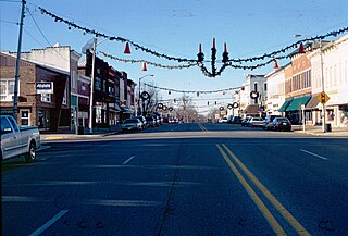
Butler is a town in and the county seat of Choctaw County, Alabama, United States. The population was 1,894 at the 2010 census.
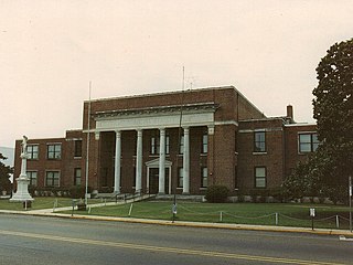
Philadelphia is a city in and the county seat of Neshoba County, Mississippi, United States. The population was 7,477 at the 2010 census.
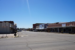
Hugo is a city and county seat of Choctaw County, Oklahoma, United States. It is located in southeastern Oklahoma about 9 miles (14 km) north of the Texas state line. As of the 2010 census, the city population was 5,310.

Choctaw is a city in Oklahoma County, Oklahoma. It is the oldest chartered town in Oklahoma Territory. The city is located approximately 10 miles (16.1 km) east of Oklahoma City and is part of the Oklahoma City metropolitan area.

The term "Five Civilized Tribes" derives from the colonial and early federal period in the history of the United States. It refers to five Native American nations—the Cherokee, Chickasaw, Choctaw, Creek (Muscogee), and Seminole. These are the first five tribes that Anglo-European settlers generally considered to be "civilized". Examples of colonial attributes adopted by these five tribes include Christianity, centralized governments, literacy, market participation, written constitutions, intermarriage with white Americans, and plantation slavery practices. The Five Civilized Tribes tended to maintain stable political relations with the Europeans.

USS Choctaw (1856) was a large (1,004-ton) steamer built for the merchant service, but acquired by the Union Navy during the second year of the American Civil War.
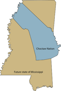
The Treaty of Dancing Rabbit Creek was a treaty signed on September 27, 1830, and proclaimed on February 24, 1831, between the Choctaw American Indian tribe and the United States Government. This was the first removal treaty carried into effect under the Indian Removal Act. The treaty ceded about 11 million acres (45,000 km2) of the Choctaw Nation in what is now Mississippi in exchange for about 15 million acres (61,000 km2) in the Indian territory, now the state of Oklahoma. The principal Choctaw negotiators were Chief Greenwood LeFlore, Musholatubbee, and Nittucachee; the U.S. negotiators were Colonel John Coffee and Secretary of War John Eaton.

The Choctaw Nation is a Native American territory and federally recognized Indian Tribe with a tribal jurisdictional area and reservation comprising 10.5 counties in Southeastern Oklahoma. The Choctaw Nation maintains a special relationship with both the United States and Oklahoma governments.

The Chickasaw Nation is a federally recognized Native American nation, located in Oklahoma. They are one of the members of the Five Civilized Tribes. The Chickasaw Nation traces its origins to its homeland of modern day Mississippi, Tennessee, Alabama and Kentucky.

The Treaty of Doak's Stand was signed on October 18, 1820 between the United States and the Choctaw Indian tribe. Based on the terms of the accord, the Choctaw agreed to give up approximately one-half of their remaining Choctaw homeland. In October 1820, Andrew Jackson and Thomas Hinds were sent as commissioners who represented the United States to negotiate a treaty to surrender a large portion of Choctaw country in Mississippi. They met with tribal representatives at Doak's Stand on the Natchez Trace. They met with the chiefs Pushmataha, Mushulatubbee, and Apuckshunubbee, who represented the three major regional divisions of the Choctaw. Chiefs of the towns and other prominent men accompanied them, such as Colonel Silas Dinsmoor.

The Choctaw Trail of Tears was the relocation of the Choctaw Nation from their country referred to now as the Deep South to lands west of the Mississippi River in Indian Territory in the 1830s. A Choctaw miko (chief) was quoted by the Arkansas Gazette that the removal was a "trail of tears and death." After removal the Choctaws became three distinct groups, the Choctaw Nation of Oklahoma, Jena Band of Choctaw Indians, and the Mississippi Band of Choctaw Indians.

The Treaty with Choctaws and Chickasaws was a treaty signed on July 12, 1861 between the Choctaw and Chickasaw and the Confederate States of America. At the beginning of the American Civil War, Albert Pike was appointed as Confederate envoy to Native Americans. In this capacity he negotiated several treaties, one of the most important being with Cherokee chief John Ross, which was concluded in 1861. The treaty was ratified and was proclaimed on December 20, 1861 by the Confederacy. The Choctaw and Chickasaw also duly ratified the treaty.

The Choctaw in the American Civil War participated in two major arenas— the Trans-Mississippi and Western Theaters. The Trans-Mississippi had the Choctaw Nation. The Western had the Mississippi Choctaw. The Choctaw Nation had removed West prior to the War. But, the Mississippi Choctaw had elected to remain in the East. Both the Choctaw Nation and the Mississippi Choctaw would ultimately side with the Confederacy.
On the eve of the American Civil War in 1861, a significant number of Indigenous peoples of the Americas had been relocated from the Southeastern United States to Indian Territory, west of the Mississippi. The inhabitants of the eastern part of the Indian Territory, the Five Civilized Tribes, were suzerain nations with established tribal governments, well established cultures, and legal systems that allowed for slavery. Before European Contact these tribes were generally matriarchial societies, with agriculture being the primary economic pursuit. The bulk of the tribes lived in towns with planned streets, residential and public areas. The people were ruled by complex hereditary chiefdoms of varying size and complexity with high levels of military organization.


