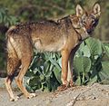
Cholistan Wildlife Sanctuary

Last updated
Cholistan Wildlife Sanctuary
Location Cholistan Desert, Punjab, Pakistan
Nearest city Bahawalpur
Coordinates 28°56′24″N72°07′55″E / 28.940°N 72.132°E / 28.940; 72.132
Area26,000 km2 (10,000 sq mi)

Cholistan Wildlife Sanctuary is located in Punjab, Pakistan. [1] It comprises 2.6 million hectares.

Contents

Topography

This desert can be classified into two geomorphic zones based on its topography, the territory of the northern section, known as Lesser Cholistan, is around 7,770 km2, bordering canal-irrigated areas, while the area of the southern region, known as Greater Cholistan, is 18,130 km2. Low sandy ridges alternate with salty alluvial flats, known locally as dahars, to form the smaller Cholistan. Saline or saline-sodic soils are the two categories into which these soils fall, with pH values varying from 8.2 to 8.4 and from 8.8 to 9.6, respectively. The Greater Cholistan consists of river terraces, sizable sand dunes, and depressions. It is a wind-sorted sandy desert. The dunes are approximately 100 metres tall on average. [2]

The region experiences a wide range of temperatures, with summers potentially reaching over 50°C. The temperature difference between day and night is significant. The region experiences sporadic, erratic, and sparse rainfall, often between 100 and 250 mm, primarily during the monsoon season. [2]


Flora and fauna

Fauna

List of fauna found in the sanctuary. [3]

Related Research Articles

<span class="mw-page-title-main">Cholistan Desert</span> Desert in Punjab, Pakistan

The Cholistan Desert, also locally known as Rohi, is a desert in the southern part of Punjab, Pakistan that forms part of the Greater Thar Desert, which extends to Sindh province and the Indian state of Rajasthan. It is one of two large deserts in Punjab, the other being the Thal Desert. The name is derived from the Turkic word chol, meaning "sands," and istan, a Persian suffix meaning "land of."

<span class="mw-page-title-main">Geography of India</span>

India is situated north of the equator between 8°4' north to 37°6' north latitude and 68°7' east to 97°25' east longitude. It is the seventh-largest country in the world, with a total area of 3,287,263 square kilometres (1,269,219 sq mi). India measures 3,214 km (1,997 mi) from north to south and 2,933 km (1,822 mi) from east to west. It has a land frontier of 15,200 km (9,445 mi) and a coastline of 7,516.6 km (4,671 mi).

<span class="mw-page-title-main">Geography of Iraq</span> Geographic features of Iraq

The geography of Iraq is diverse and falls into five main regions: the desert, Upper Mesopotamia, the northern highlands of Iraq, Lower Mesopotamia, and the alluvial plain extending from around Tikrit to the Persian Gulf.

<span class="mw-page-title-main">Geography of Namibia</span>

At 824,292 km2 (318,261 sq mi), Namibia is the world's thirty-fourth largest country. After Mongolia, Namibia is the second least densely populated country in the world. Namibia got its name from the Namib desert that stretches along the coast of the Atlantic. It is also known for its wildlife.

<span class="mw-page-title-main">Geography of Turkmenistan</span> Overview of the geography of Turkmenistan

Turkmenistan is a landlocked country in Central Asia, bordering the Caspian Sea to the west, Iran and Afghanistan to the south, Uzbekistan to the north-east, and Kazakhstan to the north-west. It is the southernmost republic of the Commonwealth of Independent States (CIS), the loose federation created at the end of 1991 by most of the Post-Soviet states.

<span class="mw-page-title-main">Thar Desert</span> Large arid region in India and Pakistan

The Thar Desert, also known as the Great Indian Desert, is an arid region in the north-western part of the Indian subcontinent that covers an area of 200,000 km2 (77,000 sq mi) in India and Pakistan. It is the world's 18th-largest desert, and the world's 9th-largest hot subtropical desert.

<span class="mw-page-title-main">Death Valley National Park</span> National park in California and Nevada, United States

Death Valley National Park is an American national park that straddles the California–Nevada border, east of the Sierra Nevada. The park boundaries include Death Valley, the northern section of Panamint Valley, the southern section of Eureka Valley and most of Saline Valley.

<span class="mw-page-title-main">Geography of Mauritania</span>

Mauritania, a country in the Western Region of the continent of Africa, is generally flat, its 1,030,700 square kilometres forming vast, arid plains broken by occasional ridges and clifflike outcroppings. Mauritania is the world’s largest country lying entirely below an altitude of 1,000 metres (3,300 ft). It borders the North Atlantic Ocean, between Senegal and Western Sahara, Mali and Algeria. It is considered part of both the Sahel and the Maghreb. A series of scarps face southwest, longitudinally bisecting these plains in the center of the country. The scarps also separate a series of sandstone plateaus, the highest of which is the Adrar Plateau, reaching an elevation of 500 metres or 1,640 feet. Spring-fed oases lie at the foot of some of the scarps. Isolated peaks, often rich in minerals, rise above the plateaus; the smaller peaks are called Guelbs and the larger ones Kedias. The concentric Guelb er Richat is a prominent feature of the north-central region. Kediet ej Jill, near the city of Zouîrât, has an elevation of 915 metres or 3,002 feet and is the highest peak.

<span class="mw-page-title-main">Great Rann of Kutch</span> Salt marsh in Gujarat, India and Sindh, Pakistan; the greater part of the Rann of Kutch

The Great Rann of Kutch is a salt marsh in the Thar Desert in the Kutch District of Gujarat, India. It is about 7500 km2 in area and is reputed to be one of the largest salt deserts in the world. This area has been inhabited by the Kutchi people.

<span class="mw-page-title-main">Ordos Desert</span> Desert in Inner Mongolia

The Ordos Desert is a desert/steppe region in Northwest China, administered under the prefecture of Ordos City in the Inner Mongolian Autonomous Region. It extends over an area of approximately 90,650 km2 (35,000 sq mi), and comprises two sub-deserts: China's 7th-largest desert, the Kubuqi Desert, in the north; and China's 8th-largest desert, the Mu Us Desert, in the south. Wedged between the arable Hetao region to the north and the Loess Plateau to the south, the soil of the Ordos Desert is mostly a mixture of dry clay and sand, and as a result is poorly suited for agriculture.

<span class="mw-page-title-main">Sandhills (Nebraska)</span> Temperate grasslands, savannas, and shrublands ecoregion of Nebraska, United States

The Sandhills, often written Sand Hills, is a region of mixed-grass prairie on grass-stabilized sand dunes in north-central Nebraska, covering just over one quarter of the state. The dunes were designated a National Natural Landmark in 1984.

<span class="mw-page-title-main">Deserts of Australia</span> Deserts in Australia

The deserts of Australia or the Australian deserts cover about 2,700,000 km2 (1,000,000 sq mi), or 18% of the Australian mainland, but about 35% of the Australian continent receives so little rain, it is practically desert. Collectively known as the Great Australian desert, they are primarily distributed throughout the Western Plateau and interior lowlands of the country, covering areas from South West Queensland, Far West region of New South Wales, Sunraysia in Victoria and Spencer Gulf in South Australia to the Barkly Tableland in Northern Territory and the Kimberley region in Western Australia.

<span class="mw-page-title-main">Thal Desert</span> Desert in Pakistan

The Thal desert is situated at 31°10’ N and 71°30’ E in the province of Punjab, Pakistan. Located near the Pothohar Plateau, the area falls under the Indomalayan biogeographic realm and stretches for a length of approximately 190 miles with a maximum breadth of 70 miles. It is bound by the piedmont of the northern Salt Range, the Indus River flood plains in the west and the Jhelum and Chenab River floodplains in the east. It is a subtropical sandy desert that resembles the deserts of Cholistan and Thar geographically.

<span class="mw-page-title-main">Desert</span> Area of land where little precipitation occurs

A desert is a landscape where little precipitation occurs and, consequently, living conditions create unique biomes and ecosystems. The lack of vegetation exposes the unprotected surface of the ground to denudation. About one-third of the land surface of the Earth is arid or semi-arid. This includes much of the polar regions, where little precipitation occurs, and which are sometimes called polar deserts or "cold deserts". Deserts can be classified by the amount of precipitation that falls, by the temperature that prevails, by the causes of desertification or by their geographical location.

Yazman, is a city and capital of Yazman Tehsil of Bahawalpur District, in southern Punjab, Pakistan. It is located at an altitude of 115 metres.

<span class="mw-page-title-main">Repetek Biosphere State Reserve</span>

Repetek Biosphere State Reserve, often referred to as Repetek Nature or Desert Reserve, is a desert nature reserve (zapovednik) of Turkmenistan, located in Lebap Province, East Karakum Desert, near Amu Darya. It is located approximately 70 km (43 mi) south from Türkmenabat and is known for its zemzen. Established in 1928 for the study and preservation of a sand-desert ecosystem, it covers an area of 346 km2 (134 sq mi).

Biosphere reserves are established according to the UNESCO's Man and the Biosphere Programme (MAB) to promote sustainable development for conservation of biological and cultural diversity. As of 2016, the Lal Suhanra Biosphere Reserve and Ziarat Juniper Forest are the only two biosphere reserve in Pakistan, which were approved by UNESCO in 1977 and 2013 respectively. A number of initiatives and projects have been undertaken to promote and develop other biosphere reserves in Pakistan but due to weak implementation this has not yet been materialized. In July 2012, Pakistan Museum of Natural History and Beijing Museum of Natural History signed a MoU to work on trans-boundary biodiversity and to improve MAB related activities in the Karakoram, Himalaya, and Hindukush regions.

Bagar, also Bagad (बागड़) a term meaning the "dry country", is a region refers in north-western India and north Rajasthan, India where the Bagri language is spoken and which is inhabited by Bagri people. The region is characterised by sandy tracks and shifting sand dunes which are now irrigated by canals.

References

  1. "Protected Areas".
  2. 1 2 "Pakistan Journal of Biological Sciences". Science Alert. Retrieved 13 November 2023.
  3. "Natural Resource Diversity in Cholistan Desert (Pakistan) and Possible Conservational Measures". researchgate.net. Research Gate. Retrieved November 13, 2023.