Chunati Wildlife Sanctuary

Last updated

Chunati Wildlife Sanctuary
IUCN category IV (habitat/species management area)
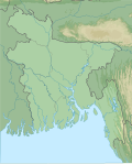
Fisherman in Chunati Wildlife Sanctuary.jpg
Bangladesh rel location map.svg
Red pog.svg
LocationFlag of Bangladesh.svg  Bangladesh
Nearest cityChittagong
Coordinates 21°54′0″N92°08′0″E / 21.90000°N 92.13333°E / 21.90000; 92.13333
Area7763.94 hectares
Established1986 (1986)
Governing bodyBangladesh Forest Department

Chunati Wildlife Sanctuary is an IUCN Category IV [1] protected area located close to the village of Chunati in the Chittagong District of the Chittagong Division in southeastern Bangladesh.

Contents

History

The Sanctuary was established in 1986 through Gazette Notification XII/For-I/84/174. Covering nearly 7764 hectares, the predominant vegetation was originally garjan forest, but illegal logging and encroachment for cultivation resulted in a fragmented and degraded habitat. By 2003, secondary scrub covered approximately 44% of the Sanctuary, but various replanting projects have been undertaken with donor support. [2] This was the first wildlife sanctuary in Bangladesh. There are 15 villages in and around the Sanctuary. [3] The Sanctuary is home to several endangered timber species. [4]

Wildlife

Chunati Wildlife Sanctuary is a major corridor for the movement of Asian elephant between Bangladesh and Myanmar. [5] Mammal species in the Sanctuary include muntjac deer, fishing cat, wild boar and Malayan porcupine. Birds include the black-rumped flameback, coppersmith barbet, chestnut-headed bee-eater, Asian green bee-eater, greater coucal, house swift, spotted dove, black drongo, jungle myna and Asian pied starling [6]

Administration and protection

The park is under the jurisdiction of Bangladesh Forest Department of the Ministry of Environment and Forest (MoEF), and is managed by them in cooperation with local communities. [7] The community patrols are led by women in green saris. They are from the local community and are funded by U.S. Agency for International Development and Germany's development agency GTZ. They receive stipends of $50 for their service. [8]

Related Research Articles

<span class="mw-page-title-main">Sundarbans</span> Mangrove forest in the Bay of Bengal

Sundarbans is a mangrove area in the delta formed by the confluence of the Ganges, Brahmaputra and Meghna Rivers in the Bay of Bengal. Sundarban Reserve Forest (SRF) of Bangladesh is the largest mangrove forest in the world. It spans the area from the Baleswar River in Bangladesh's division of Khulna to the Hooghly River in India's state of West Bengal. It comprises closed and open mangrove forests, land used for agricultural purpose, mudflats and barren land, and is intersected by multiple tidal streams and channels. Sundarbans is home to the world's largest area of mangrove forests. Four protected areas in the Sundarbans are enlisted as UNESCO World Heritage Sites, viz. Sundarbans West (Bangladesh), Sundarbans South (Bangladesh), Sundarbans East (Bangladesh) and Sundarbans National Park (India).

<span class="mw-page-title-main">Khathiar–Gir dry deciduous forests</span> Ecoregion in India

The Khathiar–Gir dry deciduous forests is a mostly arid ecoregion in northwestern India that stretches over 103,100 sq mi (267,000 km2) across Gujarat, Rajasthan and Madhya Pradesh. The dry deciduous forests in the region are dominated by teak, and thorny trees and scrub in drier areas.

<span class="mw-page-title-main">Cox's Bazar</span> City in Bangladesh

Cox's Bazar is a city, fishing port, tourism centre, and district headquarters in Southeastern Bangladesh. The iconic Cox's Bazar Beach, one of the most popular tourist attractions in Bangladesh, is the longest uninterrupted beach in the world. It is located 150 km (93 mi) south of the city of Chittagong. Cox's Bazar is also known by the name Panowa, which translates literally as "yellow flower." Another old name was "Palongkee". Kutupalong refugee camp with more than a million Rohingya refugees is in Cox's Bazar.

There are four categories of protected areas in India, constituted under the Wildlife Protection Act, 1972. Tiger reserves consist of areas under national parks and wildlife sanctuaries. There are 53 tiger reserves in India. As of January 2023, the protected areas of India cover 173,629.52 square kilometres (67,038.73 sq mi), roughly 5.28% of the total geographical area of the country.

<span class="mw-page-title-main">Lower Gangetic Plains moist deciduous forests</span> Ecoregion of India and Bangladesh

The Lower Gangetic Plains moist deciduous forests is a tropical and subtropical moist broadleaf forests ecoregion of Bangladesh and India. The ecoregion covers an area of 254,100 square kilometres (98,100 sq mi), comprising most of Bangladesh and the Indian states of West Bengal, Bihar and Tripura, and extending into adjacent states of Odisha, Uttar Pradesh and a tiny part of Assam, as well as adjacent western Myanmar.

<span class="mw-page-title-main">Lohagara Upazila, Chittagong</span> Upazila in Chattogram Division, Bangladesh

Lohagara is an upazila of Chattogram District in Chattogram Division, Bangladesh. Lohagara is situated between Chattogram and Cox's Bazar. It is one of the largest and most densely populated upazilas of Bangladesh.

<span class="mw-page-title-main">Hastinapur Wildlife Sanctuary</span> Protected area in Uttar Pradesh, India

Hastinapur Wildlife Sanctuary is a protected area in the Gangetic plains of Uttar Pradesh, India. It was established in 1986 and covers 2,073 km2 (800 sq mi) across Meerut, Muzzafarnagar, Ghaziabad, Bijnor, Meerut and Amroha districts. This area has not enjoyed protection needed to check poaching and various other threats to wildlife due to lack of proper notification.

<span class="mw-page-title-main">Lawachara National Park</span> National park and nature reserve in Bangladesh

Lawachara National Park is a major national park and nature reserve in Bangladesh. The park is located at Kamalganj Upazila, Moulvibazar District in the northeastern region of the country. It is located within the 2,740 ha (27.4 km2) West Bhanugach Reserved Forest.

<span class="mw-page-title-main">Sundarbans East Wildlife Sanctuary</span> Protected forest in Bangladesh

Sundarbans East Wildlife Sanctuary, a protected forest in Bangladesh, extends over an area of 31,227 ha. of mangrove forest. It was established in 1977 under the Bangladesh Wildlife (Preservation) (Amendment) Act, 1974, having previously been a forest reserve. It is the most fertile of the three, non-adjoining wildlife sanctuaries established in the Sundarbans at that time, the others being the Sundarbans West Wildlife Sanctuary and the Sundarbans South Wildlife Sanctuary. The dominant mangrove species is "sundri" from which the Sundarbans region gets its name.

Chunati is a small village located near the Asian Highway in southeaster Bangladesh between Chittagong and Cox's Bazar in Lohagara Upazila, Bangladesh. The distance from Chittagong is about 70 km. The population was 20,364 in 2011. Chunati Wildlife Sanctuary is an IUCN Category IV protected area located around Chunati.

<span class="mw-page-title-main">Purna Wildlife Sanctuary</span> Wildlife Sanctuary in Gujarat, India

Purna Wildlife Sanctuary is a wildlife sanctuary in the Western Ghats mountain range, in the States of Gujarat and Maharashtra, India. In the South Gujarat, it is located between Vyara, Tapi District and Ahwa, Dang District, and in Maharashtra, it is located in Nandurbar District. Apart from the Dangs' District, it is a part of the Northern Division of the Dangs' Forest.

The Vindhyan Ecology and Natural History Foundation (VENHF) is a registered non-profit organisation (2012) with its headquarter in Mirzapur, Uttar Pradesh, India, working for the protection and conservation of the nature, natural resources and rights of the nature dependent communities in the ecologically fragile landscape of Vindhya Range in India. Vindhya Bachao Abhiyan is the flagship campaign of the organization.

<span class="mw-page-title-main">Sangu Matamuhari</span> Wildlife sanctuary in Bangladesh

Sangu-Matamuhari or Sangu Wildlife Sanctuary is a wildlife sanctuary—IUCN category II —situated in Bandarban District, Chittagong Division, Bangladesh. It is part of the Sangu reserve forest. It is under the Lama Forest Division of the Bangladesh Forest Department. Its bio-ecological zone is in Chittagong Hills and Chittagong Hill Tracts.

Hail Haor Wildlife Sanctuary is a major wildlife sanctuary in Bangladesh. It is one of the most important wetlands in the Sylhet Basin for the resident and migratory waterfowls. It is also important watersource for the inhabitants living around when all other sources dry up during summer. The sanctuary is located in Moulvibazar District, in the northeast region of the country.

<span class="mw-page-title-main">Char Kukri-Mukri Wildlife Sanctuary</span>

Char Kukri-Mukri Wildlife Sanctuary is a wildlife sanctuary in southern Charfession Upazila of Bangladesh, located on Char Kukri Mukri island in the Bay of Bengal in the south of the country. The area of the sanctuary is 40 ha, and is elongated in shape. It is 130 km from Barisal town in the gangetic delta on the mouth of Meghna river. It is also called Charfasson wildlife sanctuary. Most part of the sanctuary is submerged twice in a day due to high tide and is covered with dense mangrove vegetation. The soil type is clay.

Fasiakhali Wildlife Sanctuary is a wildlife sanctuary in southern Chakaria Upazilla of Bangladesh. located on an island in Bay of Bengal in the south of the country. The area of the sanctuary is 1,302 ha, and is located on eastern and southern hills of Bangladesh.

Pablakhali Wildlife Sanctuary is a wildlife sanctuary at the northern end of the Kaptai reservoir in the Chittagong Hill Tracts region of Bangladesh. The area of the sanctuary is 42,087 ha, and it is located on the eastern and northern hills of Bangladesh. The nearest town is Rangamati (Bengali: রাঙ্গামাটি which is 112 km from the sanctuary. The western boundary of the sanctuary is formed by the Kassalong River.

Hazarikhil Wildlife Sanctuary is a Wildlife sanctuary at the Ramgarh- Sitakunda forests, 45 km north of the Chittagong port in south-East of Bangladesh. The IUCN protected area category is II.

References

  1. "Chunati Wildlife Sanctuary". Protected Planet. IUCN WDPA / UNEP-WCMC. Archived from the original on 2 April 2013. Retrieved 20 February 2015.
  2. Sinha, P.B.; Alam, M. "Secondary data collection for pilot protected area: Chunati Wildlife Sanctuary" (PDF). USAID. Retrieved 20 February 2015.
  3. Al Mamun, Abdullah. "Protect Chunati Wildlife Sanctuary". The Daily Star. Retrieved 14 July 2015.
  4. McDermott, Mat. "Bangladesh Gets $19 Million from US & Germany for Reforestation Project". treehugger.com. MNN HOLDING COMPANY, LLC. Retrieved 14 July 2015.
  5. "US, Germany join in climate change mitigation at Chunati Wildlife Sanctuary US, Germany join in climate change mitigation at Chunati Wildlife Sanctuary". bdnews24.com. Retrieved 14 July 2015.
  6. Sinha, P.B.; Alam, M. "Chunati interpretation plan" (PDF). Nishorgo Project. USAID. Archived from the original (PDF) on 20 February 2015. Retrieved 20 February 2015.
  7. "Restoring the forest and improving livelihoods in the Chunati Wildlife Sanctuary". German Embassy Dhaka. Archived from the original on 14 July 2015. Retrieved 14 July 2015.
  8. Boykoff, Pamela. "'Sari squad' protects Bangladesh wildlife sanctuary". CNN. Retrieved 14 July 2015.