Cleobury North

Last updated

Cleobury North
Cleobury North Church.jpg
St Peter & St Paul Church, Cleobury North
Shropshire UK location map.svg
Red pog.svg
Cleobury North
Location within Shropshire
Population87  [1]
OS grid reference SO622867
Civil parish
  • Cleobury North
Unitary authority
Ceremonial county
Region
Country England
Sovereign state United Kingdom
Post town Bridgnorth
Postcode district WV16
Dialling code 01746
Police West Mercia
Fire Shropshire
Ambulance West Midlands
UK Parliament
List of places
UK
England
Shropshire
52°28′37″N2°33′22″W / 52.477°N 2.556°W / 52.477; -2.556

Cleobury North is a civil parish and small village in south east Shropshire, England. It is situated on the B4364 southwest of the market town of Bridgnorth. To the north is the village of Ditton Priors and to the west is Brown Clee Hill, the county's highest hill.

Contents

The Village

Cleobury North is a parish along the River Rea, under the Clee Hills and is 8 miles S.W of Bridgnorth. [2]

St. Peter and St Paul's church dates back to the late 12th century, which is a Grade II* listed building (Listing NGR: SO6232087002). [3] Grade II* buildings are of particular special interest with only 5.5% listed as Grade II* in England. [4]

The local bus services are 141 and 143 runs through Cleobury North from Bridgnorth to Ludlow along the B4364, Monday-Saturday. [5] The nearest railway station to Cleobury North is the Ludlow railway station which is 9.97 miles away. [6]

History

Domesday Book The Domesday Book was a survey for William I which showed who owned what, how much everything was worth and how much the King was owed in tax and rent. [7] The survey showed that Cleobury North had a total population of 9 households with only 2.5 geld of taxable units. The value in 1066 was £0.60 and increased in 1086 to £1, the amount was extremely low as the village only consisted of 4 villagers, 4 smallholders and 1 slave. [8]

Hearth Tax The Hearth Tax was introduced in England in 1662. Records of the Hearth Tax in Cleobury North date back to 1672 which was calculated on the number of fireplaces in a family unit. The records show that 26 households paid in Cleobury North (e.g. Hercules Hide, David Jones and Richard Hudson) and 3 were illegible (Nicholas Millichopp, Thomas Kindsley Esq. and Robert Grove). [9]

Population change Cleobury North had a population of 136 residents in 1801, which increased to 250 in 1911. In 1911 it was at a record high but dwellers started to decrease and ended up with 110 in 1961. [10] The current day population is 87 people which shows it has declined overall throughout the years and has a net negative correlation. [11]

Occupation History During the year of 1831 the highest sector of employment in males 20 years and over was agricultural labour with 20 residents. This was over 44% of the parish males. Other occupation included retail, handicraft and non-agricultural labour with 7 males, and no males were in manufacturing. [12]

Activities

Burwarton Show- The Burwarton show is a one-day agricultural show which attracts over 20,000 visitors each year on the first Thursday in August between 8:15am-7pm. [13] Activities include sheep ring, fleece competition and sheep shearing competition. The annual dance which starts the show brought in £8,000 in 2011 which raises money for charities which include the Air Ambulance, Nightingale Nurses and Breast Cancer. [14]

Football- Brown Clee FC are a football club based in the village, who currently play in Division One of the Shropshire County Football League. They play their home games at the Hall Meadow football field. The grounds of several teams in the league, most notably Brown Clee, were featured in David Bauckham's book Dugouts, which noted the high frequency of dugouts with lockable doors which are also used for storage, a feature seemingly unique to clubs in Shropshire. [15]

Census

At the 2011 census, the village was included in the Burwarton civil parish.

See also

Related Research Articles

<span class="mw-page-title-main">Cleobury Mortimer</span> Human settlement in England

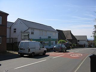
Cleobury Mortimer is a market town and civil parish in south-east Shropshire, England, which had a population of 3,036 at the 2011 census. It was granted a market charter by King Henry III in 1226.

Shropshire was established during the division of Saxon Mercia into shires in the 10th century. It is first mentioned in 1006. After the Norman Conquest it experienced significant development, following the granting of the principal estates of the county to eminent Normans, such as Roger De Montgomery and his son Robert de Bellême.

<span class="mw-page-title-main">Brown Clee Hill</span>

Brown Clee Hill is the highest hill in the rural English county of Shropshire, at 540 metres (1,770 ft) above sea level. It is one of the Clee Hills, and is in the Shropshire Hills Area of Outstanding Natural Beauty.

<span class="mw-page-title-main">Cleehill</span> Human settlement in England

Cleehill is a village in south Shropshire, England. It is sometimes written as Clee Hill Village to avoid confusion. It lies in the civil parish of Caynham. The market towns of Ludlow and Cleobury Mortimer are both 5.5 miles (8.9 km) distant, Ludlow to the west and Cleobury to the east.

<span class="mw-page-title-main">A4117 road</span> Road in Shropshire

The A4117 is a single-carriageway 'A road' in western England, largely in Shropshire, which passes through part of the Wyre Forest and Clee Hills.

The Clee Hills are a range of hills in Shropshire, England near Ludlow, consisting of Brown Clee Hill 1,772 feet (540 m), the highest peak in Shropshire, and Titterstone Clee Hill 1,749 feet (533 m). They are both in the Shropshire Hills Area of Outstanding Natural Beauty.

<span class="mw-page-title-main">Aston Botterell</span> Human settlement in England

Aston Botterell is a village and small civil parish in the county of Shropshire, West Midlands, England. The village lies 8 miles (13 km) south-west of the market town of Bridgnorth and 10 miles (16 km) north-east of the town of Ludlow. The nearest main roads are the B4364 and the A4117. According to the 2001 census, the civil parish had a population of 74. The area's economy is still largely based on agriculture, though many residents travel up to 12 miles (19 km) to work in other sectors such as the service and manufacturing industries.

<span class="mw-page-title-main">Billingsley, Shropshire</span> Human settlement in England

Billingsley is a small village and civil parish in Shropshire, England. It is located 6 miles (9.7 km) south of Bridgnorth and lies in the diocese of Hereford.

<span class="mw-page-title-main">Bitterley</span> Human settlement in England

Bitterley is a village and civil parish in Shropshire, England. According to the 2001 census the parish had a population of 802, increasing to 902 at the 2011 Census. The village is about 4 miles (6.4 km) east of Ludlow on the western slopes of Titterstone Clee Hill. Bitterley is the location for Bitterley Court about 0.62 miles (1.00 km) east of the modern village. Nearby to the east, is the small hamlet of Bedlam.

<span class="mw-page-title-main">South Shropshire (UK Parliament constituency)</span> Parliamentary constituency in the United Kingdom, 1832–1885

South Shropshire is a former United Kingdom Parliamentary constituency. It was a constituency of the House of Commons of the Parliament of the United Kingdom from 1832 to 1885. It was represented by two Knights of the Shire.

<span class="mw-page-title-main">Kinlet</span> Human settlement in England

Kinlet is a small village and civil parish in the south-east of the county of Shropshire, England. The parish is on the northern edge of the Wyre Forest and is in the Bridgnorth District of Shropshire. The parish incorporates the hamlets of Kinlet Village, Button Bridge and Button Oak. Kinlet is located 18 miles (29 km) south of Telford, the main town in Shropshire and 23 miles (37 km) west of Birmingham.

<span class="mw-page-title-main">Bouldon</span> Human settlement in England

Bouldon is a hamlet in Shropshire, England. It lies in the civil parish of Diddlebury.

<span class="mw-page-title-main">Burwarton</span> Human settlement in England

Burwarton is a small village and civil parish in Shropshire, England. Local governance is provided through the 'grouped' Parish Council for Aston Botterill, Burwarton and Cleobury North. The Parish falls within the Brown Clee Division of the Shropshire Unitary Council. There is no village meeting place, but the combined parishes share the facilities of the Village Hall at Cleobury North. The Burwarton Parish embraces most of the 'home estate' around Burwarton House. This rises westward from the main Bridgnorth-Ludlow road, passing north–south through the village, up to the ridge summit of Brown Clee Hill.

<span class="mw-page-title-main">Coreley</span> Human settlement in England

Coreley is a small, dispersed village and civil parish in south Shropshire, England, near to Clee Hill Village. It is situated approximately 30 miles (48 km) south west of Birmingham and just 4.5 miles (7.2 km) north east of Tenbury Wells. The name Corely comes from the Old English corn meaning a crane/heron and lēah meaning a forest/wood. This translates to crane wood/farmland.

CORELEY, a parish in Cleobury-Mortimer district, Salop; under the Clee Hills, 3½ miles NNE of Tenbury r[ailway]. station, and 5 WSW of Cleobury-Mortimer. Post town, Tenbury. Acres, 2,175. Rated property, £1,490. Pop[ulation]., 515. Houses, 106. The property is divided among a few. The living is a rectory in the diocese of Hereford. Value, £280.* Patron, Rev. J. Burnett Stuart. The church is of brick, and ancient, with tower and spire; and was reported in 1859 as bad.

<span class="mw-page-title-main">Ditton Priors</span> Human settlement in England

Ditton Priors is a village and civil parish in south Shropshire, England. Historically, it was also known as Priors Ditton.

<span class="mw-page-title-main">Neen Sollars</span> Human settlement in England

Neen Sollars is a village and civil parish in south east Shropshire, England.

<span class="mw-page-title-main">Clee St. Margaret</span> Human settlement in England

Clee St. Margaret is a small village and civil parish in the Clee Hills area of Shropshire, England. It is seven miles north east from the market town of Ludlow.

<span class="mw-page-title-main">Middleton, Bitterley</span> Human settlement in England

Middleton is a small village in south Shropshire, England. It is located 2.5 miles (4.0 km) northeast of Ludlow town centre, on the B4364 road, in the civil parish of Bitterley.

References

  1. "Shropshire Map Showing Location of Cleobury North". Population. TravelUK. Retrieved 7 March 2012.
  2. "History of Cleobury North". Location. visionofbritain.org.uk. Retrieved 13 March 2012.
  3. "British Listed Buildings". Church of St Peter and St Paul, Cleobury North. britishlistedbuildings.co.uk. Retrieved 13 March 2012.
  4. "Listed Buildings". Categories of listed buildings. English Heritage. Archived from the original on 26 January 2013. Retrieved 13 March 2012.
  5. "Bus Timetables". Public and passenger transport. Shropshire Council. Archived from the original on 25 September 2012. Retrieved 13 March 2012.
  6. "Big Red Directory". Cleobury North. bigreddirectory.com. Retrieved 13 March 2012.
  7. "Discover Domesday". Domesday Book. The National Archives. Retrieved 10 April 2012.
  8. "Place: Cleobury [North]". Domesday Book. Open Domesday. Archived from the original on 14 July 2014. Retrieved 10 April 2012.
  9. "Cleobury North The Shropshire Hearth Tax Roll 1672". Hearth Tax Roll. Parishmouse. Retrieved 10 April 2012.
  10. "Population". Historical statistics. visionofbritain.org.uk. Retrieved 13 March 2012.
  11. "Shropshire Map Showing Location of Cleobury North". Population. TravelUK. Retrieved 7 March 2012.
  12. "Industry". Cleobury North historical statistics. Humphrey Southall. Retrieved 11 April 2012.
  13. "Burwarton Show". Cleobury North. Retrieved 11 April 2012.
  14. "Burwarton show dance makes £8,000". Farmers Guardian. Farmers Guardian. Retrieved 11 April 2012.
  15. Bauckham, David (2006). Dugouts. New Holland. ISBN   1-8453-7478-9.

Commons-logo.svg Media related to Cleobury North at Wikimedia Commons