Clinton Township | |
|---|---|
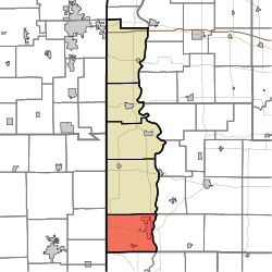 Location in Vermillion County | |
| Coordinates: 39°38′56″N87°27′26″W / 39.64889°N 87.45722°W | |
| Country | United States |
| State | Indiana |
| County | Vermillion |
| Government | |
| • Type | Indiana township |
| Area | |
• Total | 46.35 sq mi (120.0 km2) |
| • Land | 45.25 sq mi (117.2 km2) |
| • Water | 1.1 sq mi (3 km2) 2.37% |
| Elevation | 584 ft (178 m) |
| Population | |
• Total | 8,884 |
| • Density | 190/sq mi (74/km2) |
| Time zone | UTC-5 (Eastern (EST)) |
| • Summer (DST) | UTC-4 (EDT) |
| ZIP codes | 47842, 47884 |
| Area code | 765 |
| GNIS feature ID | 453234 |
Clinton Township is one of five townships in Vermillion County, Indiana, United States. As of the 2020 census, its population was 8,884 (down from 9,119 at 2010 [3] ) and it contained 4,226 housing units.
