Florida Township | |
|---|---|
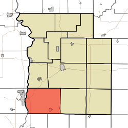 Location in Parke County | |
| Coordinates: 39°39′02″N87°18′59″W / 39.65056°N 87.31639°W | |
| Country | |
| State | |
| County | Parke |
| Government | |
| • Type | Indiana township |
| Area | |
• Total | 48.47 sq mi (125.5 km2) |
| • Land | 48.17 sq mi (124.8 km2) |
| • Water | 0.3 sq mi (0.78 km2) 0.62% |
| Elevation | 614 ft (187 m) |
| Population (2020) | |
• Total | 2,235 |
| • Density | 46.40/sq mi (17.91/km2) |
| Time zone | UTC-5 (Eastern (EST)) |
| • Summer (DST) | UTC-4 (EDT) |
| ZIP codes | 47862, 47872, 47874 |
| Area code | 765 |
| GNIS feature ID | 453297 |
Florida Township is one of thirteen townships in Parke County, Indiana, United States. As of the 2020 census, its population was 2,235 and it contained 1,059 housing units. [2]
Contents
- History
- Geography
- Cities, towns, villages
- Unincorporated towns
- Cemeteries
- Major highways
- Airports and landing strips
- School districts
- Political districts
- References
- Bibliography
- External links
| Census | Pop. | Note | %± |
|---|---|---|---|
| 1890 | 3,170 | — | |
| 1900 | 3,466 | 9.3% | |
| 1910 | 3,200 | −7.7% | |
| 1920 | 2,627 | −17.9% | |
| 1930 | 2,189 | −16.7% | |
| 1940 | 2,231 | 1.9% | |
| 1950 | 2,024 | −9.3% | |
| 1960 | 2,007 | −0.8% | |
| 1970 | 2,433 | 21.2% | |
| 1980 | 2,632 | 8.2% | |
| 1990 | 2,480 | −5.8% | |
| 2000 | 2,500 | 0.8% | |
| 2010 | 2,378 | −4.9% | |
| 2020 | 2,235 | −6.0% | |
| Source: US Decennial Census [3] | |||
