Otter Creek Township, Vigo County, Indiana

Last updated

Otter Creek Township
Map highlighting Otter Creek Township, Vigo County, Indiana.svg
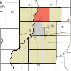
Location in Vigo County
Coordinates: 39°33′43″N87°20′53″W / 39.56194°N 87.34806°W / 39.56194; -87.34806
Country United States
State Indiana
County Vigo
Government
  Type Indiana township
Area
  Total35.61 sq mi (92.2 km2)
  Land35.24 sq mi (91.3 km2)
  Water0.37 sq mi (1.0 km2)  1.04%
Elevation
509 ft (155 m)
Population
 (2010)
  Total9,069
  Density257.3/sq mi (99.3/km2)
ZIP codes
47805, 47874
GNIS feature ID 453699

Otter Creek Township is one of twelve townships in Vigo County, Indiana, United States. As of the 2010 census, its population was 9,069 and it contained 3,917 housing units. [1]

Contents

History

Markle House and Mill Site was listed on the National Register of Historic Places in 1979. [2]

Geography

According to the 2010 census, the township has a total area of 35.61 square miles (92.2 km2), of which 35.24 square miles (91.3 km2) (or 98.96%) is land and 0.37 square miles (0.96 km2) (or 1.04%) is water. [1]

Cities, towns, villages

Unincorporated communities

Adjacent townships

Cemeteries

The township contains ten cemeteries: Denny, Evans, Haven, Kennedy, Markles, Phillips, Roselawn Memorial Park, Steveson, Stewart and Wood.

Airports and landing strips

School districts

Political districts

Related Research Articles

<span class="mw-page-title-main">Vigo County, Indiana</span> County in Indiana, United States

Vigo County is a county on the western border of the U.S. state of Indiana. According to the 2020 United States Census, it had a population of 105,994. Its county seat is Terre Haute.

<span class="mw-page-title-main">Parke County, Indiana</span> County in Indiana, United States

Parke County lies in the western part of the U.S. state of Indiana along the Wabash River. The county was formed in 1821 out of a portion of Vigo County. According to the 2020 census, the population was 16,156. The county seat is Rockville.

<span class="mw-page-title-main">North Terre Haute, Indiana</span> Census-designated place in Indiana, United States

North Terre Haute is a census-designated place (CDP) in Otter Creek Township, Vigo County, in the U.S. state of Indiana. The population was 4,305 at the 2010 census. It is part of the Terre Haute Metropolitan Statistical Area.

<span class="mw-page-title-main">West Terre Haute, Indiana</span> Town in Indiana, United States

West Terre Haute is a town in Sugar Creek Township, Vigo County, Indiana, on the western side of the Wabash River near Terre Haute. The population was 2,236 at the 2010 census. It is part of the Terre Haute Metropolitan Statistical Area. Bethany Congregational Church was placed on the National Register of Historic Places in 2003.

<span class="mw-page-title-main">Harrison Township, Vigo County, Indiana</span> Township in Indiana, United States

Harrison Township is one of twelve townships in Vigo County, Indiana, United States. As of the 2010 census, its population was 51,272 and it contained 22,940 housing units. It is entirely contained in Terre Haute's city limits, thus explaining why it is both the most densely populated and the most populated overall.

<span class="mw-page-title-main">Honey Creek Township, Vigo County, Indiana</span> Township in Indiana, United States

Honey Creek Township is one of twelve townships in Vigo County, Indiana, United States. As of the 2010 census, its population was 17,179 and it contained 6,509 housing units. It contains Terre Haute's main shopping district along U.S. Route 41 and is by far the most characteristically suburban of the twelve Vigo County townships. The population includes inmates from the Terre Haute Federal Penitentiary, located at its northwest corner.

<span class="mw-page-title-main">Lost Creek Township, Vigo County, Indiana</span> Township in Indiana, United States

Lost Creek Township is one of twelve townships in Vigo County, Indiana, United States. As of the 2010 census, its population was 10,497 and it contained 4,236 housing units. It contains Terre Haute, Indiana's eastern, suburban end, along with the affluent Hulman family ranch and the Terre Haute International Airport originally named after the family. Seelyville, the third largest city in the county, is also located there.

<span class="mw-page-title-main">Nevins Township, Vigo County, Indiana</span> Township in Indiana, United States

Nevins Township is one of twelve townships in Vigo County, Indiana, United States. As of the 2010 census, its population was 1,975 and it contained 881 housing units.

<span class="mw-page-title-main">Fayette Township, Vigo County, Indiana</span> Township in Indiana, United States

Fayette Township is one of twelve townships in Vigo County, Indiana, United States. As of the 2010 census, its population was 2,630 and it contained 1,099 housing units.

<span class="mw-page-title-main">Linton Township, Vigo County, Indiana</span> Township in Indiana, United States

Linton Township is one of twelve townships in Vigo County, Indiana, United States. As of the 2010 census, its population was 1,323 and it contained 555 housing units.

<span class="mw-page-title-main">Pierson Township, Vigo County, Indiana</span> Township in Indiana, United States

Pierson Township is one of twelve townships in Vigo County, Indiana, United States. At the 2010 census, the population was 1,210 and it contained 589 housing units.

<span class="mw-page-title-main">Prairie Creek Township, Vigo County, Indiana</span> Township in Indiana, United States

Prairie Creek Township is one of twelve townships in Vigo County, Indiana, United States. As of the 2010 census, its population was 1,195 and it contained 494 housing units.

<span class="mw-page-title-main">Prairieton Township, Vigo County, Indiana</span> Township in Indiana, United States

Prairieton Township is one of twelve townships in Vigo County, Indiana, United States. As of the 2010 census, its population was 1,222 and it contained 517 housing units.

<span class="mw-page-title-main">Riley Township, Vigo County, Indiana</span> Township in Indiana, United States

Riley Township is one of twelve townships in Vigo County, Indiana, United States. As of the 2010 census, its population was 3,123 and it contained 1,260 housing units.

<span class="mw-page-title-main">Sugar Creek Township, Vigo County, Indiana</span> Township in Indiana, United States

Sugar Creek Township is one of twelve townships in Vigo County, Indiana, United States. As of the 2010 census, its population was 7,153 and it contained 3,009 housing units.

<span class="mw-page-title-main">Perry Township, Clay County, Indiana</span> Township in Indiana, United States

Perry Township is one of eleven townships in Clay County, Indiana. As of the 2010 census, its population was 934 and it contained 419 housing units.

<span class="mw-page-title-main">Washington Township, Daviess County, Indiana</span> Township in Indiana, United States

Washington Township is one of ten townships in Daviess County, Indiana. As of the 2010 census, its population was 15,534 and it contained 6,771 housing units.

<span class="mw-page-title-main">Chester Township, Wabash County, Indiana</span> Township in Indiana, United States

Chester Township is one of seven townships in Wabash County, Indiana, United States. As of the 2010 census, its population was 8,009 and it contained 3,215 housing units.

<span class="mw-page-title-main">Union Township, Huntington County, Indiana</span> Township in Indiana, United States

Union Township is one of twelve townships in Huntington County, Indiana, United States. As of the 2020 census, its population was 1,205.

<span class="mw-page-title-main">Campbell Township, Jennings County, Indiana</span> Township in Indiana, United States

Campbell Township is one of eleven townships in Jennings County, Indiana, United States. As of the 2010 census, its population was 1,191 and it contained 498 housing units.

References

  1. 1 2 "Population, Housing Units, Area, and Density: 2010 - County -- County Subdivision and Place -- 2010 Census Summary File 1". United States Census. Archived from the original on February 10, 2020. Retrieved May 10, 2013.
  2. "National Register Information System". National Register of Historic Places . National Park Service. July 9, 2010.