Pine Ridge, Indiana | |
---|---|
Vigo County's location in Indiana | |
Coordinates: 39°34′45″N87°29′30″W / 39.57917°N 87.49167°W Coordinates: 39°34′45″N87°29′30″W / 39.57917°N 87.49167°W | |
Country | United States |
State | Indiana |
County | Vigo |
Township | Fayette |
Elevation | 614 ft (187 m) |
Time zone | UTC-5 (Eastern (EST)) |
• Summer (DST) | UTC-4 (EDT) |
ZIP code | 47885 |
Area code(s) | 812, 930 |
GNIS feature ID | 446683 |
Pine Ridge is an unincorporated community in Fayette Township, Vigo County, in the U.S. state of Indiana. [2] It is part of the Terre Haute metropolitan area.
The Pine Ridge Mine Pond reservoir is located in Pine Ridge. [3]
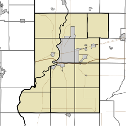
Pine Ridge is located at 39°34′45″N87°29′30″W / 39.57917°N 87.49167°W at an elevation of 614 feet.
Klondyke is an unincorporated community in Clinton Township, Vermillion County, in the U.S. state of Indiana.
Syndicate is an unincorporated community in Clinton Township, Vermillion County, in the U.S. state of Indiana.
Bee Ridge is an unincorporated community in Dick Johnson Township, Clay County, Indiana. It is part of the Terre Haute Metropolitan Statistical Area.
Hoosier is an unincorporated community in Stockton Township, Greene County, Indiana.
Summerford is an unincorporated community in Somerford Township, Madison County, Ohio, United States. It is located at 39°56′00″N83°29′30″W, at the intersection of U.S. Route 40 and State Route 56.
Furnessville is an unincorporated community in Pine Township, Porter County, in the U.S. state of Indiana.
Markles is an unincorporated community in southern Otter Creek Township, Vigo County, in the U.S. state of Indiana. Within the boundaries of Terre Haute, it is also part of the Terre Haute metropolitan area.
Swalls is an unincorporated community in Lost Creek Township, Vigo County, in the U.S. state of Indiana. It is part of the Terre Haute metropolitan area.
Baldridge is an unincorporated community in Curry Township, Sullivan County, in the U.S. state of Indiana.
Glendora is an unincorporated community in Hamilton Township, Sullivan County, in the U.S. state of Indiana.
Wilfred is an unincorporated community in western Jackson Township, Sullivan County, in the U.S. state of Indiana.
Lap Corner is an unincorporated community in northern Sugar Ridge Township, Clay County, Indiana, just north of Center Point. It is part of the Terre Haute Metropolitan Statistical Area.
Smithville is an unincorporated community in the northwest corner of Marion Township, Owen County, in the U.S. state of Indiana. It lies near the intersection of County Road 200 North and County Road 1400 West, which is a community about fifteen miles west of the city of Spencer, the county seat. Its elevation is 591 feet, and it is located at 39°19′15″N87°1′33″W.
Sand Ridge is an unincorporated community in Luce Township, Spencer County, in the U.S. state of Indiana.
Hooker Corner is an extinct town that was located in Pine Township in Warren County, Indiana, west of the town of Pine Village.
Fox Ridge is an unincorporated community in Greencastle Township, Putnam County, in the U.S. state of Indiana.
Keytsville is an unincorporated community in Parke and Putnam counties, in the U.S. state of Indiana.
Hirt Corner is an unincorporated community in Clay and Putnam counties, in the U.S. state of Indiana.
Rolling Ridge is a populated place in Addison Township, Shelby County, in the U.S. state of Indiana.
This Vigo County, Indiana location article is a stub. You can help Wikipedia by expanding it. |