Youngstown, Indiana

Last updated
Youngstown, Indiana
Map of Indiana highlighting Vigo County.svg
Vigo County's location in Indiana
Map of Vigo County Indiana Townships.svg
Red pog.svg
Youngstown
location in Vigo County, Indiana
Coordinates: 39°21′44″N87°22′56″W / 39.36222°N 87.38222°W / 39.36222; -87.38222 Coordinates: 39°21′44″N87°22′56″W / 39.36222°N 87.38222°W / 39.36222; -87.38222
Country United States
State Indiana
County Vigo
Township Honey Creek
Elevation
[1]
591 ft (180 m)
Time zone UTC-5 (Eastern (EST))
  Summer (DST) UTC-4 (EDT)
ZIP code
47802
Area code(s) 812, 930
GNIS feature ID 446419

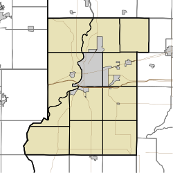
Youngstown is an unincorporated community in southern Honey Creek Township, Vigo County, in the U.S. state of Indiana. [2]

Contents

It is part of the Terre Haute metropolitan area.
History

Youngstown was subdivided and made a village on March 31, 1868, by Chauncey R. Carr. It was a station on the Evansville & Terre Haute Rail Road, about seven miles south of Terre Haute. George Planett built the first business house in 1868, when he was made the first postmaster. The post office ran until it was discontinued in 1912. [3] In 1890 the population was approximately 39. [4]

Geography

Youngstown is located at 39°21′44″N87°22′56″W / 39.36222°N 87.38222°W / 39.36222; -87.38222 at an elevation of 591 feet.

Related Research Articles

Libertyville, Indiana Unincorporated community in Indiana, United States

Libertyville is an unincorporated community in Vermillion and Vigo counties, in the U.S. state of Indiana.

Sandford, Indiana Unincorporated community in Indiana, United States

Sandford is an unincorporated community in Fayette Township, Vigo County, in the U.S. state of Indiana.

New Goshen, Indiana Census-designated place in Indiana, United States

New Goshen is a census-designated place (CDP) in Fayette Township, Vigo County, in the U.S. state of Indiana. It is part of the Terre Haute Metropolitan Statistical Area.

Pimento, Indiana Unincorporated community in Indiana, United States

Pimento is an unincorporated community in Linton Township, Vigo County, in the U.S. state of Indiana. It is part of the Terre Haute Metropolitan Statistical Area.

Shepardsville, Indiana Census-designated place in Indiana, United States

Shepardsville is an unincorporated census-designated place in northeastern Fayette Township, Vigo County, in the U.S. state of Indiana. It lies along Trinity Ave. north of the city of Terre Haute, the county seat of Vigo County. Its elevation is 502 feet (153 m), and it is located at 39°36′3″N87°25′3″W. Although Shepardsville is unincorporated, it has a post office, with the ZIP code of 47880.

Prairie Creek, Indiana Unincorporated community in Indiana, United States

Prairie Creek is an unincorporated community in southeastern Prairie Creek Township, Vigo County, in the U.S. state of Indiana. Its elevation is 528 feet (161 m), and it is located at 39°16′30″N87°29′50″W. Because the community has had multiple names, the Board on Geographic Names officially decided in favor of "Prairie Creek" in 1959. Although Prairie Creek is unincorporated, it has a post office, with the ZIP code of 47869.

Vigo, Indiana Unincorporated community in Indiana, United States

Vigo is a small unincorporated community in Prairie Creek Township, Vigo County, in the U.S. state of Indiana. The community is in the 47802 zip code, the Wabash Valley and the Terre Haute Metropolitan Statistical Area.

Cherryvale, Indiana Unincorporated community in Indiana, United States

Cherryvale is an unincorporated community in Vigo and Clay counties, in the U.S. state of Indiana.

Coal Bluff, Indiana Unincorporated community in Indiana, United States

Coal Bluff is an unincorporated community in northern Nevins Township, Vigo County, in the U.S. state of Indiana.

Dewey, Indiana Unincorporated community in Indiana, United States

Dewey is an unincorporated community in Harrison Township, Vigo County, in the U.S. state of Indiana.

East Glenn, Indiana Unincorporated community in Indiana, United States

East Glenn is an unincorporated community in central Lost Creek Township, Vigo County, in the U.S. state of Indiana.

Ehrmandale, Indiana Unincorporated community in Indiana, United States

Ehrmandale is an unincorporated community in southern Nevins Township, Vigo County, in the U.S. state of Indiana.

Hutton, Indiana Unincorporated community in Indiana, United States

Hutton is an unincorporated community in northern Prairie Creek Township, Vigo County, in the U.S. state of Indiana.

Markles, Indiana Unincorporated community in Indiana, United States

Markles is an unincorporated community in southern Otter Creek Township, Vigo County, in the U.S. state of Indiana. Within the boundaries of Terre Haute, it is also part of the Terre Haute metropolitan area.

Swalls, Indiana Unincorporated community in Indiana, United States

Swalls is an unincorporated community in Lost Creek Township, Vigo County, in the U.S. state of Indiana. It is part of the Terre Haute metropolitan area.

Tecumseh, Indiana Census-designated place in Indiana, United States

Tecumseh is an unincorporated census-designated place in eastern Fayette Township, Vigo County, in the U.S. state of Indiana. It is part of the Terre Haute metropolitan area.

Harrison, Indiana Unincorporated community in Indiana, United States

Harrison is an unincorporated community in southeastern Fayette Township, Vigo County, in the U.S. state of Indiana.

Preston, Indiana Unincorporated community in Indiana, United States

Preston is an unincorporated community in Harrison Township, Vigo County, in the U.S. state of Indiana.

Terre Town, Indiana Unincorporated community in Indiana, United States

Terre Town is an unincorporated community in northern Harrison Township, Vigo County, in the U.S. state of Indiana. Now within the borders of the city of Terre Haute, it is part of the Terre Haute metropolitan area.

Twelve Points, Indiana Unincorporated community in Indiana, United States

Twelve Points is an unincorporated community in southern Harrison Township, Vigo County, in the U.S. state of Indiana.

References

  1. "US Board on Geographic Names". United States Geological Survey. October 25, 2007. Retrieved 2016-07-14.
  2. "Youngstown, Indiana". Geographic Names Information System . United States Geological Survey . Retrieved August 6, 2017.
  3. "Vigo County". Jim Forte Postal History. Retrieved July 14, 2016.
  4. Bradsby, H.C. (1891). History of Vigo County, Indiana, with Biographical Selections. Chicago: S. B. Nelson & Co. p. 480.